


The Maine Geological Survey provides the people and businesses of Maine with essential geologic information about the land where we live and work.
Note: Many state documents are offered in PDF format. To view PDF documents, you will need the free Adobe Reader. If you need assistance, view our Maine government PDF Help page or contact the contributing Maine State agency via the link on the left sidebar under “Links”.
-

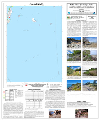
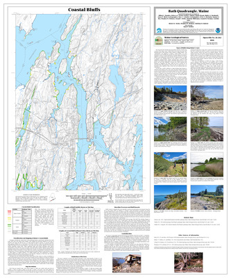
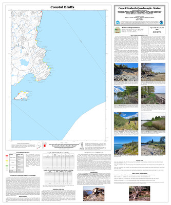
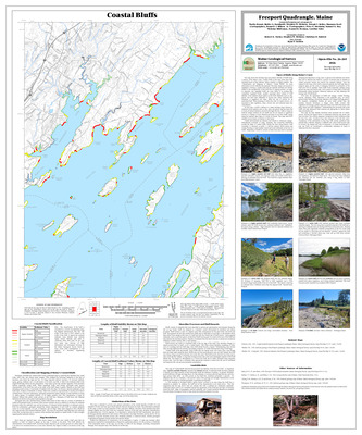
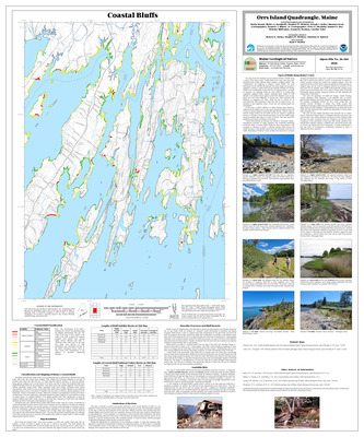
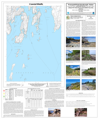
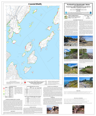
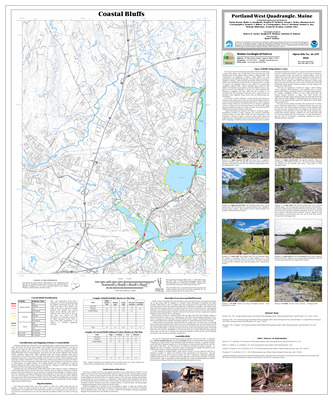
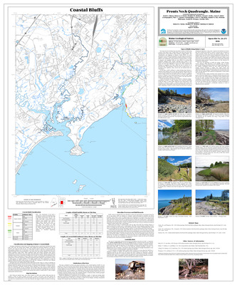
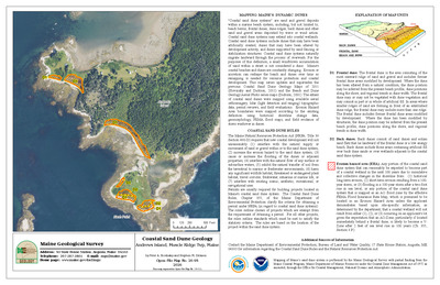
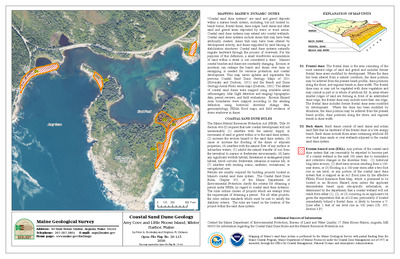
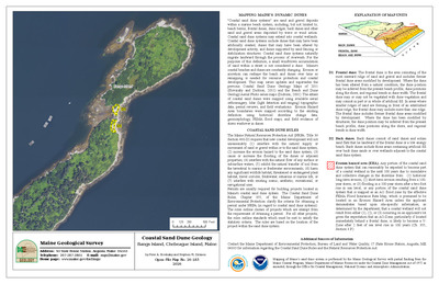
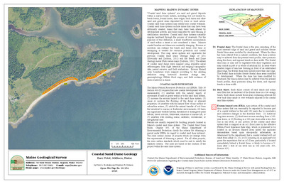
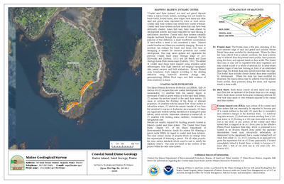
Coastal landslide hazards in the Prouts Neck quadrangle, Maine
Stephen M. Dickson
Maine Geological Survey, Open-File Map 01-537
-

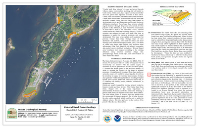
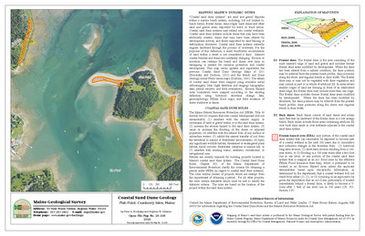
Coastal landslide hazards in the Rockland quadrangle, Maine
Stephen M. Dickson
Maine Geological Survey, Open-File Map 01-538
-

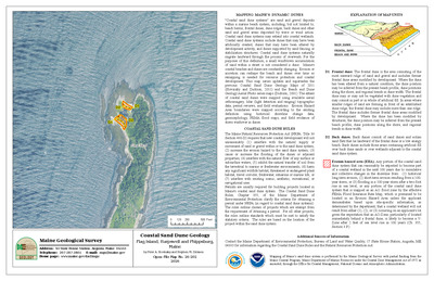
Coastal landslide hazards in the Salsbury Cove quadrangle, Maine
Stephen M. Dickson
Maine Geological Survey, Open-File Map 01-539
-

Coastal landslide hazards in the Sargentville quadrangle, Maine
Stephen M. Dickson
Maine Geological Survey, Open-File Map 01-540
-

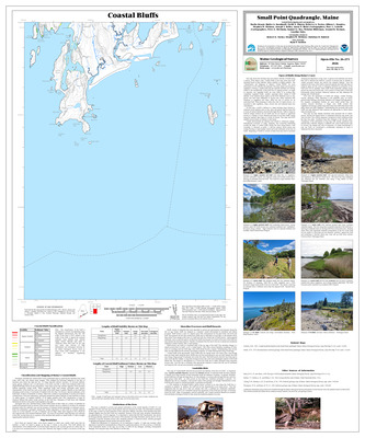
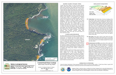
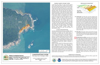
Coastal landslide hazards in the Small Point quadrangle, Maine
Stephen M. Dickson
Maine Geological Survey, Open-File Map 01-542
-

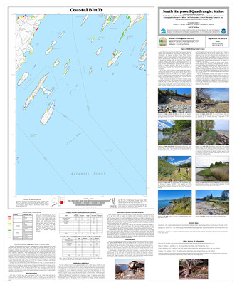
Coastal landslide hazards in the South Harpswell quadrangle, Maine
Stephen M. Dickson
Maine Geological Survey, Open-File Map 01-543
-

Coastal landslide hazards in the Stinson Neck quadrangle, Maine
Stephen M. Dickson
Maine Geological Survey, Open-File Map 01-544
-

Coastal landslide hazards in the Tenants Harbor quadrangle, Maine
Stephen M. Dickson
Maine Geological Survey, Open-File Map 01-546
-

Coastal landslide hazards in the Thomaston quadrangle, Maine
Stephen M. Dickson
Maine Geological Survey, Open-File Map 01-547
-

Coastal landslide hazards in the Waldoboro East quadrangle, Maine
Stephen M. Dickson
Maine Geological Survey, Open-File Map 01-548
-

Coastal landslide hazards in the Waldoboro West quadrangle, Maine
Stephen M. Dickson
Maine Geological Survey, Open-File Map 01-549
-

Coastal landslide hazards in the Westport quadrangle, Maine
Stephen M. Dickson
Maine Geological Survey, Open-File Map 01-550
-

Coastal landslide hazards in the Wiscasset quadrangle, Maine
Stephen M. Dickson
Maine Geological Survey, Open-File Map 01-551
-

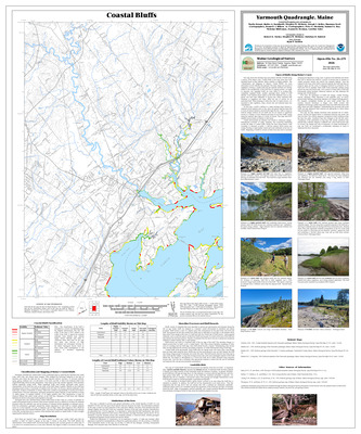
Coastal landslide hazards in the Yarmouth quadrangle, Maine
Stephen M. Dickson
Maine Geological Survey, Open-File Map 01-552
-

Coastal landslide hazards in the York Harbor quadrangle, Maine
Stephen M. Dickson
Maine Geological Survey, Open-File Map 01-553
-

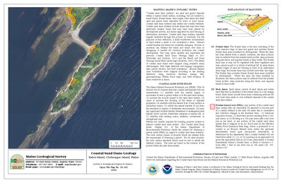
Coastal landslide hazards of the Boothbay Harbor quadrangle, Maine
Stephen M. Dickson
Maine Geological Survey, Open-File Map 01-505
-

Significant sand and gravel aquifers in the Alder Brook quadrangle, Maine
Craig D. Neil, Daniel B. Locke, and Daniel B. Locke
Maine Geological Survey, Open-File Map 01-1.
-

Significant sand and gravel aquifers in the Andover quadrangle, Maine
Lauren E. Foster, Elizabeth B. Lewis, Craig D. Neil, and Woodrow B. Thompson
Maine Geological Survey, Open-File Map 01-3
-

Significant sand and gravel aquifers in the Athens quadrangle, Maine
Elizabeth B. Lewis, Daniel B. Locke, Craig D. Neil, and Andres Meglioli
Maine Geological Survey, Open-File Map 01-5
-

Significant sand and gravel aquifers in the Benedicta quadrangle, Maine
Craig D. Neil, Daniel B. Locke, and Daniel B. Locke
Maine Geological Survey, Open-File Map 01-11
-

Significant sand and gravel aquifers in the Big Lake quadrangle, Maine
Craig D. Neil and Daniel B. Locke
Maine Geological Survey, Open-File Map 01-338
-

Significant sand and gravel aquifers in the Bingham quadrangle, Maine
Elizabeth B. Lewis, Daniel B. Locke, Craig D. Neil, and Andreas Meglioli
Maine Geological Survey, Open-File Map 01-13
-

Significant sand and gravel aquifers in the Black Mountain quadrangle, Maine
Lauren E. Foster, Elizabeth B. Lewis, Craig D. Neil, and Thomas K. Weddle
Maine Geological Survey, Open-File Map 01-15
-

Significant sand and gravel aquifers in the Black Nubble quadrangle, Maine
Lauren E. Foster, Elizabeth B. Lewis, Craig D. Neil, and Thomas K. Weddle
Maine Geological Survey, Open-File Map 01-16
-

Significant sand and gravel aquifers in the Bosebuck Mountain quadrangle, Maine
Lauren E. Foster, Elizabeth B. Lewis, Craig D. Neil, and Woodrow B. Thompson
Maine Geological Survey, Open-File Map 01-18
-

Significant sand and gravel aquifers in the Bottle Lake quadrangle, Maine
Craig D. Neil and Thomas K. Weddle
Maine Geological Survey, Open-File Map 01-336
-

Significant sand and gravel aquifers in the Bowers Mountain quadrangle, Maine
Craig D. Neil and Thomas K. Weddle
Maine Geological Survey, Open-File Map 01-334
-

Significant sand and gravel aquifers in the B Pond quadrangle, Maine
Lauren E. Foster, Elizabeth B. Lewis, Craig D. Neil, and Woodrow B. Thompson
Maine Geological Survey, Open-File Map 01-7
-

Significant sand and gravel aquifers in the Bradford quadrangle, Maine
Elizabeth B. Lewis, Daniel B. Locke, Craig D. Neil, and Thomas V. Lowell
Maine Geological Survey, Open-File Map 01-19
-

Significant sand and gravel aquifers in the Brookton quadrangle, Maine
Craig D. Neil and Thomas K. Weddle
Maine Geological Survey, Open-File Map 01-341
-

Significant sand and gravel aquifers in the Cambridge quadrangle, Maine
Elizabeth B. Lewis, Daniel B. Locke, Craig D. Neil, and Glenn C. Prescott Jr
Maine Geological Survey, Open-File Map 01-31
-

Significant sand and gravel aquifers in the Caratunk quadrangle, Maine
Elizabeth B. Lewis, Daniel B. Locke, Craig D. Neil, and Andreas Meglioli
Maine Geological Survey, Open-File Map 01-32
-

Significant sand and gravel aquifers in the Carmel quadrangle, Maine
Lauren E. Foster, Troy T. Smith, and Thomas K. Weddle
Maine Geological Survey, Open-File Map 01-34
-

Significant sand and gravel aquifers in the Cedar Lake quadrangle, Maine
Lauren E. Foster, Troy T. Smith, and Thomas K. Weddle
Maine Geological Survey, Open-File Map 01-36
-

Significant sand and gravel aquifers in the Charleston quadrangle, Maine
Elizabeth E. Lewis, Daniel B. Locke, Craig D. Neil, and Thomas V. Lowell
Maine Geological Survey, Open-File Map 01-37
-

Significant sand and gravel aquifers in the Clifford Lake quadrangle, Maine
Craig D. Neil, Craig D. Neil, and Daniel B. Locke
Maine Geological Survey, Open-File Map 01-326
-

Significant sand and gravel aquifers in the Crawford Lake quadrangle, Maine
Craig D. Neil and Daniel B. Locke
Maine Geological Survey, Open-File Map 01-327
-

Significant sand and gravel aquifers in the Crystal quadrangle, Maine
Craig D. Neil, Daniel B. Locke, and Daniel B. Locke
Maine Geological Survey, Open-File Map 01-41
-

Significant sand and gravel aquifers in the Danforth quadrangle, Maine
Craig D. Neil, Daniel B. Locke, and Daniel B. Locke
Maine Geological Survey, Open-File Map 01-43
-

Significant sand and gravel aquifers in the Dark Cove Mountain quadrangle, Maine
Craig D. Neil and Craig D. Neil
Maine Geological Survey, Open-File Map 01-318
-

Significant sand and gravel aquifers in the Deasey Mountain quadrangle, Maine
Lauren E. Foster, Troy T. Smith, and Thomas K. Weddle
Maine Geological Survey, Open-File Map 01-45
-

Significant sand and gravel aquifers in the Dill Hill quadrangle, Maine
Craig D. Neil and Thomas K. Weddle
Maine Geological Survey, Open-File Map 01-335
-

Significant sand and gravel aquifers in the Dimmick Mountain quadrangle, Maine
Elizabeth E. Lewis, Daniel B. Locke, Craig D. Neil, and Andres Meglioli
Maine Geological Survey, Open-File Map 01-47
-

Significant sand and gravel aquifers in the Dixfield quadrangle, Maine
Lauren E. Foster, Elizabeth E. Lewis, Craig D. Neil, and Glenn C. Prescott Jr
Maine Geological Survey, Open-File Map 01-49
-

Significant sand and gravel aquifers in the Dixmont quadrangle, Maine
Lauren E. Foster, Troy T. Smith, and Thomas K. Weddle
Maine Geological Survey, Open-File Map 01-51
-

Significant sand and gravel aquifers in the Dover-Foxcroft quadrangle, Maine
Elizabeth B. Lewis, Daniel B. Locke, Craig D. Neil, and Thomas V. Lowell
Maine Geological Survey, Open-File Map 01-53
-

Significant sand and gravel aquifers in the Duck Lake quadrangle, Maine
Craig D. Neil and Craig D. Neil
Maine Geological Survey, Open-File Map 01-317
-

Significant sand and gravel aquifers in the East Andover quadrangle, Maine
Lauren E. Foster, Elizabeth E. Lewis, Craig D. Neil, and Glenn C. Prescott Jr
Maine Geological Survey, Open-File Map 01-55 (Superseded by Foster, et al., 2016, Maine Geological Survey Open-File 16-24)
-

Significant sand and gravel aquifers in the East Dixmont quadrangle, Maine
Lauren E. Foster, Troy T. Smith, and Thomas K. Weddle
Maine Geological Survey, Open-File Map 01-58
-

Significant sand and gravel aquifers in the East Millinocket quadrangle, Maine
Lauren E. Foster, Troy T. Smith, and Thomas K. Weddle
Maine Geological Survey, Open-File Map 01-60
-

Significant sand and gravel aquifers in the East Winn quadrangle, Maine
Lauren E. Foster, Troy T. Smith, and Glenn C. Prescott Jr
Maine Geological Survey, Open-File Map 01-62
-

Significant sand and gravel aquifers in the Ellis Pond quadrangle, Maine
Lauren E. Foster, Elizabeth B. Lewis, Craig D. Neil, and Glenn C. Prescott Jr
Maine Geological Survey, Open-File Map 01-64
-

Significant sand and gravel aquifers in the Embden Pond quadrangle, Maine
Elizabeth B. Lewis, Daniel B. Locke, Craig D. Neil, and Andreas Meglioli
Maine Geological Survey, Open-File Map 01-65
-

Significant sand and gravel aquifers in the Endless Lake quadrangle, Maine
Lauren E. Foster, Troy T. Smith, and Daniel B. Locke
Maine Geological Survey, Open-File Map 01-67
-

Significant sand and gravel aquifers in the Farrow Mountain quadrangle, Maine
Craig D. Neil and Thomas K. Weddle
Maine Geological Survey, Open-File Map 01-342
-

Significant sand and gravel aquifers in the Fletcher Peak quadrangle, Maine
Craig D. Neil and Craig D. Neil
Maine Geological Survey, Open-File Map 01-321
-

Significant sand and gravel aquifers in the Forest quadrangle, Maine
Craig D. Neil and Michael E. Foley
Maine Geological Survey, Open-File Map 01-299
-

Significant sand and gravel aquifers in the Foster Ridge quadrangle, Maine
Elizabeth B. Lewis, Daniel B. Locke, Craig D. Neil, and Andres Meglioli
Maine Geological Survey, Open-File Map 01-69
-

Significant sand and gravel aquifers in the Garland quadrangle, Maine
Elizabeth B. Lewis, Daniel B. Locke, Craig D. Neil, and Thomas V. Lowell
Maine Geological Survey, Open-File Map 01-71
-

Significant sand and gravel aquifers in the Gassabias Lake quadrangle, Maine
Craig D. Neil and Craig D. Neil
Maine Geological Survey, Open-File Map 01-320
-

Significant sand and gravel aquifers in the Grand Lake Stream quadrangle, Maine
Craig D. Neil and Craig D. Neil
Maine Geological Survey, Open-File Map 01-319
-

Significant sand and gravel aquifers in the Greenbush quadrangle, Maine
Lauren E. Foster, Troy T. Smith, Dale F. Doughty, and Edward B. Baker
Maine Geological Survey, Open-File Map 01-77
-

Significant sand and gravel aquifers in the Green Mountain quadrangle, Maine
Craig D. Neil, Daniel B. Locke, and Daniel B. Locke
Maine Geological Survey, Open-File Map 01-75
-

Significant sand and gravel aquifers in the Guilford quadrangle, Maine
Elizabeth B. Lewis, Daniel B. Locke, Craig D. Neil, and Glenn C. Prescott Jr
Maine Geological Survey, Open-File Map 01-79
-

Significant sand and gravel aquifers in the Hardy Pond quadrangle, Maine
Lauren E. Foster, Troy T. Smith, and Daniel B. Locke
Maine Geological Survey, Open-File Map 01-83
-

Significant sand and gravel aquifers in the Harmony quadrangle, Maine
Elizabeth B. Lewis, Daniel B. Locke, Craig D. Neil, and Glenn C. Prescott Jr
Maine Geological Survey, Open-File Map 01-85
-

Significant sand and gravel aquifers in the Hartland quadrangle, Maine
Elizabeth B. Lewis, Daniel B. Locke, Craig D. Neil, and Glenn C. Prescott Jr
Maine Geological Survey, Open-File Map 01-86
-

Significant sand and gravel aquifers in the Harvey quadrangle, Maine
Craig D. Neil, Daniel B. Locke, and Daniel B. Locke
Maine Geological Survey, Open-File Map 01-88
-

Significant sand and gravel aquifers in the Haynesville quadrangle, Maine
Craig D. Neil, Daniel B. Locke, and Daniel B. Locke
Maine Geological Survey, Open-File Map 01-90
-

Significant sand and gravel aquifers in the Hermon quadrangle, Maine
Lauren E. Foster, Troy T. Smith, and Thomas K. Weddle
Maine Geological Survey, Open-File Map 01-92
-

Significant sand and gravel aquifers in the Houghton quadrangle, Maine
Lauren E. Foster, Elizabeth E. Lewis, Craig D. Neil, and Thomas K. Weddle
Maine Geological Survey, Open-File Map 01-94
-

Significant sand and gravel aquifers in the Houlton North quadrangle, Maine
Craig D. Neil, Daniel B. Locke, and Daniel B. Locke
Maine Geological Survey, Open-File Map 01-96
-

Significant sand and gravel aquifers in the Houlton South quadrangle, Maine
Craig D. Neil, Daniel B. Locke, and Daniel B. Locke
Maine Geological Survey, Open-File Map 01-98
-

Significant sand and gravel aquifers in the Howland quadrangle, Maine
Lauren E. Foster, Troy T. Smith, Dale F. Doughty, and Edward B. Baker
Maine Geological Survey, Open-File Map 01-100
-

Significant sand and gravel aquifers in the Island Falls quadrangle, Maine
Craig D. Neil, Daniel B. Locke, and Daniel B. Locke
Maine Geological Survey, Open-File Map 01-102
-

Significant sand and gravel aquifers in the Jimmey Mountain quadrangle, Maine
Craig D. Neil, Daniel B. Locke, and Daniel B. Locke
Maine Geological Survey, Open-File Map 01-104
-

Significant sand and gravel aquifers in the Katahdin Lake quadrangle, Maine
Lauren E. Foster, Troy T. Smith, and Thomas K. Weddle
Maine Geological Survey, Open-File Map 01-106
-

Significant sand and gravel aquifers in the Kennebago Lake quadrangle, Maine
Lauren E. Foster, Elizabeth B. Lewis, Craig D. Neil, and Thomas K. Weddle
Maine Geological Survey, Open-File Map 01-111
-

Significant sand and gravel aquifers in the Kennebago quadrangle, Maine
Lauren E. Foster, Elizabeth B. Lewis, Craig D. Neil, and Woodrow B. Thompson
Maine Geological Survey, Open-File Map 01-109
-

Significant sand and gravel aquifers in the Kingman quadrangle, Maine
Lauren E. Foster, Troy T. Smith, and Glenn C. Prescott Jr
Maine Geological Survey, Open-File Map 01-114
-

Significant sand and gravel aquifers in the Kingsbury quadrangle, Maine
Elizabeth B. Lewis, Daniel B. Locke, Craig D. Neil, and Andres Meglioli
Maine Geological Survey, Open-File Map 01-116
-

Significant sand and gravel aquifers in the Knowles Corner quadrangle, Maine
Craig D. Neil, Daniel B. Locke, and Daniel B. Locke
Maine Geological Survey, Open-File Map 01-118
-

Significant sand and gravel aquifers in the Lake Cathance quadrangle, Maine
Craig D. Neil and Daniel B. Locke
Maine Geological Survey, Open-File Map 01-331
-

Significant sand and gravel aquifers in the Lambert Lake quadrangle, Maine
Craig D. Neil and Michael E. Foley
Maine Geological Survey, Open-File Map 01-344
-

Significant sand and gravel aquifers in the Lee quadrangle, Maine
Lauren E. Foster, Troy T. Smith, and Glenn C. Prescott Jr
Maine Geological Survey, Open-File Map 01-122
-

Significant sand and gravel aquifers in the Lincoln Center quadrangle, Maine
Lauren E. Foster, Troy T. Smith, and Glenn C. Prescott
Maine Geological Survey, Open-File Map 01-124
-

Significant sand and gravel aquifers in the Lincoln Pond quadrangle, Maine
Lauren E. Foster, Elizabeth B. Lewis, Craig D. Neil, and Woodrow B. Thompson
Maine Geological Survey, Open-File Map 01-126
-

Significant sand and gravel aquifers in the Linneus quadrangle, Maine
Craig D. Neil, Daniel B. Locke, and Daniel B. Locke
Maine Geological Survey, Open-File Map 01-130
-

Significant sand and gravel aquifers in the Little Bigelow Mountain quadrangle, Maine
Elizabeth B. Lewis, Daniel B. Locke, Craig D. Neil, and Harold W. Borns Jr
Maine Geological Survey, Open-File Map 01-132
-

Significant sand and gravel aquifers in the Little Kennebago Lake quadrangle, Maine
Lauren E. Foster, Elizabeth B. Lewis, Craig D. Neil, and Woodrow B. Thompson
Maine Geological Survey, Open-File Map 01-133
-

Significant sand and gravel aquifers in the Lookout Mountain quadrangle, Maine
Lauren E. Foster, Troy T. Smith, and Thomas K. Weddle
Maine Geological Survey, Open-File Map 01-135
-

Significant sand and gravel aquifers in the Loon Bay quadrangle, Maine
Craig D. Neil and Michael E. Foley
Maine Geological Survey, Open-File Map 01-348
-

Significant sand and gravel aquifers in the Ludlow quadrangle, Maine
Craig D. Neil, Daniel B. Locke, and Daniel B. Locke
Maine Geological Survey, Open-File Map 01-137
-

Significant sand and gravel aquifers in the Madrid quadrangle, Maine
Lauren E. Foster, Elizabeth B. Lewis, Craig D. Neil, and Thomas K. Weddle
Maine Geological Survey, Open-File Map 01-139
-

Significant sand and gravel aquifers in the Mattamiscontis Mountain quadrangle, Maine
Lauren E. Foster, Troy T. Smith, and Daniel B. Locke
Maine Geological Survey, Open-File Map 01-143
-

Significant sand and gravel aquifers in the Mattaseunk Lake quadrangle, Maine
Lauren E. Foster, Troy T. Smith, and Glenn C. Prescott Jr
Maine Geological Survey, Open-File Map 01-145
-

Significant sand and gravel aquifers in the Mattawamkeag Lake quadrangle, Maine
Craig D. Neil, Daniel B. Locke, and Daniel B. Locke
Maine Geological Survey, Open-File Map 01-149
-

Significant sand and gravel aquifers in the Mattawamkeag quadrangle, Maine
Lauren E. Foster, Troy T. Smith, and Glenn C. Prescott Jr
Maine Geological Survey, Open-File Map 01-147
-

Significant sand and gravel aquifers in the McNally Ridge quadrangle, Maine
Craig D. Neil, Daniel B. Locke, and Daniel B. Locke
Maine Geological Survey, Open-File Map 01-151
-

Significant sand and gravel aquifers in the Meddybemps Lake West quadrangle, Maine
Craig D. Neil and Daniel B. Locke
Maine Geological Survey, Open-File Map 01-328
-

Significant sand and gravel aquifers in the Medunkeunk Lake quadrangle, Maine
Lauren E. Foster, Troy T. Smith, and Thomas K. Weddle
Maine Geological Survey, Open-File Map 01-153
-

Significant sand and gravel aquifers in the Metallak Mountain quadrangle, Maine
Lauren E. Foster, Elizabeth B. Lewis, Craig D. Neil, and Woodrow B. Thompson
Maine Geological Survey, Open-File Map 01-155
-

Significant sand and gravel aquifers in the Middle Dam quadrangle, Maine
Lauren E. Foster, Elizabeth B. Lewis, Craig D. Neil, and Woodrow B. Thompson
Maine Geological Survey, Open-File Map 01-156
-

Significant sand and gravel aquifers in the Millinocket quadrangle, Maine
Lauren E. Foster, Troy T. Smith, and Thomas K. Weddle
Maine Geological Survey, Open-File Map 01-157
-

Significant sand and gravel aquifers in the Milo South quadrangle, Maine
Elizabeth B. Lewis, Daniel B. Locke, Craig D. Neil, and Thomas V. Lowell
Maine Geological Survey, Open-File Map 01-159
-

Significant sand and gravel aquifers in the Molunkus Lake quadrangle, Maine
Craig D. Neil, Daniel B. Locke, and Daniel B. Locke
Maine Geological Survey, Open-File Map 01-161
-

Significant sand and gravel aquifers in the Monarda quadrangle, Maine
Craig D. Neil, Daniel B. Locke, and Daniel B. Locke
Maine Geological Survey, Open-File Map 01-163
-

Significant sand and gravel aquifers in the Monroe Lake quadrangle, Maine
Craig D. Neil and Craig D. Neil
Maine Geological Survey, Open-File Map 01-322
-

Significant sand and gravel aquifers in the Monticello quadrangle, Maine
Craig D. Neil, Daniel B. Locke, and Daniel B. Locke
Maine Geological Survey, Open-File Map 01-165
-

Significant sand and gravel aquifers in the Monument Brook quadrangle, Maine
Craig D. Neil, Daniel B. Locke, and Daniel B. Locke
Maine Geological Survey, Open-File Map 01-167
-

Significant sand and gravel aquifers in the Mount Chase quadrangle, Maine
Craig D. Neil, Daniel B. Locke, and Daniel B. Locke
Maine Geological Survey, Open-File Map 01-172
-

Significant sand and gravel aquifers in the Mount Waldo quadrangle, Maine
Lauren E. Foster, Troy T. Smith, and Thomas K. Weddle
Maine Geological Survey, Open-File Map 01-171
-

Significant sand and gravel aquifers in the Nine Meadow Ridge quadrangle, Maine
Lauren E. Foster, Troy T. Smith, and Daniel B. Locke
Maine Geological Survey, Open-File Map 01-176
-

Significant sand and gravel aquifers in the Nollesemic Lake quadrangle, Maine
Lauren E. Foster, Troy T. Smith, and Thomas K. Weddle
Maine Geological Survey, Open-File Map 01-178
-

Significant sand and gravel aquifers in the North Amity quadrangle, Maine
Craig D. Neil, Daniel B. Locke, and Daniel B. Locke
Maine Geological Survey, Open-File Map 01-179
-

Significant sand and gravel aquifers in the Oakfield quadrangle, Maine
Craig D. Neil, Daniel B. Locke, and Daniel B. Locke
Maine Geological Survey, Open-File Map 01-182
-

Significant sand and gravel aquifers in the Olamon quadrangle, Maine
Lauren E. Foster, Troy T. Smith, and Edward B. Baker
Maine Geological Survey, Open-File Map 01-184
-

Significant sand and gravel aquifers in the Old Speck Mountain quadrangle, Maine
Lauren E. Foster, Elizabeth B. Lewis, Craig D. Neil, and Woodrow B. Thompson
Maine Geological Survey, Open-File Map 01-186
-

Significant sand and gravel aquifers in the Oquossoc quadrangle, Maine
Lauren E. Foster, Elizabeth B. Lewis, Craig D. Neil, and Woodrow B. Thompson
Maine Geological Survey, Open-File Map 01-190
-

Significant sand and gravel aquifers in the Orient quadrangle, Maine
Craig D. Neil, Daniel B. Locke, and Daniel B. Locke
Maine Geological Survey, Open-File Map 01-192
-

Significant sand and gravel aquifers in the Oxbrook Lakes quadrangle, Maine
Craig D. Neil and Thomas K. Weddle
Maine Geological Survey, Open-File Map 01-343
-

Significant sand and gravel aquifers in the Parmachenee Lake quadrangle, Maine
Lauren E. Foster, Elizabeth B. Lewis, Craig D. Neil, and Woodrow B. Thompson
Maine Geological Survey, Open-File Map 01-198
-

Significant sand and gravel aquifers in the Passadumkeag quadrangle, Maine
Lauren E. Foster, Troy T. Smith, and Edward B. Baker
Maine Geological Survey, Open-File Map 01-200
-

Significant sand and gravel aquifers in the Patten quadrangle, Maine
Craig D. Neil, Daniel B. Locke, and Daniel B. Locke
Maine Geological Survey, Open-File Map 01-202
-

Significant sand and gravel aquifers in the Peaked Mountain quadrangle, Maine
Craig D. Neil and Craig D. Neil
Maine Geological Survey, Open-File Map 01-324
-

Significant sand and gravel aquifers in the Plymouth quadrangle, Maine
Lauren E. Foster, Troy T. Smith, and Thomas K. Weddle
Maine Geological Survey, Open-File Map 01-204
-

Significant sand and gravel aquifers in the Poplar Mountain quadrangle, Maine
Elizabeth B. Lewis, Daniel B. Locke, Craig D. Neil, and Harold W. Borns Jr
Maine Geological Survey, Open-File Map 01-206
-

Significant sand and gravel aquifers in the Potter Hill quadrangle, Maine
Craig D. Neil and Thomas K. Weddle
Maine Geological Survey, Open-File Map 01-332
-

Significant sand and gravel aquifers in the Princeton quadrangle, Maine
Craig D. Neil and Daniel B. Locke
Maine Geological Survey, Open-File Map 01-339
-

Significant sand and gravel aquifers in the Puzzle Mountain quadrangle, Maine
Lauren E. Foster, Elizabeth B. Lewis, Craig D. Neil, and Woodrow B. Thompson
Maine Geological Survey, Open-File Map 01-210
-

Significant sand and gravel aquifers in the Quill Hill quadrangle, Maine
Lauren E. Foster, Elizabeth B. Lewis, Craig D. Neil, and Thomas K. Weddle
Maine Geological Survey, Open-File Map 01-212
-

Significant sand and gravel aquifers in the Quillpig Mountain quadrangle, Maine
Craig D. Neil and Craig D. Neil
Maine Geological Survey, Open-File Map 01-323
-

Significant sand and gravel aquifers in the Redington quadrangle, Maine
Lauren E. Foster, Elizabeth B. Lewis, Craig D. Neil, and Craig D. Neil
Maine Geological Survey, Open-File Map 01-214
-

Significant sand and gravel aquifers in the Reed Pond quadrangle, Maine
Craig D. Neil, Daniel B. Locke, and Daniel B. Locke
Maine Geological Survey, Open-File Map 01-216
-

Significant sand and gravel aquifers in the Richardson Pond quadrangle, Maine
Lauren E. Foster, Elizabeth B. Lewis, Craig D. Neil, and Woodrow B. Thompson
Maine Geological Survey, Open-File Map 01-218
-

Significant sand and gravel aquifers in the Round Lake quadrangle, Maine
Craig D. Neil and Daniel B. Locke
Maine Geological Survey, Open-File Map 01-330
-

Significant sand and gravel aquifers in the Roxbury quadrangle, Maine
Lauren E. Foster, Elizabeth B. Lewis, Craig D. Neil, and Glenn C. Prescott Jr
Maine Geological Survey, Open-File Map 01-220
-

Significant sand and gravel aquifers in the Rumford quadrangle, Maine
Lauren E. Foster, Elizabeth B. Lewis, Craig D. Neil, and Glenn C. Prescott Jr
Maine Geological Survey, Open-File Map 01-222
-

Significant sand and gravel aquifers in the Rump Mountain quadrangle, Maine
Lauren E. Foster, Elizabeth B. Lewis, Craig D. Neil, and Woodrow B. Thompson
Maine Geological Survey, Open-File Map 01-224
-

Significant sand and gravel aquifers in the Saddleback Mountain quadrangle, Maine
Lauren E. Foster, Elizabeth B. Lewis, Craig D. Neil, and Craig D. Neil
Maine Geological Survey, Open-File Map 01-226
-

Significant sand and gravel aquifers in the Salmon Stream Lake quadrangle, Maine
Craig D. Neil, Daniel B. Locke, and Daniel B. Locke
Maine Geological Survey, Open-File Map 01-228
-

Significant sand and gravel aquifers in the Sangerville quadrangle, Maine
Elizabeth B. Lewis, Daniel B. Locke, Craig D. Neil, and Glenn C. Prescott Jr
Maine Geological Survey, Open-File Map 01-230
-

Significant sand and gravel aquifers in the Scraggly Lake quadrangle, Maine
Craig D. Neil and Thomas K. Weddle
Maine Geological Survey, Open-File Map 01-337
-

Significant sand and gravel aquifers in the Seboeis quadrangle, Maine
Lauren E. Foster, Troy T. Smith, and Daniel B. Locke
Maine Geological Survey, Open-File Map 01-232
-

Significant sand and gravel aquifers in the Simsquish Lake quadrangle, Maine
Craig D. Neil and Michael E. Foley
Maine Geological Survey, Open-File Map 01-347
-

Significant sand and gravel aquifers in the Smyrna Mills quadrangle, Maine
Craig D. Neil, Daniel B. Locke, and Daniel B. Locke
Maine Geological Survey, Open-File Map 01-234
-

Significant sand and gravel aquifers in the Solon quadrangle, Maine
Elizabeth B. Lewis, Daniel B. Locke, Craig D. Neil, and Andres Meglioli
Maine Geological Survey, Open-File Map 01-238
-

Significant sand and gravel aquifers in the South Lagrange quadrangle, Maine
Lauren E. Foster, Troy T. Smith, and Dale F. Doughty
Maine Geological Survey, Open-File Map 01-240
-

Significant sand and gravel aquifers in the Springfield quadrangle, Maine
Lauren E. Foster, Troy T. Smith, and Glenn C. Prescott Jr
Maine Geological Survey, Open-File Map 01-242
-

Significant sand and gravel aquifers in the Stacyville quadrangle, Maine
Lauren E. Foster, Troy T. Smith, and Thomas K. Weddle
Maine Geological Survey, Open-File Map 01-246
-

Significant sand and gravel aquifers in the St. Croix Lake quadrangle, Maine
Craig D. Neil, Daniel B. Locke, and Daniel B. Locke
Maine Geological Survey, Open-File Map 01-244
-

Significant sand and gravel aquifers in the Stetson Mountain quadrangle, Maine
Craig D. Neil and Thomas K. Weddle
Maine Geological Survey, Open-File Map 01-333
-

Significant sand and gravel aquifers in the Stetson quadrangle, Maine
Elizabeth B. Lewis, Daniel B. Locke, Craig D. Neil, and Thomas V. Lowell
Maine Geological Survey, Open-File Map 01-248
-

Significant sand and gravel aquifers in the Stratton quadrangle, Maine
Lauren E. Foster, Elizabeth B. Lewis, Craig D. Neil, and Thomas K. Weddle
Maine Geological Survey, Open-File Map 01-249
-

Significant sand and gravel aquifers in the Sugarloaf Mountain quadrangle, Maine
Elizabeth B. Lewis, Daniel B. Locke, Craig D. Neil, and Harold W. Borns Jr
Maine Geological Survey, Open-File Map 01-251
-

Significant sand and gravel aquifers in the Ten Mile Lake quadrangle, Maine
Craig D. Neil, Daniel B. Locke, and Daniel B. Locke
Maine Geological Survey, Open-File Map 01-252
-

Significant sand and gravel aquifers in the Tomah Mountain quadrangle, Maine
Craig D. Neil and Michael E. Foley
Maine Geological Survey, Open-File Map 01-346
-

Significant sand and gravel aquifers in the Tomah Ridge quadrangle, Maine
Craig D. Neil and Michael E. Foley
Maine Geological Survey, Open-File Map 01-350
-

Significant sand and gravel aquifers in the Trout Mountain quadrangle, Maine
Lauren E. Foster, Troy T. Smith, and Thomas K. Weddle
Maine Geological Survey, Open-File Map 01-255
-

Significant sand and gravel aquifers in the Tug Mountain quadrangle, Maine
Craig D. Neil and Craig D. Neil
Maine Geological Survey, Open-File Map 01-325
-

Significant sand and gravel aquifers in the Twin Brook quadrangle, Maine
Craig D. Neil, Daniel B. Locke, and Daniel B. Locke
Maine Geological Survey, Open-File Map 01-256
-

Significant sand and gravel aquifers in the Umbagog Lake North quadrangle, Maine
Lauren E. Foster, Elizabeth B. Lewis, Craig D. Neil, and Woodrow B. Thompson
Maine Geological Survey, Open-File Map 01-258
-

Significant sand and gravel aquifers in the Umbagog Lake South quadrangle, Maine
Lauren E. Foster, Elizabeth B. Lewis, Craig D. Neil, and Woodrow B. Thompson
Maine Geological Survey, Open-File Map 01-259
-

Significant sand and gravel aquifers in the Umcolcus Lake quadrangle, Maine
Craig D. Neil, Daniel B. Locke, and Daniel B. Locke
Maine Geological Survey, Open-File Map 01-260
-

Significant sand and gravel aquifers in the Vanceboro quadrangle, Maine
Craig D. Neil and Michael E. Foley
Maine Geological Survey, Open-File Map 01-345
-

Significant sand and gravel aquifers in the Waite quadrangle, Maine
Craig D. Neil and Michael E. Foley
Maine Geological Survey, Open-File Map 01-349
-

Significant sand and gravel aquifers in the Weir Pond quadrangle, Maine
Lauren E. Foster, Troy T. Smith, and Glenn C. Prescott Jr
Maine Geological Survey, Open-File Map 01-264
-

Significant sand and gravel aquifers in the Weld quadrangle, Maine
Lauren E. Foster, Elizabeth B. Lewis, Craig D. Neil, and Glenn C. Prescott Jr
Maine Geological Survey, Open-File Map 01-265
-

Significant sand and gravel aquifers in the Wellington quadrangle, Maine
Elizabeth B. Lewis, Daniel B. Locke, Craig D. Neil, and Glenn C. Prescott Jr
Maine Geological Survey, Open-File Map 01-267
-

Significant sand and gravel aquifers in the Wesley quadrangle, Maine
Craig D. Neil and Craig D. Neil
Maine Geological Survey, Open-File Map 01-329
-

Significant sand and gravel aquifers in the West Corinth quadrangle, Maine
Elizabeth B. Lewis, Daniel B. Locke, Craig D. Neil, and Thomas V. Lowell
Maine Geological Survey, Open-File Map 01-268
-

Significant sand and gravel aquifers in the Whetstone Mountain quadrangle, Maine
Lauren E. Foster, Troy T. Smith, and Thomas K. Weddle
Maine Geological Survey, Open-File Map 01-270
-

Significant sand and gravel aquifers in the Wilsons Mills quadrangle, Maine
Lauren E. Foster, Elizabeth B. Lewis, Craig D. Neil, and Woodrow B. Thompson
Maine Geological Survey, Open-File Map 01-274
-

Significant sand and gravel aquifers in the Witham Mountain quadrangle, Maine
Elizabeth B. Lewis, Daniel B. Locke, Craig D. Neil, and Harold W. Borns Jr
Maine Geological Survey, Open-File Map 01-276
-

Significant sand and gravel aquifers in the Woodland quadrangle, Maine
Craig D. Neil and Daniel B. Locke
Maine Geological Survey, Open-File Map 01-340
-

Significant sand and gravel aquifers in the Wytopitlock quadrangle, Maine
Craig D. Neil, Daniel B. Locke, and Daniel B. Locke
Maine Geological Survey, Open-File Map 01-278
-

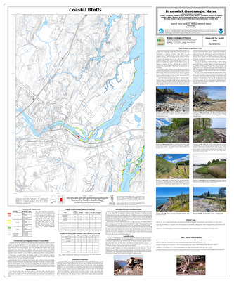
Surficial geology of the Brunswick quadrangle, Maine
Thomas K. Weddle
Maine Geological Survey, Open-File Map 01-484
-

Surficial geology of the Mechanic Falls quadrangle, Maine
Carol T. Hildreth
Maine Geological Survey, Open-File Map 01-478
-

Surficial geology of the Oxford quadrangle, Maine
Woodrow B. Thompson
Maine Geological Survey, Open-File Map 01-393
-

Surficial materials of the Alder Brook quadrangle, Maine
Daniel B. Locke
Maine Geological Survey, Open-File Map 01-2
-

Surficial materials of the Andover quadrangle, Maine
Woodrow B. Thompson
Maine Geological Survey, Open-File Map 01-4 (Superseded by Theis, et. al., 2025, Maine Geological Survey Open-File 25-24)
-

Surficial materials of the Athens quadrangle, Maine
Andres Meglioli
Maine Geological Survey, Open-File Map 01-6
-

Surficial materials of the Benedicta quadrangle, Maine
Daniel B. Locke
Maine Geological Survey, Open-File Map 01-12
-

Surficial materials of the Big Lake quadrangle, Maine
Daniel B. Locke
Maine Geological Survey, Open-File Map 01-289
-

Surficial materials of the Bingham quadrangle, Maine
Andres Meglioli
Maine Geological Survey, Open-File Map 01-14
-

Surficial materials of the Black Nubble quadrangle, Maine
Thomas K. Weddle
Maine Geological Survey, Open-File Map 01-17
-

Surficial materials of the Bottle Lake quadrangle, Maine
Thomas K. Weddle
Maine Geological Survey, Open-File Map 01-314
-

Surficial materials of the Bowers Mountain quadrangle, Maine
Thomas K. Weddle
Maine Geological Survey, Open-File Map 01-311
-

Surficial materials of the B Pond quadrangle, Maine
Woodrow B. Thompson
Maine Geological Survey, Open-File Map 01-8 (Superseded by Theis and Thompson, 2025, Maine Geological Survey Open-File 25-4)
-

Surficial materials of the Bradford quadrangle, Maine
Thomas V. Lowell
Maine Geological Survey, Open-File Map 01-20
-

Surficial materials of the Brookton quadrangle, Maine
Thomas K. Weddle
Maine Geological Survey, Open-File Map 01-310
-

Surficial materials of the Brunswick quadrangle, Maine
Daniel B. Locke and Thomas K. Weddle
Maine Geological Survey, Open-File Map 01-485
-

Surficial materials of the Caratunk quadrangle, Maine
Andres Meglioli
Maine Geological Survey, Open-File Map 01-33
-

Surficial materials of the Carmel quadrangle, Maine
Thomas K. Weddle
Maine Geological Survey, Open-File Map 01-35
-

Surficial materials of the Charleston quadrangle, Maine
Thomas V. Lowell
Maine Geological Survey, Open-File Map 01-38
-

Surficial materials of the Clifford Lake quadrangle, Maine
Craig D. Neil and Daniel B. Locke
Maine Geological Survey, Open-File Map 01-292
-

Surficial materials of the Crawford Lake quadrangle, Maine
Daniel B. Locke
Maine Geological Survey, Open-File Map 01-293
-

Surficial materials of the Crystal quadrangle, Maine
Daniel B. Locke
Maine Geological Survey, Open-File Map 01-42
-

Surficial materials of the Danforth quadrangle, Maine
Daniel B. Locke
Maine Geological Survey, Open-File Map 01-44
-

Surficial materials of the Dark Cove Mountain quadrangle, Maine
Craig D. Neil
Maine Geological Survey, Open-File Map 01-281
-

Surficial materials of the Deasey Mountain quadrangle, Maine
Thomas K. Weddle
Maine Geological Survey, Open-File Map 01-46
-

Surficial materials of the Dill Hill quadrangle, Maine
Thomas K. Weddle
Maine Geological Survey, Open-File Map 01-312
-

Surficial materials of the Dimmick Mountain quadrangle, Maine
Andres Meglioli
Maine Geological Survey, Open-File Map 01-48
-

Surficial materials of the Dixfield quadrangle, Maine
Glenn C. Prescott Jr
Maine Geological Survey, Open-File Map 01-50 (Superseded by Spigel and Prescott, 2018, Maine Geological Survey Open-File 18-3)
-

Surficial materials of the Dixmont quadrangle, Maine
Thomas K. Weddle
Maine Geological Survey, Open-File Map 01-52
-

Surficial materials of the Dover-Foxcroft quadrangle, Maine
Thomas V. Lowell
Maine Geological Survey, Open-File Map 01-54
-

Surficial materials of the Duck Lake quadrangle, Maine
Craig D. Neil
Maine Geological Survey, Open-File Map 01-280
-

Surficial materials of the East Andover quadrangle, Maine
Glenn C. Prescott Jr
Maine Geological Survey, Open-File Map 01-56 (Superseded by Prescott, 2016, Maine Geological Survey Open-File 16-25)
-

Surficial materials of the East Dixmont quadrangle, Maine
Thomas K. Weddle
Maine Geological Survey, Open-File Map 01-59
-

Surficial materials of the East Millinocket quadrangle, Maine
Thomas K. Weddle
Maine Geological Survey, Open-File Map 01-61
-

Surficial materials of the East Winn quadrangle, Maine
Glenn C. Prescott Jr
Maine Geological Survey, Open-File Map 01-63
-

Surficial materials of the Embden Pond quadrangle, Maine
Andres Meglioli
Maine Geological Survey, Open-File Map 01-66
-

Surficial materials of the Endless Lake quadrangle, Maine
Daniel B. Locke
Maine Geological Survey, Open-File Map 01-68
-

Surficial materials of the Farrow Mountain quadrangle, Maine
Thomas K. Weddle
Maine Geological Survey, Open-File Map 01-313
-

Surficial materials of the Fletcher Peak quadrangle, Maine
Craig D. Neil
Maine Geological Survey, Open-File Map 01-284
-

Surficial materials of the Forest City quadrangle, Maine
Michael E. Foley
Maine Geological Survey, Open-File Map 01-351
-

Surficial materials of the Forest quadrangle, Maine
Michael E. Foley
Maine Geological Survey, Open-File Map 01-298
-

Surficial materials of the Foster Ridge quadrangle, Maine
Andres Meglioli
Maine Geological Survey, Open-File Map 01-70
-

Surficial materials of the Garland quadrangle, Maine
Thomas V. Lowell
Maine Geological Survey, Open-File Map 01-72
-

Surficial materials of the Gassabias Lake quadrangle, Maine
Craig D. Neil
Maine Geological Survey, Open-File Map 01-283
-

Surficial materials of the Grand Lake Stream quadrangle, Maine
Craig D. Neil
Maine Geological Survey, Open-File Map 01-282
-

Surficial materials of the Green Mountain quadrangle, Maine
Daniel B. Locke
Maine Geological Survey, Open-File Map 01-76
-

Surficial materials of the Guilford quadrangle, Maine
Glenn C. Prescott Jr
Maine Geological Survey, Open-File Map 01-80
-

Surficial materials of the Hardy Pond quadrangle, Maine
Daniel B. Locke
Maine Geological Survey, Open-File Map 01-84
-

Surficial materials of the Hartland quadrangle, Maine
Glenn C. Prescott Jr
Maine Geological Survey, Open-File Map 01-87
-

Surficial materials of the Harvey quadrangle, Maine
Daniel B. Locke
Maine Geological Survey, Open-File Map 01-89
-

Surficial materials of the Haynesville quadrangle, Maine
Daniel B. Locke
Maine Geological Survey, Open-File Map 01-91
-

Surficial materials of the Houghton quadrangle, Maine
Thomas K. Weddle
Maine Geological Survey, Open-File Map 01-95
-

Surficial materials of the Houlton North quadrangle, Maine
Daniel B. Locke
Maine Geological Survey, Open-File Map 01-97
-

Surficial materials of the Houlton South quadrangle, Maine
Daniel B. Locke
Maine Geological Survey, Open-File Map 01-99
-

Surficial materials of the Howland quadrangle, Maine
Dale F. Doughty and Edward B. Baker
Maine Geological Survey, Open-File Map 01-101 (Superseded by Hooke and others, 2016, Maine Geological Survey Open-File 16-23)
-

Surficial materials of the Island Falls quadrangle, Maine
Daniel B. Locke
Maine Geological Survey, Open-File Map 01-103
-

Surficial materials of the Jimmey Mountain quadrangle, Maine
Daniel B. Locke
Maine Geological Survey, Open-File Map 01-105
-

Surficial materials of the Kelleyland quadrangle, Maine
Michael E. Foley
Maine Geological Survey, Open-File Map 01-307
-

Surficial materials of the Kennebago quadrangle, Maine
Woodrow B. Thompson
Maine Geological Survey, Open-File Map 01-110
-

Surficial materials of the Kingman quadrangle, Maine
Glenn C. Prescott Jr
Maine Geological Survey, Open-File Map 01-115
-

Surficial materials of the Kingsbury quadrangle, Maine
Andres Meglioli
Maine Geological Survey, Open-File Map 01-117
-

Surficial materials of the Knowles Corner quadrangle, Maine
Daniel B. Locke
Maine Geological Survey, Open-File Map 01-119
-

Surficial materials of the Lagrange quadrangle, Maine
Dale F. Doughty
Maine Geological Survey, Open-File Map 01-121
-

Surficial materials of the Lake Auburn West quadrangle, Maine
Daniel B. Locke and Woodrow B. Thompson
Maine Geological Survey, Open-File Map 01-397
-

Surficial materials of the Lake Cathance quadrangle, Maine
Daniel B. Locke
Maine Geological Survey, Open-File Map 01-297
-

Surficial materials of the Lambert Lake quadrangle, Maine
Michael E. Foley
Maine Geological Survey, Open-File Map 01-300
-

Surficial materials of the Lee quadrangle, Maine
Glenn C. Prescott Jr
Maine Geological Survey, Open-File Map 01-123
-

Surficial materials of the Lincoln Center quadrangle, Maine
Glenn C. Prescott Jr
Maine Geological Survey, Open-File Map 01-125
-

Surficial materials of the Lincoln Pond quadrangle, Maine
Woodrow B. Thompson
Maine Geological Survey, Open-File Map 01-127
-

Surficial materials of the Lincoln West quadrangle, Maine
Daniel B. Locke
Maine Geological Survey, Open-File Map 01-129
-

Surficial materials of the Linneus quadrangle, Maine
Daniel B. Locke
Maine Geological Survey, Open-File Map 01-131
-

Surficial materials of the Little Kennebago Lake quadrangle, Maine
Woodrow B. Thompson
Maine Geological Survey, Open-File Map 01-134
-

Surficial materials of the Lookout Mountain quadrangle, Maine
Thomas K. Weddle
Maine Geological Survey, Open-File Map 01-136
-

Surficial materials of the Loon Bay quadrangle, Maine
Michael E. Foley
Maine Geological Survey, Open-File Map 01-304