


The Maine Geological Survey provides the people and businesses of Maine with essential geologic information about the land where we live and work.
Note: Many state documents are offered in PDF format. To view PDF documents, you will need the free Adobe Reader. If you need assistance, view our Maine government PDF Help page or contact the contributing Maine State agency via the link on the left sidebar under “Links”.
-

Surficial materials of the Ludlow quadrangle, Maine
Daniel B. Locke
Maine Geological Survey, Open-File Map 01-138
-

Surficial materials of the Madrid quadrangle, Maine
Thomas K. Weddle
Maine Geological Survey, Open-File Map 01-140
-

Surficial materials of the Mahoney Hill quadrangle, Maine
Andres Meglioli
Maine Geological Survey, Open-File Map 01-142
-

Surficial materials of the Mattamiscontis Mountain quadrangle, Maine
Daniel B. Locke
Maine Geological Survey, Open-File Map 01-144
-

Surficial materials of the Mattaseunk Lake quadrangle, Maine
Glenn C. Prescott Jr
Maine Geological Survey, Open-File Map 01-146
-

Surficial materials of the Mattawamkeag Lake quadrangle, Maine
Daniel B. Locke
Maine Geological Survey, Open-File Map 01-150
-

Surficial materials of the Mattawamkeag quadrangle, Maine
Glenn C. Prescott Jr
Maine Geological Survey, Open-File Map 01-148
-

Surficial materials of the McNally Ridge quadrangle, Maine
Daniel B. Locke
Maine Geological Survey, Open-File Map 01-152
-

Surficial materials of the Mechanic Falls quadrangle, Maine
Daniel B. Locke and Carol T. Hildreth
Maine Geological Survey, Open-File Map 01-482
-

Surficial materials of the Meddybemps Lake West quadrangle, Maine
Daniel B. Locke
Maine Geological Survey, Open-File Map 01-294
-

Surficial materials of the Medunkeunk Lake quadrangle, Maine
Thomas K. Weddle
Maine Geological Survey, Open-File Map 01-154
-

Surficial materials of the Millinocket quadrangle, Maine
Thomas K. Weddle
Maine Geological Survey, Open-File Map 01-158
-

Surficial materials of the Milo South quadrangle, Maine
Thomas V. Lowell
Maine Geological Survey, Open-File Map 01-160
-

Surficial materials of the Minot quadrangle, Maine
Daniel B. Locke and Carol T. Hildreth
Maine Geological Survey, Open-File Map 01-483
-

Surficial materials of the Molunkus Lake quadrangle, Maine
Daniel B. Locke
Maine Geological Survey, Open-File Map 01-162
-

Surficial materials of the Monarda quadrangle, Maine
Daniel B. Locke
Maine Geological Survey, Open-File Map 01-164
-

Surficial materials of the Monroe Lake quadrangle, Maine
Craig D. Neil
Maine Geological Survey, Open-File Map 01-285
-

Surficial materials of the Monticello quadrangle, Maine
Daniel B. Locke
Maine Geological Survey, Open-File Map 01-166
-

Surficial materials of the Monument Brook quadrangle, Maine
Daniel B. Locke
Maine Geological Survey, Open-File Map 01-168
-

Surficial materials of the Mount Abraham quadrangle, Maine
Thomas K. Weddle
Maine Geological Survey, Open-File Map 01-170
-

Surficial materials of the Mount Chase quadrangle, Maine
Daniel B. Locke
Maine Geological Survey, Open-File Map 01-173
-

Surficial materials of the Nine Meadow Ridge quadrangle, Maine
Daniel B. Locke
Maine Geological Survey, Open-File Map 01-177
-

Surficial materials of the North Amity quadrangle, Maine
Daniel B. Locke
Maine Geological Survey, Open-File Map 01-180
-

Surficial materials of the North Brook Ridge quadrangle, Maine
Daniel B. Locke
Maine Geological Survey, Open-File Map 01-181
-

Surficial materials of the Oakfield quadrangle, Maine
Daniel B. Locke
Maine Geological Survey, Open-File Map 01-183
-

Surficial materials of the Olamon quadrangle, Maine
Edward B. Baker
Maine Geological Survey, Open-File Map 01-185
-

Surficial materials of the Old Speck Mountain quadrangle, Maine
Woodrow B. Thompson
Maine Geological Survey, Open-File Map 01-187 (Superseded by Theis and Thompson, 2023, Maine Geological Survey Open-File 23-9)
-

Surficial materials of the Oquossoc quadrangle, Maine
Woodrow B. Thompson
Maine Geological Survey, Open-File Map 01-191
-

Surficial materials of the Orient quadrangle, Maine
Daniel B. Locke
Maine Geological Survey, Open-File Map 01-193
-

Surficial materials of the Oxbrook Lakes quadrangle, Maine
Thomas K. Weddle
Maine Geological Survey, Open-File Map 01-316
-

Surficial materials of the Oxford quadrangle, Maine
Daniel B. Locke and Woodrow B. Thompson
Maine Geological Survey, Open-File Map 01-396
-

Surficial materials of the Parmachenee Lake quadrangle, Maine
Woodrow B. Thompson
Maine Geological Survey, Open-File Map 01-199
-

Surficial materials of the Passadumkeag quadrangle, Maine
Edward B. Baker
Maine Geological Survey, Open-File Map 01-201
-

Surficial materials of the Patten quadrangle, Maine
Daniel B. Locke
Maine Geological Survey, Open-File Map 01-203
-

Surficial materials of the Peaked Mountain quadrangle, Maine
Craig D. Neil
Maine Geological Survey, Open-File Map 01-287
-

Surficial materials of the Plymouth quadrangle, Maine
Thomas K. Weddle
Maine Geological Survey, Open-File Map 01-205
-

Surficial materials of the Poplar Mountain quadrangle, Maine
Harold W. Borns Jr
Maine Geological Survey, Open-File Map 01-207
-

Surficial materials of the Potter Hill quadrangle, Maine
Thomas K. Weddle
Maine Geological Survey, Open-File Map 01-308
-

Surficial materials of the Princeton quadrangle, Maine
Daniel B. Locke
Maine Geological Survey, Open-File Map 01-290
-

Surficial materials of the Puzzle Mountain quadrangle, Maine
Woodrow B. Thompson
Maine Geological Survey, Open-File Map 01-211 (Superseded by Spigel, 2021, Maine Geological Survey Open-File 21-5)
-

Surficial materials of the Quill Hill quadrangle, Maine
Thomas K. Weddle
Maine Geological Survey, Open-File Map 01-213
-

Surficial materials of the Quillpig Mountain quadrangle, Maine
Craig D. Neil
Maine Geological Survey, Open-File Map 01-286
-

Surficial materials of the Redington quadrangle, Maine
Craig D. Neil
Maine Geological Survey, Open-File Map 01-215
-

Surficial materials of the Reed Pond quadrangle, Maine
Daniel B. Locke
Maine Geological Survey, Open-File Map 01-217
-

Surficial materials of the Richardson Pond quadrangle, Maine
Woodrow B. Thompson
Maine Geological Survey, Open-File Map 01-219
-

Surficial materials of the Round Lake quadrangle, Maine
Daniel B. Locke
Maine Geological Survey, Open-File Map 01-296
-

Surficial materials of the Roxbury quadrangle, Maine
Glenn C. Prescott Jr
Maine Geological Survey, Open-File Map 01-221 (Superseded by Spigel and Prescott, 2020, Maine Geological Survey Open-File 20-4)
-

Surficial materials of the Rumford quadrangle, Maine
Glenn C. Prescott Jr
Maine Geological Survey, Open-File Map 01-223 (Superseded by Locke and Weddle, 2017, Maine Geological Survey Open-File 17-6)
-

Surficial materials of the Rump Mountain quadrangle, Maine
Woodrow B. Thompson
Maine Geological Survey, Open-File Map 01-225
-

Surficial materials of the Saddleback Mountain quadrangle, Maine
Craig D. Neil
Maine Geological Survey, Open-File Map 01-227. (Superseded by Theis, 2025, Maine Geological Survey Open-File 25-7)
-

Surficial materials of the Salmon Stream Lake quadrangle, Maine
Daniel B. Locke
Maine Geological Survey, Open-File Map 01-229
-

Surficial materials of the Sangerville quadrangle, Maine
Glenn C. Prescott Jr
Maine Geological Survey, Open-File Map 01-231
-

Surficial materials of the Scraggly Lake quadrangle, Maine
Thomas K. Weddle
Maine Geological Survey, Open-File Map 01-315
-

Surficial materials of the Seboeis quadrangle, Maine
Daniel B. Locke
Maine Geological Survey, Open-File Map 01-233
-

Surficial materials of the Simsquish Lake quadrangle, Maine
Michael E. Foley
Maine Geological Survey, Open-File Map 01-303
-

Surficial materials of the Smyrna Mills quadrangle, Maine
Daniel B. Locke
Maine Geological Survey, Open-File Map 01-235
-

Surficial materials of the Solon quadrangle, Maine
Andres Meglioli
Maine Geological Survey, Open-File Map 01-239
-

Surficial materials of the South Lagrange quadrangle, Maine
Dale F. Doughty
Maine Geological Survey, Open-File Map 01-241
-

Surficial materials of the Springfield quadrangle, Maine
Glenn C. Prescott Jr
Maine Geological Survey, Open-File Map 01-243
-

Surficial materials of the Stacyville quadrangle, Maine
Thomas K. Weddle
Maine Geological Survey, Open-File Map 01-247
-

Surficial materials of the St. Croix Lake quadrangle, Maine
Daniel B. Locke
Maine Geological Survey, Open-File Map 01-245
-

Surficial materials of the Stetson Mountain quadrangle, Maine
Thomas K. Weddle
Maine Geological Survey, Open-File Map 01-309
-

Surficial materials of the Stratton quadrangle, Maine
Thomas K. Weddle
Maine Geological Survey, Open-File Map 01-250
-

Surficial materials of the Ten Mile Lake quadrangle, Maine
Daniel B. Locke
Maine Geological Survey, Open-File Map 01-253
-

Surficial materials of the Tomah Mountain quadrangle, Maine
Michael E. Foley
Maine Geological Survey, Open-File Map 01-302
-

Surficial materials of the Tomah Ridge quadrangle, Maine
Michael E. Foley
Maine Geological Survey, Open-File Map 01-306
-

Surficial materials of the Tug Mountain quadrangle, Maine
Craig D. Neil
Maine Geological Survey, Open-File Map 01-288
-

Surficial materials of the Twin Brook quadrangle, Maine
Daniel B. Locke
Maine Geological Survey, Open-File Map 01-257
-

Surficial materials of the Umcolcus Lake quadrangle, Maine
Daniel B. Locke
Maine Geological Survey, Open-File Map 01-261
-

Surficial materials of the Vanceboro quadrangle, Maine
Michael E. Foley
Maine Geological Survey, Open-File Map 01-301
-

Surficial materials of the Waite quadrangle, Maine
Michael E. Foley
Maine Geological Survey, Open-File Map 01-305
-

Surficial materials of the Weld quadrangle, Maine
Glenn C. Prescott Jr
Maine Geological Survey, Open-File Map 01-266 (Superseded by Spigel and Prescott, 2020, Maine Geological Survey Open-File 20-6)
-

Surficial materials of the Wesley quadrangle, Maine
Craig D. Neil
Maine Geological Survey, Open-File Map 01-295
-

Surficial materials of the West Corinth quadrangle, Maine
Thomas V. Lowell
Maine Geological Survey, Open-File Map 01-269
-

Surficial materials of the Whetstone Mountain quadrangle, Maine
Thomas K. Weddle
Maine Geological Survey, Open-File Map 01-271
-

Surficial materials of the Whetstone Pond quadrangle, Maine
Glenn C. Prescott Jr
Maine Geological Survey, Open-File Map 01-273
-

Surficial materials of the Wilsons Mills quadrangle, Maine
Woodrow B. Thompson
Maine Geological Survey, Open-File Map 01-275
-

Surficial materials of the Witham Mountain quadrangle, Maine
Harold W. Borns Jr
Maine Geological Survey, Open-File Map 01-277
-

Surficial materials of the Woodland quadrangle, Maine
Daniel B. Locke
Maine Geological Survey, Open-File Map 01-291
-

Surficial materials of the Wytopitlock quadrangle, Maine
Daniel B. Locke
Maine Geological Survey, Open-File Map 01-279
-

Significant sand and gravel aquifers in the Addison quadrangle, Maine
Craig D. Neil and Daniel B. Locke
Maine Geological Survey, Open-File Map 00-196
-

Significant sand and gravel aquifers in the Amherst quadrangle, Maine
Craig D. Neil and Daniel B. Locke
Maine Geological Survey, Open-File Map 00-175
-

Significant sand and gravel aquifers in the Beech Hill Pond quadrangle, Maine
Craig D. Neil and Daniel B. Locke
Maine Geological Survey, Open-File Map 00-177
-

Significant sand and gravel aquifers in the Belgrade Lakes quadrangle, Maine
Craig D. Neil and Daniel B. Locke
Maine Geological Survey, Open-File Map 00-28
-

Significant sand and gravel aquifers in the Bog Lake quadrangle, Maine
Craig D. Neil and Daniel B. Locke
Maine Geological Survey, Open-File Map 00-191
-

Significant sand and gravel aquifers in the Burnham quadrangle, Maine
Craig D. Neil and Daniel B. Locke
Maine Geological Survey, Open-File Map 00-17
-

Significant sand and gravel aquifers in the Calais quadrangle, Maine
Craig D. Neil and Daniel B. Locke
Maine Geological Survey, Open-File Map 00-114
-

Significant sand and gravel aquifers in the Canaan quadrangle, Maine
Craig D. Neil and Daniel B. Locke
Maine Geological Survey, Open-File Map 00-13
-

Significant sand and gravel aquifers in the Cherryfield quadrangle, Maine
Craig D. Neil and Daniel B. Locke
Maine Geological Survey, Open-File Map 00-188
-

Significant sand and gravel aquifers in the China Lake quadrangle, Maine
Craig D. Neil and Daniel B. Locke
Maine Geological Survey, Open-File Map 00-1.
-

Significant sand and gravel aquifers in the Clinton quadrangle, Maine
Craig D. Neil and Daniel B. Locke
Maine Geological Survey, Open-File Map 00-16
-

Significant sand and gravel aquifers in the Columbia Falls quadrangle, Maine
Craig D. Neil and Daniel B. Locke
Maine Geological Survey, Open-File Map 00-193
-

Significant sand and gravel aquifers in the Cutler quadrangle, Maine
Craig D. Neil and Daniel B. Locke
Maine Geological Survey, Open-File Map 00-131
-

Significant sand and gravel aquifers in the Eastbrook quadrangle, Maine
Craig D. Neil and Daniel B. Locke
Maine Geological Survey, Open-File Map 00-178
-

Significant sand and gravel aquifers in the East Dixfield quadrangle, Maine
Craig D. Neil and Daniel B. Locke
Maine Geological Survey, Open-File Map 00-37
-

Significant sand and gravel aquifers in the Epping quadrangle, Maine
Craig D. Neil and Daniel B. Locke
Maine Geological Survey, Open-File Map 00-186
-

Significant sand and gravel aquifers in the Farmington Falls quadrangle, Maine
Craig D. Neil and Daniel B. Locke
Maine Geological Survey, Open-File Map 00-39
-

Significant sand and gravel aquifers in the Farmington quadrangle, Maine
Craig D. Neil and Daniel B. Locke
Maine Geological Survey, Open-File Map 00-35
-

Significant sand and gravel aquifers in the Harrington quadrangle, Maine
Craig D. Neil and Daniel B. Locke
Maine Geological Survey, Open-File Map 00-189
-

Significant sand and gravel aquifers in the Hinckley quadrangle, Maine
Craig D. Neil and Daniel B. Locke
Maine Geological Survey, Open-File Map 00-27
-

Significant sand and gravel aquifers in the Jefferson quadrangle, Maine
Craig D. Neil and Daniel B. Locke
Maine Geological Survey, Open-File Map 00-8
-

Significant sand and gravel aquifers in the Jonesport quadrangle, Maine
Craig D. Neil and Daniel B. Locke
Maine Geological Survey, Open-File Map 00-197
-

Significant sand and gravel aquifers in the Lead Mountain quadrangle, Maine
Craig D. Neil and Daniel B. Locke
Maine Geological Survey, Open-File Map 00-181
-

Significant sand and gravel aquifers in the Liberty quadrangle, Maine
Craig D. Neil and Daniel B. Locke
Maine Geological Survey, Open-File Map 00-3
-

Significant sand and gravel aquifers in the Long Lake quadrangle, Maine
Craig D. Neil and Daniel B. Locke
Maine Geological Survey, Open-File Map 00-127
-

Significant sand and gravel aquifers in the Lubec quadrangle, Maine
Craig D. Neil and Daniel B. Locke
Maine Geological Survey, Open-File Map 00-119
-

Significant sand and gravel aquifers in the Machias Bay quadrangle, Maine
Craig D. Neil and Daniel B. Locke
Maine Geological Survey, Open-File Map 00-130
-

Significant sand and gravel aquifers in the Machias quadrangle, Maine
Craig D. Neil and Daniel B. Locke
Maine Geological Survey, Open-File Map 00-195
-

Significant sand and gravel aquifers in the Madison East quadrangle, Maine
Craig D. Neil and Daniel B. Locke
Maine Geological Survey, Open-File Map 00-23
-

Significant sand and gravel aquifers in the Madison West quadrangle, Maine
Craig D. Neil and Daniel B. Locke
Maine Geological Survey, Open-File Map 00-22
-

Significant sand and gravel aquifers in the Meddybemps Lake East quadrangle, Maine
Craig D. Neil and Daniel B. Locke
Maine Geological Survey, Open-File Map 00-115
-

Significant sand and gravel aquifers in the Mercer quadrangle, Maine
Craig D. Neil and Daniel B. Locke
Maine Geological Survey, Open-File Map 00-25
-

Significant sand and gravel aquifers in the Molasses Pond quadrangle, Maine
Craig D. Neil and Daniel B. Locke
Maine Geological Survey, Open-File Map 00-179
-

Significant sand and gravel aquifers in the Montegail Pond quadrangle, Maine
Craig D. Neil and Daniel B. Locke
Maine Geological Survey, Open-File Map 00-183
-

Significant sand and gravel aquifers in the Mount Blue quadrangle, Maine
Craig D. Neil and Daniel B. Locke
Maine Geological Survey, Open-File Map 00-34
-

Significant sand and gravel aquifers in the Newport quadrangle, Maine
Craig D. Neil and Daniel B. Locke
Maine Geological Survey, Open-File Map 00-15
-

Significant sand and gravel aquifers in the New Sharon quadrangle, Maine
Craig D. Neil and Daniel B. Locke
Maine Geological Survey, Open-File Map 00-36
-

Significant sand and gravel aquifers in the Norridgewock quadrangle, Maine
Craig D. Neil and Daniel B. Locke
Maine Geological Survey, Open-File Map 00-26
-

Significant sand and gravel aquifers in the Northeast Bluff quadrangle, Maine
Craig D. Neil and Daniel B. Locke
Maine Geological Survey, Open-File Map 00-182
-

Significant sand and gravel aquifers in the Palermo quadrangle, Maine
Craig D. Neil and Daniel B. Locke
Maine Geological Survey, Open-File Map 00-2
-

Significant sand and gravel aquifers in the Peaked Mountain Pond quadrangle, Maine
Craig D. Neil and Daniel B. Locke
Maine Geological Survey, Open-File Map 00-190
-

Significant sand and gravel aquifers in the Pembroke quadrangle, Maine
Craig D. Neil and Daniel B. Locke
Maine Geological Survey, Open-File Map 00-118
-

Significant sand and gravel aquifers in the Pittsfield quadrangle, Maine
Craig D. Neil and Daniel B. Locke
Maine Geological Survey, Open-File Map 00-14
-

Significant sand and gravel aquifers in the Porcupine Mountain quadrangle, Maine
Craig D. Neil and Daniel B. Locke
Maine Geological Survey, Open-File Map 00-117
-

Significant sand and gravel aquifers in the Razorville quadrangle, Maine
Craig D. Neil and Daniel B. Locke
Maine Geological Survey, Open-File Map 00-5
-

Significant sand and gravel aquifers in the Red Beach quadrangle, Maine
Craig D. Neil and Daniel B. Locke
Maine Geological Survey, Open-File Map 00-116
-

Significant sand and gravel aquifers in the Rocky Pond quadrangle, Maine
Craig D. Neil and Daniel B. Locke
Maine Geological Survey, Open-File Map 00-176
-

Significant sand and gravel aquifers in the Rome quadrangle, Maine
Craig D. Neil and Daniel B. Locke
Maine Geological Survey, Open-File Map 00-29
-

Significant sand and gravel aquifers in the Roque Bluffs quadrangle, Maine
Craig D. Neil and Daniel B. Locke
Maine Geological Survey, Open-File Map 00-198
-

Significant sand and gravel aquifers in the Schoodic Lake quadrangle, Maine
Craig D. Neil and Daniel B. Locke
Maine Geological Survey, Open-File Map 00-185
-

Significant sand and gravel aquifers in the Skowhegan quadrangle, Maine
Craig D. Neil and Daniel B. Locke
Maine Geological Survey, Open-File Map 00-24
-

Significant sand and gravel aquifers in the Sullivan quadrangle, Maine
Craig D. Neil and Daniel B. Locke
Maine Geological Survey, Open-File Map 00-180
-

Significant sand and gravel aquifers in the Tunk Lake quadrangle, Maine
Craig D. Neil and Daniel B. Locke
Maine Geological Survey, Open-File Map 00-187
-

Significant sand and gravel aquifers in the Tunk Mountain quadrangle, Maine
Craig D. Neil and Daniel B. Locke
Maine Geological Survey, Open-File Map 00-184
-

Significant sand and gravel aquifers in the Unity Pond quadrangle, Maine
Craig D. Neil and Daniel B. Locke
Maine Geological Survey, Open-File Map 00-18
-

Significant sand and gravel aquifers in the Unity quadrangle, Maine
Craig D. Neil and Daniel B. Locke
Maine Geological Survey, Open-File Map 00-21
-

Significant sand and gravel aquifers in the Washington quadrangle, Maine
Craig D. Neil and Daniel B. Locke
Maine Geological Survey, Open-File Map 00-6
-

Significant sand and gravel aquifers in the Waterville quadrangle, Maine
Craig D. Neil and Daniel B. Locke
Maine Geological Survey, Open-File Map 00-30
-

Significant sand and gravel aquifers in the Weeks Mills quadrangle, Maine
Craig D. Neil and Daniel B. Locke
Maine Geological Survey, Open-File Map 00-4
-

Significant sand and gravel aquifers in the West Lubec quadrangle, Maine
Craig D. Neil and Daniel B. Locke
Maine Geological Survey, Open-File Map 00-129
-

Significant sand and gravel aquifers in the Whiting quadrangle, Maine
Craig D. Neil and Daniel B. Locke
Maine Geological Survey, Open-File Map 00-128
-

Significant sand and gravel aquifers in the Whitneyville quadrangle, Maine
Craig D. Neil and Daniel B. Locke
Maine Geological Survey, Open-File Map 00-194
-

Significant sand and gravel aquifers in the Wilton quadrangle, Maine
Craig D. Neil and Daniel B. Locke
Maine Geological Survey, Open-File Map 00-38
-

Surficial geology of the Casco quadrangle, Maine
Carol T. Hildreth
Maine Geological Survey, Open-File Map 00-141
-

Surficial materials of the Addison quadrangle, Maine
Daniel B. Locke
Maine Geological Survey, Open-File Map 00-171
-

Surficial materials of the Amherst quadrangle, Maine
Daniel B. Locke
Maine Geological Survey, Open-File Map 00-150
-

Surficial materials of the Beech Hill Pond quadrangle, Maine
Daniel B. Locke
Maine Geological Survey, Open-File Map 00-152
-

Surficial materials of the Belgrade Lakes quadrangle, Maine
Daniel B. Locke
Maine Geological Survey, Open-File Map 00-67 (Superseded by Theis and Locke, 2023, Maine Geological Survey Open-File 23-7)
-

Surficial materials of the Bog Lake quadrangle, Maine
Daniel B. Locke
Maine Geological Survey, Open-File Map 00-166
-

Surficial materials of the Bridgton quadrangle, Maine
Daniel B. Locke and Carol T. Hildreth
Maine Geological Survey, Open-File Map 00-140
-

Surficial materials of the Burnham quadrangle, Maine
Daniel B. Locke
Maine Geological Survey, Open-File Map 00-56
-

Surficial materials of the Calais quadrangle, Maine
Daniel B. Locke
Maine Geological Survey, Open-File Map 00-105
-

Surficial materials of the Canaan quadrangle, Maine
Daniel B. Locke
Maine Geological Survey, Open-File Map 00-52
-

Surficial materials of the Casco quadrangle, Maine
Daniel B. Locke and Carol T. Hildreth
Maine Geological Survey, Open-File Map 00-143
-

Surficial materials of the Cherryfield quadrangle, Maine
Daniel B. Locke
Maine Geological Survey, Open-File Map 00-163
-

Surficial materials of the Clinton quadrangle, Maine
Daniel B. Locke
Maine Geological Survey, Open-File Map 00-55
-

Surficial materials of the Columbia Falls quadrangle, Maine
Daniel B. Locke
Maine Geological Survey, Open-File Map 00-168
-

Surficial materials of the Cross Island quadrangle, Maine
Daniel B. Locke
Maine Geological Survey, Open-File Map 00-126
-

Surficial materials of the Cutler quadrangle, Maine
Daniel B. Locke
Maine Geological Survey, Open-File Map 00-124
-

Surficial materials of the Devils Head quadrangle, Maine
Daniel B. Locke
Maine Geological Survey, Open-File Map 00-106
-

Surficial materials of the Eastbrook quadrangle, Maine
Daniel B. Locke
Maine Geological Survey, Open-File Map 00-153
-

Surficial materials of the East Dixfield quadrangle, Maine
Daniel B. Locke
Maine Geological Survey, Open-File Map 00-76 (Superseded by Spigel and Locke, 2018, Maine Geological Survey Open-File 18-17)
-

Surficial materials of the Eastport quadrangle, Maine
Daniel B. Locke
Maine Geological Survey, Open-File Map 00-112
-

Surficial materials of the Epping quadrangle, Maine
Daniel B. Locke
Maine Geological Survey, Open-File Map 00-161
-

Surficial materials of the Farmington Falls quadrangle, Maine
Daniel B. Locke
Maine Geological Survey, Open-File Map 00-78 (Superseded by Theis and Millette, 2024, Maine Geological Survey Geologic Map 24-7)
-

Surficial materials of the Harrington quadrangle, Maine
Daniel B. Locke
Maine Geological Survey, Open-File Map 00-164
-

Surficial materials of the Hinckley quadrangle, Maine
Daniel B. Locke
Maine Geological Survey, Open-File Map 00-66 (Superseded by Johnston and Locke, 2016, Maine Geological Survey Open-File 16-4)
-

Surficial materials of the Hopkins Pond quadrangle, Maine
Daniel B. Locke
Maine Geological Survey, Open-File Map 00-149
-

Surficial materials of the Jonesport quadrangle, Maine
Daniel B. Locke
Maine Geological Survey, Open-File Map 00-172
-

Surficial materials of the Lead Mountain quadrangle, Maine
Daniel B. Locke
Maine Geological Survey, Open-File Map 00-156
-

Surficial materials of the Liberty quadrangle, Maine
Daniel B. Locke
Maine Geological Survey, Open-File Map 00-42
-

Surficial materials of the Long Lake quadrangle, Maine
Daniel B. Locke
Maine Geological Survey, Open-File Map 00-120
-

Surficial materials of the Lubec quadrangle, Maine
Daniel B. Locke
Maine Geological Survey, Open-File Map 00-113
-

Surficial materials of the Machias Bay quadrangle, Maine
Daniel B. Locke
Maine Geological Survey, Open-File Map 00-123
-

Surficial materials of the Machias quadrangle, Maine
Daniel B. Locke
Maine Geological Survey, Open-File Map 00-170
-

Surficial materials of the Madison East quadrangle, Maine
Daniel B. Locke
Maine Geological Survey, Open-File Map 00-62
-

Surficial materials of the Madison West quadrangle, Maine
Daniel B. Locke
Maine Geological Survey, Open-File Map 00-61
-

Surficial materials of the Meddybemps Lake East quadrangle, Maine
Daniel B. Locke
Maine Geological Survey, Open-File Map 00-107
-

Surficial materials of the Mercer quadrangle, Maine
Daniel B. Locke
Maine Geological Survey, Open-File Map 00-64
-

Surficial materials of the Molasses Pond quadrangle, Maine
Daniel B. Locke
Maine Geological Survey, Open-File Map 00-154
-

Surficial materials of the Montegail Pond quadrangle, Maine
Daniel B. Locke
Maine Geological Survey, Open-File Map 00-158
-

Surficial materials of the Moose River quadrangle, Maine
Daniel B. Locke
Maine Geological Survey, Open-File Map 00-125
-

Surficial materials of the Mount Blue quadrangle, Maine
Daniel B. Locke
Maine Geological Survey, Open-File Map 00-73 (Superseded by Spigel and Locke, 2018, Maine Geological Survey Open-File 18-19)
-

Surficial materials of the Newport quadrangle, Maine
Daniel B. Locke
Maine Geological Survey, Open-File Map 00-54
-

Surficial materials of the New Sharon quadrangle, Maine
Daniel B. Locke
Maine Geological Survey, Open-File Map 00-75
-

Surficial materials of the Norridgewock quadrangle, Maine
Daniel B. Locke
Maine Geological Survey, Open-File Map 00-65 (Superseded by Theis and Locke, 2025, Maine Geological Survey Open-File 25-18)
-

Surficial materials of the Northeast Bluff quadrangle, Maine
Daniel B. Locke
Maine Geological Survey, Open-File Map 00-157
-

Surficial materials of the Norway quadrangle, Maine
Daniel B. Locke and Woodrow B. Thompson
Maine Geological Survey, Open-File Map 00-132
-

Surficial materials of the Palermo quadrangle, Maine
Daniel B. Locke
Maine Geological Survey, Open-File Map 00-41
-

Surficial materials of the Peaked Mountain Pond quadrangle, Maine
Daniel B. Locke
Maine Geological Survey, Open-File Map 00-165
-

Surficial materials of the Pembroke quadrangle, Maine
Daniel B. Locke
Maine Geological Survey, Open-File Map 00-111
-

Surficial materials of the Pittsfield quadrangle, Maine
Daniel B. Locke
Maine Geological Survey, Open-File Map 00-53
-

Surficial materials of the Porcupine Mountain quadrangle, Maine
Daniel B. Locke
Maine Geological Survey, Open-File Map 00-110
-

Surficial materials of the Razorville quadrangle, Maine
Daniel B. Locke
Maine Geological Survey, Open-File Map 00-44
-

Surficial materials of the Red Beach quadrangle, Maine
Daniel B. Locke
Maine Geological Survey, Open-File Map 00-108
-

Surficial materials of the Robbinston quadrangle, Maine
Daniel B. Locke
Maine Geological Survey, Open-File Map 00-109
-

Surficial materials of the Rocky Pond quadrangle, Maine
Daniel B. Locke
Maine Geological Survey, Open-File Map 00-151
-

Surficial materials of the Rome quadrangle, Maine
Daniel B. Locke
Maine Geological Survey, Open-File Map 00-68 (Superseded by Theis and Locke, 2023, Maine Geological Survey Open-File 23-5)
-

Surficial materials of the Roque Bluffs quadrangle, Maine
Daniel B. Locke
Maine Geological Survey, Open-File Map 00-173
-

Surficial materials of the Schoodic Lake quadrangle, Maine
Daniel B. Locke
Maine Geological Survey, Open-File Map 00-160
-

Surficial materials of the Skowhegan quadrangle, Maine
Daniel B. Locke
Maine Geological Survey, Open-File Map 00-63
-

Surficial materials of the Tunk Lake quadrangle, Maine
Daniel B. Locke
Maine Geological Survey, Open-File Map 00-162
-

Surficial materials of the Tunk Mountain quadrangle, Maine
Daniel B. Locke
Maine Geological Survey, Open-File Map 00-159
-

Surficial materials of the Unity Pond quadrangle, Maine
Daniel B. Locke
Maine Geological Survey, Open-File Map 00-57 (Superseded by Spigel and Locke, 2022, Maine Geological Survey Open-File 22-3)
-

Surficial materials of the Unity quadrangle, Maine
Daniel B. Locke
Maine Geological Survey, Open-File Map 00-60 (Superseded by Spigel and Locke, 2022, Maine Geological Survey Open-File 22-1)
-

Surficial materials of the Washington quadrangle, Maine
Daniel B. Locke
Maine Geological Survey, Open-File Map 00-45
-

Surficial materials of the Waterford Flat quadrangle, Maine
Daniel B. Locke and Woodrow B. Thompson
Maine Geological Survey, Open-File Map 00-134
-

Surficial materials of the Waterville quadrangle, Maine
Daniel B. Locke
Maine Geological Survey, Open-File Map 00-69 (Superseded by Weddle and Locke, 2016, Maine Geological Survey Open-File 16-7)
-

Surficial materials of the West Lubec quadrangle, Maine
Daniel B. Locke
Maine Geological Survey, Open-File Map 00-122
-

Surficial materials of the Whiting quadrangle, Maine
Daniel B. Locke
Maine Geological Survey, Open-File Map 00-121
-

Surficial materials of the Whitneyville quadrangle, Maine
Daniel B. Locke
Maine Geological Survey, Open-File Map 00-169
-

Surficial materials of the Wilton quadrangle, Maine
Daniel B. Locke
Maine Geological Survey, Open-File Map 00-77 (Superseded by Theis, 2024, Maine Geological Survey Geologic Map 24-8)
-

Significant sand and gravel aquifers in the Augusta quadrangle, Maine
Craig D. Neil and Daniel B. Locke
Maine Geological Survey, Open-File Map 99-33
-

Significant sand and gravel aquifers in the Bath quadrangle, Maine
Craig D. Neil and Daniel B. Locke
Maine Geological Survey, Open-File Map 99-19
-

Significant sand and gravel aquifers in the Belgrade quadrangle, Maine
Craig D. Neil and Daniel B. Locke
Maine Geological Survey, Open-File Map 99-30
-

Significant sand and gravel aquifers in the Bristol quadrangle, Maine
Craig D. Neil and Daniel B. Locke
Maine Geological Survey, Open-File Map 99-13
-

Significant sand and gravel aquifers in the Brunswick quadrangle, Maine
Craig D. Neil and Daniel B. Locke
Maine Geological Survey, Open-File Map 99-18
-

Significant sand and gravel aquifers in the Cumberland Center quadrangle, Maine
Craig D. Neil and Daniel B. Locke
Maine Geological Survey, Open-File Map 99-27
-

Significant sand and gravel aquifers in the Gardiner quadrangle, Maine
Craig D. Neil and Daniel B. Locke
Maine Geological Survey, Open-File Map 99-36
-

Significant sand and gravel aquifers in the Gray quadrangle, Maine
Craig D. Neil and Daniel B. Locke
Maine Geological Survey, Open-File Map 99-24
-

Significant sand and gravel aquifers in the Lewiston quadrangle, Maine
Craig D. Neil and Daniel B. Locke
Maine Geological Survey, Open-File Map 99-22
-

Significant sand and gravel aquifers in the Lisbon Falls North quadrangle, Maine
Craig D. Neil and Daniel B. Locke
Maine Geological Survey, Open-File Map 99-22
-

Significant sand and gravel aquifers in the Lisbon Falls South quadrangle, Maine
Craig D. Neil and Daniel B. Locke
Maine Geological Survey, Open-File Map 99-26
-

Significant sand and gravel aquifers in the Minot quadrangle, Maine
Craig D. Neil and Daniel B. Locke
Maine Geological Survey, Open-File Map 99-21
-

Significant sand and gravel aquifers in the North Pownal quadrangle, Maine
Craig D. Neil and Daniel B. Locke
Maine Geological Survey, Open-File Map 99-25
-

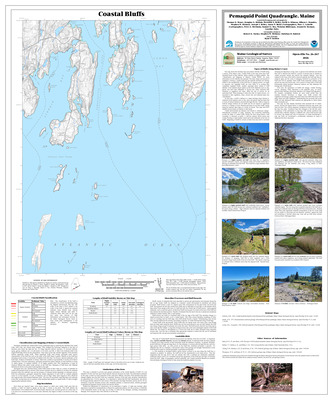
Significant sand and gravel aquifers in the Pemaquid Point quadrangle, Maine
Craig D. Neil and Daniel B. Locke
Maine Geological Survey, Open-File Map 99-14
-

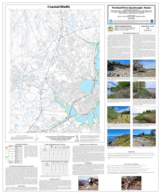
Significant sand and gravel aquifers in the Portland West quadrangle, Maine
Craig D. Neil and Daniel B. Locke
Maine Geological Survey, Open-File Map 99-11
-

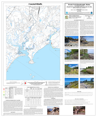
Significant sand and gravel aquifers in the Prouts Neck quadrangle, Maine
Craig D. Neil and Daniel B. Locke
Maine Geological Survey, Open-File Map 99-12
-

Significant sand and gravel aquifers in the Purgatory quadrangle, Maine
C D. Neil
Maine Geological Survey, Open-File Map 99-35.
-

Significant sand and gravel aquifers in the Vassalboro quadrangle, Maine
Craig D. Neil and Daniel B. Locke
Maine Geological Survey, Open-File Map 99-31
-

Significant sand and gravel aquifers in the Westport quadrangle, Maine
Craig D. Neil and Daniel B. Locke
Maine Geological Survey, Open-File Map 99-20
-

Significant sand and gravel aquifers in the Wiscasset quadrangle, Maine
Craig D. Neil and Daniel B. Locke
Maine Geological Survey, Open-File Map 99-17
-

Significant sand and gravel aquifers in the Yarmouth quadrangle, Maine
Craig D. Neil and Daniel B. Locke
Maine Geological Survey, Open-File Map 99-28
-

Surficial geology of the Alfred quadrangle, Maine
Craig D. Neil
Maine Geological Survey, Open-File Map 99-76
-

Surficial geology of the Bar Mills quadrangle, Maine
Lewis E. Hunter
Maine Geological Survey, Open-File Map 99-77
-

Surficial geology of the Biddeford Pool quadrangle, Maine
Carol T. Hildreth
Maine Geological Survey, Open-File Map 99-79
-

Surficial geology of the Cape Elizabeth quadrangle, Maine
J Michael Clinch and Woodrow B. Thompson
Maine Geological Survey, Open-File Map 99-80
-

Surficial geology of the Cumberland Center quadrangle, Maine
Michael J. Retelle
Maine Geological Survey, Open-File Map 99-81
-

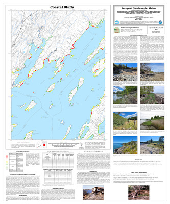
Surficial geology of the Freeport quadrangle, Maine
Thomas K. Weddle
Maine Geological Survey, Open-File Map 99-83
-

Surficial geology of the Gorham quadrangle, Maine
Geoffrey W. Smith
Maine Geological Survey, Open-File Map 99-84
-

Surficial geology of the Hiram quadrangle, Maine
Woodrow B. Thompson and William R. Holland
Maine Geological Survey, Open-File Map 99-85
-

Surficial geology of the Kennebunkport quadrangle, Maine
Geofrey W. Smith
Maine Geological Survey, Open-File Map 99-87
-

Surficial geology of the Kennebunk quadrangle, Maine
Geoffrey W. Smith
Maine Geological Survey, Open-File Map 99-86
-

Surficial geology of the Kittery quadrangle, Maine
Patrick B. O'Toole, J Michael Clinch, and Cornelia C. Cameron
Maine Geological Survey, Open-File Map 99-88
-

Surficial geology of the Limerick quadrangle, Maine
Thom Wilch
Maine Geological Survey, Open-File Map 99-89
-

Surficial geology of the Limington quadrangle, Maine
Andres Meglioli and Woodrow B. Thompson
Maine Geological Survey, Open-File Map 99-90
-

Surficial geology of the Milton quadrangle, Maine
Andres Meglioli
Maine Geological Survey, Open-File Map 99-91
-

Surficial geology of the North Berwick quadrangle, Maine
Geoffrey W. Smith
Maine Geological Survey, Open-File Map 99-92
-

Surficial geology of the North Pownal quadrangle, Maine
Cheryl L. Marvinney
Maine Geological Survey, Open-File Map 99-93
-

Surficial geology of the Old Orchard Beach quadrangle, Maine
Michael J. Retelle
Maine Geological Survey, Open-File Map 99-94