


The Maine Geological Survey provides the people and businesses of Maine with essential geologic information about the land where we live and work.
Note: Many state documents are offered in PDF format. To view PDF documents, you will need the free Adobe Reader. If you need assistance, view our Maine government PDF Help page or contact the contributing Maine State agency via the link on the left sidebar under “Links”.
-

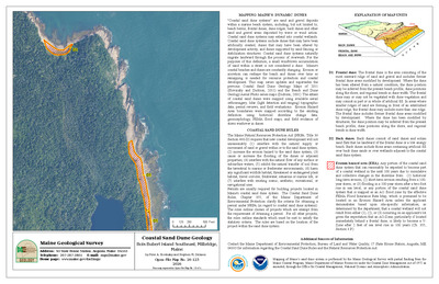
Coastal marine geologic environments of the Cutler quadrangle, Maine
Barry S. Timson
Maine Geological Survey, Open-File Map 76-80
-

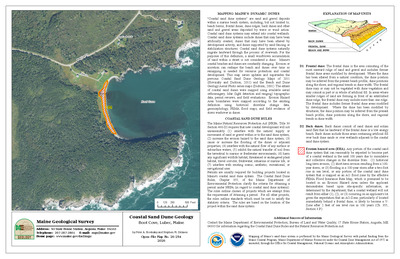
Coastal marine geologic environments of the Damariscotta quadrangle, Maine
Barry S. Timson
Maine Geological Survey, Open-File Map 76-81
-
![Coastal marine geologic environments of the Deer Isle NE [Stinson Neck 7.5'] quadrangle, Maine by Barry S. Timson](https://digitalmaine.com/mgs_maps/1168/thumbnail.jpg "Coastal marine geologic environments of the Deer Isle NE [Stinson Neck 7.5'] quadrangle, Maine by Barry S. Timson")
Coastal marine geologic environments of the Deer Isle NE [Stinson Neck 7.5'] quadrangle, Maine
Barry S. Timson
Maine Geological Survey, Open-File Map 76-82
-
![Coastal marine geologic environments of the Deer Isle NW [Deer Isle 7.5'] quadrangle, Maine by Barry S. Timson](https://digitalmaine.com/mgs_maps/1169/thumbnail.jpg "Coastal marine geologic environments of the Deer Isle NW [Deer Isle 7.5'] quadrangle, Maine by Barry S. Timson")
Coastal marine geologic environments of the Deer Isle NW [Deer Isle 7.5'] quadrangle, Maine
Barry S. Timson
Maine Geological Survey, Open-File Map 76-83
-

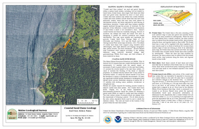
Coastal marine geologic environments of the Devils Head quadrangle, Maine
Barry S. Timson
Maine Geological Survey, Open-File Map 76-84
-

Coastal marine geologic environments of the Dover East quadrangle, Maine
Barry S. Timson
Maine Geological Survey, Open-File Map 76-85
-

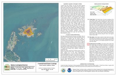
Coastal marine geologic environments of the Drisko Island quadrangle, Maine
Barry S. Timson
Maine Geological Survey, Open-File Map 76-86
-

Coastal marine geologic environments of the East Pittston quadrangle, Maine
Barry S. Timson
Maine Geological Survey, Open-File Map 76-87
-

Coastal marine geologic environments of the Eastport quadrangle, Maine
Barry S. Timson
Maine Geological Survey, Open-File Map 76-88
-
![Coastal marine geologic environments of the Ellsworth SE [Hancock 7.5'] quadrangle, Maine by Barry S. Timson](https://digitalmaine.com/mgs_maps/1122/thumbnail.jpg "Coastal marine geologic environments of the Ellsworth SE [Hancock 7.5'] quadrangle, Maine by Barry S. Timson")
Coastal marine geologic environments of the Ellsworth SE [Hancock 7.5'] quadrangle, Maine
Barry S. Timson
Maine Geological Survey, Open-File Map 76-89
-
![Coastal marine geologic environments of the Ellsworth SW [Ellsworth 7.5'] quadrangle, Maine by Barry S. Timson](https://digitalmaine.com/mgs_maps/1123/thumbnail.jpg "Coastal marine geologic environments of the Ellsworth SW [Ellsworth 7.5'] quadrangle, Maine by Barry S. Timson")
Coastal marine geologic environments of the Ellsworth SW [Ellsworth 7.5'] quadrangle, Maine
Barry S. Timson
Maine Geological Survey, Open-File Map 76-90
-

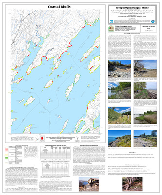
Coastal marine geologic environments of the Freeport quadrangle, Maine
Barry S. Timson
Maine Geological Survey, Open-File Map 76-91
-
![Coastal marine geologic environments of the Gardiner NE [Gardiner 7.5'] quadrangle, Maine by Barry S. Timson](https://digitalmaine.com/mgs_maps/1125/thumbnail.jpg "Coastal marine geologic environments of the Gardiner NE [Gardiner 7.5'] quadrangle, Maine by Barry S. Timson")
Coastal marine geologic environments of the Gardiner NE [Gardiner 7.5'] quadrangle, Maine
Barry S. Timson
Maine Geological Survey, Open-File Map 76-92
-
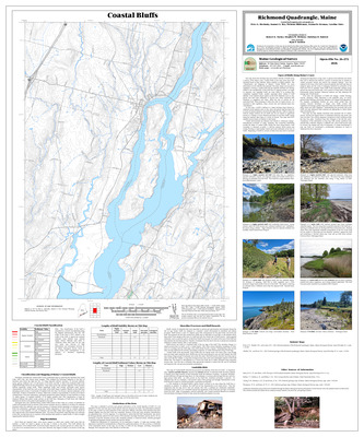
![Coastal marine geologic environments of the Gardiner SE [Richmond 7.5'] quadrangle, Maine by Barry S. Timson](https://digitalmaine.com/mgs_maps/1121/thumbnail.jpg "Coastal marine geologic environments of the Gardiner SE [Richmond 7.5'] quadrangle, Maine by Barry S. Timson")
Coastal marine geologic environments of the Gardiner SE [Richmond 7.5'] quadrangle, Maine
Barry S. Timson
Maine Geological Survey, Open-File Map 76-93
-
![Coastal marine geologic environments of the Gardiner SW [Bowdoinham 7.5'] quadrangle, Maine by Barry S. Timson](https://digitalmaine.com/mgs_maps/1175/thumbnail.jpg "Coastal marine geologic environments of the Gardiner SW [Bowdoinham 7.5'] quadrangle, Maine by Barry S. Timson")
Coastal marine geologic environments of the Gardiner SW [Bowdoinham 7.5'] quadrangle, Maine
Barry S. Timson
Maine Geological Survey, Open-File Map 76-94
-

Coastal marine geologic environments of the Great Wass Island quadrangle, Maine
Barry S. Timson
Maine Geological Survey, Open-File Map 76-95
-

Coastal marine geologic environments of the Harrington quadrangle, Maine
Barry S. Timson
Maine Geological Survey, Open-File Map 76-96
-

Coastal marine geologic environments of the Isles of Shoals quadrangle, Maine
Barry S. Timson
Maine Geological Survey, Open-File Map 76-97
-

Coastal marine geologic environments of the Jonesport quadrangle, Maine
Barry S. Timson
Maine Geological Survey, Open-File Map 76-98
-
![Coastal marine geologic environments of the Kennebunk NE [Kennebunk 7.5'] quadrangle, Maine by Barry S. Timson](https://digitalmaine.com/mgs_maps/1170/thumbnail.jpg "Coastal marine geologic environments of the Kennebunk NE [Kennebunk 7.5'] quadrangle, Maine by Barry S. Timson")
Coastal marine geologic environments of the Kennebunk NE [Kennebunk 7.5'] quadrangle, Maine
Barry S. Timson
Maine Geological Survey, Open-File Map 76-99
-

Coastal marine geologic environments of the Kennebunkport quadrangle, Maine
Barry S. Timson
Maine Geological Survey, Open-File Map 76-100
-

Coastal marine geologic environments of the Kittery quadrangle, Maine
Barry S. Timson
Maine Geological Survey, Open-File Map 76-101
-

Coastal marine geologic environments of the Lincolnville quadrangle, Maine
Barry S. Timson
Maine Geological Survey, Open-File Map 76-102
-

Coastal marine geologic environments of the Louds Island quadrangle, Maine
Barry S. Timson
Maine Geological Survey, Open-File Map 76-103
-

Coastal marine geologic environments of the Lubec quadrangle, Maine
Barry S. Timson
Maine Geological Survey, Open-File Map 76-104
-

Coastal marine geologic environments of the Machias Bay quadrangle, Maine
Barry S. Timson
Maine Geological Survey, Open-File Map 76-106
-

Coastal marine geologic environments of the Machias quadrangle, Maine
Barry S. Timson
Maine Geological Survey, Open-File Map 76-105
-

Coastal marine geologic environments of the Moose River quadrangle, Maine
Barry S. Timson
Maine Geological Survey, Open-File Map 76-107
-
![Coastal marine geologic environments of the Mt. Desert NE [Salsbury Cove 7.5'] quadrangle, Maine by Barry S. Timson](https://digitalmaine.com/mgs_maps/1194/thumbnail.jpg "Coastal marine geologic environments of the Mt. Desert NE [Salsbury Cove 7.5'] quadrangle, Maine by Barry S. Timson")
Coastal marine geologic environments of the Mt. Desert NE [Salsbury Cove 7.5'] quadrangle, Maine
Barry S. Timson
Maine Geological Survey, Open-File Map 76-108
-
![Coastal marine geologic environments of the Mt. Desert NW [Newbury Neck 7.5'] quadrangle, Maine by Barry S. Timson](https://digitalmaine.com/mgs_maps/1284/thumbnail.jpg "Coastal marine geologic environments of the Mt. Desert NW [Newbury Neck 7.5'] quadrangle, Maine by Barry S. Timson")
Coastal marine geologic environments of the Mt. Desert NW [Newbury Neck 7.5'] quadrangle, Maine
Barry S. Timson
Maine Geological Survey, Open-File Map 76-109
-
![Coastal marine geologic environments of the Mt. Desert SE [Southwest Harbor 7.5'] quadrangle, Maine by Barry S. Timson](https://digitalmaine.com/mgs_maps/1185/thumbnail.jpg "Coastal marine geologic environments of the Mt. Desert SE [Southwest Harbor 7.5'] quadrangle, Maine by Barry S. Timson")
Coastal marine geologic environments of the Mt. Desert SE [Southwest Harbor 7.5'] quadrangle, Maine
Barry S. Timson
Maine Geological Survey, Open-File Map 76-110
-
![Coastal marine geologic environments of the Mt. Desert SW [Bartlett Island 7.5'] quadrangle, Maine by Barry S. Timson](https://digitalmaine.com/mgs_maps/1188/thumbnail.jpg "Coastal marine geologic environments of the Mt. Desert SW [Bartlett Island 7.5'] quadrangle, Maine by Barry S. Timson")
Coastal marine geologic environments of the Mt. Desert SW [Bartlett Island 7.5'] quadrangle, Maine
Barry S. Timson
Maine Geological Survey, Open-File Map 76-111
-

Coastal marine geologic environments of the New Harbor quadrangle, Maine
Barry S. Timson
Maine Geological Survey, Open-File Map 76-112
-

Coastal marine geologic environments of the Old Orchard Beach quadrangle, Maine
Barry S. Timson
Maine Geological Survey, Open-File Map 76-113
-
![Coastal marine geologic environments of the Orland SW [Orland 7.5'] quadrangle, Maine by Barry S. Timson](https://digitalmaine.com/mgs_maps/1184/thumbnail.jpg "Coastal marine geologic environments of the Orland SW [Orland 7.5'] quadrangle, Maine by Barry S. Timson")
Coastal marine geologic environments of the Orland SW [Orland 7.5'] quadrangle, Maine
Barry S. Timson
Maine Geological Survey, Open-File Map 76-114
-
![Coastal marine geologic environments of the Orono SW [Veazie 7.5'] quadrangle, Maine by Barry S. Timson](https://digitalmaine.com/mgs_maps/1183/thumbnail.jpg "Coastal marine geologic environments of the Orono SW [Veazie 7.5'] quadrangle, Maine by Barry S. Timson")
Coastal marine geologic environments of the Orono SW [Veazie 7.5'] quadrangle, Maine
Barry S. Timson
Maine Geological Survey, Open-File Map 76-115
-

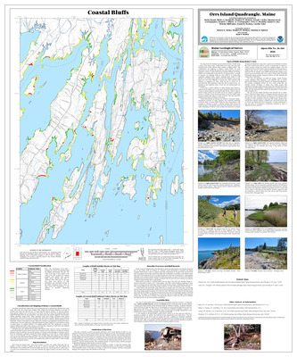
Coastal marine geologic environments of the Orrs Island quadrangle, Maine
Barry S. Timson
Maine Geological Survey, Open-File Map 76-116
-

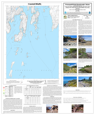
Coastal marine geologic environments of the Pemaquid Point quadrangle, Maine
Barry S. Timson
Maine Geological Survey, Open-File Map 76-117
-

Coastal marine geologic environments of the Pembroke quadrangle, Maine
Barry S. Timson
Maine Geological Survey, Open-File Map 76-118
-

Coastal marine geologic environments of the Petit Manan quadrangle, Maine
Barry S. Timson
Maine Geological Survey, Open-File Map 76-119
-

Coastal marine geologic environments of the Phippsburg quadrangle, Maine
Barry S. Timson
Maine Geological Survey, Open-File Map 76-120
-

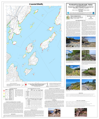
Coastal marine geologic environments of the Portland East quadrangle, Maine
Barry S. Timson
Maine Geological Survey, Open-File Map 76-121
-

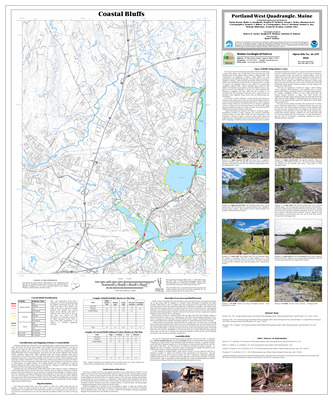
Coastal marine geologic environments of the Portland West quadrangle, Maine
Barry S. Timson
Maine Geological Survey, Open-File Map 76-122
-

Coastal marine geologic environments of the Portsmouth quadrangle, Maine
Barry S. Timson
Maine Geological Survey, Open-File Map 76-123
-

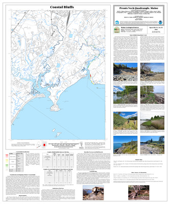
Coastal marine geologic environments of the Prouts Neck quadrangle, Maine
Barry S. Timson
Maine Geological Survey, Open-File Map 76-124
-

Coastal marine geologic environments of the Red Beach quadrangle, Maine
Barry S. Timson
Maine Geological Survey, Open-File Map 76-125
-

Coastal marine geologic environments of the Robbinston quadrangle, Maine
Barry S. Timson
Maine Geological Survey, Open-File Map 76-126
-

Coastal marine geologic environments of the Roque Bluffs quadrangle, Maine
Barry S. Timson
Maine Geological Survey, Open-File Map 76-127
-

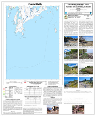
Coastal marine geologic environments of the Small Point quadrangle, Maine
Barry S. Timson
Maine Geological Survey, Open-File Map 76-128
-

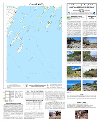
Coastal marine geologic environments of the South Harpswell quadrangle, Maine
Barry S. Timson
Maine Geological Survey, Open-File Map 76-129
-
![Coastal marine geologic environments of the Swans Island NE [Bass Harbor 7.5'] quadrangle, Maine by Barry S. Timson](https://digitalmaine.com/mgs_maps/1149/thumbnail.jpg "Coastal marine geologic environments of the Swans Island NE [Bass Harbor 7.5'] quadrangle, Maine by Barry S. Timson")
Coastal marine geologic environments of the Swans Island NE [Bass Harbor 7.5'] quadrangle, Maine
Barry S. Timson
Maine Geological Survey, Open-File Map 76-130
-
![Coastal marine geologic environments of the Swans Island NW [Swans Island 7.5'] quadrangle, Maine by Barry S. Timson](https://digitalmaine.com/mgs_maps/1132/thumbnail.jpg "Coastal marine geologic environments of the Swans Island NW [Swans Island 7.5'] quadrangle, Maine by Barry S. Timson")
Coastal marine geologic environments of the Swans Island NW [Swans Island 7.5'] quadrangle, Maine
Barry S. Timson
Maine Geological Survey, Open-File Map 76-131
-
![Coastal marine geologic environments of the Swans Island SE [Frenchboro 7.5'] quadrangle, Maine by Barry S. Timson](https://digitalmaine.com/mgs_maps/1128/thumbnail.jpg "Coastal marine geologic environments of the Swans Island SE [Frenchboro 7.5'] quadrangle, Maine by Barry S. Timson")
Coastal marine geologic environments of the Swans Island SE [Frenchboro 7.5'] quadrangle, Maine
Barry S. Timson
Maine Geological Survey, Open-File Map 76-132
-
![Coastal marine geologic environments of the Swans Island SW [Johns Island 7.5'] quadrangle, Maine by Barry S. Timson](https://digitalmaine.com/mgs_maps/1112/thumbnail.jpg "Coastal marine geologic environments of the Swans Island SW [Johns Island 7.5'] quadrangle, Maine by Barry S. Timson")
Coastal marine geologic environments of the Swans Island SW [Johns Island 7.5'] quadrangle, Maine
Barry S. Timson
Maine Geological Survey, Open-File Map 76-133
-

Coastal marine geologic environments of the Thomaston quadrangle, Maine
Barry S. Timson
Maine Geological Survey, Open-File Map 76-134
-
![Coastal marine geologic environments of the Tunk Lake SW [Sullivan 7.5'] quadrangle, Maine by Barry S. Timson](https://digitalmaine.com/mgs_maps/1114/thumbnail.jpg "Coastal marine geologic environments of the Tunk Lake SW [Sullivan 7.5'] quadrangle, Maine by Barry S. Timson")
Coastal marine geologic environments of the Tunk Lake SW [Sullivan 7.5'] quadrangle, Maine
Barry S. Timson
Maine Geological Survey, Open-File Map 76-135
-

Coastal marine geologic environments of the Waldoboro East quadrangle, Maine
Barry S. Timson
Maine Geological Survey, Open-File Map 76-136
-

Coastal marine geologic environments of the Waldoboro West quadrangle, Maine
Barry S. Timson
Maine Geological Survey, Open-File Map 76-137
-

Coastal marine geologic environments of the Wells quadrangle, Maine
Barry S. Timson
Maine Geological Survey, Open-File Map 76-138
-

Coastal marine geologic environments of the West Lubec quadrangle, Maine
Barry S. Timson
Maine Geological Survey, Open-File Map 76-139
-

Coastal marine geologic environments of the Westport quadrangle, Maine
Barry S. Timson
Maine Geological Survey, Open-File Map 76-140
-

Coastal marine geologic environments of the Whiting quadrangle, Maine
Barry S. Timson
Maine Geological Survey, Open-File Map 76-141
-

Coastal marine geologic environments of the Whitneyville quadrangle, Maine
Barry S. Timson
Maine Geological Survey, Open-File Map 76-142
-

Coastal marine geologic environments of the Wiscasset quadrangle, Maine
Barry S. Timson
Maine Geological Survey, Open-File Map 76-143
-

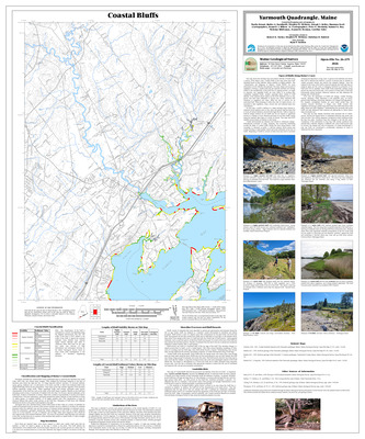
Coastal marine geologic environments of the Yarmouth quadrangle, Maine
Barry S. Timson
Maine Geological Survey, Open-File Map 76-144
-

Coastal marine geologic environments of the York Beach quadrangle, Maine
Barry S. Timson
Maine Geological Survey, Open-File Map 76-145
-

Coastal marine geologic environments of the York Harbor quadrangle, Maine
Barry S. Timson
Maine Geological Survey, Open-File Map 76-146
-

Preliminary report on the geology of the Liberty 15' quadrangle and adjoining parts of the Burnham, Brooks, Belfast, and Vassalboro quadrangles in south-central Maine
Kost A. Pankiwskyj
Maine Geological Survey, Open-File Report 76-29
-

Reconnaissance bedrock geology of the Bangor quadrangle
John R. Griffin
Maine Geological Survey, Open-File Map 76-23
-

Reconnaissance bedrock geology of the Great Pond quadrangle, Maine
John R. Griffin
Maine Geological Survey, Open-File Map 76-22
-

Reconnaissance bedrock geology of the Orono quadrangle, Maine
John R. Griffin
Maine Geological Survey, Open-File Map 76-21
-

Reconnaissance bedrock geology of the Passadumkeag quadrangle, Maine
John R. Griffin
Maine Geological Survey, Open-File Map 76-24
-

Reconnaissance bedrock geology of the Saponac quadrangle, Maine
John R. Griffin
Maine Geological Survey, Open-File Map 76-19
-

Reconnaissance surficial geology of the Attean quadrangle, Maine
Dabney W. Caldwell and Lindley S. Hanson
Maine Geological Survey, Open-File Map 76-4.
-

Reconnaissance surficial geology of the Bingham quadrangle, Maine
Uldis Kaktins, Thomas Brewer, and Dabney W. Caldwell
Maine Geological Survey, Open-File Map 76-25
-

Reconnaissance surficial geology of the Boothbay Harbor quadrangle, Maine
Geoffrey W. Smith
Maine Geological Survey, Open-File Map 76-33
-

Reconnaissance surficial geology of the Brassua Lake quadrangle, Maine
Dabney W. Caldwell and Lindley S. Hanson
Maine Geological Survey, Open-File Map 76-5
-

Reconnaissance surficial geology of the Bristol quadrangle, Maine
Geoffrey W. Smith
Maine Geological Survey, Open-File Map 76-34
-

Reconnaissance surficial geology of The Forks quadrangle, Maine
Uldis Kaktins and Dabney W. Caldwell
Maine Geological Survey, Open-File Map 76-26.
-

Reconnaissance surficial geology of the Long Pond quadrangle, Maine
Dabney W. Caldwell and Lindley S. Hanson
Maine Geological Survey, Open-File Map 76-6
-

Reconnaissance surficial geology of the Louds Island quadrangle, Maine
Geoffrey W. Smith
Maine Geological Survey, Open-File Map 76-36
-

Reconnaissance surficial geology of the North East Carry quadrangle, Maine
Thomas Brewer and Dabney W. Caldwell
Maine Geological Survey, Open-File Map 76-2
-

Reconnaissance surficial geology of the Penobscot Lake quadrangle, Maine
Andrew N. Genes, Dabney W. Caldwell, and Lindley S. Hanson
Maine Geological Survey, Open-File Map 76-15
-

Reconnaissance surficial geology of the Phippsburg quadrangle, Maine
Geoffrey W. Smith
Maine Geological Survey, Open-File Map 76-37
-

Reconnaissance surficial geology of the Pierce Pond quadrangle, Maine
Dabney W. Caldwell and Lindley S. Hanson
Maine Geological Survey, Open-File Map 76-7
-

Reconnaissance surficial geology of the Sandy Bay quadrangle, Maine
Dabney W. Caldwell and Lindley S. Hanson
Maine Geological Survey, Open-File Map 76-8
-

Reconnaissance surficial geology of the Seboomook Lake quadrangle, Maine
Andrew N. Genes, Uldis Kaktins, and Thomas Brewer
Maine Geological Survey, Open-File Map 76-16
-

Reconnaissance surficial geology of the Skinner quadrangle, Maine
Dabney W. Caldwell and Lindley S. Hanson
Maine Geological Survey, Open-File Map 76-9
-

Reconnaissance surficial geology of the Small Point quadrangle, Maine
Geoffrey W. Smith
Maine Geological Survey, Open-File Map 76-38
-

Reconnaissance surficial geology of the Spencer Lake quadrangle, Maine
Dabney W. Caldwell, Lindley S. Hanson, and Dorothy S. Hunnewell
Maine Geological Survey, Open-File Map 76-10
-

Reconnaissance surficial geology of the Westport quadrangle, Maine
Geoffrey W. Smith
Maine Geological Survey, Open-File Map 76-40
-

Surficial geologic map of Mt. Katahdin
P Thompson Davis
Maine Geological Survey, Open-File Map 76-12. Black and white map showing moraines, talus, avalanche areas, and other surficial features of the area around Mt. Katahdin.
-
![Coastal marine geologic environments of the Deer Isle SE [Isle au Haut East 7.5'] quadrangle, Maine by Barry S. Timson](https://digitalmaine.com/mgs_maps/1103/thumbnail.jpg "Coastal marine geologic environments of the Deer Isle SE [Isle au Haut East 7.5'] quadrangle, Maine by Barry S. Timson")
Coastal marine geologic environments of the Deer Isle SE [Isle au Haut East 7.5'] quadrangle, Maine
Barry S. Timson
Maine Geological Survey, Open-File Map 75-27
-
![Coastal marine geologic environments of the Deer Isle SW [Isle au Haut West 7.5'] quadrangle, Maine by Barry S. Timson](https://digitalmaine.com/mgs_maps/1102/thumbnail.jpg "Coastal marine geologic environments of the Deer Isle SW [Isle au Haut West 7.5'] quadrangle, Maine by Barry S. Timson")
Coastal marine geologic environments of the Deer Isle SW [Isle au Haut West 7.5'] quadrangle, Maine
Barry S. Timson
Maine Geological Survey, Open-File Map 75-28
-

Coastal marine geologic environments of the Matinicus quadrangle, Maine
Barry S. Timson
Maine Geological Survey, Open-File Map 75-29
-

Coastal marine geologic environments of the Monhegan quadrangle, Maine
Barry S. Timson
Maine Geological Survey, Open-File Map 75-30
-
![Coastal marine geologic environments of the Vinalhaven NE [North Haven East 7.5'] quadrangle, Maine by Barry S. Timson](https://digitalmaine.com/mgs_maps/1097/thumbnail.jpg "Coastal marine geologic environments of the Vinalhaven NE [North Haven East 7.5'] quadrangle, Maine by Barry S. Timson")
Coastal marine geologic environments of the Vinalhaven NE [North Haven East 7.5'] quadrangle, Maine
Barry S. Timson
Maine Geological Survey, Open-File Map 75-31
-
![Coastal marine geologic environments of the Vinalhaven NW [North Haven West 7.5'] quadrangle, Maine by Barry S. Timson](https://digitalmaine.com/mgs_maps/1104/thumbnail.jpg "Coastal marine geologic environments of the Vinalhaven NW [North Haven West 7.5'] quadrangle, Maine by Barry S. Timson")
Coastal marine geologic environments of the Vinalhaven NW [North Haven West 7.5'] quadrangle, Maine
Barry S. Timson
Maine Geological Survey, Open-File Map 75-32
-
![Coastal marine geologic environments of the Vinalhaven SE [Vinalhaven 7.5'] quadrangle, Maine by Barry S. Timson](https://digitalmaine.com/mgs_maps/1098/thumbnail.jpg "Coastal marine geologic environments of the Vinalhaven SE [Vinalhaven 7.5'] quadrangle, Maine by Barry S. Timson")
Coastal marine geologic environments of the Vinalhaven SE [Vinalhaven 7.5'] quadrangle, Maine
Barry S. Timson
Maine Geological Survey, Open-File Map 75-33
-
![Coastal marine geologic environments of the Vinalhaven SW [Leadbetter Island 7.5'] quadrangle, Maine by Barry S. Timson](https://digitalmaine.com/mgs_maps/1101/thumbnail.jpg "Coastal marine geologic environments of the Vinalhaven SW [Leadbetter Island 7.5'] quadrangle, Maine by Barry S. Timson")
Coastal marine geologic environments of the Vinalhaven SW [Leadbetter Island 7.5'] quadrangle, Maine
Barry S. Timson
Maine Geological Survey, Open-File Map 75-34
-

Reconnaissance surficial geology of the Arnold Pond quadrangle, Maine
Dabney W. Caldwell
Maine Geological Survey, Open-File Map 75-7
-

Reconnaissance surficial geology of the Columbia Falls quadrangle, Maine
Harold W. Borns Jr
Maine Geological Survey, Open-File Map 75-1
-

Reconnaissance surficial geology of the Cupsuptic quadrangle, Maine
Dabney W. Caldwell
Maine Geological Survey, Open-File Map 75-8
-

Reconnaissance surficial geology of the Eastport quadrangle, Maine
Harold W. Borns Jr
Maine Geological Survey, Open-File Map 75-2
-

Reconnaissance surficial geology of the Errol quadrangle, Maine
Dabney W. Caldwell
Maine Geological Survey, Open-File Map 75-9
-

Reconnaissance surficial geology of the Kennebago Lake quadrangle, Maine
Dabney W. Caldwell
Maine Geological Survey, Open-File Map 75-10
-

Reconnaissance surficial geology of the Milan quadrangle, Maine
Dabney W. Caldwell
Maine Geological Survey, Open-File Map 75-11
-

Reconnaissance surficial geology of the Moose Bog quadrangle, Maine
Dabney W. Caldwell
Maine Geological Survey, Open-File Map 75-12
-

Reconnaissance surficial geology of the New Harbor quadrangle, Maine
Geoffrey W. Smith
Maine Geological Survey, Open-File Map 75-21
-

Reconnaissance surficial geology of the Old Speck Mountain quadrangle, Maine
Dabney W. Caldwell
Maine Geological Survey, Open-File Map 75-15
-

Reconnaissance surficial geology of the Oquossoc quadrangle, Maine
Dabney W. Caldwell
Maine Geological Survey, Open-File Map 75-16
-

Reconnaissance surficial geology of the Pemaquid Point quadrangle, Maine
Geoffrey W. Smith
Maine Geological Survey, Open-File Map 75-22
-

Reconnaissance surficial geology of the Phillips quadrangle, Maine
Dabney W. Caldwell
Maine Geological Survey, Open-File Map 75-13
-

Reconnaissance surficial geology of the Rangeley quadrangle, Maine
Dabney W. Caldwell
Maine Geological Survey, Open-File Map 75-14
-

Reconnaissance surficial geology of the Roque Bluffs quadrangle, Maine
Harold W. Borns Jr and Woodrow B. Thompson
Maine Geological Survey, Open-File Map 75-5
-

Reconnaissance surficial geology of the Second Connecticut Lake quadrangle, Maine
Dabney W. Caldwell
Maine Geological Survey, Open-File Map 75-17
-

Coastal marine geologic environments of the Camden quadrangle, Maine
Barry S. Timson
Maine Geological Survey, Open-File Map 74-21
-

Coastal marine geologic environments of the Friendship quadrangle, Maine
Barry S. Timson
Maine Geological Survey, Open-File Map 74-22
-
![Coastal marine geologic environments of the Hewett Island [Hewitt Island 7.5'] quadrangle, Maine by Barry S. Timson](https://digitalmaine.com/mgs_maps/1095/thumbnail.jpg "Coastal marine geologic environments of the Hewett Island [Hewitt Island 7.5'] quadrangle, Maine by Barry S. Timson")
Coastal marine geologic environments of the Hewett Island [Hewitt Island 7.5'] quadrangle, Maine
Barry S. Timson
Maine Geological Survey, Open-File Map 74-23
-

Coastal marine geologic environments of the Rockland quadrangle, Maine
Barry S. Timson
Maine Geological Survey, Open-File Map 74-24
-

Coastal marine geologic environments of the Tenants Harbor quadrangle, Maine
Barry S. Timson
Maine Geological Survey, Open-File Map 74-25
-

Physical resources of Knox County, Maine
W Bradford Caswell Jr
Maine Geological Survey, Physical Resource Series No. 1. Includes descriptive text and map showing bedrock geology, description of ground water geology and maps of well yield, well depth, bedrock surface topography, thickness of overburden, and piezometric surface.
-

Reconnaissance surficial geology of the Bar Harbor quadrangle, Maine
Harold W. Borns Jr
Maine Geological Survey, Open-File Map 74-1
-

Reconnaissance surficial geology of the Cutler quadrangle, Maine
Harold W. Borns
Maine Geological Survey, Open-File Map 74-2
-

Reconnaissance surficial geology of the Deer Isle quadrangle, Maine
Harold W. Borns Jr, Geoffrey W. Smith, and Woodrow B. Thompson
Maine Geological Survey, Open-File Map 74-12
-

Reconnaissance surficial geology of the Devils Head quadrangle, Maine
Harold W. Borns Jr
Maine Geological Survey, Open-File Map 74-3
-

Reconnaissance surficial geology of the Friendship quadrangle, Maine
Geoffrey W. Smith
Maine Geological Survey, Open-File Map 74-15
-

Reconnaissance surficial geology of the Machias Bay quadrangle, Maine
Harold W. Borns Jr
Maine Geological Survey, Open-File Map 74-5
-

Reconnaissance surficial geology of the Machias quadrangle, Maine
Harold W. Borns Jr
Maine Geological Survey, Open-File Map 74-4
-

Reconnaissance surficial geology of the Moose River quadrangle, Maine
Harold W. Borns Jr
Maine Geological Survey, Open-File Map 74-6
-

Reconnaissance surficial geology of the Mount Desert quadrangle, Maine
Harold W. Borns Jr
Maine Geological Survey, Open-File Map 74-7
-

Reconnaissance surficial geology of the Petit Manan quadrangle, Maine
Harold W. Borns Jr
Maine Geological Survey, Open-File Map 74-8
-

Reconnaissance surficial geology of the Red Beach quadrangle, Maine
Harold W. Borns Jr
Maine Geological Survey, Open-File Map 74-9
-

Reconnaissance surficial geology of the Robbinston quadrangle, Maine
Harold W. Borns Jr
Maine Geological Survey, Open-File Map 74-10
-

Reconnaissance surficial geology of the Tenants Harbor quadrangle, Maine
Geoffrey W. Smith
Maine Geological Survey, Open-File Map 74-17
-

Geologic map and cross sections of the Orrs Island 7.5' quadrangle and adjacent area, Maine
Arthur M. Hussey II
Maine Geological Survey (Department of Economic Development), Geologic Map Series GM-2
-

Geologic map of the Portland quadrangle, Maine
Arthur M. Hussey II
Maine Geological Survey (Department of Economic Development), Geologic Map Series GM-1
-

Reconnaissance bedrock geology of the Boyd Lake quadrangle, Maine
John R. Griffin
Maine Geological Survey, Open-File Map 71-7
-

Reconnaissance bedrock geology of the Dover-Foxcroft quadrangle, Maine
John R. Griffin
Maine Geological Survey, Open-File Map 71-8
-

Reconnaissance bedrock geology of the Friendship 7.5' quadrangle, Maine
Arthur M. Hussey II
Maine Geological Survey, Open-File Map 71-9 (superseded by Sidle, 1991, Maine Geological Survey Open-File 91-3)
-

Reconnaissance bedrock geology of the Guilford quadrangle, Maine
John R. Griffin
Maine Geological Survey, Open-File Map 71-5
-

Reconnaissance bedrock geology of the Pittsfield quadrangle, Maine
John R. Griffin
Maine Geological Survey, Open-File Map 71-3
-

Reconnaissance bedrock geology of the Schoodic quadrangle, Maine
John R. Griffin
Maine Geological Survey, Open-File Map 71-2
-

Reconnaissance bedrock geology of the Sebec Lake quadrangle, Maine
John R. Griffin
Maine Geological Survey, Open-File Map 71-6
-

Reconnaissance bedrock geology of the Sebec quadrangle, Maine
John R. Griffin
Maine Geological Survey, Open-File Map 71-4
-

Reconnaissance bedrock geology of the Stetson quadrangle, Maine
John R. Griffin
Maine Geological Survey, Open-File Map 71-1
-

Stratigraphy of the southern end of the Munsungun anticlinorium, Maine
Bradford A. Hall
Maine Geological Survey (Department of Economic Development), Bulletin 22. Includes appendix on fossil localities in southern end of Munsungun anticlinorium. Covers parts of the Umsaskis Lake, Musquacook Lakes, Churchill Lake, Spider Lake, Chesuncook, and Telos Lake 15' quadrangles.
-

Geology of the Moose River and Roach River synclinoria, northwestern Maine
Arthur J. Boucot and Edward W. Heath
Maine Geological Survey (Department of Economic Development), Bulletin 21. Describes stratigraphy, paleontology, intrusive rocks, metamorphism, and structure. Plates include reconnaissance maps, cross sections, stratigraphic columns, and fossil localities. Includes appendix of fossil localities in the area. Covers parts of the North East Carry, Ragged Lake, Attean, Long Pond, Brassua Lake, Moosehead Lake, First Roach Pond, Spencer Lake, Pierce Pond, and The Forks 15' quadrangles.
-

Stratigraphy, structural geology, and metamorphism of the Waterville-Vassalboro area, Maine
Philip H. Osberg
Maine Geological Survey (Department of Economic Development), Bulletin 20. Includes parts of Norridgewock, Waterville, Augusta, and Vassalboro 15' quads
-

Preliminary geologic map of Maine
Arthur M. Hussey II, Carleton A. Chapman, Robert G. Doyle, Arthur M. Hussey II, Philip H. Osberg, Louis Pavlides, and Jeffrey Warner
Maine Geological Survey (Department of Economic Development) (Superseded by Osberg, Philip H., Hussey, Arthur M., II, and Boone, Gary M., 1984, Open-File No. 84-1). A 42" x 58" color wall map showing the bedrock geology of Maine. Ages of rocks in color, lithologies differentiated by patterns, inset map of metamorphic zones, correlation chart and extensive reference list.
-

Geology of the Bryant Pond quadrangle, Maine
Charles V. Guidotti
Maine Geological Survey (Department of Economic Development), Bulletin 16 (Quadrangle Mapping Series 3)
-

Reconnaissance bedrock geology of the Presque Isle quadrangle, Maine
Arthur J. Boucot, Michael T. Field, Raymond Fletcher, William H. Forbes, Richard S. Naylor, and Louis Pavlides
Maine Geological Survey (Department of Economic Development), Bulletin 15 (Quadrangle Mapping Series 2), 123 p., illus., geologic maps
-

The geology of southern York County, Maine
Arthur M. Hussey II
Maine Geological Survey (Department of Economic Development), Bulletin 14 (Special Studies Series 4), 67 p., illus., table, geologic maps
-

Geologic map of the Cutler and Moose River quadrangles, Washington County, Maine
Olcott Gates
Maine Geological Survey, Open-File Map 61-1. From out-of-print Maine Geological Survey Bulletin 13
-

Reconnaissance bedrock geology of the Cherryfield quadrangle, Maine
Richard A. Gilman
Maine Geological Survey, Open-File Map 61-2
-

The geology of the Cutler and Moose River quadrangles, Washington County, Maine
Olcott Gates
Maine Geological Survey (Department of Economic Development), Bulletin 13 (Quadrangle Mapping Series 1), 67 p., illustrations, geologic map
-

Mineral resources of Maine - Lewiston sheet
Robert G. Doyle
Maine Geological Survey (Department of Economic Development), Mineral Resource Reference Map Series, No. 2, MRRM-2
-

Mineral resources of Maine - Portland-Bath sheet
Robert G. Doyle
Maine Geological Survey (Department of Economic Development), Mineral Resources Reference Map Series No. 3, MRRM-3
-

Mineral resources of Maine - Bangor sheet
John R. Rand
Maine Geological Survey (Department of Economic Development), Mineral Resource Reference Map Series No. 1, MRRM-1