


The Maine Geological Survey provides the people and businesses of Maine with essential geologic information about the land where we live and work.
Note: Many state documents are offered in PDF format. To view PDF documents, you will need the free Adobe Reader. If you need assistance, view our Maine government PDF Help page or contact the contributing Maine State agency via the link on the left sidebar under “Links”.
-

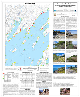
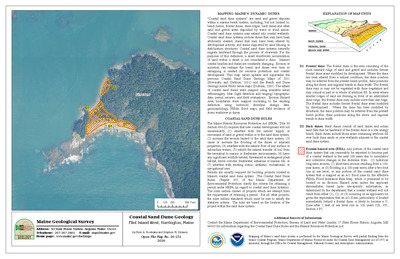
Coastal bluffs in the Harrington quadrangle, Maine
Kristie A. Ferland, Adam T. Labelle, Stephen M. Dickson, and Joseph T. Kelley
Maine Geological Survey, Open-File Map 06-63.
-

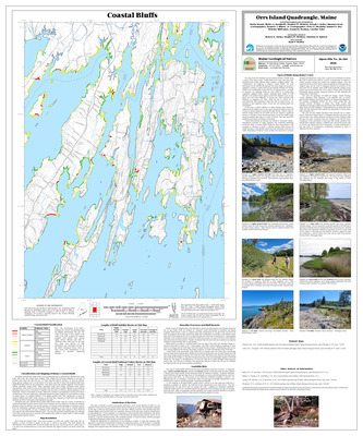
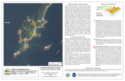
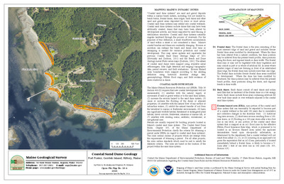
Coastal bluffs in the Kennebunkport quadrangle, Maine
Christopher E. Miller, Nicole A. Raineault, Stephen M. Dickson, and Joseph T. Kelley
Maine Geological Survey, Open-File Map 06-57.
-

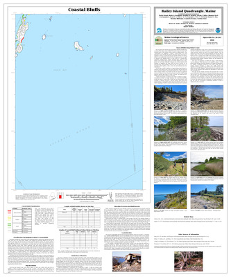
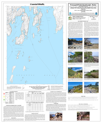
Coastal bluffs in the Schoodic Head quadrangle, Maine
Christopher E. Miller, Nicole A. Raineault, Stephen M. Dickson, and Joseph T. Kelley
Maine Geological Survey, Open-File Map 06-68.
-

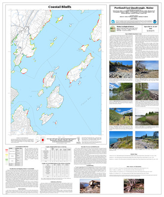
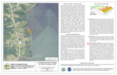
Coastal bluffs in the Wells quadrangle, Maine
Christopher E. Miller, Nicole A. Raineault, Stephen M. Dickson, and Joseph T. Kelley
Maine Geological Survey, Open-File Map 06-55.
-

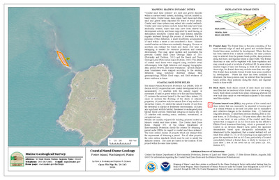
Coastal bluffs in the Winter Harbor quadrangle, Maine
Nicole A. Raineault, Christopher E. Miller, Kristie A. Ferland, Adam T. Labelle, Stephen M. Dickson, and Joseph T. Kelley
Maine Geological Survey, Open-File Map 06-66.
-

Coastal bluffs in the York Beach quadrangle, Maine
Christopher E. Miller, Nicole A. Raineault, Stephen M. Dickson, and Joseph T. Kelley
Maine Geological Survey, Open-File Map 06-59.
-

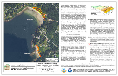
Coastal landslide hazards in the Addison quadrangle, Maine
Stephen M. Dickson
Maine Geological Survey, Open-File Map 06-62.
-

Coastal landslide hazards in the Bar Harbor quadrangle, Maine
Stephen M. Dickson
Maine Geological Survey, Open-File Map 06-71.
-

Coastal landslide hazards in the Drisko Island quadrangle, Maine
Stephen M. Dickson
Maine Geological Survey, Open-File Map 06-65.
-

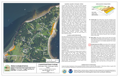
Coastal landslide hazards in the Kennebunkport quadrangle, Maine
Stephen M. Dickson
Maine Geological Survey, Open-File Map 06-58.
-

Coastal landslide hazards in the Schoodic Head quadrangle, Maine
Stephen M. Dickson
Maine Geological Survey, Open-File Map 06-69.
-

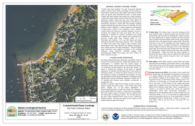
Coastal landslide hazards in the Wells quadrangle, Maine
Stephen M. Dickson
Maine Geological Survey, Open-File Map 06-56.
-

Coastal landslide hazards in the Winter Harbor quadrangle, Maine
Stephen M. Dickson
Maine Geological Survey, Open-File Map 06-67.
-

Coastal landslide hazards in the York Beach quadrangle, Maine
Stephen M. Dickson
Maine Geological Survey, Open-File Map 06-60.
-

Deglaciation features in the Portland 1:100,000 quadrangle, Maine
Susan S. Tolman
Maine Geological Survey, Open-File Map 06-5.
-

Glacial ice-flow indicators in the Portland 1:100,000 quadrangle, Maine
Susan S. Tolman
Maine Geological Survey, Open-File Map 06-4.
-

Significant sand and gravel aquifers in the Allagash Falls quadrangle, Maine
Michael E. Foley
Maine Geological Survey, Open-File Map 06-25.
-

Significant sand and gravel aquifers in the Big Black Rapids quadrangle, Maine
Robert A. Johnston
Maine Geological Survey, Open-File Map 06-46.
-

Significant sand and gravel aquifers in the Big Brook Lake quadrangle, Maine
Michael E. Foley
Maine Geological Survey, Open-File Map 06-29.
-

Significant sand and gravel aquifers in the Blue Brook quadrangle, Maine
Robert A. Johnston
Maine Geological Survey, Open-File Map 06-44.
-

Significant sand and gravel aquifers in the Buckfield quadrangle, Maine
Craig D. Neil and Daniel B. Locke
Maine Geological Survey, Open-File Map 06-24.
-

Significant sand and gravel aquifers in the Canton quadrangle, Maine
Craig D. Neil and Daniel B. Locke
Maine Geological Survey, Open-File Map 06-73.
-

Significant sand and gravel aquifers in the Castine quadrangle, Maine
Craig D. Neil and Michael E. Foley
Maine Geological Survey, Open-File Map 06-13.
-

Significant sand and gravel aquifers in the Charles Pond quadrangle, Maine
Robert A. Johnston
Maine Geological Survey, Open-File Map 06-50.
-

Significant sand and gravel aquifers in the Fish River Lake SW quadrangle, Maine
Michael E. Foley
Maine Geological Survey, Open-File Map 06-27.
-

Significant sand and gravel aquifers in the Five Finger Brook quadrangle, Maine
Michael E. Foley
Maine Geological Survey, Open-File Map 06-31.
-

Significant sand and gravel aquifers in the Gardner Pond quadrangle, Maine
Michael E. Foley
Maine Geological Survey, Open-File Map 06-35.
-

Significant sand and gravel aquifers in the Houlton Pond quadrangle, Maine
Robert A. Johnston
Maine Geological Survey, Open-File Map 06-40.
-

Significant sand and gravel aquifers in the Lincolnville quadrangle, Maine
Craig D. Neil and Thomas K. Weddle
Maine Geological Survey, Open-File Map 06-78.
-

Significant sand and gravel aquifers in the McKeen Lake quadrangle, Maine
Michael E. Foley
Maine Geological Survey, Open-File Map 06-33.
-

Significant sand and gravel aquifers in the Ninemile Deadwater quadrangle, Maine
Robert A. Johnston
Maine Geological Survey, Open-File Map 06-48.
-

Significant sand and gravel aquifers in the Petit Manan quadrangle, Maine
Thomas K. Weddle
Maine Geological Survey, Open-File Map 06-3
-

Significant sand and gravel aquifers in the Round Pond quadrangle, Maine
Michael E. Foley
Maine Geological Survey, Open-File Map 06-37.
-

Significant sand and gravel aquifers in the Sargentville quadrangle, Maine
Michael E. Foley and Craig D. Neil
Maine Geological Survey, Open-File Map 06-10.
-

Significant sand and gravel aquifers in the Seal Harbor quadrangle, Maine
Craig D. Neil and Michael E. Foley
Maine Geological Survey, Open-File Map 06-8.
-

Significant sand and gravel aquifers in the Searsmont quadrangle, Maine
Craig D. Neil and Thomas K. Weddle
Maine Geological Survey, Open-File Map 06-76.
-

Significant sand and gravel aquifers in the Seven Islands quadrangle, Maine
Robert A. Johnston
Maine Geological Survey, Open-File Map 06-42.
-

Significant sand and gravel aquifers in the Southwest Harbor quadrangle, Maine
Michael E. Foley and Craig D. Neil
Maine Geological Survey, Open-File Map 06-12.
-

Significant sand and gravel aquifers in the St. Pamphile quadrangle, Maine
Robert A. Johnston
Maine Geological Survey, Open-File Map 06-52.
-

Significant sand and gravel aquifers in the West Sumner quadrangle, Maine
Craig D. Neil and Daniel B. Locke
Maine Geological Survey, Open-File Map 06-74.
-

Significant sand and gravel aquifers in the Worthley Pond quadrangle, Maine
Craig D. Neil and Daniel B. Locke
Maine Geological Survey, Open-File Map 06-72.
-

Surficial geology of the Portland 1:100,000 quadrangle, Maine
Susan S. Tolman
Maine Geological Survey, Open-File Map 06-1.
-

Surficial materials of the Allagash Falls quadrangle, Maine
Michael E. Foley
Maine Geological Survey, Open-File Map 06-26.
-

Surficial materials of the Big Black Rapids quadrangle, Maine
Robert A. Johnston
Maine Geological Survey, Open-File Map 06-47.
-

Surficial materials of the Big Brook Lake quadrangle, Maine
Michael E. Foley
Maine Geological Survey, Open-File Map 06-30.
-

Surficial materials of the Blue Brook quadrangle, Maine
Robert A. Johnston
Maine Geological Survey, Open-File Map 06-45.
-

Surficial materials of the Buckfield quadrangle, Maine
Daniel B. Locke, Thomas K. Weddle, and Jonathan W. Duchette
Maine Geological Survey, Open-File Map 06-16.
-

Surficial materials of the Canton quadrangle, Maine
Woodrow B. Thompson and Daniel B. Locke
Maine Geological Survey, Open-File Map 06-18.
-

Surficial materials of the Charles Pond quadrangle, Maine
Robert A. Johnston
Maine Geological Survey, Open-File Map 06-51.
-

Surficial materials of the Depot Lake quadrangle, Maine
Robert A. Johnston
Maine Geological Survey, Open-File Map 06-39.
-

Surficial materials of the Fish River Lake SW quadrangle, Maine
Michael E. Foley
Maine Geological Survey, Open-File Map 06-28.
-

Surficial materials of the Five Finger Brook quadrangle, Maine
Michael E. Foley
Maine Geological Survey, Open-File Map 06-32.
-

Surficial materials of the Gardner Pond quadrangle, Maine
Michael E. Foley
Maine Geological Survey, Open-File Map 06-36.
-

Surficial materials of the Houlton Pond quadrangle, Maine
Robert A. Johnston
Maine Geological Survey, Open-File Map 06-41.
-

Surficial materials of the McKeen Lake quadrangle, Maine
Michael E. Foley
Maine Geological Survey, Open-File Map 06-34.
-

Surficial materials of the McKinnon Brook quadrangle, Maine
Michael E. Foley
Maine Geological Survey, Open-File Map 06-15.
-

Surficial materials of the Ninemile Deadwater quadrangle, Maine
Robert A. Johnston
Maine Geological Survey, Open-File Map 06-49.
-

Surficial materials of the Petit Manan quadrangle, Maine
Glenn C. Prescott Jr and Thomas K. Weddle
Maine Geological Survey, Open-File Map 06-2.
-

Surficial materials of the Round Pond quadrangle, Maine
Michael E. Foley
Maine Geological Survey, Open-File Map 06-38.
-

Surficial materials of the Sargentville quadrangle, Maine
Glenn C. Prescott Jr and Michael E. Foley
Maine Geological Survey, Open-File Map 06-9.
-

Surficial materials of the Searsmont quadrangle, Maine
Woodrow B. Thompson, Thomas Brewer, Andrew N. Genes, and Thomas K. Weddle
Maine Geological Survey, Open-File Map 06-75.
-

Surficial materials of the Seven Islands quadrangle, Maine
Robert A. Johnston
Maine Geological Survey, Open-File Map 06-43.
-

Surficial materials of the St. Pamphile quadrangle, Maine
Robert A. Johnston
Maine Geological Survey, Open-File Map 06-53.
-

Surficial materials of the West Sumner quadrangle, Maine
Carol T. Hildreth and Daniel B. Locke
Maine Geological Survey, Open-File Map 06-19.
-

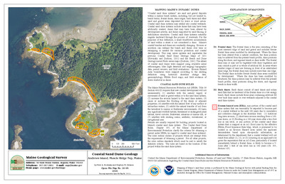
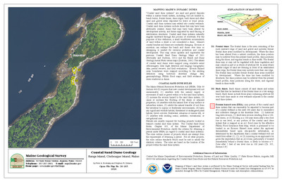
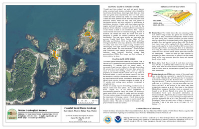
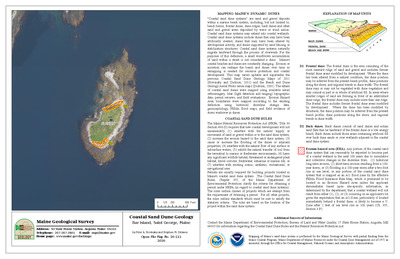
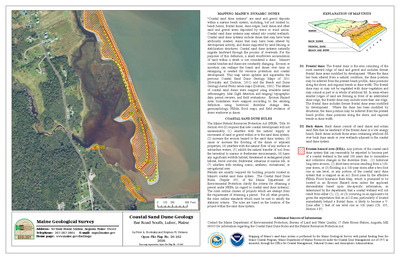
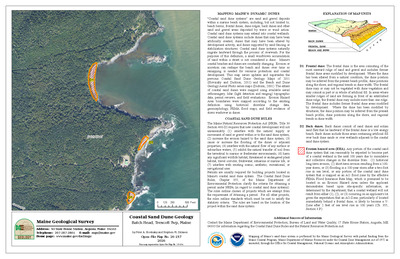
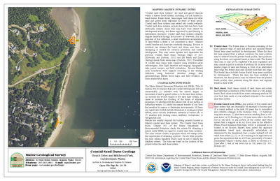
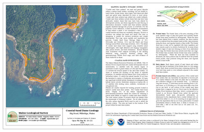
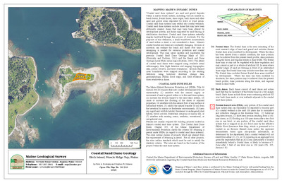
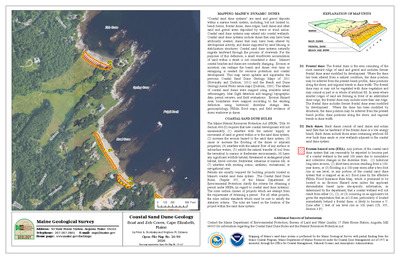
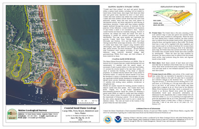
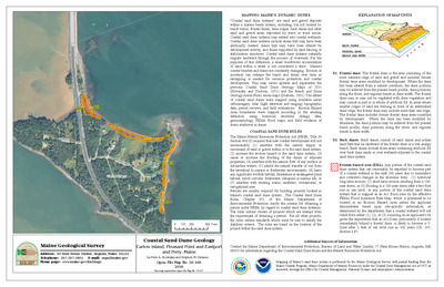
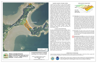
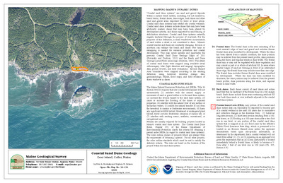
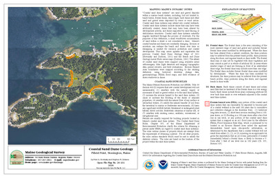
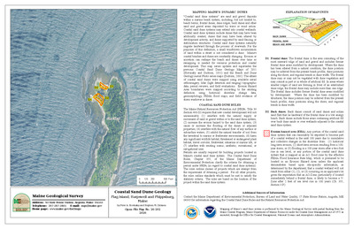
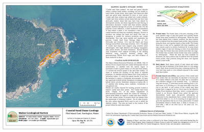
Beach and Dune Geology Aerial Photo: Old Orchard Beach, East Grand Avenue, Old Orchard Beach
Stephen M. Dickson
Maine Geological Survey, Open-File Map 05-12 (Superseded by Slovinsky and Dickson, 2011, Maine Geological Survey Open-File Maps 11-1114 and 11-115).
-

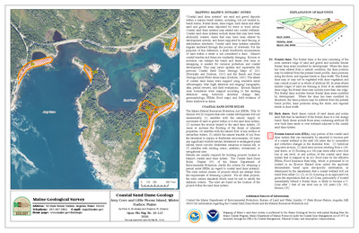
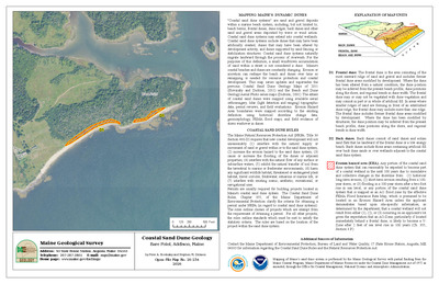
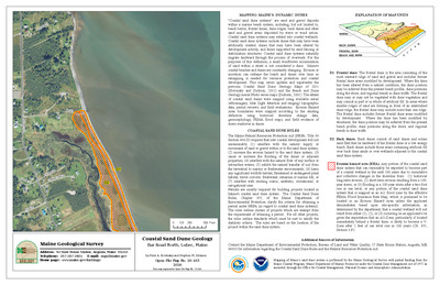
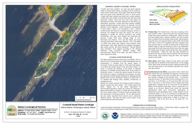
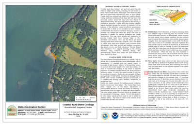
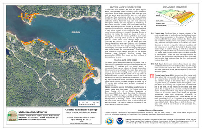
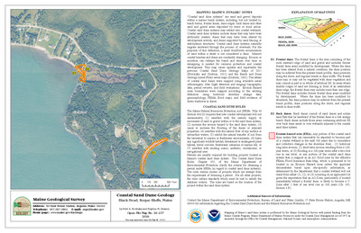
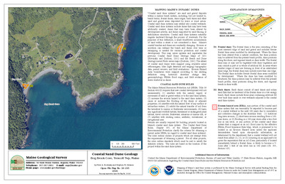
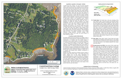
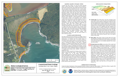
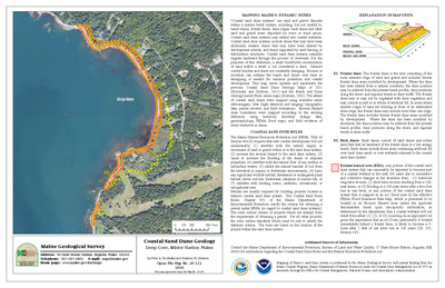
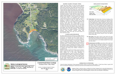
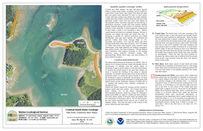
Beach and Dune Geology Aerial Photo: Old Orchard Beach, Ocean Park Beach, Old Orchard Beach
Stephen M. Dickson
Maine Geological Survey, Open-File Map 05-13 (Superseded by Slovinsky and Dickson, 2011, Maine Geological Survey, Maine Geological Survey Open-File Map 11-113).
-

Coastal bluffs in the Baker Island quadrangle, Maine
Nicole A. Raineault, Christopher E. Miller, Stephen M. Dickson, and Joseph T. Kelley
Maine Geological Survey, Open-File Map 05-47
-

Coastal bluffs in the Bass Harbor quadrangle, Maine
Nicole A. Raineault, Christopher E. Miller, Stephen M. Dickson, and Joseph T. Kelley
Maine Geological Survey, Open-File Map 05-19
-

Coastal bluffs in the Hancock quadrangle, Maine
Christopher E. Miller, Kristie A. Ferland, Corinn C. Koblinsky, Stephen G. Perrin, Stephen M. Dickson, and Joseph T. Kelley
Maine Geological Survey, Open-File Map 05-41.
-

Coastal bluffs in the Seal Harbor quadrangle, Maine
Christopher E. Miller, Nicole A. Raineault, Stephen M. Dickson, and Joseph T. Kelley
Maine Geological Survey, Open-File Map 05-21.
-

Coastal bluffs in the Southwest Harbor quadrangle, Maine
Christopher E. Miller, Nicole A. Raineault, Stephen M. Dickson, and Joseph T. Kelley
Maine Geological Survey, Open-File Map 05-22.
-

Coastal bluffs in the Sullivan quadrangle, Maine
Christopher E. Miller, Corinn C. Koblinsky, Nathan C. Gardner, Kristie A. Ferland, Jennifer L. Hall, Stephen G. Perrin, Stephen M. Dickson, and Joseph T. Kelley
Maine Geological Survey, Open-File Map 05-42.
-

Coastal landslide hazards in the Baker Island quadrangle, Maine
Stephen M. Dickson
Maine Geological Survey, Open-File Map 05-31.
-

Coastal landslide hazards in the Bass Harbor quadrangle, Maine
Stephen M. Dickson
Maine Geological Survey, Open-File Map 05-32.
-

Coastal landslide hazards in the Hancock quadrangle, Maine
Stephen M. Dickson
Maine Geological Survey, Open-File Map 05-24.
-

Coastal landslide hazards in the Seal Harbor quadrangle, Maine
Stephen M. Dickson
Maine Geological Survey, Open-File Map 05-34.
-

Coastal landslide hazards in the Southwest Harbor quadrangle, Maine
Stephen M. Dickson
Maine Geological Survey, Open-File Map 05-35.
-

Coastal landslide hazards in the Sullivan quadrangle, Maine
Stephen M. Dickson
Maine Geological Survey, Open-File Map 05-37.
-

Significant sand and gravel aquifers in the Togus Pond quadrangle, Maine
Craig D. Neil and Daniel B. Locke
Maine Geological Survey, Open-File Map 05-44.
-

Significant sand and gravel aquifers in the Whetstone Pond quadrangle, Maine
Elizabeth B. Lewis, Daniel B. Locke, and Craig D. Neil
Maine Geological Survey, Open-File Map 05-1.
-

Surficial geology of the Belgrade quadrangle, Maine
Carol T. Hildreth
Maine Geological Survey, Open-File Map 05-45.
-

Surficial geology of the Purgatory quadrangle, Maine
Carol T. Hildreth
Maine Geological Survey, Open-File Map 05-46.
-

Surficial geology of the Vassalboro quadrangle, Maine
Carol T. Hildreth
Maine Geological Survey, Open-File Map 05-8.
-

Surficial materials of the China Lake quadrangle, Maine
Kent M. Syverson, David P. Mans, and Daniel B. Locke
Maine Geological Survey, Open-File Map 05-7.
-

Surficial materials of the Gardiner quadrangle, Maine
Woodrow B. Thompson and Daniel B. Locke
Maine Geological Survey, Open-File Map 05-2.
-

Surficial materials of the Togus Pond quadrangle, Maine
Woodrow B. Thompson and Daniel B. Locke
Maine Geological Survey, Open-File Map 05-3.
-

Surficial materials of the Vassalboro quadrangle, Maine
Carol T. Hildreth and Daniel B. Locke
Maine Geological Survey, Open-File Map 05-9.
-

Surficial materials of the Weeks Mills quadrangle, Maine
Thomas K. Weddle and Daniel B. Locke
Maine Geological Survey, Open-File Map 05-11.
-

Bedrock geology of the Milton quadrangle, New Hampshire-Maine
Peter J. Thompson
Maine Geological Survey, Open-File Map 04-77.
-

Bedrock geology of the Razorville quadrangle, Maine
David P. West Jr and Emily M. Peterman
Maine Geological Survey, Open-File Map 04-29.
-

Bedrock geology of the Waterboro quadrangle, Maine
Chris Guzofski
Maine Geological Survey, Open-File Map 04-15.
-

Coastal bluffs in the Bois Bubert quadrangle, Maine
Kristie A. Ferland, Adam T. Labelle, Stephen M. Dickson, and Joseph T. Kelley
Maine Geological Survey, Open-File Map 04-18.
-

Coastal bluffs in the Cherryfield quadrangle, Maine
Kristie A. Ferland, Adam T. Labelle, Stephen M. Dickson, and Joseph T. Kelley
Maine Geological Survey, Open-File Map 04-20.
-

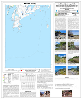
Coastal bluffs in the Petit Manan quadrangle, Maine
Kristie A. Ferland, Adam T. Labelle, Stephen M. Dickson, and Joseph T. Kelley
Maine Geological Survey, Open-File Map 04-24.
-

Coastal landslide hazards in the Bois Bubert quadrangle, Maine
Stephen M. Dickson
Maine Geological Survey, Open-File Map 04-19.
-

Coastal landslide hazards in the Cherryfield quadrangle, Maine
Stephen M. Dickson
Maine Geological Survey, Open-File Map 04-21.
-

Coastal landslide hazards in the Harrington quadrangle, Maine
Stephen M. Dickson
Maine Geological Survey, Open-File Map 04-23.
-

Coastal landslide hazards in the Petit Manan quadrangle, Maine
Stephen M. Dickson
Maine Geological Survey, Open-File Map 04-25.
-

Significant sand and gravel aquifers in the Allagash quadrangle, Maine
Thomas K. Weddle
Maine Geological Survey, Open-File Map 04-61.
-

Significant sand and gravel aquifers in the Bowdoinham quadrangle, Maine
Craig D. Neil and Thomas K. Weddle
Maine Geological Survey, Open-File Map 04-80.
-

Significant sand and gravel aquifers in the Bowlin Brook quadrangle, Maine
Daniel B. Locke and Craig D. Neil
Maine Geological Survey, Open-File Map 04-75.
-

Significant sand and gravel aquifers in the Carr Pond quadrangle, Maine
Robert A. Johnston and Robert A. Johnston
Maine Geological Survey, Open-File Map 04-7.
-

Significant sand and gravel aquifers in the Chandler Mountain quadrangle, Maine
Craig D. Neil and Michael E. Foley
Maine Geological Survey, Open-File Map 04-57.
-

Significant sand and gravel aquifers in the Eagle Lake quadrangle, Maine
Robert A. Johnston and Robert A. Johnston
Maine Geological Survey, Open-File Map 04-13.
-

Significant sand and gravel aquifers in the Falls Brook Lake quadrangle, Maine
Thomas K. Weddle
Maine Geological Survey, Open-File Map 04-67.
-

Significant sand and gravel aquifers in the Fish River Lake quadrangle
Robert A. Johnston and Robert A. Johnston
Maine Geological Survey, Open-File Map 04-9.
-

Significant sand and gravel aquifers in the Forks of Machias quadrangle, Maine
Michael E. Foley
Maine Geological Survey, Open-File Map 04-51.
-

Significant sand and gravel aquifers in the Grand Lake Seboeis quadrangle, Maine
Michael E. Foley and Craig D. Neil
Maine Geological Survey, Open-File Map 04-59.
-

Significant sand and gravel aquifers in the Hay Brook Mountain quadrangle, Maine
Daniel B. Locke and Craig D. Neil
Maine Geological Survey, Open-File Map 04-73.
-

Significant sand and gravel aquifers in the Hay Lake quadrangle, Maine
Daniel B. Locke and Craig D. Neil
Maine Geological Survey, Open-File Map 04-71.
-

Significant sand and gravel aquifers in the La Pomkeag Lake quadrangle, Maine
Michael E. Foley and Craig D. Neil
Maine Geological Survey, Open-File Map 04-53.
-

Significant sand and gravel aquifers in the Little Machias Lake quadrangle, Maine
Robert A. Johnston and Robert A. Johnston
Maine Geological Survey, Open-File Map 04-3.
-

Significant sand and gravel aquifers in the Millinocket Lake East quadrangle, Maine
Michael E. Foley and Craig D. Neil
Maine Geological Survey, Open-File Map 04-49.
-

Significant sand and gravel aquifers in the Oxbow West quadrangle, Maine
Craig D. Neil and Michael E. Foley
Maine Geological Survey, Open-File Map 04-55.
-

Significant sand and gravel aquifers in the Pelletier Brook Lakes quadrangle, Maine
Thomas K. Weddle
Maine Geological Survey, Open-File Map 04-63.
-

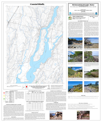
Significant sand and gravel aquifers in the Richmond quadrangle, Maine
Craig D. Neil and Daniel B. Locke
Maine Geological Survey, Open-File Map 04-17.
-

Significant sand and gravel aquifers in the Shin Pond quadrangle, Maine
Daniel B. Locke and Craig D. Neil
Maine Geological Survey, Open-File Map 04-46.
-

Significant sand and gravel aquifers in the St Francis quadrangle, Maine
Thomas K. Weddle
Maine Geological Survey, Open-File Map 04-65.
-

Significant sand and gravel aquifers in the Traveler quadrangle, Maine
Daniel B. Locke and Craig D. Neil
Maine Geological Survey, Open-File Map 04-48.
-

Significant sand and gravel aquifers in the Trout Brook Mountain quadrangle, Maine
Daniel B. Locke and Craig D. Neil
Maine Geological Survey, Open-File Map 04-69.
-

Significant sand and gravel aquifers in the Winterville quadrangle, Maine
Robert A. Johnston and Robert A. Johnston
Maine Geological Survey, Open-File Map 04-11.
-

Significant sand and gravel aquifers in the Winthrop quadrangle, Maine
Craig D. Neil and Thomas K. Weddle
Maine Geological Survey, Open-File Map 04-78.
-

Surficial geology of the Bowdoinham quadrangle, Maine
Carol T. Hildreth
Maine Geological Survey, Open-File Map 03-52.
-

Surficial geology of the Readfield quadrangle, Maine
Carol T. Hildreth
Maine Geological Survey, Open-File Map 04-40.
-

Surficial materials of the Allagash quadrangle, Maine
Thomas K. Weddle
Maine Geological Survey, Open-File Map 04-62.
-

Surficial materials of the Augusta quadrangle, Maine
Woodrow B. Thompson and Daniel B. Locke
Maine Geological Survey, Open-File Map 04-30.
-

Surficial materials of the Belgrade quadrangle, Maine
Carol T. Hildreth, Daniel B. Locke, and Woodrow B. Thompson
Maine Geological Survey, Open-File Map 04-36.
-

Surficial materials of the Bowdoinham quadrangle, Maine
Daniel B. Locke and Carol T. Hildreth
Maine Geological Survey, Open-File Map 04-44.
-

Surficial materials of the Bowlin Brook quadrangle, Maine
Daniel B. Locke
Maine Geological Survey, Open-File Map 04-76.
-

Surficial materials of the Carr Pond quadrangle, Maine
Robert A. Johnston
Maine Geological Survey, Open-File Map 04-8.
-

Surficial materials of the Chandler Mountain quadrangle
Michael E. Foley
Maine Geological Survey, Open-File Map 04-58.
-

Surficial materials of the Eagle Lake quadrangle, Maine
Robert A. Johnston
Maine Geological Survey, Open-File Map 04-14.
-

Surficial materials of the Falls Brook Lake quadrangle, Maine
Thomas K. Weddle
Maine Geological Survey, Open-File Map 04-68.
-

Surficial materials of the Fish River Lake quadrangle, Maine
Robert A. Johnston and Craig D. Neil
Maine Geological Survey, Open-File Map 04-10.
-

Surficial materials of the Forks of Machias quadrangle, Maine
Michael E. Foley
Maine Geological Survey, Open-File Map 04-52.
-

Surficial materials of the Grand Lake Seboeis quadrangle, Maine
Michael E. Foley
Maine Geological Survey, Open-File Map 04-60.
-

Surficial materials of the Hay Brook Mountain quadrangle, Maine
Daniel B. Locke
Maine Geological Survey, Open-File Map 04-74.
-

Surficial materials of the Hay Lake quadrangle, Maine
Daniel B. Locke
Maine Geological Survey, Open-File Map 04-72.
-

Surficial materials of the La Pomkeag Lake quadrangle, Maine
Michael E. Foley
Maine Geological Survey, Open-File Map 04-54.
-

Surficial materials of the Little Machias Lake quadrangle, Maine
Robert A. Johnston
Maine Geological Survey, Open-File Map 04-4.
-

Surficial materials of the Millinocket Lake East quadrangle, Maine
Michael E. Foley
Maine Geological Survey, Open-File Map 04-50.
-

Surficial materials of the Oxbow West quadrangle, Maine
Michael E. Foley
Maine Geological Survey, Open-File Map 04-56.
-

Surficial materials of the Pelletier Brook Lakes quadrangle, Maine
Thomas K. Weddle
Maine Geological Survey, Open-File Map 04-64.
-

Surficial materials of the Portage Lake West quadrangle, Maine
Robert A. Johnston
Maine Geological Survey, Open-File Map 04-6.
-

Surficial materials of the Purgatory quadrangle, Maine
Daniel B. Locke and Carol T. Hildreth
Maine Geological Survey, Open-File Map 04-43.
-

Surficial materials of the Readfield quadrangle, Maine
Carol T. Hildreth, Daniel B. Locke, and Woodrow B. Thompson
Maine Geological Survey, Open-File Map 04-39.
-

Surficial materials of the Richmond quadrangle, Maine
Daniel S. Frost, Thomas K. Weddle, and Daniel B. Locke
Maine Geological Survey, Open-File Map 04-2.
-

Surficial materials of the Shin Pond quadrangle, Maine
Daniel B. Locke
Maine Geological Survey, Open-File Map 04-45.
-

Surficial materials of the St Francis quadrangle, Maine
Thomas K. Weddle
Maine Geological Survey, Open-File Map 04-66.
-

Surficial materials of The Traveler quadrangle, Maine
Daniel B. Locke
Maine Geological Survey, Open-File Map 04-47.
-

Surficial materials of the Trout Brook Mountain quadrangle, Maine
Daniel B. Locke
Maine Geological Survey, Open-File Map 04-70.
-

Surficial materials of the Winterville quadrangle
Robert A. Johnston
Maine Geological Survey, Open-File Map 04-12.
-

Surficial materials of the Winthrop quadrangle, Maine
Woodrow B. Thompson and Daniel B. Locke
Maine Geological Survey, Open-File Map 04-33.
-

Bedrock geology of the Calais 1:100,000 quadrangle, Maine
Allan Ludman and Henry N. Berry IV
Maine Geological Survey, Open-File Map 03-97
-

Bedrock geology of the Dill Hill quadrangle, Maine
Allan Ludman
Maine Geological Survey, Open-File Map 03-93.
-

Bedrock geology of the Old Orchard Beach quadrangle, Maine
Arthur M. Hussey II
Maine Geological Survey, Open-File Map 03-96
-

Bedrock geology of the Portland East quadrangle, Maine
Arthur M. Hussey II
Maine Geological Survey, Open-File Map 03-90.
-

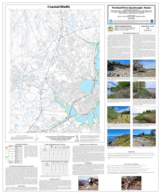
Bedrock geology of the Portland West quadrangle, Maine
Arthur M. Hussey II
Maine Geological Survey, Open-File Map 03-94
-

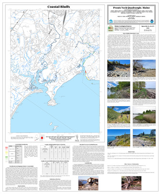
Bedrock geology of the Prouts Neck quadrangle, Maine
Arthur M. Hussey II
Maine Geological Survey, Open-File Map 03-95
-

Bedrock geology of the Salsbury Cove quadrangle, Maine
Douglas N. Reusch
Maine Geological Survey, Open-File Map 03-91.
-

Bedrock geology of the Weeks Mills quadrangle, Maine
Timothy W. Grover and Leslie C. Fernandes
Maine Geological Survey, Open-File Map 03-49.
-

Coastal bluffs in the Bartlett Island quadrangle, Maine
Kristie A. Ferland, Corinn C. Keblinsky, Stephen M. Dickson, and Joseph T. Kelley
Maine Geological Survey, Open-File Map 03-8
-

Coastal bluffs in the Cape Rosier quadrangle, Maine
Walter A. Barnhardt, Kristie A. Ferland, Corinn C. Keblinsky, Stephen M. Dickson, and Joseph T. Kelley
Maine Geological Survey, Open-File Map 03-16
-

Coastal bluffs in the Castine quadrangle, Maine
Walter A. Barnhardt, Marita Bryant, Corinn C. Keblinsky, Stephen M. Dickson, and Joseph T. Kelley
Maine Geological Survey, Open-File Map 03-102
-

Coastal bluffs in the Islesboro quadrangle, Maine
Kristie A. Ferland, Kendra Murray, Corinn C. Keblinsky, Marita Bryant, Walter A. Barnhardt, Stephen M. Dickson, and Joseph T. Kelley
Maine Geological Survey, Open-File Map 03-22
-

Coastal bluffs in the North Haven West quadrangle, Maine
Kristie A. Ferland, Corinn C. Keblinsky, Kendra Murray, Stephen M. Dickson, and Joseph T. Kelley
Maine Geological Survey, Open-File Map 03-20
-

Coastal bluffs in the Searsport quadrangle, Maine
Marita Bryant, Walter A. Barnhardt, Kendra Murray, Corinn C. Keblinsky, Stephen M. Dickson, and Joseph T. Kelley
Maine Geological Survey, Open-File Map 03-24
-

Coastal bluffs in the Swans Island quadrangle, Maine
Corinn C. Keblinsky, Stephen M. Dickson, and Joseph T. Kelley
Maine Geological Survey, Open-File Map 03-18
-

Coastal landslide hazards in the Bartlett Island quadrangle, Maine
Stephen M. Dickson
Maine Geological Survey, Open-File Map 03-9
-

Coastal landslide hazards in the Cape Rosier quadrangle, Maine
Stephen M. Dickson
Maine Geological Survey, Open-File Map 03-15
-

Coastal landslide hazards in the Castine quadrangle, Maine
Stephen M. Dickson
Maine Geological Survey, Open-File Map 03-101
-

Coastal landslide hazards in the Islesboro quadrangle, Maine
Stephen M. Dickson
Maine Geological Survey, Open-File Map 03-21
-

Coastal landslide hazards in the North Haven West quadrangle, Maine
Stephen M. Dickson
Maine Geological Survey, Open-File Map 03-19
-

Coastal landslide hazards in the Searsport quadrangle, Maine
Stephen M. Dickson
Maine Geological Survey, Open-File Map 03-23
-

Coastal landslide hazards in the Swans Island quadrangle, Maine
Stephen M. Dickson
Maine Geological Survey, Open-File Map 03-17
-

Earthquakes in Maine
Henry N. Berry IV and Marc Loiselle
Maine Geological Survey. Map of Maine showing all earthquakes since 1814 for which magnitudes were measured or have been estimated. Also includes discussion of Maine's earthquake history, what happens during an earthquake, regional seismicity, and causes and risks of Maine earthquakes.
-

Significant sand and gravel aquifers in the Attean Pond quadrangle, Maine
Michael E. Foley
Maine Geological Survey, Open-File Map 03-79
-

Significant sand and gravel aquifers in the Bethel quadrangle, Maine
Craig D. Neil and Daniel B. Locke
Maine Geological Survey, Open-File Map 03-98.
-

Significant sand and gravel aquifers in the Campbell Brook quadrangle, Maine
Thomas K. Weddle
Maine Geological Survey, Open-File Map 03-39
-

Significant sand and gravel aquifers in the Catheart Mountain quadrangle, Maine
Michael E. Foley
Maine Geological Survey, Open-File Map 03-81
-

Significant sand and gravel aquifers in the Chain of Ponds quadrangle, Maine
Michael E. Foley
Maine Geological Survey, Open-File Map 03-74
-

Significant sand and gravel aquifers in the Churchill Stream quadrangle, Maine
Thomas K. Weddle
Maine Geological Survey, Open-File Map 03-42
-

Significant sand and gravel aquifers in the East Stoneham quadrangle, Maine
Craig D. Neil and Daniel B. Locke
Maine Geological Survey, Open-File Map 03-3
-

Significant sand and gravel aquifers in the Gilead quadrangle, Maine
Craig D. Neil and Daniel B. Locke
Maine Geological Survey, Open-File Map 03-99
-

Significant sand and gravel aquifers in the Heald Pond quadrangle, Maine
Thomas K. Weddle
Maine Geological Survey, Open-File Map 03-41
-

Significant sand and gravel aquifers in the Jackman quadrangle, Maine
Thomas K. Weddle
Maine Geological Survey, Open-File Map 03-40
-

Significant sand and gravel aquifers in the Jim Pond quadrangle, Maine
Michael E. Foley
Maine Geological Survey, Open-File Map 03-76
-

Significant sand and gravel aquifers in the Johnson Mountain quadrangle, Maine
Michael E. Foley
Maine Geological Survey, Open-File Map 03-85
-

Significant sand and gravel aquifers in the Kokadjo quadrangle, Maine
Daniel B. Locke
Maine Geological Survey, Open-File Map 03-67
-

Significant sand and gravel aquifers in the Lobster Mountain quadrangle, Maine
Daniel B. Locke
Maine Geological Survey, Open-File Map 03-65
-

Significant sand and gravel aquifers in the Long Pond quadrangle, Maine
Michael E. Foley
Maine Geological Survey, Open-File Map 03-83
-

Significant sand and gravel aquifers in the Louise Mountain quadrangle, Maine
Thomas K. Weddle and Craig D. Neil
Maine Geological Survey, Open-File Map 03-36
-

Significant sand and gravel aquifers in the Merrill Mountain quadrangle, Maine
Thomas K. Weddle
Maine Geological Survey, Open-File Map 03-38
-

Significant sand and gravel aquifers in the Moose Bog quadrangle, Maine
Thomas K. Weddle and Craig D. Neil
Maine Geological Survey, Open-File Map 03-35
-

Significant Sand and Gravel Aquifers in the Northwest Pond quadrangle, Maine
Thomas K. Weddle and Craig D. Neil
Maine Geological Survey, Open-File Map 03-37
-

Significant sand and gravel aquifers in the Penobscot Farm quadrangle, Maine
Daniel B. Locke
Maine Geological Survey, Open-File Map 03-64
-

Significant sand and gravel aquifers in the Phillips quadrangle, Maine
Craig D. Neil and Daniel B. Locke
Maine Geological Survey, Open-File Map 03-55.
-

Significant sand and gravel aquifers in the Spencer Bay quadrangle, Maine
Daniel B. Locke
Maine Geological Survey, Open-File Map 03-66
-

Significant sand and gravel aquifers in the Strong quadrangle, Maine
Craig D. Neil and Daniel B. Locke
Maine Geological Survey, Open-File Map 03-100.
-

Significant sand and gravel aquifers in the Tim Mountain quadrangle, Maine
Lauren E. Foster, Elizabeth B. Lewis, Craig D. Neil, and Thomas K. Weddle
Maine Geological Survey, Open-File Map 03-87
-

Significant sand and gravel aquifers in the Twin Peaks quadrangle, Maine
Michael E. Foley
Maine Geological Survey, Open-File Map 03-72
-

Simplified surficial geologic map of Maine
Marc Loiselle
Maine Geological Survey. This map shows the simplified surficial geology of Maine. Inset map shows maximum ice extent. The map also includes a generalized geologic cross section and block diagrams showing glacial recession in southern Maine.
-

Surficial geology of the East Stoneham quadrangle, Maine
Woodrow B. Thompson
Maine Geological Survey, Open-File Map 03-2
-

Surficial geology of the Farmington quadrangle, Maine
Thomas K. Weddle
Maine Geological Survey, Open-File Map 03-51
-

Surficial geology of the Gilead quadrangle, Maine
Woodrow B. Thompson
Maine Geological Survey, Open-File Map 03-57.
-

Surficial geology of the Lisbon Falls North quadrangle, Maine
Thomas K. Weddle, Amanda E. Normand, and Alexa A. Bernotavicz
Maine Geological Survey, Open-File Map 03-14
-

Surficial geology of the Phillips quadrangle, Maine
Kent M. Syverson and Rachel M. Greve
Maine Geological Survey, Open-File Map 03-47
-

Surficial materials of the Attean Pond quadrangle, Maine
Michael E. Foley
Maine Geological Survey, Open-File Map 03-80
-

Surficial materials of the Bethel quadrangle, Maine
Woodrow B. Thompson and Daniel B. Locke
Maine Geological Survey, Open-File Map 03-43
-

Surficial materials of the Campbell Brook quadrangle, Maine
Thomas K. Weddle
Maine Geological Survey, Open-File Map 03-31
-

Surficial materials of the Catheart Mountain quadrangle, Maine
Michael E. Foley
Maine Geological Survey, Open-File Map 03-82
-

Surficial materials of the Chain of Ponds quadrangle, Maine
Craig D. Neil
Maine Geological Survey, Open-File Map 03-75
-

Surficial materials of the Churchill Stream quadrangle, Maine
Thomas K. Weddle
Maine Geological Survey, Open-File Map 03-34
-

Surficial materials of the East Stoneham quadrangle, Maine
Woodrow B. Thompson and Daniel B. Locke
Maine Geological Survey, Open-File Map 03-1
-

Surficial materials of the Farmington quadrangle, Maine
Thomas K. Weddle and Daniel B. Locke
Maine Geological Survey, Open-File Map 03-50
-

Surficial materials of the Gilead quadrangle, Maine
Woodrow B. Thompson and Daniel B. Locke
Maine Geological Survey, Open-File Map 03-56
-

Surficial materials of the Heald Pond quadrangle, Maine
Thomas K. Weddle
Maine Geological Survey, Open-File Map 03-33
-

Surficial materials of the Jackman quadrangle, Maine
Thomas K. Weddle
Maine Geological Survey, Open-File Map 03-32
-

Surficial materials of the Jim Pond quadrangle, Maine
Craig D. Neil
Maine Geological Survey, Open-File Map 03-77
-

Surficial materials of the Johnson Mountain quadrangle, Maine
Michael E. Foley
Maine Geological Survey, Open-File Map 03-86
-

Surficial materials of the Kokadjo quadrangle, Maine
Daniel B. Locke
Maine Geological Survey, Open-File Map 03-71
-

Surficial materials of the Lobster Mountain quadrangle, Maine
Daniel B. Locke
Maine Geological Survey, Open-File Map 03-69
-

Surficial materials of the Long Pond quadrangle, Maine
Michael E. Foley
Maine Geological Survey, Open-File Map 03-84
-

Surficial materials of the Louise Mountain quadrangle, Maine
Craig D. Neil
Maine Geological Survey, Open-File Map 03-28
-

Surficial materials of the Merrill Mountain quadrangle, Maine
Craig D. Neil
Maine Geological Survey, Open-File Map 03-30
-

Surficial materials of the Moose Bog quadrangle, Maine
Craig D. Neil
Maine Geological Survey, Open-File Map 03-27
-

Surficial materials of the Northwest Pond quadrangle, Maine
Craig D. Neil
Maine Geological Survey, Open-File Map 03-29
-

Surficial materials of the Penobscot Farm quadrangle, Maine
Daniel B. Locke
Maine Geological Survey, Open-File Map 03-68
-

Surficial materials of the Phillips quadrangle, Maine
Daniel B. Locke, Kent M. Syverson, and Rachel M. Greve
Maine Geological Survey, Open-File Map 03-46
-

Surficial materials of the Spencer Bay quadrangle, Maine
Daniel B. Locke
Maine Geological Survey, Open-File Map 03-70
-

Surficial materials of the Strong quadrangle, Maine
Craig D. Neil and Daniel B. Locke
Maine Geological Survey, Open-File Map 03-63
-

Surficial materials of the Twin Peaks quadrangle, Maine
Craig D. Neil
Maine Geological Survey, Open-File Map 03-73
-

Bedrock geology of the Bath 1:100,000 quadrangle, Maine
Arthur M. Hussey II and Robert G. Marvinney
Maine Geological Survey, Geologic Map 02-152
-

Bedrock geology of the Newbury Neck quadrangle, Maine
Douglas N. Reusch and John P. Hogan
Maine Geological Survey, Open-File Map 02-162.
-

Coastal bluffs in the Bailey Island quadrangle, Maine
Marita Bryant, Walter A. Barnhardt, Stephen M. Dickson, and Joseph T. Kelley
Maine Geological Survey, Open-File Map 02-168 (Superseded by Bryant, et. al., 2026, Maine Geological Survey Open-File 26-261)
-

Coastal bluffs in the Bangor quadrangle, Maine
Marita Bryant, Walter A. Barnhardt, Stephen M. Dickson, and Joseph T. Kelley
Maine Geological Survey, Open-File Map 02-169
-

Coastal bluffs in the Bath quadrangle, Maine
Allison L. Brandes, Rebecca A. Nestor, David A. Sinson, Marita Bryant, Walter A. Barnhardt, Stephen M. Dickson, and Joseph T. Kelley
Maine Geological Survey, Open-File Map 02-171 (Superseded by Brandes, et. al., 2020, Maine Geological Survey Open-File 20-20)
-

Coastal bluffs in the Belfast quadrangle, Maine
Marita Bryant, Walter A. Barnhardt, Stephen M. Dickson, and Joseph T. Kelley
Maine Geological Survey, Open-File Map 02-172
-

Coastal bluffs in the Biddeford Pool quadrangle, Maine
David A. Sinson, Rebecca A. Nestor, Stephen M. Dickson, and Joseph T. Kelley
Maine Geological Survey, Open-File Map 02-174
-

Coastal bluffs in the Biddeford quadrangle, Maine
David A. Sinson, Rebecca A. Nestor, Stephen M. Dickson, and Joseph T. Kelley
Maine Geological Survey, Open-File Map 02-173
-

Coastal bluffs in the Blue Hill quadrangle, Maine
Rebecca A. Nestor, Ben C. Johnston, Jessica L. Black, Stephen M. Dickson, and Joseph T. Kelley
Maine Geological Survey, Open-File Map 02-175
-

Coastal bluffs in the Bristol quadrangle, Maine
Thomas D. Henze, Douglas G. Hodum, Meredith A. Kelly, Stephen M. Dickson, and Joseph T. Kelley
Maine Geological Survey, Open-File Map 02-177
-

Coastal bluffs in the Brooklin quadrangle, Maine
Jessica L. Black, Rebecca A. Nestor, Ben C. Johnston, Bret Vandarheuvel, Walter A. Barnhardt, Stephen M. Dickson, and Joseph T. Kelley
Maine Geological Survey, Open-File Map 02-178
-

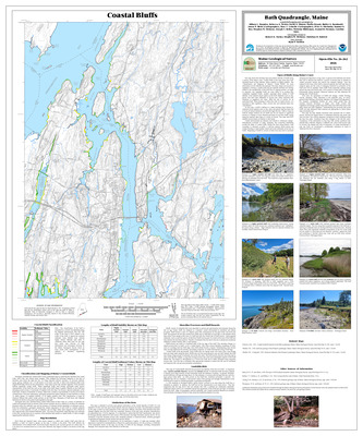
Coastal bluffs in the Brunswick quadrangle, Maine
Corinn C. Keblinsky, Jennifer L. Hall, Marita Bryant, Walter A. Barnhardt, Stephen M. Dickson, and Joseph T. Kelley
Maine Geological Survey, Open-File Map 02-179 (Superseded by Keblinsky, et. al., 2020, Maine Geological Survey Open-File 20-19)
-

Coastal bluffs in the Bucksport quadrangle, Maine
Marita Bryant, Walter A. Barnhardt, Stephen M. Dickson, and Joseph T. Kelley
Maine Geological Survey, Open-File Map 02-180
-

Coastal bluffs in the Camden quadrangle, Maine
Marita Bryant, Walter A. Barnhardt, Stephen M. Dickson, and Joseph T. Kelley
Maine Geological Survey, Open-File Map 02-181
-

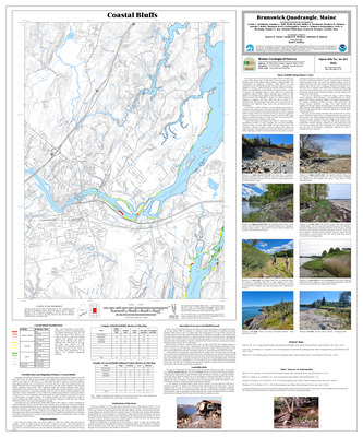
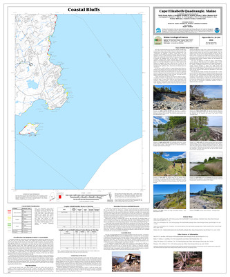
Coastal bluffs in the Cape Elizabeth quadrangle, Maine
Marita Bryant, Walter A. Barnhardt, Stephen M. Dickson, and Joseph T. Kelley
Maine Geological Survey, Open-File Map 02-182 (Superseded by Bryant et. al., 2026, Maine Geological Survey Open-File 26-264)
-

Coastal bluffs in the Damariscotta quadrangle, Maine
Thomas D. Henze, Douglas G. Hodum, Meredith A. Kelly, Stephen M. Dickson, and Joseph T. Kelley
Maine Geological Survey, Open-File Map 02-185
-

Coastal bluffs in the Dover East quadrangle, Maine
Allison L. Brandes, Stephen M. Dickson, and Joseph T. Kelley
Maine Geological Survey, Open-File Map 02-186
-

Coastal bluffs in the Ellsworth quadrangle, Maine
Ben C. Johnston, Rebecca A. Nestor, Stephen M. Dickson, and Joseph T. Kelley
Maine Geological Survey, Open-File Map 02-187