


The Maine Geological Survey provides the people and businesses of Maine with essential geologic information about the land where we live and work.
Note: Many state documents are offered in PDF format. To view PDF documents, you will need the free Adobe Reader. If you need assistance, view our Maine government PDF Help page or contact the contributing Maine State agency via the link on the left sidebar under “Links”.
-

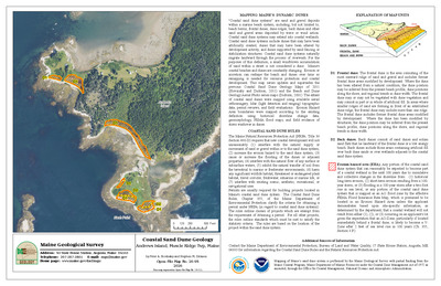
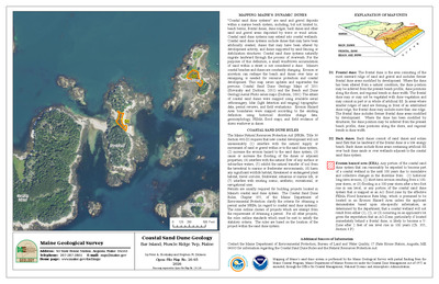
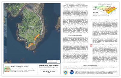
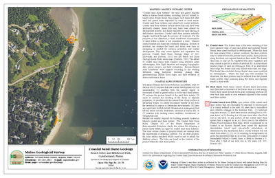
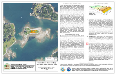
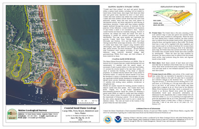
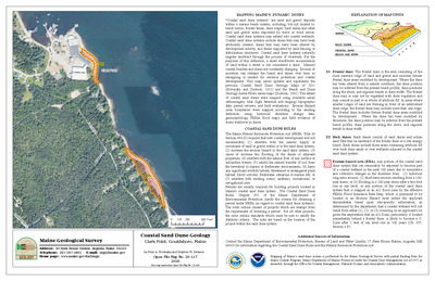
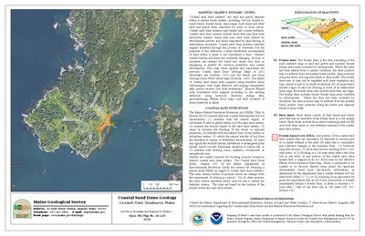
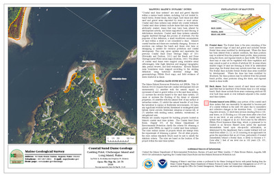
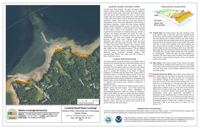
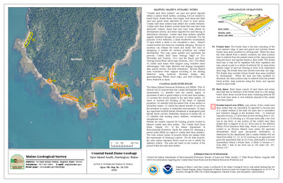
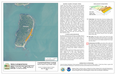
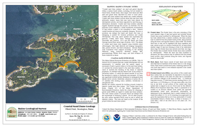
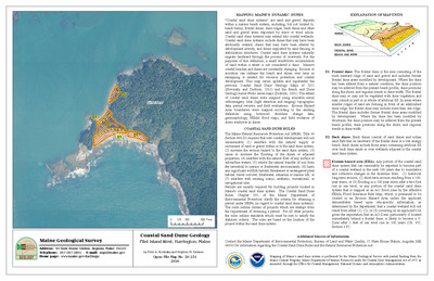
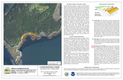
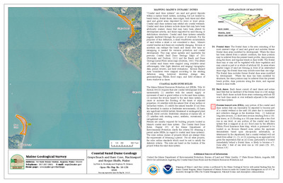
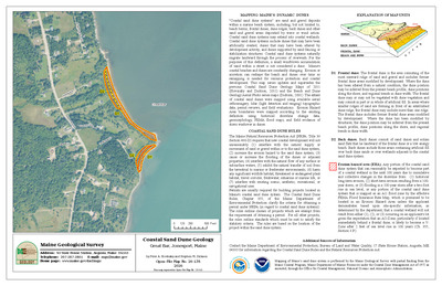
Coastal sand dune geology: Sand Beach and The Maypole, Cranberry Isles, Maine
Peter A. Slovinsky and Stephen M. Dickson
Maine Geological Survey, Open-File Map 23-416.
-

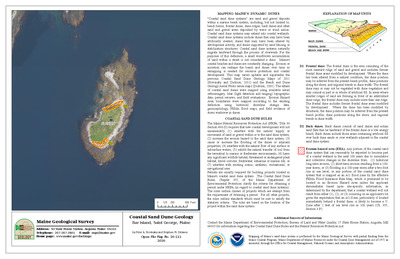
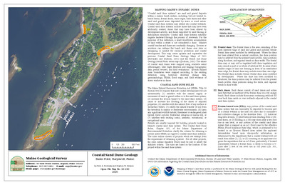
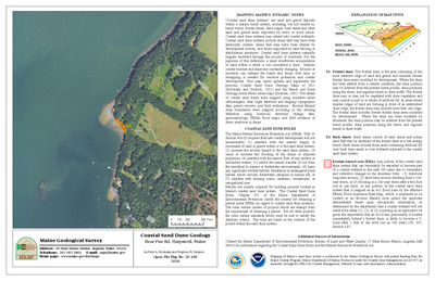
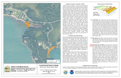
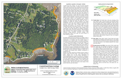
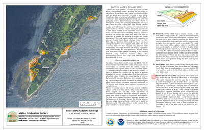
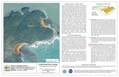
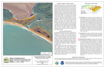
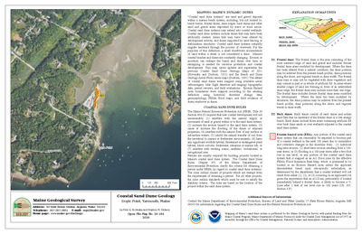
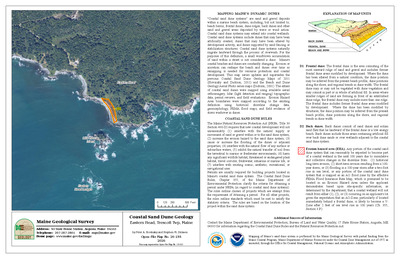
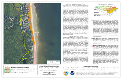
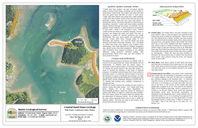
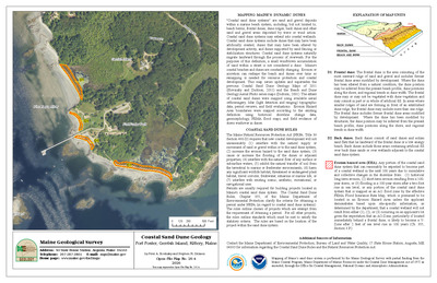
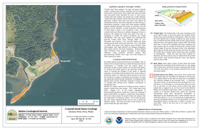
Coastal sand dune geology: Sand Beach and Whale Cove, Swans Island, Maine
Peter A. Slovinsky and Stephen M. Dickson
Maine Geological Survey, Open-File Map 23-345.
-

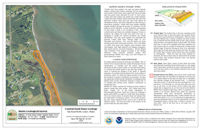
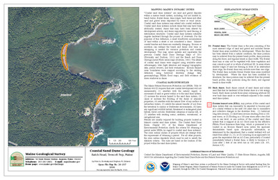
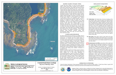
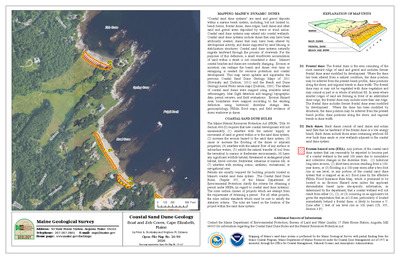
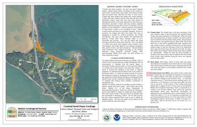
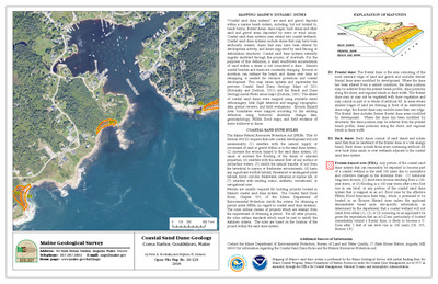
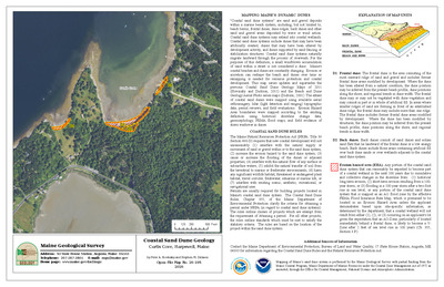
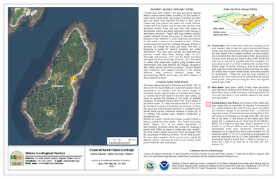
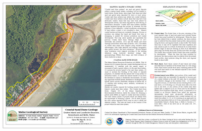
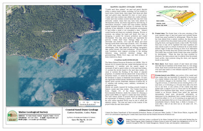
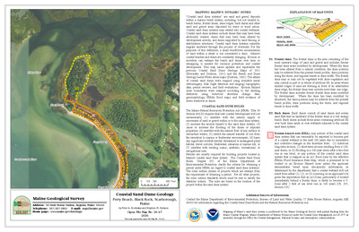
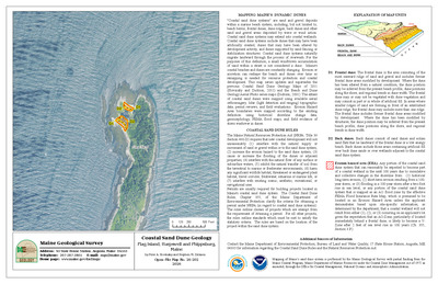
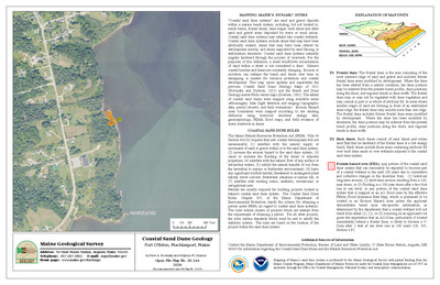
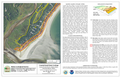
Coastal sand dune geology: Sand Beach, Bar Harbor, Maine
Peter A. Slovinsky and Stephen M. Dickson
Maine Geological Survey, Open-File Map 23-403.
-

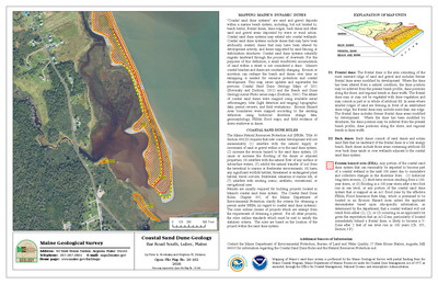
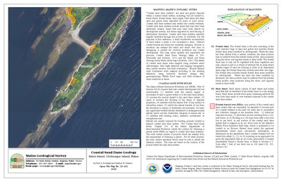
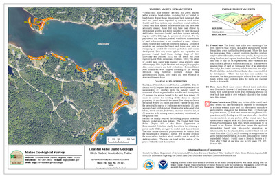
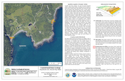
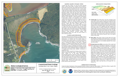
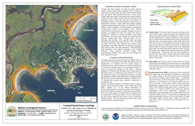
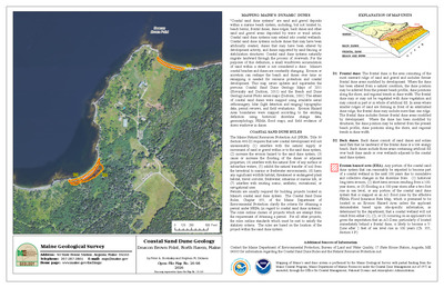
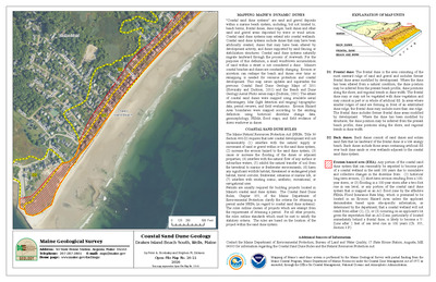
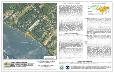
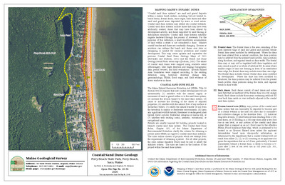
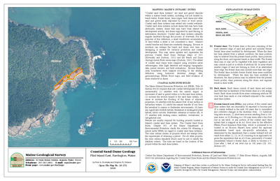
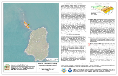
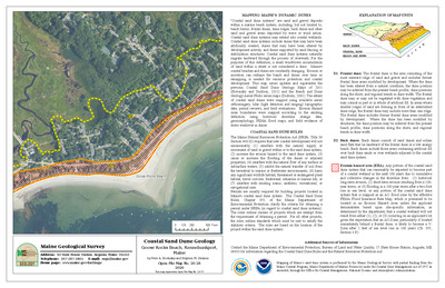
Coastal sand dune geology: Sand Beach, Stonington, Maine
Peter A. Slovinsky and Stephen M. Dickson
Maine Geological Survey, Open-File Map 23-307.
-

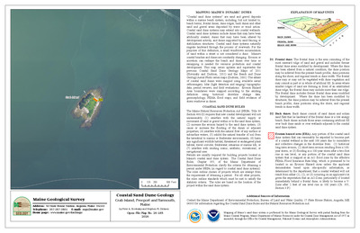
Coastal sand dune geology: Sand Cove, Gouldsboro, Maine
Peter A. Slovinsky and Stephen M. Dickson
Maine Geological Survey, Open-File Map 23-451 (Superseded by Slovinsky and Dickson, 2026, Maine Geological Survey Open-File Map 26-119).
-

Coastal sand dune geology: Sand Cove, Swans Island, Maine
Peter A. Slovinsky and Stephen M. Dickson
Maine Geological Survey, Open-File Map 23-340.
-

Coastal sand dune geology: Sand Cove, Youngs Point, and Bar Island, Gouldsboro, Maine
Peter A. Slovinsky and Stephen M. Dickson
Maine Geological Survey, Open-File Map 23-453.
-

Coastal sand dune geology: Sand Island, Stonington, Maine
Peter A. Slovinsky and Stephen M. Dickson
Maine Geological Survey, Open-File Map 23-305.
-

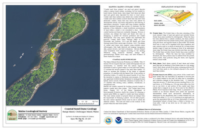
Coastal sand dune geology: Sand Point, Blue Hill, Maine
Peter A. Slovinsky and Stephen M. Dickson
Maine Geological Survey, Open-File Map 23-375.
-

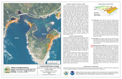
Coastal sand dune geology: Sandy Cove and Walkers Point, Kennebunkport, Maine
Peter A. Slovinsky and Stephen M. Dickson
Maine Geological Survey, Open-File Map 23-64.
-

Coastal sand dune geology: Sandy Cove, Harpswell, Maine
Peter A. Slovinsky and Stephen M. Dickson
Maine Geological Survey, Open-File Map 23-162 (Superseded by Slovinsky and Dickson, 2026, Maine Geological Survey Open-File Map 26-85).
-

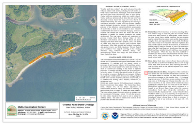
Coastal sand dune geology: Sandy Point Beach, Stockton Springs, Maine
Peter A. Slovinsky and Stephen M. Dickson
Maine Geological Survey, Open-File Map 23-295.
-

Coastal sand dune geology: Sandy Point, Stockton Springs, Maine
Peter A. Slovinsky and Stephen M. Dickson
Maine Geological Survey, Open-File Map 23-294.
-

Coastal sand dune geology: Sandy River Beach, Jonesport, Maine
Peter A. Slovinsky and Stephen M. Dickson
Maine Geological Survey, Open-File Map 23-509 (Superseded by Slovinsky and Dickson, 2026, Maine Geological Survey Open-File Map 26-132).
-

Coastal sand dune geology: Sargent Head, Mount Desert, Maine
Peter A. Slovinsky and Stephen M. Dickson
Maine Geological Survey, Open-File Map 23-397.
-

Coastal sand dune geology: Saturday Cove, Northport, Maine
Peter A. Slovinsky and Stephen M. Dickson
Maine Geological Survey, Open-File Map 23-270.
-

Coastal sand dune geology: Scarborough Beach, Prouts Neck, Scarborough, Maine
Peter A. Slovinsky and Stephen M. Dickson
Maine Geological Survey, Open-File Map 23-105 (Superseded by Slovinsky and Dickson, 2026, Maine Geological Survey Open-File Map 26-50).
-

Coastal sand dune geology: Scarborough Beach, Scarborough, Maine
Peter A. Slovinsky and Stephen M. Dickson
Maine Geological Survey, Open-File Map 23-107 (Superseded by Slovinsky and Dickson, 2026, Maine Geological Survey Open-File Map 26-52).
-

Coastal sand dune geology: Scarborough Beach State Park, Scarborough, Maine
Peter A. Slovinsky and Stephen M. Dickson
Maine Geological Survey, Open-File Map 23-106 (Superseded by Slovinsky and Dickson, 2026, Maine Geological Survey Open-File Map 26-51).
-

Coastal sand dune geology: Schoodic Island, Winter Harbor, Maine
Peter A. Slovinsky and Stephen M. Dickson
Maine Geological Survey, Open-File Map 23-443.
-

Coastal sand dune geology: Sea Cove, Frenchboro, Maine
Peter A. Slovinsky and Stephen M. Dickson
Maine Geological Survey, Open-File Map 23-362.
-

Coastal sand dune geology: Seal Cove, Criehaven Twp, Maine
Peter A. Slovinsky and Stephen M. Dickson
Maine Geological Survey, Open-File Map 23-231.
-

Coastal sand dune geology: Seal Cove, Cutler, Maine
Peter A. Slovinsky and Stephen M. Dickson
Maine Geological Survey, Open-File Map 23-538.
-

Coastal sand dune geology: Seal Cove Ledge, Cutler, Maine
Peter A. Slovinsky and Stephen M. Dickson
Maine Geological Survey, Open-File Map 23-540 (Superseded by Slovinsky and Dickson, 2026, Maine Geological Survey Open-File Map 26-150).
-

Coastal sand dune geology: Seal Cove, Winter Harbor, Maine
Peter A. Slovinsky and Stephen M. Dickson
Maine Geological Survey, Open-File Map 23-436.
-

Coastal sand dune geology: Seal Harbor, Mount Desert, Maine
Peter A. Slovinsky and Stephen M. Dickson
Maine Geological Survey, Open-File Map 23-400 (Superseded by Slovinsky and Dickson, 2026, Maine Geological Survey Open-File Map 26-105).
-

Coastal sand dune geology: Seapoint Beach, Cutts Island, Kittery, Maine
Peter A. Slovinsky and Stephen M. Dickson
Maine Geological Survey, Open-File Map 23-28 (Superseded by Slovinsky and Dickson, 2026, Maine Geological Survey Open-File Map 26-7).
-

Coastal sand dune geology: Sears Island Northeast, Searsport, Maine
Peter A. Slovinsky and Stephen M. Dickson
Maine Geological Survey, Open-File Map 23-291.
-

Coastal sand dune geology: Sears Island Northwest, Searsport, Maine
Peter A. Slovinsky and Stephen M. Dickson
Maine Geological Survey, Open-File Map 23-290.
-

Coastal sand dune geology: Seashore Avenue and Wharf Cove, Portland, Maine
Peter A. Slovinsky and Stephen M. Dickson
Maine Geological Survey, Open-File Map 23-124 (Superseded by Slovinsky and Dickson, 2026, Maine Geological Survey Open-File Map 26-63).
-

Coastal sand dune geology: Seashore Avenue, Portland, Maine
Peter A. Slovinsky and Stephen M. Dickson
Maine Geological Survey, Open-File Map 23-123 (Superseded by Slovinsky and Dickson, 2026, Maine Geological Survey Open-File Map 26-62).
-

Coastal sand dune geology: Seawall Beach, Morse River, Phippsburg, Maine
Peter A. Slovinsky and Stephen M. Dickson
Maine Geological Survey, Open-File Map 23-172.
-

Coastal sand dune geology: Seawall Beach, Phippsburg, Maine
Peter A. Slovinsky and Stephen M. Dickson
Maine Geological Survey, Open-File Map 23-171.
-

Coastal sand dune geology: Seawall Beach, Sprague River, Phippsburg, Maine
Peter A. Slovinsky and Stephen M. Dickson
Maine Geological Survey, Open-File Map 23-170 (Superseded by Slovinsky and Dickson, 2026, Maine Geological Survey Open-File Map 26-86).
-

Coastal sand dune geology: Seawall Picnic Area, Southwest Harbor, Maine
Peter A. Slovinsky and Stephen M. Dickson
Maine Geological Survey, Open-File Map 23-390 (Superseded by Slovinsky and Dickson, 2026, Maine Geological Survey Open-File Map 26-102).
-

Coastal sand dune geology: Seawall Pond, Southwest Harbor, Maine
Peter A. Slovinsky and Stephen M. Dickson
Maine Geological Survey, Open-File Map 23-391 (Superseded by Slovinsky and Dickson, 2026, Maine Geological Survey Open-File Map 26-103).
-

Coastal sand dune geology: Sequin Island and Head Harbor Island, Jonesport, Maine
Peter A. Slovinsky and Stephen M. Dickson
Maine Geological Survey, Open-File Map 23-502.
-

Coastal sand dune geology: Seward Neck, Lubec, Maine
Peter A. Slovinsky and Stephen M. Dickson
Maine Geological Survey, Open-File Map 23-566.
-

Coastal sand dune geology: Sewards Cove, Gerrish Island, Kittery, Maine
Peter A. Slovinsky and Stephen M. Dickson
Maine Geological Survey, Open-File Map 23-25.
-

Coastal sand dune geology: Sheephead Island, Deer Isle, Maine
Peter A. Slovinsky and Stephen M. Dickson
Maine Geological Survey, Open-File Map 23-311.
-

Coastal sand dune geology: Sheep Island, Addison, Maine
Peter A. Slovinsky and Stephen M. Dickson
Maine Geological Survey, Open-File Map 23-484.
-

Coastal sand dune geology: Sheep Island, Owls Head, Maine
Peter A. Slovinsky and Stephen M. Dickson
Maine Geological Survey, Open-File Map 23-226.
-

Coastal sand dune geology: Sherman Cove and Northeast Point, Camden, Maine
Peter A. Slovinsky and Stephen M. Dickson
Maine Geological Survey, Open-File Map 23-264.
-

Coastal sand dune geology: Ship Cove, Cape Elizabeth, Maine
Peter A. Slovinsky and Stephen M. Dickson
Maine Geological Survey, Open-File Map 23-119.
-

Coastal sand dune geology: Ship Island, Tremont, Maine
Peter A. Slovinsky and Stephen M. Dickson
Maine Geological Survey, Open-File Map 23-366.
-

Coastal sand dune geology: Shorey Cove, Jonesport, Maine
Peter A. Slovinsky and Stephen M. Dickson
Maine Geological Survey, Open-File Map 23-513.
-

Coastal sand dune geology: Short Sands Beach, York, Maine
Peter A. Slovinsky and Stephen M. Dickson
Maine Geological Survey, Open-File Map 23-39 (Superseded by Slovinsky and Dickson, 2026, Maine Geological Survey Open-File Map 26-12).
-

Coastal sand dune geology: Sisters Point, Gerrish Island, Kittery, Maine
Peter A. Slovinsky and Stephen M. Dickson
Maine Geological Survey, Open-File Map 23-26 (Superseded by Slovinsky and Dickson, 2026, Maine Geological Survey Open-File Map 26-5).
-

Coastal sand dune geology: Smalls Cove, Deer Isle, Maine
Peter A. Slovinsky and Stephen M. Dickson
Maine Geological Survey, Open-File Map 23-310.
-

Coastal sand dune geology: Smiths Ledge, Trenton, Maine
Peter A. Slovinsky and Stephen M. Dickson
Maine Geological Survey, Open-File Map 23-386.
-

Coastal sand dune geology: Southern Harbor, North Haven, Maine
Peter A. Slovinsky and Stephen M. Dickson
Maine Geological Survey, Open-File Map 23-249.
-

Coastal sand dune geology: Southern Island, Saint George, Maine
Peter A. Slovinsky and Stephen M. Dickson
Maine Geological Survey, Open-File Map 23-214.
-

Coastal sand dune geology: South Lubec Road, Lubec, Maine
Peter A. Slovinsky and Stephen M. Dickson
Maine Geological Survey, Open-File Map 23-563 (Superseded by Slovinsky and Dickson, 2026, Maine Geological Survey Open-File Map 26-164).
-

Coastal sand dune geology: South Road, Chebeague Island, Maine
Peter A. Slovinsky and Stephen M. Dickson
Maine Geological Survey, Open-File Map 23-143.
-

Coastal sand dune geology: South Trescott, Lubec, Maine
Peter A. Slovinsky and Stephen M. Dickson
Maine Geological Survey, Open-File Map 23-555 (Superseded by Slovinsky and Dickson, 2026, Maine Geological Survey Open-File Map 26-158).
-

Coastal sand dune geology: Southwest Cove, Swans Island, Maine
Peter A. Slovinsky and Stephen M. Dickson
Maine Geological Survey, Open-File Map 23-348.
-

Coastal sand dune geology: Southwest Point, Trenton, Maine
Peter A. Slovinsky and Stephen M. Dickson
Maine Geological Survey, Open-File Map 23-384.
-

Coastal sand dune geology: Spectacle and Turtle Islands, Winter Harbor, Maine
Peter A. Slovinsky and Stephen M. Dickson
Maine Geological Survey, Open-File Map 23-440.
-

Coastal sand dune geology: Spectacle Island, Eastport, Maine
Peter A. Slovinsky and Stephen M. Dickson
Maine Geological Survey, Open-File Map 23-575.
-

Coastal sand dune geology: Spicers Cove and Little Beach, Portland, Maine
Peter A. Slovinsky and Stephen M. Dickson
Maine Geological Survey, Open-File Map 23-121.
-

Coastal sand dune geology: Sprague Neck Bar, Cutler, Maine
Peter A. Slovinsky and Stephen M. Dickson
Maine Geological Survey, Open-File Map 23-532.
-

Coastal sand dune geology: Spragues Beach, Islesboro, Maine
Peter A. Slovinsky and Stephen M. Dickson
Maine Geological Survey, Open-File Map 23-284.
-

Coastal sand dune geology: Spring Brook, Camden, Maine
Peter A. Slovinsky and Stephen M. Dickson
Maine Geological Survey, Open-File Map 23-265.
-

Coastal sand dune geology: Spruce Point and Wonsqueak Harbor, Gouldsboro, Maine
Peter A. Slovinsky and Stephen M. Dickson
Maine Geological Survey, Open-File Map 23-445 (Superseded by Slovinsky and Dickson, 2026, Maine Geological Survey Open-File Map 26-114).
-

Coastal sand dune geology: Spurling Cove, Cranberry Isles, Maine
Peter A. Slovinsky and Stephen M. Dickson
Maine Geological Survey, Open-File Map 23-407.
-

Coastal sand dune geology: Squire Point, Jonesport, Maine
Peter A. Slovinsky and Stephen M. Dickson
Maine Geological Survey, Open-File Map 23-514.
-

Coastal sand dune geology: Stage Island, Kennebunkport, Maine
Peter A. Slovinsky and Stephen M. Dickson
Maine Geological Survey, Open-File Map 23-68.
-

Coastal sand dune geology: Stanley Point Road, Steuben, Maine
Peter A. Slovinsky and Stephen M. Dickson
Maine Geological Survey, Open-File Map 23-459.
-

Coastal sand dune geology: Stanley Point, Steuben, Maine
Peter A. Slovinsky and Stephen M. Dickson
Maine Geological Survey, Open-File Map 23-458 (Superseded by Slovinsky and Dickson, 2026, Maine Geological Survey Open-File Map 26-121).
-

Coastal sand dune geology: Stanley Point, Swans Island, Maine
Peter A. Slovinsky and Stephen M. Dickson
Maine Geological Survey, Open-File Map 23-349.
-

Coastal sand dune geology: Starboard Creek, Machiasport, Maine
Peter A. Slovinsky and Stephen M. Dickson
Maine Geological Survey, Open-File Map 23-525 (Superseded by Slovinsky and Dickson, 2026, Maine Geological Survey Open-File Map 26-140).
-

Coastal sand dune geology: Starboard Island, Machiasport, Maine
Peter A. Slovinsky and Stephen M. Dickson
Maine Geological Survey, Open-File Map 23-524 (Superseded by Slovinsky and Dickson, 2026, Maine Geological Survey Open-File Map 26-139).
-

Coastal sand dune geology: Starboard, Machiasport, Maine
Peter A. Slovinsky and Stephen M. Dickson
Maine Geological Survey, Open-File Map 23-526 (Superseded by Slovinsky and Dickson, 2026, Maine Geological Survey Open-File Map 26-141).
-

Coastal sand dune geology: State Park, Lamoine, Maine
Peter A. Slovinsky and Stephen M. Dickson
Maine Geological Survey, Open-File Map 23-422.
-

Coastal sand dune geology: Stave Island, Chebeague Island, Maine
Peter A. Slovinsky and Stephen M. Dickson
Maine Geological Survey, Open-File Map 23-141.
-

Coastal sand dune geology: Stave Island East, Gouldsboro, Maine
Peter A. Slovinsky and Stephen M. Dickson
Maine Geological Survey, Open-File Map 23-429.
-

Coastal sand dune geology: Stave Island South, Gouldsboro, Maine
Peter A. Slovinsky and Stephen M. Dickson
Maine Geological Survey, Open-File Map 23-427.
-

Coastal sand dune geology: Stave Island West, Gouldsboro, Maine
Peter A. Slovinsky and Stephen M. Dickson
Maine Geological Survey, Open-File Map 23-428.
-

Coastal sand dune geology: Stimpsons Island, North Haven, Maine
Peter A. Slovinsky and Stephen M. Dickson
Maine Geological Survey, Open-File Map 23-252.
-

Coastal sand dune geology: Stover Cove, Milbridge, Maine
Peter A. Slovinsky and Stephen M. Dickson
Maine Geological Survey, Open-File Map 23-475.
-

Coastal sand dune geology: Stover Point, Harpswell, Maine
Peter A. Slovinsky and Stephen M. Dickson
Maine Geological Survey, Open-File Map 23-156.
-

Coastal sand dune geology: Stratton Island, Saco, Maine
Peter A. Slovinsky and Stephen M. Dickson
Maine Geological Survey, Open-File Map 23-108.
-

Coastal sand dune geology: Strawberry Hill Beach, Cape Elizabeth, Maine
Peter A. Slovinsky and Stephen M. Dickson
Maine Geological Survey, Open-File Map 23-111 (Superseded by Slovinsky and Dickson, 2026, Maine Geological Survey Open-File Map 26-54).
-

Coastal sand dune geology: Summer Harbor, Winter Harbor, Maine
Peter A. Slovinsky and Stephen M. Dickson
Maine Geological Survey, Open-File Map 23-432.
-

Coastal sand dune geology: Surf Point, York, Maine
Peter A. Slovinsky and Stephen M. Dickson
Maine Geological Survey, Open-File Map 23-31.
-

Coastal sand dune geology: Surfside Beach, Old Orchard Beach, Maine
Peter A. Slovinsky and Stephen M. Dickson
Maine Geological Survey, Open-File Map 23-97 (Superseded by Slovinsky and Dickson, 2026, Maine Geological Survey Open-File Map 26-43).
-

Coastal sand dune geology: Sutton Island South, Cranberry Isles, Maine
Peter A. Slovinsky and Stephen M. Dickson
Maine Geological Survey, Open-File Map 23-419.
-

Coastal sand dune geology: Swans Island Head, Swans Island, Maine
Peter A. Slovinsky and Stephen M. Dickson
Maine Geological Survey, Open-File Map 23-344.
-

Coastal sand dune geology: Sylvester Cove, Deer Isle, Maine
Peter A. Slovinsky and Stephen M. Dickson
Maine Geological Survey, Open-File Map 23-313.
-

Coastal sand dune geology: Taft Point, Gouldsboro, Maine
Peter A. Slovinsky and Stephen M. Dickson
Maine Geological Survey, Open-File Map 23-430.
-

Coastal sand dune geology: Thayer Point, Vinalhaven, Maine
Peter A. Slovinsky and Stephen M. Dickson
Maine Geological Survey, Open-File Map 23-243.
-

Coastal sand dune geology: The Nubble, Deer Isle, Maine
Peter A. Slovinsky and Stephen M. Dickson
Maine Geological Survey, Open-File Map 23-321.
-

Coastal sand dune geology: The Pier, Old Orchard Beach, Maine
Peter A. Slovinsky and Stephen M. Dickson
Maine Geological Survey, Open-File Map 23-95 (Superseded by Slovinsky and Dickson, 2026, Maine Geological Survey Open-File Map 26-41).
-

Coastal sand dune geology: Thomas Point Beach, Brunswick, Maine
Peter A. Slovinsky and Stephen M. Dickson
Maine Geological Survey, Open-File Map 23-163.
-

Coastal sand dune geology: Thorn Plum Point and Bounty Cove, Islesboro, Maine
Peter A. Slovinsky and Stephen M. Dickson
Maine Geological Survey, Open-File Map 23-280 (Superseded by Slovinsky and Dickson, 2026, Maine Geological Survey Open-File Map 26-100).
-

Coastal sand dune geology: Timber Island, Biddeford, Maine
Peter A. Slovinsky and Stephen M. Dickson
Maine Geological Survey, Open-File Map 23-75.
-

Coastal sand dune geology: Timber Point, Biddeford, Maine
Peter A. Slovinsky and Stephen M. Dickson
Maine Geological Survey, Open-File Map 23-76 (Superseded by Slovinsky and Dickson, 2026, Maine Geological Survey Open-File Map 26-30).
-

Coastal sand dune geology: Tinker Island South, Tremont, Maine
Peter A. Slovinsky and Stephen M. Dickson
Maine Geological Survey, Open-File Map 23-369.
-

Coastal sand dune geology: Tinker Island West, Tremont, Maine
Peter A. Slovinsky and Stephen M. Dickson
Maine Geological Survey, Open-File Map 23-370.
-

Coastal sand dune geology: Toothacher and Little House Coves, Swans Island, Maine
Peter A. Slovinsky and Stephen M. Dickson
Maine Geological Survey, Open-File Map 23-346.
-

Coastal sand dune geology: Torrington Point, Portland, Maine
Peter A. Slovinsky and Stephen M. Dickson
Maine Geological Survey, Open-File Map 23-122 (Superseded by Slovinsky and Dickson, 2026, Maine Geological Survey Open-File Map 26-61).
-

Coastal sand dune geology: Trafton Island, Harrington, Maine
Peter A. Slovinsky and Stephen M. Dickson
Maine Geological Survey, Open-File Map 23-476.
-

Coastal sand dune geology: Trumpet, Tremont, Maine
Peter A. Slovinsky and Stephen M. Dickson
Maine Geological Survey, Open-File Map 23-367.
-

Coastal sand dune geology: Trundys Point and Mill Island, Deer Isle, Maine
Peter A. Slovinsky and Stephen M. Dickson
Maine Geological Survey, Open-File Map 23-312.
-

Coastal sand dune geology: Upper Flag Island, Harpswell, Maine
Peter A. Slovinsky and Stephen M. Dickson
Maine Geological Survey, Open-File Map 23-149 (Superseded by Slovinsky and Dickson, 2026, Maine Geological Survey Open-File Map 26-80).
-

Coastal sand dune geology: Upper Herring Cove, Jonesport, Maine
Peter A. Slovinsky and Stephen M. Dickson
Maine Geological Survey, Open-File Map 23-499.
-

Coastal sand dune geology: Upper Torrey Island, Brooklin, Maine
Peter A. Slovinsky and Stephen M. Dickson
Maine Geological Survey, Open-File Map 23-332.
-

Coastal sand dune geology: Vail Island, Long Island, Maine
Peter A. Slovinsky and Stephen M. Dickson
Maine Geological Survey, Open-File Map 23-130 (Superseded by Slovinsky and Dickson, 2026, Maine Geological Survey Open-File Map 26-68).
-

Coastal sand dune geology: Vaughn Island, Kennebunkport, Maine
Peter A. Slovinsky and Stephen M. Dickson
Maine Geological Survey, Open-File Map 23-66.
-

Coastal sand dune geology: Waddell Pond, York, Maine
Peter A. Slovinsky and Stephen M. Dickson
Maine Geological Survey, Open-File Map 23-42.
-

Coastal sand dune geology: Wadsworth Cove, Castine, Maine
Peter A. Slovinsky and Stephen M. Dickson
Maine Geological Survey, Open-File Map 23-286.
-

Coastal sand dune geology: Waldo Point, Chebeague Island, Maine
Peter A. Slovinsky and Stephen M. Dickson
Maine Geological Survey, Open-File Map 23-140.
-

Coastal sand dune geology: Wales Beach, Northport, Maine
Peter A. Slovinsky and Stephen M. Dickson
Maine Geological Survey, Open-File Map 23-269.
-

Coastal sand dune geology: Wallace Cove, Lubec, Maine
Peter A. Slovinsky and Stephen M. Dickson
Maine Geological Survey, Open-File Map 23-557 (Superseded by Slovinsky and Dickson, 2026, Maine Geological Survey Open-File Map 26-160).
-

Coastal sand dune geology: Warren Island and Birch Point, Islesboro, Maine
Peter A. Slovinsky and Stephen M. Dickson
Maine Geological Survey, Open-File Map 23-276.
-

Coastal sand dune geology: Waterman Point, South Thomaston, Maine
Peter A. Slovinsky and Stephen M. Dickson
Maine Geological Survey, Open-File Map 23-222.
-

Coastal sand dune geology: Wells Beach, Casino Point, Wells, Maine
Peter A. Slovinsky and Stephen M. Dickson
Maine Geological Survey, Open-File Map 23-52.
-

Coastal sand dune geology: Wells Beach Central, Wells, Maine
Peter A. Slovinsky and Stephen M. Dickson
Maine Geological Survey, Open-File Map 23-53.
-

Coastal sand dune geology: Wells Beach North, Wells, Maine
Peter A. Slovinsky and Stephen M. Dickson
Maine Geological Survey, Open-File Map 23-54 (Superseded by Slovinsky and Dickson, 2026, Maine Geological Survey Open-File Map 26-20).
-

Coastal sand dune geology: Wells Beach, South, Wells, Maine
Peter A. Slovinsky and Stephen M. Dickson
Maine Geological Survey, Open-File Map 23-51.
-

Coastal sand dune geology: West Cundy Point and Rogue Island, Harpswell, Maine
Peter A. Slovinsky and Stephen M. Dickson
Maine Geological Survey, Open-File Map 23-161.
-

Coastal sand dune geology: Western and Ferry Beaches, Scarborough, Maine
Peter A. Slovinsky and Stephen M. Dickson
Maine Geological Survey, Open-File Map 23-102 (Superseded by Slovinsky and Dickson, 2026, Maine Geological Survey Open-File Map 26-48).
-

Coastal sand dune geology: Western Bay, Trenton, Maine
Peter A. Slovinsky and Stephen M. Dickson
Maine Geological Survey, Open-File Map 23-387.
-

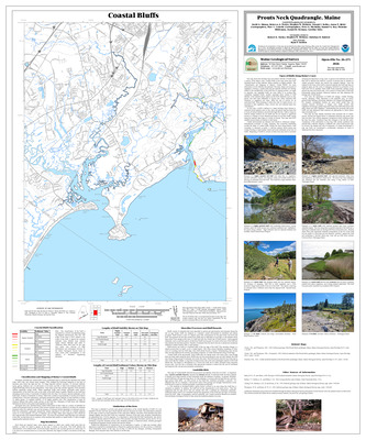
Coastal sand dune geology: Western Beach, Prouts Neck, Scarborough, Maine
Peter A. Slovinsky and Stephen M. Dickson
Maine Geological Survey, Open-File Map 23-103 (Superseded by Slovinsky and Dickson, 2026, Maine Geological Survey Open-File Map 26-49).
-

Coastal sand dune geology: Western Head, Cutler, Maine
Peter A. Slovinsky and Stephen M. Dickson
Maine Geological Survey, Open-File Map 23-548 (Superseded by Slovinsky and Dickson, 2026, Maine Geological Survey Open-File Map 26-152).
-

Coastal sand dune geology: Western Island, Deer Isle, Maine
Peter A. Slovinsky and Stephen M. Dickson
Maine Geological Survey, Open-File Map 23-323.
-

Coastal sand dune geology: West Quoddy Head, Lubec, Maine
Peter A. Slovinsky and Stephen M. Dickson
Maine Geological Survey, Open-File Map 23-559.
-

Coastal sand dune geology: Weymouth Point, Surry, Maine
Peter A. Slovinsky and Stephen M. Dickson
Maine Geological Survey, Open-File Map 23-383.
-

Coastal sand dune geology: Widow Island, Vinalhaven, Maine
Peter A. Slovinsky and Stephen M. Dickson
Maine Geological Survey, Open-File Map 23-244.
-

Coastal sand dune geology: Wildlife Drive, Cutler, Maine
Peter A. Slovinsky and Stephen M. Dickson
Maine Geological Survey, Open-File Map 23-543.
-

Coastal sand dune geology: Willard Beach, South Portland, South Portland, Maine
Peter A. Slovinsky and Stephen M. Dickson
Maine Geological Survey, Open-File Map 23-120.
-

Coastal sand dune geology: Wilson Point, Castine, Maine
Peter A. Slovinsky and Stephen M. Dickson
Maine Geological Survey, Open-File Map 23-288.
-

Coastal sand dune geology: Winter Harbor, Winter Harbor, Maine
Peter A. Slovinsky and Stephen M. Dickson
Maine Geological Survey, Open-File Map 23-438.
-

Coastal sand dune geology: Wood Pond Cove, Steuben, Maine
Peter A. Slovinsky and Stephen M. Dickson
Maine Geological Survey, Open-File Map 23-465.
-

Coastal sand dune geology: Woodward Point, Lubec, Maine
Peter A. Slovinsky and Stephen M. Dickson
Maine Geological Survey, Open-File Map 23-562.
-

Coastal sand dune geology: Wooster Cove, North Haven, Maine
Peter A. Slovinsky and Stephen M. Dickson
Maine Geological Survey, Open-File Map 23-246.
-

Coastal sand dune geology: Wreck Cove and Fowler Road, Long Island, Maine
Peter A. Slovinsky and Stephen M. Dickson
Maine Geological Survey, Open-File Map 23-129 (Superseded by Slovinsky and Dickson, 2026, Maine Geological Survey Open-File Map 26-67).
-

Coastal sand dune geology: Yellow Birch Head, Steuben, Maine
Peter A. Slovinsky and Stephen M. Dickson
Maine Geological Survey, Open-File Map 23-461.
-

Coastal sand dune geology: York Harbor Beach, York, Maine
Peter A. Slovinsky and Stephen M. Dickson
Maine Geological Survey, Open-File Map 23-33.
-

Reconnaissance bedrock geology of the Wayne quadrangle, Maine
Alison S. Lathrop
Maine Geological Survey, Open-File Map 23-13.
-

Surficial geology of the Belgrade Lakes quadrangle, Maine
Lindsay J. Theis
Maine Geological Survey, Geologic Map 23-8
-

Surficial geology of the Old Speck Mountain quadrangle, Maine
Lindsay J. Theis
Maine Geological Survey, Geologic Map 23-10 (Superseded by Theis, 2025, Maine Geological Survey Open-File 25-10)
-

Surficial geology of the Rome quadrangle, Maine
Lindsay J. Theis
Maine Geological Survey, Geologic Map 23-6
-

Surficial geology of the Success Pond quadrangle, Maine
Lindsay J. Theis
Maine Geological Survey, Open-File Map 23-4
-

Surficial materials of the Belgrade Lakes quadrangle, Maine
Lindsay J. Theis and Daniel B. Locke
Maine Geological Survey Open-File Map 23-7
-

Surficial materials of the Old Speck Mountain quadrangle, Maine
Lindsay J. Theis and Woodrow B. Thompson
Maine Geological Survey, Open-File Map 23-9
-

Surficial materials of the Rome quadrangle, Maine
Lindsay J. Theis and Daniel B. Locke
Maine Geological Survey, Open-File Map 23-5
-

Surficial materials of the Success Pond quadrangle, Maine
Lindsay J. Theis
Maine Geological Survey, Open-File Map 23-3
-

Bedrock geology of the Boothbay Harbor quadrangle, Maine
David P. West Jr and Arthur M. Hussey II
Maine Geological Survey, Geologic Map 22-9.
-

Bedrock geology of the Bristol quadrangle, Maine
David P. West Jr and Arthur M. Hussey II
Maine Geological Survey, Geologic Map 22-7.
-

Bedrock geology of the Carr Pond quadrangle, Maine
Chunzeng Wang
Maine Geological Survey, Geologic Map 22-6.
-

Bedrock geology of the East Andover quadrangle, Maine
J Dykstra Eusden Jr, Myles M. Felch, Dwight C. Bradley, Maeve Mikulski, and Evan Saltman
Maine Geological Survey, Open-File Map 22-17.
-

Bedrock geology of the Fish River Lake quadrangle, Maine
Chunzeng Wang
Maine Geological Survey, Geologic Map 22-5.
-

Bedrock geology of the Lewiston quadrangle, Maine
Amber T H Whittaker and Arthur M. Hussey II
Maine Geological Survey, Geologic Map 22-16.
-

Bedrock geology of the Lisbon Falls North quadrangle, Maine
Amber T H Whittaker, David P. West Jr, and Arthur M. Hussey II
Maine Geological Survey, Geologic Map 22-15.
-

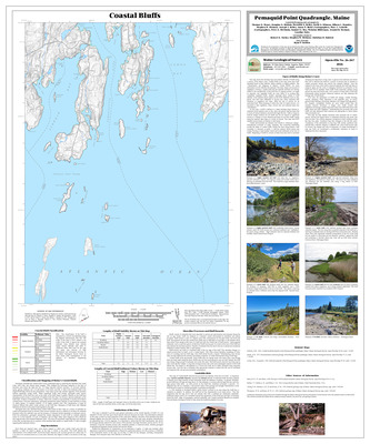
Bedrock geology of the Pemaquid Point quadrangle, Maine
David P. West Jr and Arthur M. Hussey II
Maine Geological Survey, Geologic Map 22-10.
-

Bedrock geology of the Phippsburg quadrangle, Maine
Arthur M. Hussey II, David P. West Jr, and Amber TH Whittaker
Maine Geological Survey, Geologic Map 22-8.
-

Bedrock geology of the Puzzle Mountain quadrangle, Maine
Christopher Koteas
Maine Geological Survey, Open-File Map 22-18.
-

Surficial geology of the Unity Pond quadrangle, Maine
Lindsay J. Spigel
Maine Geological Survey, Open-File Map 22-4.
-

Surficial geology of the Unity quadrangle, Maine
Lindsay J. Spigel
Maine Geological Survey, Open-File Map 22-2.
-

Surficial materials of the Unity Pond quadrangle, Maine
Lindsay J. Spigel and Daniel B. Locke
Maine Geological Survey, Open-File Map 22-3.
-

Surficial materials of the Unity quadrangle, Maine
Lindsay J. Spigel and Daniel B. Locke
Maine Geological Survey, Open-File Map 22-1.
-

Bedrock geology of the Big Machias Lake quadrangle, Maine
Chunzeng Wang
Maine Geological Survey, Open-File Map 21-12.
-

Bedrock geology of the Greenlaw Pond quadrangle, Maine
Chunzeng Wang
Maine Geological Survey, Open-File Map 21-2.
-

Bedrock geology of the Monmouth quadrangle, Maine
David P. West Jr and Arthur M. Hussey II
Maine Geological Survey, Open-File Map 21-15.
-

Bedrock geology of the Union quadrangle, Maine
Stephen A. Norton, Henry N. Berry IV, and David P. West Jr
Maine Geological Survey, Open-File Map 21-1.
-

Surficial geology of the Ellis Pond quadrangle, Maine
Lindsay J. Spigel
Maine Geological Survey, Open-File Map 21-8.
-

Surficial geology of the Puzzle Mountain quadrangle, Maine
Lindsay J. Spigel
Maine Geological Survey, Open-File Map 21-6.
-

Surficial geology of the Weld quadrangle, Maine
Lindsay J. Spigel
Maine Geological Survey, Open-File Map 21-9.
-

Surficial materials of the Ellis Pond quadrangle, Maine
Lindsay J. Spigel
Maine Geological Survey, Open-File Map 21-7.
-

Surficial materials of the Puzzle Mountain quadrangle, Maine
Lindsay J. Spigel and Woodrow B. Thompson
Maine Geological Survey, Open-File Map 21-5.
-

Bedrock geology of the Bath quadrangle, Maine
David P. West Jr and Arthur M. Hussey II
Maine Geological Survey, Open-File Map 20-12.
-

Bedrock geology of the Bethel quadrangle, Maine
J Dykstra Eusden, James J. Brady, Riley M. Eusden, Myles M. Felch, Thorn K. Merrill, and Kurt A. Niiler
Maine Geological Survey, Open-File Map 20-11.
-

Bedrock geology of the Camden quadrangle, Maine
Philip H. Osberg and Henry N. Berry IV
Maine Geological Survey, Open-File Map 20-8.
-

Bedrock geology of the Lincoln Center quadrangle, Maine
Allan Ludman
Maine Geological Survey, Open-File Map 20-24.
-

Bedrock geology of the Mooseleuk Mountain quadrangle, Maine
Stephen G. Pollock
Maine Geological Survey, Open-File Map 20-1.
-

Bedrock geology of the North Pownal quadrangle, Maine
Amber T.H. Whittaker
Maine Geological Survey, Open-File Map 20-23.
-

Bedrock geology of the West Rockport quadrangle, Maine
Henry N. Berry IV, Philip H. Osberg, and Andrew Fagenholz
Maine Geological Survey, Open-File Map 20-14.
-

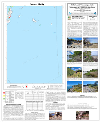
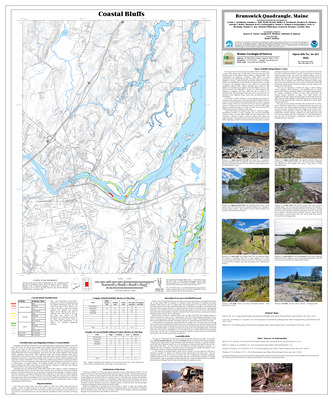
Coastal bluffs in the Bath quadrangle, Maine
Allison L. Brandes, Rebecca A. Nestor, David A. Sinson, Marita Bryant, Walter A. Barnhardt, Stephen M. Dickson, Joseph T. Kelley, and Peter A. Slovnisky
Maine Geological Survey, Open-File Map 20-20 (Superseded by Brandes et. al., 2026, Maine Geological Survey Open-File 26-262).
-

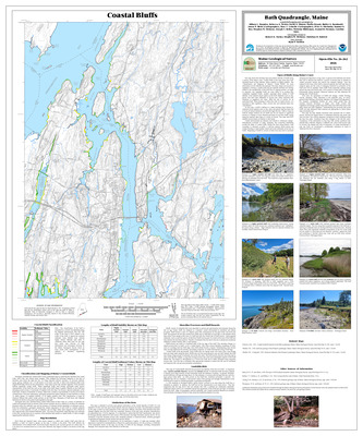
Coastal bluffs in the Brunswick quadrangle, Maine
Corinn C. Keblinsky, Jennifer L. Hall, Marita Bryant, Walter A. Barnhardt, Stephen M. Dickson, Joseph T. Kelley, and Peter A. Slovinsky
Maine Geological Survey, Open-File Map 20-19 (Superseded by Keblinsky et. al., 2026, Maine Geological Survey Open-File 26-263).
-

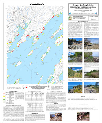
Coastal bluffs in the Freeport quadrangle, Maine
Marita Bryant, Walter A. Barnhardt, Stephen M. Dickson, Joseph T. Keley, and Peter A. Slovinsky
Maine Geological Survey, Open-File Map 20-17 (Superseded by Bryant et. al., 2026, Maine Geological Survey Open-File 26-265).
-

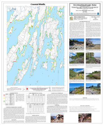
Coastal bluffs in the Orrs Island quadrangle, Maine
Marita Bryant, Walter A. Barnhardt, Stephen M. Dickson, Joseph T. Kelley, and Peter A. Slovinsky
Maine Geological Survey, Open-File Map 20-18 (Superseded by Bryant et. al., 2026, Maine Geological Survey Open-File 26-266).
-

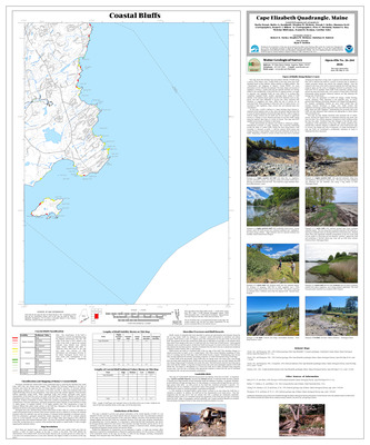
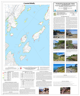
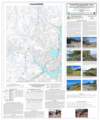
Coastal bluffs in the Portland East quadrangle, Maine
Marita Bryant, Walter A. Barnhardt, Stephen M. Dickson, Joseph T. Kelley, and Peter A. Slovinsky
Maine Geological Survey, Open-File Map 20-15 (Superseded by Bryant et. al., 2026, Maine Geological Survey Open-File 26-269).
-

Coastal bluffs in the South Harpswell quadrangle, Maine
Marita Bryant, Walter A. Barnhardt, Stephen M. Dickson, Joseph T. Kelley, and Peter A. Slovinsky
Maine Geological Survey, Open-File Map 20-16 (Superseded by Bryant, et. al., 2026, Maine Geological Survey Open-File 26-274).
-

Surficial geology of the Dixfield quadrangle, Maine
Lindsay J. Spigel
Maine Geological Survey, Open-File Map 20-2.
-

Surficial geology of the Roxbury quadrangle, Maine
Lindsay J. Spigel
Maine Geological Survey, Open-File Map 20-3.
-

Surficial geology of the Weld quadrangle, Maine
Lindsay J. Spigel
Maine Geological Survey, Open-File Map 20-5 (Superseded by Spigel, 2021, Maine Geological Survey Open-File 21-9).
-

Surficial materials of the Roxbury quadrangle, Maine
Lindsay J. Spigel and Glenn C. Prescott
Maine Geological Survey, Open-File Map 20-4.
-

Surficial materials of the Weld quadrangle, Maine
Lindsay J. Spigel
Maine Geological Survey, Open-File Map 20-6.
-

Bedrock geology of the Bartlett Island quadrangle, Maine
Duane D. Braun
Maine Geological Survey, Open-File Map 19-8.
-

Bedrock geology of the Jack Mountain quadrangle, Maine
Chunzeng Wang
Maine Geological Survey, Open-File Map 19-6.
-

Bedrock geology of the Lisbon Falls South quadrangle, Maine
David P. West Jr
Maine Geological Survey, Open-File Map 19-7.
-

Bedrock geology of the Northeastern Portion of the Swans Island quadrangle, Maine
Duane D. Braun
Maine Geological Survey, Open-File Map 19-14.
-

Bedrock geology of the Northern Portion of the Bass Harbor quadrangle, Maine
Duane D. Braun
Maine Geological Survey, Open-File Map 19-10.
-

Bedrock geology of the Northwestern Portion of the Baker Island quadrangle, Maine
Duane D. Braun
Maine Geological Survey, Open-File Map 19-12.
-

Bedrock geology of the Seal Harbor quadrangle, Maine
Duane D. Braun
Maine Geological Survey, Open-File Map 19-11.
-

Bedrock geology of the southwestern portion of the Bar Harbor quadrangle, Maine
Duane D. Braun
Maine Geological Survey, Open-File Map 19-13.
-

Bedrock geology of the Southwest Harbor quadrangle, Maine
Duane D. Braun
Maine Geological Survey, Open-File Map 19-9.
-

Coastal bluffs in the Freeport quadrangle, Maine
Marita Bryant, Walter A. Barnhardt, Stephen M. Dickson, and Joseph T. Kelley
Maine Geological Survey, Open-File Map 19-5 (Superseded by Bryant, et. al., 2020, Maine Geological Survey Open-File 20-17).
-

Bedrock geology of the Brooks East quadrangle, Maine
Stephen G. Pollock
Maine Geological Survey, Open-File Map 18-15.
-

Bedrock geology of the Brooks West quadrangle, Maine
David P. West
Maine Geological Survey, Open-File Map 18-14.
-

Bedrock geology of the Brunswick quadrangle, Maine
Arthur M. Hussey II and David P. West Jr
Maine Geological Survey, Open-File Map 18-4.
-

Bedrock geology of the Freeport quadrangle, Maine
David P. West Jr and Arthur M. Hussey II
Maine Geological Survey, Open-File Map 18-11.
-

Bedrock geology of the Gilead quadrangle, Maine
J Dykstra Eusden, Saebyul Choe, Erik Divan, Riley Eusden, Sula Watermulder, and Audrey Wheatcroft
Maine Geological Survey, Open-File Map 18-12.
-

Bedrock geology of the Round Mountain quadrangle, Maine
Chunzeng Wang
Maine Geological Survey, Open-File Map 18-8.
-

Bedrock geology of the Yarmouth quadrangle, Maine
David P. West Jr and Arthur M. Hussey II
Maine Geological Survey, Open-File Map 18-10.
-

Preliminary bedrock geology of the Greenfield quadrangle, Maine
Allan Ludman
Maine Geological Survey, Open-File Map 18-13 (Superseded by Ludman, 2020, Maine Geological Survey Open-File 20-10).
-

Surficial geology of the Dixfield quadrangle, Maine
Lindsay J. Spigel
Maine Geological Survey, Open-File Map 18-2 (Superseded by Spigel, 2020, Maine Geological Survey Open-File 20-20).
-

Surficial geology of the East Dixfield quadrangle, Maine
Lindsay J. Spigel
Maine Geological Survey, Open-File Map 18-18 (Superseded by Theis, 2024, Maine Geological Survey Open-File 24-13).
-

Surficial geology of the Mount Blue quadrangle, Maine
Lindsay J. Spigel
Maine Geological Survey, Open-File Map 18-20.
-

Surficial materials of the Dixfield quadrangle, Maine
Lindsay J. Spigel and Glenn C. Prescott Jr
Maine Geological Survey, Open-File Map 18-3.
-

Surficial materials of the East Dixfield quadrangle, Maine
Lindsay J. Spigel and Daniel B. Locke
Maine Geological Survey, Open-File Map 18-17.
-

Surficial materials of the Mount Blue quadrangle, Maine
Lindsay J. Spigel
Maine Geological Survey, Open-File Map 18-19.
-

Bedrock geology of the Yarmouth quadrangle, Maine
David P. West Jr and Arthur M. Hussey II
Maine Geological Survey, Open-File Map 17-11 (Superseded by West and Hussey, 2018, Maine Geological Survey Open-File 18-10).
-

Surficial geology of the East Andover quadrangle, Maine
Thomas K. Weddle, Daniel B. Locke, and Lindsay J. Spigel
Maine Geological Survey, Open-File Map 17-7.
-

Surficial geology of the Islesboro quadrangle, Maine
Thomas K. Weddle
Maine Geological Survey, Open-File Map 17-1.
-

Surficial geology of the Rumford quadrangle, Maine
Thomas K. Weddle, Daniel B. Locke, and Lindsay J. Spigel
Maine Geological Survey, Open-File Map 17-8.
-

Surficial materials of the East Andover quadrangle, Maine
Daniel B. Locke, Thomas K. Weddle, and Glenn C. Prescott Jr
Maine Geological Survey, Open-File Map 17-5
-

Surficial materials of the Islesboro quadrangle, Maine
Thomas K. Weddle
Maine Geological Survey, Open-File Map 17-2.
-

Surficial materials of the Rumford quadrangle, Maine
Daniel B. Locke, Thomas K. Weddle, and Glenn C. Prescott Jr
Maine Geological Survey, Open-File Map 17-6.
-

Bedrock geology of the Brewer Lake quadrangle, Maine
Stephen G. Pollock and David P. West Jr
Maine Geological Survey, Open-File Map 16-9.
-

Bedrock geology of the Hampden quadrangle, Maine
David P. West Jr and Stephen G. Pollock
Maine Geological Survey, Open-File Map 16-10.
-

Bedrock geology of the Kittery 1:100,000 quadrangle, Maine and New Hampshire
Arthur M. Hussey II, Wallace A. Bothner, and Peter J. Thompson
Maine Geological Survey, Geologic Map 16-6 (Corrected 2019).
-

Bedrock geology of the northwestern half of the Mount Waldo quadrangle, Maine
Stephen G. Pollock
Maine Geological Survey, Open-File Map 16-12.
-

Bedrock geology of the Snow Mountain quadrangle, Maine
David P. West Jr
Maine Geological Survey, Open-File Map 16-26.
-

Bedrock geology of the southeastern half of the East Dixmont quadrangle, Maine
Stephen G. Pollock
Maine Geological Survey, Open-File Map 16-11.
-

Bedrock geology of the Wiscasset quadrangle, Maine
David P. West Jr
Maine Geological Survey, Open-File Map 16-27.
-

Reconnaissance bedrock geology of the Damariscotta quadrangle, Maine
Timothy W. Grover and Donald W. Newberg
Maine Geological Survey, Open-File Map 16-22.
-

Significant sand and gravel aquifers in the East Andover quadrangle, Maine
Lauren E. Foster, Elizabeth E. Lewis, Craig D. Neil, and Glenn C. Prescott Jr
Maine Geological Survey, Open-File Map 16-24.
-

Surficial geology of Mount Desert Island
Duane D. Braun, Thomas V. Lowell, and Thomas K. Weddle
Maine Geological Survey, Open-File Map 16-1.
-

Surficial geology of the eastern portion of the Bartlett Island quadrangle, Maine
Duane D. Braun
Maine Geological Survey, Open-File Map 16-16.
-

Surficial geology of the Greenbush quadrangle, Maine
Roger LeB Hooke, Elizabet Metcalfe, and Robin Wiesner
Maine Geological Survey, Open-File Map 16-3.
-

Surficial geology of the Hinckley quadrangle, Maine
Robert A. Johnston
Maine Geological Survey, Open-File Map 16-5.
-

Surficial geology of the Howland quadrangle, Maine
Roger LeB Hooke
Maine Geological Survey, Open-File Map 16-2.
-

Surficial geology of the Newbury Neck quadrangle, Maine
Duane D. Braun and Thomas K. Weddle
Maine Geological Survey, Open-File Map 16-17.
-

Surficial geology of the northeastern portion of the Swans Island quadrangle, Maine
Duane D. Braun
Maine Geological Survey, Open-File Map 16-15.
-

Surficial geology of the northern portion of the Baker Island quadrangle, Maine
Duane D. Braun
Maine Geological Survey, Open-File Map 16-13.
-

Surficial geology of the northern portion of the Bass Harbor quadrangle, Maine
Duane D. Braun
Maine Geological Survey, Open-File Map 16-14.
-

Surficial geology of the Salsbury Cove quadrangle, Maine
Duane D. Braun and Thomas K. Weddle
Maine Geological Survey, Open-File Map 16-18.
-

Surficial geology of the Seal Harbor quadrangle, Maine
Duane D. Braun
Maine Geological Survey, Open-File Map 16-20.
-

Surficial geology of the southwestern portion of the Bar Harbor quadrangle, Maine
Duane D. Braun
Maine Geological Survey, Open-File Map 16-19.
-

Surficial geology of the Southwest Harbor quadrangle, Maine
Duane D. Braun, Thomas V. Lowell, and Michael E. Foley
Maine Geological Survey, Open-File Map 16-21.
-

Surficial geology of the Waterville quadrangle, Maine
Thomas K. Weddle and Sydney D. Eckert
Maine Geological Survey, Open-File Map 16-8.
-

Surficial materials of the East Andover quadrangle, Maine
Glenn C. Prescott Jr
Maine Geological Survey, Open-File Map 16-25. (Superseded by Locke and Weddle, 2017, Maine Geological Survey Open-File 17-5)
-

Surficial materials of the Hinckley quadrangle, Maine
Robert A. Johnston and Daniel B. Locke
Maine Geological Survey, Open-File Map 16-4.
-

Surficial materials of the Howland quadrangle, Maine
Roger LeB Hooke, Dale F. Doughty, and Edward B. Baker
Maine Geological Survey, Open-File Map 16-23.
-

Surficial materials of the Waterville quadrangle, Maine
Thomas K. Weddle and Daniel B. Locke
Maine Geological Survey, Open-File Map 16-7.
-

Bedrock geology of the Snow Mountain quadrangle, Maine
David P. West Jr
Maine Geological Survey, Open-File Map 15-26 (Superseded by West, 2016, Maine Geological Survey Open-File 16-26)
-

Significant sand and gravel aquifers in the Albion quadrangle, Maine
Craig D. Neil and Daniel B. Locke
Maine Geological Survey, Open-File Map 15-27.
