


The Maine Geological Survey provides the people and businesses of Maine with essential geologic information about the land where we live and work.
Note: Many state documents are offered in PDF format. To view PDF documents, you will need the free Adobe Reader. If you need assistance, view our Maine government PDF Help page or contact the contributing Maine State agency via the link on the left sidebar under “Links”.
-

Significant sand and gravel aquifers in the Fairfield quadrangle, Maine
Craig D. Neil and Daniel B. Locke
Maine Geological Survey, Open-File Map 15-28.
-

Significant sand and gravel aquifers in the Lincoln West quadrangle, Maine
Lauren E. Foster, Troy T. Smith, and Daniel B. Locke
Maine Geological Survey, Open-File Map 15-23.
-

Significant sand and gravel aquifers in the Mahoney Hill quadrangle, Maine
Elizabeth B. Lewis, Daniel B. Locke, Craig D. Neil, and Andres Meglioli
Maine Geological Survey, Open-File Map 15-24.
-

Significant sand and gravel aquifers in the Scopan Lake West quadrangle, Maine
Craig D. Neil and Daniel B. Locke
Maine Geological Survey, Open-File Map 15-4.
-

Significant sand and gravel aquifers in the Scopan quadrangle, Maine
Craig D. Neil and Daniel B. Locke
Maine Geological Survey, Open-File Map 15-1.
-

Surficial geology of the Albion quadrangle, Maine
Thomas K. Weddle
Maine Geological Survey, Open-File Map 15-14.
-

Surficial geology of the China Lake quadrangle, Maine
Kent M. Syverson and David P. Mans
Maine Geological Survey, Open-File Map 15-18.
-

Surficial geology of the eastern portion of the Bartlett Island quadrangle, Maine
Duane D. Braun
Maine Geological Survey, Open-File Map 15-34 (Superseded by Braun, 2016, Maine Geological Survey Open-File 16-16).
-

Surficial geology of the Fairfield quadrangle, Maine
Thomas K. Weddle and Sydney D. Eckert
Maine Geological Survey, Open-File Map 15-12.
-

Surficial geology of the Newbury Neck quadrangle, Maine
Duane D. Braun and Thomas K. Weddle
Maine Geological Survey, Open-File Map 15-35 (Superseded by Braun and Weddle, 2016, Maine Geological Survey Open-File 16-17).
-

Surficial geology of the northeastern portion of the Swans Island quadrangle, Maine
Duane D. Braun
Maine Geological Survey, Open-File Map 15-33 (Superseded by Braun, 2016, Maine Geological Survey Open-File 16-15).
-

Surficial geology of the northern portion of the Baker Island quadrangle, Maine
Duane D. Braun
Maine Geological Survey, Open-File Map 15-31 (Superseded by Braun, 2016, Maine Geological Survey Open-File 16-13).
-

Surficial geology of the northern portion of the Bass Harbor quadrangle, Maine
Duane D. Braun
Maine Geological Survey, Open-File Map 15-32 (Superseded by Braun, 2016, Maine Geological Survey Open-File 16-14).
-

Surficial geology of the Salsbury Cove quadrangle, Maine
Duane D. Braun and Thomas K. Weddle
Maine Geological Survey, Open-File Map 15-36 (Superseded by Braun and Weddle, 2016, Maine Geological Survey Open-File 16-18).
-

Surficial geology of the Seal Harbor quadrangle, Maine
Duane D. Braun
Maine Geological Survey, Open-File Map 15-30 (Superseded by Braun, 2016, Maine Geological Survey Open-File 16-20).
-

Surficial geology of the southwestern portion of the Bar Harbor quadrangle, Maine
Duane D. Braun
Maine Geological Survey, Open-File Map 15-37 (Superseded by Braun, 2016, Maine Geological Survey Open-File 16-19).
-

Surficial geology of the Southwest Harbor quadrangle, Maine
Duane D. Braun, Thomas V. Lowell, and Michael E. Foley
Maine Geological Survey, Open-File Map 15-38 (Superseded by Braun, Lowell and Foley, 2016, Maine Geological Survey Open-File 16-21).
-

Surficial materials of the Albion quadrangle, Maine
Daniel B. Locke and Thomas K. Weddle
Maine Geological Survey, Open-File Map 15-13.
-

Surficial materials of the eastern portion of the Bartlett Island quadrangle, Maine
Duane D. Braun
Maine Geological Survey, Open-File Map 15-19.
-

Surficial materials of the Fairfield quadrangle, Maine
Daniel B. Locke and Thomas K. Weddle
Maine Geological Survey, Open-File Map 15-11.
-

Surficial materials of the Newbury Neck quadrangle, Maine
Thomas K. Weddle and Duane D. Braun
Maine Geological Survey, Open-File Map 15-7.
-

Surficial materials of the northeastern portion of the Swans Island quadrangle, Maine
Duane D. Braun
Maine Geological Survey, Open-File Map 15-20.
-

Surficial materials of the northern portion of the Baker Island quadrangle, Maine
Duane D. Braun
Maine Geological Survey, Open-File Map 15-22.
-

Surficial materials of the northern portion of the Bass Harbor quadrangle, Maine
Duane D. Braun
Maine Geological Survey, Open-File Map 15-21.
-

Surficial materials of the Salsbury Cove quadrangle, Maine
Thomas K. Weddle, Duane D. Braun, Glenn C. Prescott Jr, and Daniel B. Locke
Maine Geological Survey, Open-File Map 15-8.
-

Surficial materials of the Scopan Lake East quadrangle, Maine
Daniel B. Locke
Maine Geological Survey, Open-File Map 15-3.
-

Surficial materials of the Scopan Lake West quadrangle, Maine
Daniel B. Locke
Maine Geological Survey, Open-File Map 15-5.
-

Surficial materials of the Scopan quadrangle, Maine
Daniel B. Locke
Maine Geological Survey, Open-File Map 15-2.
-

Surficial materials of the Seal Harbor quadrangle, Maine
Duane D. Braun, Michael E. Foley, and Glenn C. Prescott Jr
Maine Geological Survey, Open-File Map 15-15.
-

Surficial materials of the southwestern portion of the Bar Harbor quadrangle, Maine
Duane D. Braun
Maine Geological Survey, Open-File Map 15-16.
-

Surficial materials of the Southwest Harbor quadrangle, Maine
Duane D. Braun, Thomas V. Lowell, and Michael E. Foley
Maine Geological Survey, Open-File Map 15-17.
-

Bedrock geology of the Brooks West quadrangle, Maine
David P. West Jr
Maine Geological Survey, Open-File Map 14-4 (Superseded by West, 2018, Maine Geological Survey Open-File 18-14).
-

Bedrock geology of the East Pittston quadrangle, Maine
Timothy W. Grover and David P. West Jr
Maine Geological Survey, Open-File Map 14-30.
-

Bedrock geology of the Winthrop quadrangle, Maine
Timothy W. Grover
Maine Geological Survey, Open-File Map 14-3.
-

Bedrock geology of the York Beach quadrangle, Maine
Arthur M. Hussey II and John A. Brooks
Maine Geological Survey, Progress Map 14-2.
-

Bedrock geology of the York Harbor quadrangle, Maine
Arthur M. Hussey II and John A. Brooks
Maine Geological Survey, Progress Map 14-1.
-

Significant sand and gravel aquifers in the Belfast quadrangle, Maine
Craig D. Neil, Daniel B. Locke, and Daniel B. Locke
Maine Geological Survey, Open-File Map 14-17
-

Significant sand and gravel aquifers in the Brooks East quadrangle, Maine
Lauren E. Foster, Troy T. Smith, Daniel B. Locke, and Thomas K. Weddle
Maine Geological Survey, Open-File Map 14-18
-

Significant sand and gravel aquifers in the Brooks West quadrangle, Maine
Lauren E. Foster, Troy T. Smith, and Thomas K. Weddle
Maine Geological Survey, Open-File Map 14-19
-

Significant sand and gravel aquifers in the Morrill quadrangle, Maine
Craig D. Neil and Daniel B. Locke
Maine Geological Survey, Open-File Map 14-16
-

Significant sand and gravel aquifers in the Searsport quadrangle, Maine
Craig D. Neil and Daniel B. Locke
Maine Geological Survey, Open-File Map 14-20.
-

Surficial geology of the Belfast quadrangle, Maine
Thomas K. Weddle
Maine Geological Survey, Open-File Map 14-13.
-

Surficial geology of the Brooks East quadrangle, Maine
Woodrow B. Thompson
Maine Geological Survey, Open-File Map 14-10.
-

Surficial geology of the Brooks West quadrangle, Maine
Woodrow B. Thompson
Maine Geological Survey, Open-File Map 14-8.
-

Surficial geology of the Center Lovell quadrangle, Maine
Woodrow B. Thompson
Maine Geological Survey, Open-File Map 14-28.
-

Surficial geology of the Fryeburg quadrangle, Maine
Woodrow B. Thompson
Maine Geological Survey, Open-File Map 14-29
-

Surficial geology of the Jefferson quadrangle, Maine
Woodrow B. Thompson
Maine Geological Survey, Open-File Map 14-24.
-

Surficial geology of the Morrill quadrangle, Maine
Thomas K. Weddle
Maine Geological Survey, Open-File Map 14-15.
-

Surficial geology of the Mount Waldo quadrangle, Maine
Carol T. Hildreth
Maine Geological Survey, Open-File Map 14-22.
-

Surficial geology of the North Waterford quadrangle, Maine
Woodrow B. Thompson
Maine Geological Survey, Open-File Map 14-27.
-

Surficial geology of the Otter Chain Ponds quadrangle, Maine
Alice R. Kelley
Maine Geological Survey, Open-File Map 14-21.
-

Surficial geology of the Pleasant Mountain quadrangle, Maine
Woodrow B. Thompson
Maine Geological Survey, Open-File Map 14-26
-

Surficial geology of the Searsport quadrangle, Maine
Woodrow B. Thompson
Maine Geological Survey, Open-File Map 14-23.
-

Surficial geology of the The Horseback quadrangle, Maine
Alice R. Kelley and Lynn Caron
Maine Geological Survey, Open-File Map 14-6.
-

Surficial geology of the Union quadrangle, Maine
Woodrow B. Thompson
Maine Geological Survey, Open-File Map 14-25.
-

Surficial materials of the Belfast quadrangle, Maine
Thomas K. Weddle and Daniel B. Locke
Maine Geological Survey, Open-File Map 14-12
-

Surficial materials of the Brooks East quadrangle, Maine
Woodrow B. Thompson and Thomas K. Weddle
Maine Geological Survey, Open-File Map 14-11.
-

Surficial materials of the Brooks West quadrangle, Maine
Woodrow B. Thompson and Thomas K. Weddle
Maine Geological Survey, Open-File Map 14-9.
-

Surficial materials of the Morrill quadrangle, Maine
Thomas K. Weddle and Daniel B. Locke
Maine Geological Survey, Open-File Map 14-14.
-

Surficial materials of the The Horseback quadrangle, Maine
Alice K. Kelley, Lynn Caron, and Daniel B. Locke
Maine Geological Survey, Open-File Map 14-5
-

Bedrock geology of the Readfield quadrangle, Maine
Robert G. Marvinney and Timothy W. Grover
Maine Geological Survey, Open-File Map 13-21.
-

Bedrock geology of the southern part of the Brooks West quadrangle, Maine
David P. West Jr
Maine Geological Survey, Progress Map 13-15 (Superseded by West, David P., Jr., 2014, Maine Geological Survey Open-File Map 14-4.).
-

Bedrock geology of the Wells quadrangle, Maine
Arthur M. Hussey II
Maine Geological Survey, Open-File Map 13-20.
-

Significant sand and gravel aquifers in the Searsport quadrangle, Maine
Craig D. Neil and Daniel B. Locke
Maine Geological Survey, Open-File Map 13-16 (Superseded by Neil, Craig D. (compiler), Locke, Daniel B. (mapper) , 2014, Maine Geological Survey Open-File Map 14-20.).
-

Significant sand and gravel aquifers in the Snow Mountain quadrangle, Maine
Lauren E. Foster, Troy T. Smith, and Thomas K. Weddle
Maine Geological Survey, Open-File Map 13-17.
-

Surficial geology of the Bucksport quadrangle, Maine
Alice R. Kelley and Lynn Caron
Maine Geological Survey, Open-File Map 13-14.
-

Surficial geology of the Castine quadrangle, Maine
Woodrow B. Thompson
Maine Geological Survey, Open-File Map 13-8.
-

Surficial geology of the Hampden quadrangle, Maine
Kent M. Syverson and Jeffrey D. Olson
Maine Geological Survey, Open-File Map 13-12.
-

Surficial geology of the Hermon quadrangle, Maine
Thomas K. Weddle
Maine Geological Survey, Open-File Map 13-13.
-

Surficial geology of the Lincolnville quadrangle, Maine
Thomas K. Weddle
Maine Geological Survey, Open-File Map 13-7.
-

Surficial geology of the Mount Waldo quadrangle, Maine
Carol T. Hildreth
Maine Geological Survey, Open-File Map 13-10 (Superseded by Hildreth, Carol T., 2014, Maine Geological Survey Open-File Map 14-22.).
-

Surficial geology of the Searsport quadrangle, Maine
Woodrow B. Thompson
Maine Geological Survey, Open-File Map 13-5 (Superseded by Thompson, 2014, Maine Geological Survey Open-File 14-23).
-

Surficial geology of the Snow Mountain quadrangle, Maine
Alice R. Kelley and Lynn Caron
Maine Geological Survey, Open-File Map 13-3.
-

Surficial materials of the Castine quadrangle, Maine
Woodrow B. Thompson, Glenn C. Prescott Jr, and Michael E. Foley
Maine Geological Survey, Open-File Map 13-9.
-

Surficial materials of the Lincolnville quadrangle, Maine
Thomas K. Weddle, Woodrow B. Thompson, Thomas Brewer, and Andres N. Genes
Maine Geological Survey, Open-File Map 13-6.
-

Surficial materials of the Mount Waldo quadrangle, Maine
Carol T. Hildreth
Maine Geological Survey, Open-File Map 13-11.
-

Surficial materials of the Searsport quadrangle, Maine
Woodrow B. Thompson and Daniel B. Locke
Maine Geological Survey, Open-File Map 13-4.
-

Surficial materials of the Snow Mountain quadrangle, Maine
Alice R. Kelley, Lynn Caron, and Thomas K. Weddle
Maine Geological Survey, Open-File Map 13-2.
-

Bedrock geology of the Augusta quadrangle, Maine
Robert G. Marvinney and Daniel S. Barker
Maine Geological Survey, Open-File Map 12-36.
-

Bedrock geology of the Belfast quadrangle, Maine
Stephen G. Pollock
Maine Geological Survey, Open-File Map 12-37.
-

Bedrock geology of the Cape Elizabeth quadrangle, Maine
Arthur M. Hussey II
Maine Geological Survey, Open-File Map 12-32.
-

Bedrock geology of the Dover East quadrangle, Maine
Arthur M. Hussey II and Wallace A. Bothner
Maine Geological Survey, Progress Map 12-27.
-

Bedrock geology of the Great Pond quadrangle, Maine
Chunzeng Wang
Maine Geological Survey, Open-File Map 12-33.
-

Bedrock geology of the Kittery quadrangle, Maine
Arthur M. Hussey II
Maine Geological Survey, Open-File Map 12-28.
-

Bedrock geology of the northern part of the Small Point quadrangle, Maine
Arthur M. Hussey II
Maine Geological Survey, Open-File Map 12-1.
-

Bedrock geology of the Portsmouth quadrangle, Maine
Arthur M. Hussey II and Wallace A. Bothner
Maine Geological Survey, Progress Map 12-29.
-

Bedrock geology of the Rochester quadrangle, Maine
Peter J. Thompson, Wallace A. Bothner, and Arthur M. Hussey II
Maine Geological Survey, Progress Map 12-30.
-

Bedrock geology of the Saddleback Hills, Baldwin, Maine
Adam Schoonmaker
Maine Geological Survey, Open-File Map 12-21.
-

Bedrock geology of the Somersworth quadrangle, Maine
Arthur M. Hussey II
Maine Geological Survey, Progress Map 12-31.
-

Significant sand and gravel aquifers in the Ellsworth quadrangle, Maine
Craig D. Neil and Daniel B. Locke
Maine Geological Survey, Open-File Map 12-18.
-

Significant sand and gravel aquifers in the Newbury Neck quadrangle, Maine
Thomas K. Weddle
Maine Geological Survey, Open-File Map 12-14.
-

Significant sand and gravel aquifers in the Otter Chain Ponds quadrangle, Maine
Lauren E. Foster, Troy T. Smith, and Edward B. Baker
Maine Geological Survey, Open-File Map 12-17.
-

Significant sand and gravel aquifers in the Union quadrangle, Maine
Craig D. Neil and Daniel B. Locke
Maine Geological Survey, Open-File Map 12-19.
-

Surficial geology of the Chemo Pond quadrangle, Maine
Carol T. Hildreth
Maine Geological Survey, Open-File Map 12-16.
-

Surficial geology of the Hancock quadrangle, Maine
Carol T. Hildreth
Maine Geological Survey, Open-File Map 12-26.
-

Surficial geology of the Jefferson quadrangle, Maine
Woodrow B. Thompson
Maine Geological Survey, Open-File Map 12-2 (Superseded by Thompson, 2014, Maine Geological Survey Open-File 14-24).
-

Surficial geology of the Newbury Neck quadrangle, Maine
Thomas K. Weddle
Maine Geological Survey, Open-File Map 12-4 (Superseded by Braun and Weddle, 2015, Maine Geological Survey Open-File Map 15-35).
-

Surficial geology of the Old Town quadrangle, Maine
Alice R. Kelley and Joseph T. Kelley
Maine Geological Survey, Open-File Map 12-15.
-

Surficial geology of the Otter Chain Ponds quadrangle, Maine
Alice R. Kelley
Maine Geological Survey, Open-File Map 12-6 (Superseded by Kelley, Alice R., 2014, Maine Geological Survey Open-File Map 14-21.).
-

Surficial geology of the Salsbury Cove quadrangle, Maine
Thomas K. Weddle
Maine Geological Survey, Open-File Map 12-8 (Superseded by Braun and Weddle, 2015, Maine Geological Survey Open-File Map 15-36).
-

Surficial geology of the Southwest Harbor quadrangle, Maine
Thomas V. Lowell
Maine Geological Survey, Open-File Map 12-23 (Superseded by Braun, Weddle, and Lowell, 2015, Maine Geological Survey Open-File Map 15-38).
-

Surficial geology of the Sullivan quadrangle, Maine
Carol T. Hildreth
Maine Geological Survey, Open-File Map 12-10.
-

Surficial geology of the Union quadrangle, Maine
Woodrow B. Thompson
Maine Geological Survey, Open-File Map 12-12 (Superseded by Thompson, 2014, Maine Geological Survey Open-File 14-25).
-

Surficial geology of the Waldoboro East quadrangle, Maine
Woodrow B. Thompson
Maine Geological Survey, Open-File Map 12-20.
-

Surficial geology of the Waldoboro West quadrangle, Maine
Woodrow B. Thompson
Maine Geological Survey, Open-File Map 12-25.
-

Surficial materials of the Jefferson quadrangle, Maine
Woodrow B. Thompson and Daniel B. Locke
Maine Geological Survey, Open-File Map 12-38.
-

Surficial materials of the Jefferson quadrangle, Maine
Woodrow B. Thompson and Daniel B. Locke
Maine Geological Survey, Open-File Map 12-3 (Superseded by Thompson and Locke, 2012, Maine Geological Survey Open-File Map 12-38).
-

Surficial materials of the Newbury Neck quadrangle, Maine
Thomas K. Weddle
Maine Geological Survey, Open-File Map 12-5 (Superseded by Braun and Weddle, 2015, Maine Geological Survey Open-File Map 15-7).
-

Surficial materials of the Otter Chain Ponds quadrangle, Maine
Alice R. Kelley and Edward B. Baker
Maine Geological Survey, Open-File Map 12-7.
-

Surficial materials of the Salsbury Cove quadrangle, Maine
Thomas K. Weddle, Glenn C. Prescott, and Daniel B. Locke
Maine Geological Survey, Open-File Map 12-9 (Superseded by Braun and Weddle, 2015, Maine Geological Survey Open-File Map 15-8).
-

Surficial materials of the Sullivan quadrangle, Maine
Carol T. Hildreth and Daniel B. Locke
Maine Geological Survey, Open-File Map 12-11.
-

Surficial materials of the Union quadrangle, Maine
Woodrow B. Thompson and Daniel B. Locke
Maine Geological Survey, Open-File Map 12-13 (Superseded by Thompson and Locke, 2012, Maine Geological Survey Open-File Map 12-35).
-

Surficial materials of the Union quadrangle, Maine
Woodrow B. Thompson and Daniel B. Locke
Maine Geological Survey, Open-File Map 12-35.
-

Surficial materials of the Waldoboro East quadrangle, Maine
Woodrow B. Thompson and Daniel B. Locke
Maine Geological Survey, Open-File Map 12-22.
-

Surficial materials of the Waldoboro West quadrangle, Maine
Woodrow B. Thompson and Daniel B. Locke
Maine Geological Survey, Open-File Map 12-24.
-

Bedrock geology of the Bangor quadrangle, Maine
Stephen G. Pollock
Maine Geological Survey, Open-File Map 11-57.
-

Bedrock geology of the China Lake quadrangle, Maine
Stephen G. Pollock and Wyeth Bowdoin
Maine Geological Survey, Open-File Map 11-148.
-

Bedrock geology of the southern part of the Carmel quadrangle, Maine
Douglas N. Reusch
Maine Geological Survey, Progress Map 11-55.
-

Bedrock geology of the Veazie quadrangle, Maine
Stephen G. Pollock
Maine Geological Survey, Open-file Map 11-58.
-

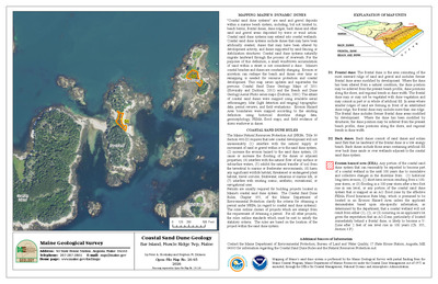
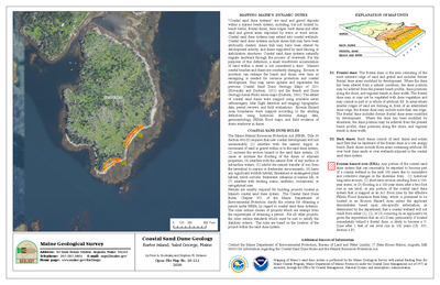
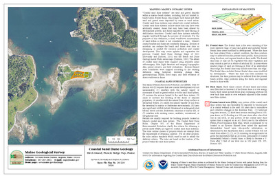
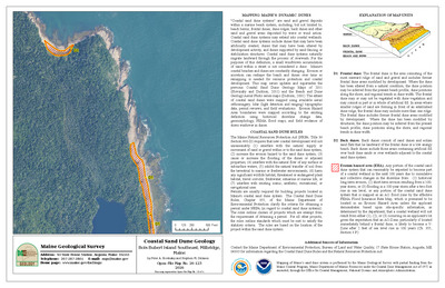
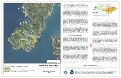
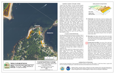
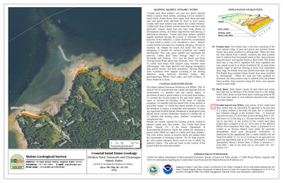
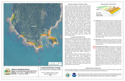
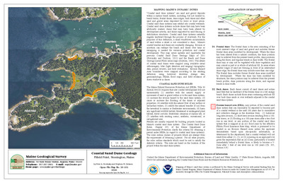
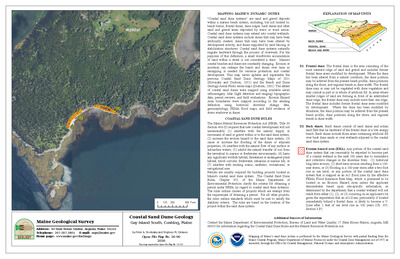
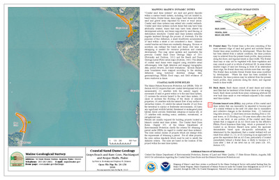
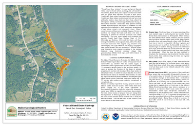
Coastal sand dune geology: Bald Head and Head Coves, Small Point, Phippsburg, Maine
Peter A. Slovinsky and Stephen M. Dickson
Maine Geological Survey, Open-File Map 11-134 (Superseded by Slovinsky and Dickson, 2023, Maine Geological Survey Open-File Map 23-168).
-

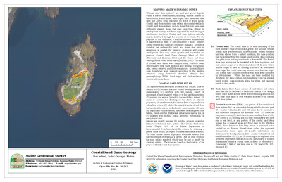
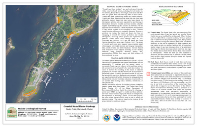
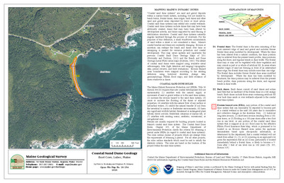
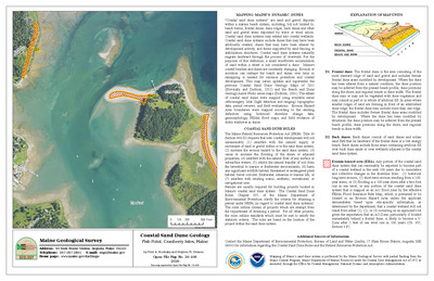
Coastal sand dune geology: Bald Head and Seal Coves, Small Point, Phippsburg, Maine
Peter A. Slovinsky and Stephen M. Dickson
Maine Geological Survey, Open-File Map 11-133 (Superseded by Slovinsky and Dickson, 2023, Maine Geological Survey Open-File Map 23-169).
-

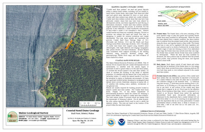
Coastal sand dune geology: Brave Boat Harbor, Kittery, Maine
Peter A. Slovinsky and Stephen M. Dickson
Maine Geological Survey, Open-File Map 11-65 (Superseded by Slovinsky and Dickson, 2023, Maine Geological Survey Open-File Map 23-29).
-

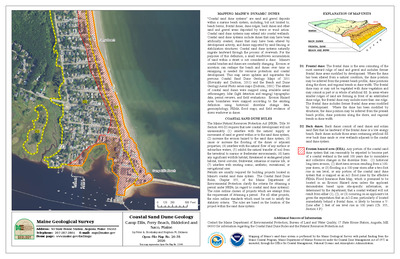
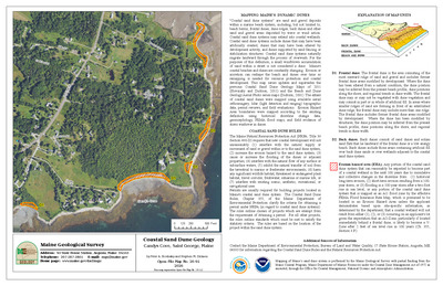
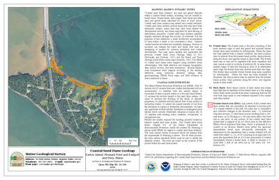
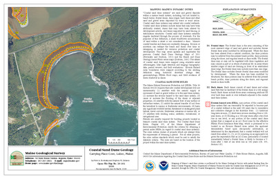
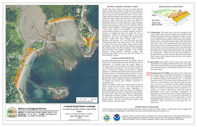
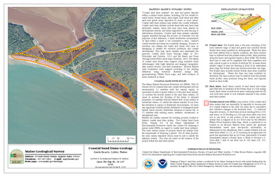
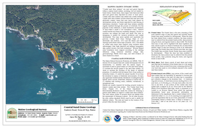
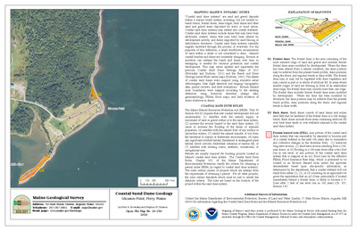
Coastal sand dune geology: Camp Ellis, Ferry Beach, Saco, Maine
Peter A. Slovinsky and Stephen M. Dickson
Maine Geological Survey, Open-File Map 11-108 (Superseded by Slovinsky and Dickson, 2023, Maine Geological Survey Open-File Map 23-89).
-

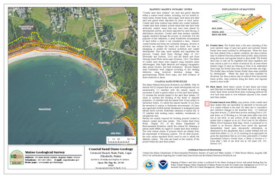
Coastal sand dune geology: Crescent Beach and Jordan Point Beach, Cape Elizabeth, Maine
Peter A. Slovinsky and Stephen M. Dickson
Maine Geological Survey, Open-File Map 11-129 (Superseded by Slovinsky and Dickson, 2023, Maine Geological Survey Open-File Map 23-113).
-

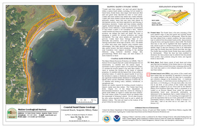
Coastal sand dune geology: Crescent Beach, Seapoint, Kittery, Maine
Peter A. Slovinsky and Stephen M. Dickson
Maine Geological Survey, Open-File Map 11-63 (Superseded by Slovinsky and Dickson, 2023, Maine Geological Survey Open-File Map 23-27).
-

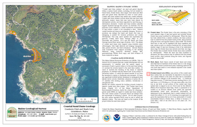
Coastal sand dune geology: Crescent Beach State Park, Cape Elizabeth, Maine
Peter A. Slovinsky and Stephen M. Dickson
Maine Geological Survey, Open-File Map 11-130 (Superseded by Slovinsky and Dickson, 2023, Maine Geological Survey Open-File Map 23-114).
-

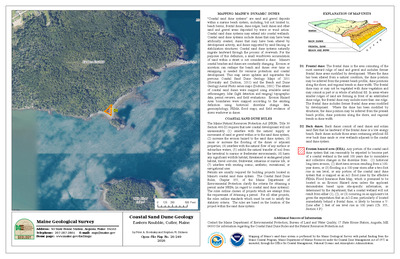
Coastal sand dune geology: Crescent Surf Beach, Kennebunk, Maine
Peter A. Slovinsky and Stephen M. Dickson
Maine Geological Survey, Open-File Map 11-88 (Superseded by Slovinsky and Dickson, 2023, Maine Geological Survey Open-File Map 23-57).
-

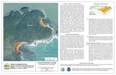
Coastal sand dune geology: Curtis Cove, New Barn Cove, Biddeford, Maine
Peter A. Slovinsky and Stephen M. Dickson
Maine Geological Survey, Open-File Map 11-99 (Superseded by Slovinsky and Dickson, 2023, Maine Geological Survey Open-File Map 23-77).
-

Coastal sand dune geology: Drakes Island and Laudholm Beaches, Wells, Maine
Peter A. Slovinsky and Stephen M. Dickson
Maine Geological Survey, Open-File Map 11-87 (Superseded by Slovinsky and Dickson, 2023, Maine Geological Survey Open-File Map 23-56).
-

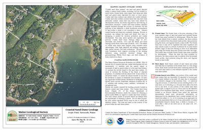
Coastal sand dune geology: Drakes Island Beach South, Wells, Maine
Peter A. Slovinsky and Stephen M. Dickson
Maine Geological Survey, Open-File Map 11-86 (Superseded by Slovinsky and Dickson, 2023, Maine Geological Survey Open-File Map 23-55).
-

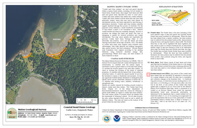
Coastal sand dune geology: East Point and Cow Beach, York, Maine
Peter A. Slovinsky and Stephen M. Dickson
Maine Geological Survey, Open-File Map 11-70 (Superseded by Slovinsky and Dickson, 2023, Maine Geological Survey Open-File Map 23-34).
-

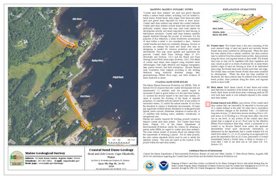
Coastal sand dune geology: Ferry Beach, Bay View, Saco, Maine
Peter A. Slovinsky and Stephen M. Dickson
Maine Geological Survey, Open-File Map 11-110 (Superseded by Slovinsky and Dickson, 2023, Maine Geological Survey Open-File Map 23-91).
-

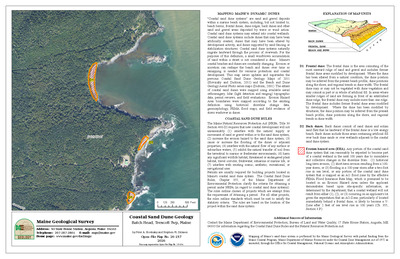
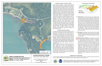
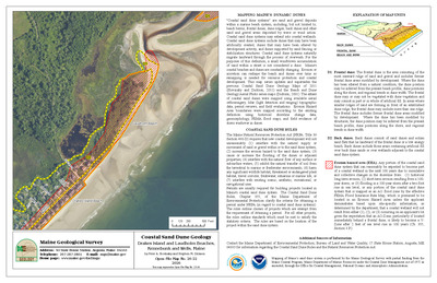
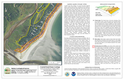
Coastal sand dune geology: Ferry Beach, Black Rock, Scarborough, Maine
Peter A. Slovinsky and Stephen M. Dickson
Maine Geological Survey, Open-File Map 11-120 (Superseded by Slovinsky and Dickson, 2023, Maine Geological Survey Open-File Map 23-101).
-

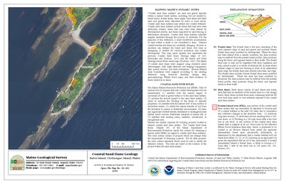
Coastal sand dune geology: Ferry Beach State Park, Ferry Beach, Saco, Maine
Peter A. Slovinsky and Stephen M. Dickson
Maine Geological Survey, Open-File Map 11-109 (Superseded by Slovinsky and Dickson, 2023, Maine Geological Survey Open-File Map 23-90).
-

Coastal sand dune geology: Fort Foster, Gerrish Island, Kittery, Maine
Peter A. Slovinsky and Stephen M. Dickson
Maine Geological Survey, Open-File Map 11-60 (Superseded by Slovinsky and Dickson, 2023, Maine Geological Survey Open-File Map 23-24).
-

Coastal sand dune geology: Fortunes Rocks Beach, Fortunes Rocks, Biddeford, Maine
Peter A. Slovinsky and Stephen M. Dickson
Maine Geological Survey, Open-File Map 11-101 (Superseded by Slovinsky and Dickson, 2023, Maine Geological Survey Open-File Map 23-80).
-

Coastal sand dune geology: Fortunes Rocks Beach, The Pool, Biddeford, Maine
Peter A. Slovinsky and Stephen M. Dickson
Maine Geological Survey, Open-File Map 11-102 (Superseded by Slovinsky and Dickson, 2023, Maine Geological Survey Open-File Map 23-81).
-

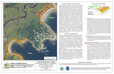
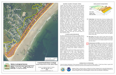
Coastal sand dune geology: Godfreys Cove, Seal Head Point, York, Maine
Peter A. Slovinsky and Stephen M. Dickson
Maine Geological Survey, Open-File Map 11-68 (Superseded by Slovinsky and Dickson, 2023, Maine Geological Survey Open-File Map 23-32).
-

Coastal sand dune geology: Goochs Beach and Colony Beach, Kennebunk and Kennebunkport, Maine
Peter A. Slovinsky and Stephen M. Dickson
Maine Geological Survey, Open-File Map 11-94 (Superseded by Slovinsky and Dickson, 2023, Maine Geological Survey Open-File Map 23-63).
-

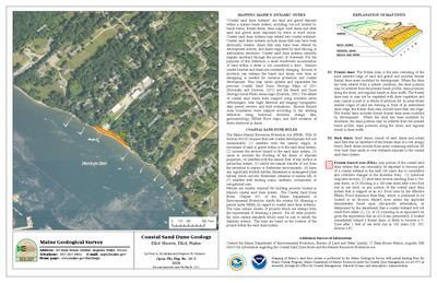
Coastal sand dune geology: Goochs Beach, Middle Beach, Kennebunk, Maine
Peter A. Slovinsky and Stephen M. Dickson
Maine Geological Survey, Open-File Map 11-93 (Superseded by Slovinsky and Dickson, 2023, Maine Geological Survey Open-File Map 23-62).
-

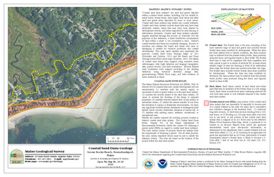
Coastal sand dune geology: Goose Rocks Beach, Batson River, Kennebunkport, Maine
Peter A. Slovinsky and Stephen M. Dickson
Maine Geological Survey, Open-File Map 11-95 (Superseded by Slovinsky and Dickson, 2023, Maine Geological Survey Open-File Map 23-71).
-

Coastal sand dune geology: Goose Rocks Beach, Kennebunkport, Maine
Peter A. Slovinsky and Stephen M. Dickson
Maine Geological Survey, Open-File Map 11-97 (Superseded by Slovinsky and Dickson, 2023, Maine Geological Survey Open-File Map 23-73).
-

Coastal sand dune geology: Goose Rocks Beach, Little River, Kennebunkport, Maine
Peter A. Slovinsky and Stephen M. Dickson
Maine Geological Survey, Open-File Map 11-98 (Superseded by Slovinsky and Dickson, 2023, Maine Geological Survey Open-File Map 23-74).
-

Coastal sand dune geology: Goose Rocks Beach, Smith Brook, Kennebunkport, Maine
Peter A. Slovinsky and Stephen M. Dickson
Maine Geological Survey, Open-File Map 11-96 (Superseded by Slovinsky and Dickson, 2023, Maine Geological Survey Open-File Map 23-72).
-

Coastal sand dune geology: Grand Beach, Surfside Beach, Scarborough and Old Orchard Beach, Maine
Peter A. Slovinsky and Stephen M. Dickson
Maine Geological Survey, Open-File Map 11-117 (Superseded by Slovinsky and Dickson, 2023, Maine Geological Survey Open-File Map 23-98).
-

Coastal sand dune geology: Half Mile Beach, Reid State Park, Georgetown, Maine
Peter A. Slovinsky and Stephen M. Dickson
Maine Geological Survey, Open-File Map 11-144 (Superseded by Slovinsky and Dickson, 2023, Maine Geological Survey Open-File Map 23-182).
-

Coastal sand dune geology: Head Beach and Hermit Island, Phippsburg, Maine
Peter A. Slovinsky and Stephen M. Dickson
Maine Geological Survey, Open-File Map 11-135 (Superseded by Slovinsky and Dickson, 2023, Maine Geological Survey Open-File Map 23-167).
-

Coastal sand dune geology: Higgins Beach and Spurwink River, Scarborough and Cape Elizabeth, Maine
Peter A. Slovinsky and Stephen M. Dickson
Maine Geological Survey, Open-File Map 11-126 (Superseded by Slovinsky and Dickson, 2023, Maine Geological Survey Open-File Map 23-109).
-

Coastal sand dune geology: Hills Beach, Biddeford, Maine
Peter A. Slovinsky and Stephen M. Dickson
Maine Geological Survey, Open-File Map 11-106 (Superseded by Slovinsky and Dickson, 2023, Maine Geological Survey Open-File Map 23-87).
-

Coastal sand dune geology: Hills Beach, Fort Hill, Biddeford, Maine
Peter A. Slovinsky and Stephen M. Dickson
Maine Geological Survey, Open-File Map 11-105 (Superseded by Slovinsky and Dickson, 2023, Maine Geological Survey Open-File Map 23-86).
-

Coastal sand dune geology: Hills Beach, Saco River, Biddeford
Peter A. Slovinsky and Stephen M. Dickson
Maine Geological Survey, Open-File Map 11-107 (Superseded by Slovinsky and Dickson, 2023, Maine Geological Survey Open-File Map 23-88).
-

Coastal sand dune geology: Horseshoe Cove, Biddeford, Maine
Peter A. Slovinsky and Stephen M. Dickson
Maine Geological Survey, Open-File Map 11-100 (Superseded by Slovinsky and Dickson, 2023, Maine Geological Survey Open-File Map 23-78).
-

Coastal sand dune geology: Hunnewell Beach, Phippsburg, Maine
Peter A. Slovinsky and Stephen M. Dickson
Maine Geological Survey, Open-File Map 11-141 (Superseded by Slovinsky and Dickson, 2023, Maine Geological Survey Open-File Map 23-175).
-

Coastal sand dune geology: Hunnewell Beach, River Beach, Phippsburg, Maine
Peter A. Slovinsky and Stephen M. Dickson
Maine Geological Survey, Open-File Map 11-142 (Superseded by Slovinsky and Dickson, 2023, Maine Geological Survey Open-File Map 23-176).
-

Coastal sand dune geology: Kinney Shores and Ocean Park, Saco and Old Orchard Beach, Maine
Peter A. Slovinsky and Stephen M. Dickson
Maine Geological Survey, Open-File Map 11-112 (Superseded by Slovinsky and Dickson, 2023, Maine Geological Survey Open-File Map 23-93).
-

Coastal sand dune geology: Kinney Shores, Bay View, Saco, Maine
Peter A. Slovinsky and Stephen M. Dickson
Maine Geological Survey, Open-File Map 11-111 (Superseded by Slovinsky and Dickson, 2023, Maine Geological Survey Open-File Map 23-92).
-

Coastal sand dune geology: Lamson Cove, Great Diamond Island, Portland, Maine
Peter A. Slovinsky and Stephen M. Dickson
Maine Geological Survey, Open-File Map 11-132 (Superseded by Slovinsky and Dickson, 2023, Maine Geological Survey Open-File Map 23-126).
-

Coastal sand dune geology: Lobster Cove, York, Maine
Peter A. Slovinsky and Stephen M. Dickson
Maine Geological Survey, Open-File Map 11-71 (Superseded by Slovinsky and Dickson, 2023, Maine Geological Survey Open-File Map 23-35).
-

Coastal sand dune geology: Long Beach, Central, York, Maine
Peter A. Slovinsky and Stephen M. Dickson
Maine Geological Survey, Open-File Map 11-73 (Superseded by Slovinsky and Dickson, 2023, Maine Geological Survey Open-File Map 23-37).
-

Coastal sand dune geology: Long Beach, North, York, Maine
Peter A. Slovinsky and Stephen M. Dickson
Maine Geological Survey, Open-File Map 11-74 (Superseded by Slovinsky and Dickson, 2023, Maine Geological Survey Open-File Map 23-38).
-

Coastal sand dune geology: Long Beach, South, York, Maine
Peter A. Slovinsky and Stephen M. Dickson
Maine Geological Survey, Open-File Map 11-72 (Superseded by Slovinsky and Dickson, 2023, Maine Geological Survey Open-File Map 23-36).
-

Coastal sand dune geology: Lords Point, Libbys Point, Kennebunk, Maine
Peter A. Slovinsky and Stephen M. Dickson
Maine Geological Survey, Open-File Map 11-91 (Superseded by Slovinsky and Dickson, 2023, Maine Geological Survey Open-File Map 23-60).
-

Coastal sand dune geology: Main Beach, Ram Island, Cape Elizabeth, Maine
Peter A. Slovinsky and Stephen M. Dickson
Maine Geological Survey, Open-File Map 11-127 (Superseded by Slovinsky and Dickson, 2023, Maine Geological Survey Open-File Map 23-110).
-

Coastal sand dune geology: Middle Beach, Mothers Beach, Kennebunk, Maine
Peter A. Slovinsky and Stephen M. Dickson
Maine Geological Survey, Open-File Map 11-92 (Superseded by Slovinsky and Dickson, 2023, Maine Geological Survey Open-File Map 23-61).
-

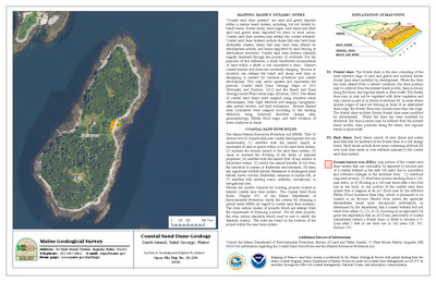
Coastal sand dune geology: Mile Beach, Reid State Park, Georgetown, Maine
Peter A. Slovinsky and Stephen M. Dickson
Maine Geological Survey, Open-File Map 11-145 (Superseded by Slovinsky and Dickson, 2023, Maine Geological Survey Open-File Map 23-183).
-

Coastal sand dune geology: Mile Stretch Beach, South Point, Biddeford, Maine
Peter A. Slovinsky and Stephen M. Dickson
Maine Geological Survey, Open-File Map 11-104 (Superseded by Slovinsky and Dickson, 2023, Maine Geological Survey Open-File Map 23-83).
-

Coastal sand dune geology: Mile Stretch Beach, The Pool, Biddeford, Maine
Peter A. Slovinsky and Stephen M. Dickson
Maine Geological Survey, Open-File Map 11-103 (Superseded by Slovinsky and Dickson, 2023, Maine Geological Survey Open-File Map 23-82).
-

Coastal sand dune geology: Moody Beach, North, Wells, Maine
Peter A. Slovinsky and Stephen M. Dickson
Maine Geological Survey, Open-File Map 11-80 (Superseded by Slovinsky and Dickson, 2023, Maine Geological Survey Open-File Map 23-49).
-

Coastal sand dune geology: Moody Beach, South, Wells, Maine
Peter A. Slovinsky and Stephen M. Dickson
Maine Geological Survey, Open-File Map 11-79 (Superseded by Slovinsky and Dickson, 2023, Maine Geological Survey Open-File Map 23-48).
-

Coastal sand dune geology: Moody Point, Fishermans Cove, Wells, Maine
Peter A. Slovinsky and Stephen M. Dickson
Maine Geological Survey, Open-File Map 11-81 (Superseded by Slovinsky and Dickson, 2023, Maine Geological Survey Open-File Map 23-50).
-

Coastal sand dune geology: Ogunquit Beach, Central, Ogunquit, Maine
Peter A. Slovinsky and Stephen M. Dickson
Maine Geological Survey, Open-File Map 11-77 (Superseded by Slovinsky and Dickson, 2023, Maine Geological Survey Open-File Map 23-46).
-

Coastal sand dune geology: Ogunquit Beach, North, Ogunquit, Maine
Peter A. Slovinsky and Stephen M. Dickson
Maine Geological Survey, Open-File Map 11-78 (Superseded by Slovinsky and Dickson, 2023, Maine Geological Survey Open-File Map 23-47).
-

Coastal sand dune geology: Ogunquit Beach, South, Ogunquit, Maine
Peter A. Slovinsky and Stephen M. Dickson
Maine Geological Survey, Open-File Map 11-76 (Superseded by Slovinsky and Dickson, 2023, Maine Geological Survey Open-File Map 23-45).
-

Coastal sand dune geology: Old Orchard Beach, East Grand Avenue, Old Orchard Beach, Maine
Peter A. Slovinsky and Stephen M. Dickson
Maine Geological Survey, Open-File Map 11-115 (Superseded by Slovinsky and Dickson, 2023, Maine Geological Survey Open-File Map 23-96).
-

Coastal sand dune geology: Old Orchard Beach, West Grand Avenue, Old Orchard Beach, Maine
Peter A. Slovinsky and Stephen M. Dickson
Maine Geological Survey, Open-File Map 11-113 (Superseded by Slovinsky and Dickson, 2023, Maine Geological Survey Open-File Map 23-94).
-

Coastal sand dune geology: Parsons Beach, Great Hill, Kennebunk, Maine
Peter A. Slovinsky and Stephen M. Dickson
Maine Geological Survey, Open-File Map 11-90 (Superseded by Slovinsky and Dickson, 2023, Maine Geological Survey Open-File Map 23-59).
-

Coastal sand dune geology: Parsons Beach, Kennebunk, Maine
Peter A. Slovinsky and Stephen M. Dickson
Maine Geological Survey, Open-File Map 11-89 (Superseded by Slovinsky and Dickson, 2023, Maine Geological Survey Open-File Map 23-58).
-

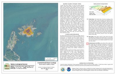
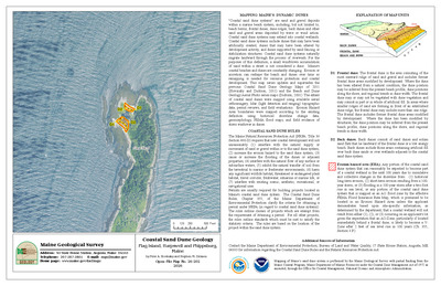
Coastal sand dune geology: Pemaquid Beach, Fish Point, Bristol, Maine
Peter A. Slovinsky and Stephen M. Dickson
Maine Geological Survey, Open-File Map 11-146 (Superseded by Slovinsky and Dickson, 2023, Maine Geological Survey Open-File Map 23-192).
-

Coastal sand dune geology: Pine Point Beach, Scarborough, Maine
Peter A. Slovinsky and Stephen M. Dickson
Maine Geological Survey, Open-File Map 11-118 (Superseded by Slovinsky and Dickson, 2023, Maine Geological Survey Open-File Map 23-99).
-

Coastal sand dune geology: Pine Point Beach, Scarborough River, Scarborough, Maine
Peter A. Slovinsky and Stephen M. Dickson
Maine Geological Survey, Open-File Map 11-119 (Superseded by Slovinsky and Dickson, 2023, Maine Geological Survey Open-File Map 23-100).
-

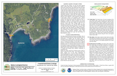
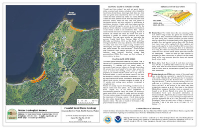
Coastal sand dune geology: Popham Beach, Morse River, Phippsburg, Maine
Peter A. Slovinsky and Stephen M. Dickson
Maine Geological Survey, Open-File Map 11-139 (Superseded by Slovinsky and Dickson, 2023, Maine Geological Survey Open-File Map 23-173).
-

Coastal sand dune geology: Popham Beach, Phippsburg, Maine
Peter A. Slovinsky and Stephen M. Dickson
Maine Geological Survey, Open-File Map 11-140 (Superseded by Slovinsky and Dickson, 2023, Maine Geological Survey Open-File Map 23-174).
-

Coastal sand dune geology: Raynes Neck, York, Maine
Peter A. Slovinsky and Stephen M. Dickson
Maine Geological Survey, Open-File Map 11-66 (Superseded by Slovinsky and Dickson, 2023, Maine Geological Survey Open-File Map 23-30).
-

Coastal sand dune geology: River Beach, Fort Popham, Phippsburg
Peter A. Slovinsky and Stephen M. Dickson
Maine Geological Survey, Open-File Map 11-143 (Superseded by Slovinsky and Dickson, 2023, Maine Geological Survey Open-File Map 23-177).
-

Coastal sand dune geology: Scarborough Beach, Prouts Neck, Scarborough, Maine
Peter A. Slovinsky and Stephen M. Dickson
Maine Geological Survey, Open-File Map 11-123 (Superseded by Slovinsky and Dickson, 2023, Maine Geological Survey Open-File Map 23-105).
-

Coastal sand dune geology: Scarborough Beach, Scarborough, Maine
Peter A. Slovinsky and Stephen M. Dickson
Maine Geological Survey, Open-File Map 11-125 (Superseded by Slovinsky and Dickson, 2023, Maine Geological Survey Open-File Map 23-107).
-

Coastal sand dune geology: Scarborough Beach State Park, Scarborough, Maine
Peter A. Slovinsky and Stephen M. Dickson
Maine Geological Survey, Open-File Map 11-124 (Superseded by Slovinsky and Dickson, 2023, Maine Geological Survey Open-File Map 23-106).
-

Coastal sand dune geology: Seapoint Beach, Cutts Island, Kittery, Maine
Peter A. Slovinsky and Stephen M. Dickson
Maine Geological Survey, Open-File Map 11-64 (Superseded by Slovinsky and Dickson, 2023, Maine Geological Survey Open-File Map 23-28).
-

Coastal sand dune geology: Seawall Beach, Morse River, Phippsburg, Maine
Peter A. Slovinsky and Stephen M. Dickson
Maine Geological Survey, Open-File Map 11-138 (Superseded by Slovinsky and Dickson, 2023, Maine Geological Survey Open-File Map 23-172).
-

Coastal sand dune geology: Seawall Beach, Phippsburg, Maine
Peter A. Slovinsky and Stephen M. Dickson
Maine Geological Survey, Open-File Map 11-137 (Superseded by Slovinsky and Dickson, 2023, Maine Geological Survey Open-File Map 23-171).
-

Coastal sand dune geology: Seawall Beach, Sprague River, Phippsburg, Maine
Peter A. Slovinsky and Stephen M. Dickson
Maine Geological Survey, Open-File Map 11-136 (Superseded by Slovinsky and Dickson, 2023, Maine Geological Survey Open-File Map 23-170).
-

Coastal sand dune geology: Sewards Cove, Gerrish Island, Kittery, Maine
Peter A. Slovinsky and Stephen M. Dickson
Maine Geological Survey, Open-File Map 11-61 (Superseded by Slovinsky and Dickson, 2023, Maine Geological Survey Open-File Map 23-25).
-

Coastal sand dune geology: Short Sands Beach, York, Maine
Peter A. Slovinsky and Stephen M. Dickson
Maine Geological Survey, Open-File Map 11-75 (Superseded by Slovinsky and Dickson, 2023, Maine Geological Survey Open-File Map 23-39).
-

Coastal sand dune geology: Sisters Point, Gerrish Island, Kittery, Maine
Peter A. Slovinsky and Stephen M. Dickson
Maine Geological Survey, Open-File Map 11-62 (Superseded by Slovinsky and Dickson, 2023, Maine Geological Survey Open-File Map 23-26).
-

Coastal sand dune geology: Strawberry Hill Beach, Cape Elizabeth, Maine
Peter A. Slovinsky and Stephen M. Dickson
Maine Geological Survey, Open-File Map 11-128 (Superseded by Slovinsky and Dickson, 2023, Maine Geological Survey Open-File Map 23-111).
-

Coastal sand dune geology: Surf Point, York, Maine
Peter A. Slovinsky and Stephen M. Dickson
Maine Geological Survey, Open-File Map 11-67 (Superseded by Slovinsky and Dickson, 2023, Maine Geological Survey Open-File Map 23-31).
-

Coastal sand dune geology: Surfside Beach, Old Orchard Beach, Maine
Peter A. Slovinsky and Stephen M. Dickson
Maine Geological Survey, Open-File Map 11-116 (Superseded by Slovinsky and Dickson, 2023, Maine Geological Survey Open-File Map 23-97).
-

Coastal sand dune geology: The Pier, Old Orchard Beach, Maine
Peter A. Slovinsky and Stephen M. Dickson
Maine Geological Survey, Open-File Map 11-114 (Superseded by Slovinsky and Dickson, 2023, Maine Geological Survey Open-File Map 23-95).
-

Coastal sand dune geology: Wells Beach, Casino Point, Wells, Maine
Peter A. Slovinsky and Stephen M. Dickson
Maine Geological Survey, Open-File Map 11-83 (Superseded by Slovinsky and Dickson, 2023, Maine Geological Survey Open-File Map 23-52).
-

Coastal sand dune geology: Wells Beach Central, Wells, Maine
Peter A. Slovinsky and Stephen M. Dickson
Maine Geological Survey, Open-File Map 11-84 (Superseded by Slovinsky and Dickson, 2023, Maine Geological Survey Open-File Map 23-53).
-

Coastal sand dune geology: Wells Beach North, Wells, Maine
Peter A. Slovinsky and Stephen M. Dickson
Maine Geological Survey, Open-File Map 11-85 (Superseded by Slovinsky and Dickson, 2023, Maine Geological Survey Open-File Map 23-54).
-

Coastal sand dune geology: Wells Beach, South, Wells, Maine
Peter A. Slovinsky and Stephen M. Dickson
Maine Geological Survey, Open-File Map 11-82 (Superseded by Slovinsky and Dickson, 2023, Maine Geological Survey Open-File Map 23-51).
-

Coastal sand dune geology: Western and Ferry Beaches, Scarborough, Maine
Peter A. Slovinsky and Stephen M. Dickson
Maine Geological Survey, Open-File Map 11-121 (Superseded by Slovinsky and Dickson, 2023, Maine Geological Survey Open-File Map 23-102).
-

Coastal sand dune geology: Western Beach, Prouts Neck, Scarborough, Maine
Peter A. Slovinsky and Stephen M. Dickson
Maine Geological Survey, Open-File Map 11-122 (Superseded by Slovinsky and Dickson, 2023, Maine Geological Survey Open-File Map 23-103).
-

Coastal sand dune geology: Willard Beach, South Portland, Maine
Peter A. Slovinsky and Stephen M. Dickson
Maine Geological Survey, Open-File Map 11-131 (Superseded by Slovinsky and Dickson, 2023, Maine Geological Survey Open-File Map 23-120).
-

Coastal sand dune geology: York Harbor Beach, York, Maine
Peter A. Slovinsky and Stephen M. Dickson
Maine Geological Survey, Open-File Map 11-69 (Superseded by Slovinsky and Dickson, 2023, Maine Geological Survey Open-File Map 23-33).
-

Significant sand and gravel aquifers in the Branch Lake quadrangle, Maine
Lauren E. Foster and Troy T. Smith
Maine Geological Survey, Open-File Map 11-50.
-

Significant sand and gravel aquifers in the Brewer Lake quadrangle, Maine
Lauren E. Foster, Troy T. Smith, and Dale F. Doughty
Maine Geological Survey, Open-File Map 11-53.
-

Significant sand and gravel aquifers in the Bucksport quadrangle, Maine
Lauren E. Foster, Troy T. Smith, and Dale F. Doughty
Maine Geological Survey, Open-File Map 11-59.
-

Significant sand and gravel aquifers in the Ellsworth quadrangle, Maine
Craig D. Neil and Daniel B. Locke
Maine Geological Survey, Open-File Map 11-48 (Superseded by Neil, 2012, Maine Geological Survey Open-File 12-18).
-

Significant sand and gravel aquifers in the Green Lake quadrangle, Maine
Lauren E. Foster, Troy T. Smith, and Dale F. Doughty
Maine Geological Survey, Open-File Map 11-29.
-

Significant sand and gravel aquifers in the Hampden quadrangle, Maine
Lauren E. Foster, Troy T. Smith, and Dale F. Doughty
Maine Geological Survey, Open-File Map 11-5.
-

Significant sand and gravel aquifers in the Hancock quadrangle, Maine
Craig D. Neil and Daniel B. Locke
Maine Geological Survey, Open-File Map 11-49.
-

Significant sand and gravel aquifers in the Orland quadrangle, Maine
Lauren E. Foster, Troy T. Smith, and Dale F. Doughty
Maine Geological Survey, Open-File Map 11-51.
-

Significant sand and gravel aquifers in the West Rockport quadrangle, Maine
Thomas K. Weddle
Maine Geological Survey, Open-File Map 11-1.
-

Surficial geology of the Bangor quadrangle, Maine
Kent M. Syverson and Andrew H. Thompson
Maine Geological Survey, Open-File Map 11-6.
-

Surficial geology of the Branch Lake quadrangle, Maine
Thomas K. Weddle
Maine Geological Survey, Open-File Map 11-16.
-

Surficial geology of the Brewer Lake quadrangle, Maine
Alice R. Kelley and Lynn Caron
Maine Geological Survey, Open-File Map 11-18.
-

Surficial geology of the Bucksport quadrangle, Maine
Alice R. Kelley and Lynn Caron
Maine Geological Survey, Open-File Map 11-9 (Superseded by Kelley and Caron, 2013, Maine Geological Survey Open-File Map 13-14).
-

Surficial geology of the Ellsworth quadrangle, Maine
Thomas K. Weddle
Maine Geological Survey, Open-File Map 11-33.
-

Surficial geology of the Green Lake quadrangle, Maine
Carol T. Hildreth
Maine Geological Survey, Open-File Map 11-20.
-

Surficial geology of the Hampden quadrangle, Maine
Kent M. Syverson
Maine Geological Survey, Open-File Map 11-4 (Superseded by Syverson and Olson, 2013, Maine Geological Survey Open-File Map 13-12).
-

Surficial geology of the Hampden quadrangle, Maine
Kent M. Syverson and Jeffrey D. Olson
Maine Geological Survey, Open-File Map 11-4 (Superseded by Syverson and Olson, 2011, Maine Geological Survey Open-file Map 11-31).
-

Surficial geology of the Hancock quadrangle, Maine
Carol T. Hildreth
Maine Geological Survey, Open-File Map 11-34 (Superseded by Hildreth, 2012, Maine Geological Survey Open-File Map 12-26 ).
-

Surficial geology of the Orland quadrangle, Maine
Thomas K. Weddle
Maine Geological Survey, Open-File Map 11-22.
-

Surficial geology of the Thomaston quadrangle, Maine
Woodrow B. Thompson
Maine Geological Survey, Open-File Map 11-30.
-

Surficial geology of the Veazie quadrangle, Maine
Carol T. Hildreth
Maine Geological Survey, Open-File Map 11-32.
-

Surficial geology of the Waldoboro East quadrangle, Maine
Woodrow B. Thompson
Maine Geological Survey, Open-File Map 11-13 (Superseded by Thompson, 2012, Maine Geological Survey Open-File Map 12-20).
-

Surficial geology of the Waldoboro West quadrangle, Maine
Woodrow B. Thompson
Maine Geological Survey, Open-File Map 11-14 (Superseded by Thompson, 2012, Maine Geological Survey Open-File Map 12-25).
-

Surficial materials of the Branch Lake quadrangle, Maine
Thomas K. Weddle and Dale F. Doughty
Maine Geological Survey, Open-File Map 11-15.
-

Surficial materials of the Brewer Lake quadrangle, Maine
Alice R. Kelley, Lynn Caron, and Dale F. Doughty
Maine Geological Survey, Open-File Map 11-17.
-

Surficial materials of the Bucksport quadrangle, Maine
Alice R. Kelly, Lynn Caron, and Dale F. Doughty
Maine Geological Survey, Open-File Map 11-10.
-

Surficial materials of the Green Lake quadrangle, Maine
Carol T. Hildreth and Dale F. Doughty
Maine Geological Survey, Open-File Map 11-19.
-

Surficial materials of the Hampden quadrangle, Maine
Kent M. Syverson, Jeffrey D. Olson, and Dale F. Doughty
Maine Geological Survey, Open-File Map 11-3.
-

Surficial materials of the Orland quadrangle, Maine
Thomas K. Weddle and Dale F. Doughty
Maine Geological Survey, Open-File Map 11-21.
-

Surficial materials of the Waldoboro East quadrangle, Maine
Woodrow B. Thompson and Daniel B. Locke
Maine Geological Survey, Open-File Map 11-11 (Superseded by Thompson and Locke, Maine Geological Survey Open-file Map 12-22).
-

Surficial materials of the Waldoboro West quadrangle, Maine
Woodrow B. Thompson and Daniel B. Locke
Maine Geological Survey, Open-File Map 11-12 (Superseded by Thompson and Locke, Maine Geological Survey Open-file Map 12-24).
-

Bedrock geology of the Bowdoinham quadrangle, Maine
David P. West Jr and Joel F. Cubley
Maine Geological Survey, Open-File Map 10-20.
-

Bedrock geology of the Purgatory quadrangle, Maine
David P. West and Evan D. Ellenberger
Maine Geological Survey, Open-File Map 10-21.
-

Bedrock geology of the Richmond quadrangle, Maine
David P. West Jr, Henry N. Berry IV, and Lee B. Corbett
Maine Geological Survey, Open-File Map 10-19.
-

Bedrock well depths in parts of the Millinocket and Danforth 30x60-minute quadrangles, Maine
Susan S. Tolman
Maine Geological Survey, Open-File Map 10-61.
-

Bedrock well depths in the Augusta 30x60-minute quadrangle, Maine
Susan S. Tolman
Maine Geological Survey, Open-File Map 10-27.
-

Bedrock well depths in the Bangor 30x60-minute quadrangle, Maine
Susan S. Tolman
Maine Geological Survey, Open-File Map 10-28.
-

Bedrock well depths in the Bar Harbor 30x60-minute quadrangle, Maine
Susan S. Tolman
Maine Geological Survey, Open-File Map 10-31.
-

Bedrock well depths in the Bath 30x60-minute quadrangle, Maine
Susan S. Tolman
Maine Geological Survey, Open-File Map 10-34.
-

Bedrock well depths in the Calais 30x60-minute quadrangle, Maine
Susan S. Tolman
Maine Geological Survey, Open-File Map 10-37.
-

Bedrock well depths in the Dover-Foxcroft 30x60-minute quadrangle, Maine
Susan S. Tolman
Maine Geological Survey, Open-File Map 10-40.
-

Bedrock well depths in the Houlton 30x60-minute quadrangle, Maine
Susan S. Tolman
Maine Geological Survey, Open-File Map 10-43.
-

Bedrock well depths in the Kittery 30x60-minute quadrangle, Maine
Susan S. Tolman
Maine Geological Survey, Open-File Map 10-46.
-

Bedrock well depths in the Lewiston 30x60-minute quadrangle, Maine
Susan S. Tolman
Maine Geological Survey, Open-File Map 10-49.