


The Maine Geological Survey provides the people and businesses of Maine with essential geologic information about the land where we live and work.
Note: Many state documents are offered in PDF format. To view PDF documents, you will need the free Adobe Reader. If you need assistance, view our Maine government PDF Help page or contact the contributing Maine State agency via the link on the left sidebar under “Links”.
-

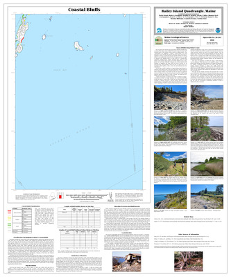
Coastal bluffs in the Bailey Island quadrangle, Maine
Marita Bryant, Walter A. Barnhardt, Stephen M. Dickson, Joseph T. Kelley, Shannon Scott, Bennett J. Wilson Jr, Peter A. Slovinsky, Samuel G. Roy, Nicholas Whiteman, Jeannette Berman, and Caroline Fales
Maine Geological Survey, Open-File Map 26-261.
-

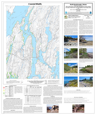
Coastal bluffs in the Bath quadrangle, Maine
Allison L. Brandes, Rebecca A. Nestor, David A. Sinson, Marita Bryant, Walter A. Barnhardt, Jason N. Weist, Marc C. Loiselle, Peter A. Slovinsky, Samuel G. Roy, Stephen M. Dickson, Joseph T. Kelley, Nicholas Whiteman, Jeannette Berman, and Caroline Fales
Maine Geological Survey, Open-File Map 26-262.
-

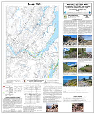
Coastal bluffs in the Brunswick quadrangle, Maine
Corinn C. Keblinsky, Jennifer L. Hall, Marita Bryant, Walter A. Barnhardt, Stephen M. Dickson, Joseph T. Kelley, Shannon Scott, Susan S. Tolman, Peter A. Slovinsky, Samuel G. Roy, Nicholas Whiteman, Jeannette Berman, and Caroline Fales
Maine Geological Survey, Open-File Map 26-263.
-

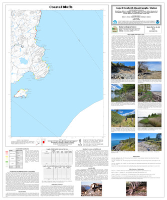
Coastal bluffs in the Cape Elizabeth quadrangle, Maine
Marita Bryant, Walter A. Barnhardt, Stephen M. Dickson, Joseph T. Kelley, Shannon Scott, Bennett J. Wilson Jr, Peter A. Slovinsky, Samuel G. Roy, Nicholas Whiteman, Jeannette Berman, and Caroline Fales
Maine Geological Survey, Open-File Map 26-264.
-

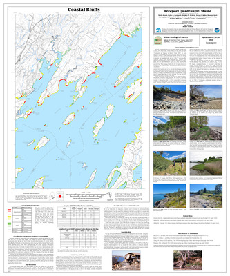
Coastal bluffs in the Freeport quadrangle, Maine
Marita Bryant, Walter A. Barnhardt, Stephen M. Dickson, Joseph T. Kelley, Shannon Scott, Bennett J. Wilson Jr, Peter A. Slovinsky, Samuel G. Roy, Nicholas Whiteman, Jeannette Berman, and Caroline Fales
Maine Geological Survey, Open-File Map 26-265.
-

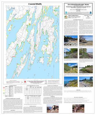
Coastal bluffs in the Orrs Island quadrangle, Maine
Marita Bryant, Walter A. Barnhardt, Stephen M. Dickson, Joseph T. Kelley, Shannon Scott, Bennett J. Wilson Jr, Peter A. Slovinsky, Samuel G. Roy, Nicholas Whiteman, Jeannette Berman, and Caroline Fales
Maine Geological Survey, Open-File Map 26-266.
-

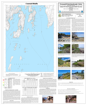
Coastal bluffs in the Pemaquid Point quadrangle, Maine
Thomas D. Henze, Douglas G. Hodum, Meredith A. Kelley, David A. Stinson, Allison L. Brandes, Stephen M. Dickson, Joseph T. Kelley, Jason N. Weist, Marc C. Loiselle, Peter A. Slovinsky, Samuel G. Roy, Nicholas Whiteman, Jeannette Berman, and Caroline Fales
Maine Geological Survey, Open-File Map 26-267.
-

Coastal bluffs in the Phippsburg quadrangle, Maine
Allison L. Brandes, David A. Sinson, Rebecca A. Nestor, Earle G. Hildreth, Marita Bryant, Walter A. Barnhardt, Stephen M. Dickson, Joseph T. Kelley, Jason N. Weist, Marc C. Loiselle, Peter A. Slovinsky, Samuel G. Roy, Nicholas Whiteman, Jeannette Berman, and Caroline Fales
Maine Geological Survey, Open-File Map 26-268.
-

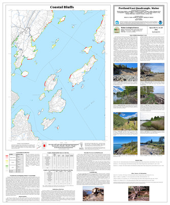
Coastal bluffs in the Portland East quadrangle, Maine
Marita Bryant, Walter A. Barnhardt, Stephen M. Dickson, Joseph T. Kelley, Shannon Scott, Bennett J. Wilson Jr, Peter A. Slovinsky, Samuel G. Roy, Nicholas Whiteman, Jeannette Berman, and Caroline Fales
Maine Geological Survey, Open-File Map 26-269.
-

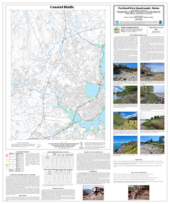
Coastal bluffs in the Portland West quadrangle, Maine
Marita Bryant, Walter A. Barnhardt, Stephen M. Dickson, Joseph T. Kelley, Shannon Scott, Bennett J. Wilson Jr, Peter A. Slovinsky, Samuel G. Roy, Nicholas Whiteman, Jeannette Berman, and Caroline Fales
Maine Geological Survey, Open-File Map 26-270.
-

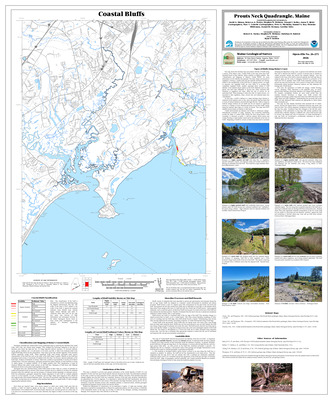
Coastal bluffs in the Prouts Neck quadrangle, Maine
David A. Sinson, Rebecca A. Nestor, Stephen M. Dickson, Joseph T. Kelley, Jason N. Weist, Marc C. Loiselle, Peter A. Slovinsky, Samuel G. Roy, Nicholas Whiteman, Jeannette Berman, and Caroline Fales
Maine Geological Survey, Open-File Map 26-271.
-

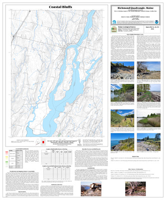
Coastal bluffs in the Richmond quadrangle, Maine
Peter A. Slovinsky, Samuel G. Roy, Nicholas Whiteman, Jeannette Berman, and Caroline Fales
Maine Geological Survey, Open-File Map 26-272.
-

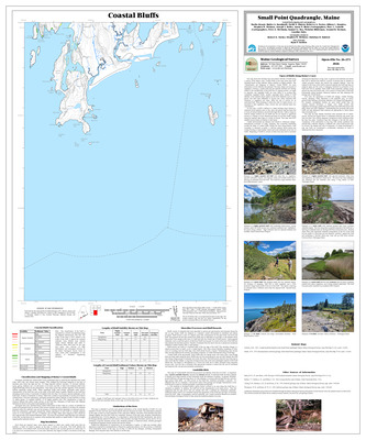
Coastal bluffs in the Small Point quadrangle, Maine
Marita Bryant, Walter A. Barnhardt, David A. Sinson, Rebecca A. Nestor, Allison L. Brandes, Stephen M. Dickson, Joseph T. Kelley, Jason N. Weist, Marc C. Loiselle, Peter A. Slovinsky, Samuel G. Roy, Nicholas Whiteman, Jeannette Berman, and Caroline Fales
Maine Geological Survey, Open-File Map 26-273.
-

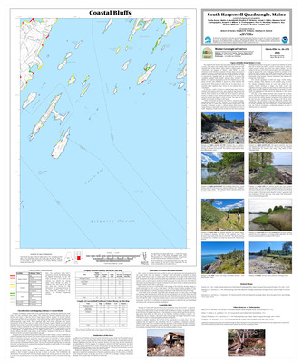
Coastal bluffs in the South Harpswell quadrangle, Maine
Marita Bryant, Walter A. Barnhardt, Stephen M. Dickson, Joseph T. Kelley, Shannon Scott, Bennett J. Wilson Jr, Peter A. Slovinsky, Samuel G. Roy, Nicholas Whiteman, Jeannette Berman, and Caroline Fales
Maine Geological Survey, Open-File Map 26-274.
-

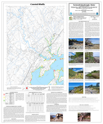
Coastal bluffs in the Yarmouth quadrangle, Maine
Marita Bryant, Walter A. Barnhardt, Stephen M. Dickson, Joseph T. Kelley, Shannon Scott, Bennett J. Wilson Jr, Peter A. Slovinsky, Samuel G. Roy, Nicholas Whiteman, Jeannette Berman, and Caroline Fales
Maine Geological Survey, Open-File Map 26-275.
-

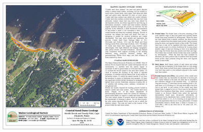
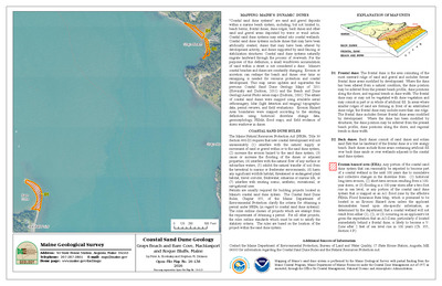
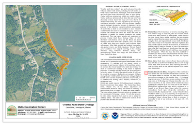
Coastal sand dune geology: Alewife Brook and Trundy Point, Cape Elizabeth, Maine
Peter A. Slovinsky and Stephen M. Dickson
Maine Geological Survey, Open-File Map 26-58
-

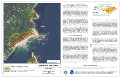
Coastal sand dune geology: Andrews Beach and Shark Cove, Long Island, Maine
Peter A. Slovinsky and Stephen M. Dickson
Maine Geological Survey, Open-File Map 26-69
-

Coastal sand dune geology: Andrews Island, Muscle Ridge Twp, Maine
Peter A. Slovinsky and Stephen M. Dickson
Maine Geological Survey, Open-File Map 26-95
-

Coastal sand dune geology: Arey Cove and Little Moose Island, Winter Harbor, Maine
Peter A. Slovinsky and Stephen M. Dickson
Maine Geological Survey, Open-File Map 26-113
-

Coastal sand dune geology: Bangs Island, Chebeague Island, Maine
Peter A. Slovinsky and Stephen M. Dickson
Maine Geological Survey, Open-File Map 26-183
-

Coastal sand dune geology: Bare Point, Addison, Maine
Peter A. Slovinsky and Stephen M. Dickson
Maine Geological Survey, Open-File Map 26-234
-

Coastal sand dune geology: Bar Island, Muscle Ridge Twp, Maine
Peter A. Slovinsky and Stephen M. Dickson
Maine Geological Survey, Open-File Map 26-93
-

Coastal sand dune geology: Bar Island, Saint George, Maine
Peter A. Slovinsky and Stephen M. Dickson
Maine Geological Survey, Open-File Map 26-212
-

Coastal sand dune geology: Bar Road North, Lubec, Maine
Peter A. Slovinsky and Stephen M. Dickson
Maine Geological Survey, Open-File Map 26-163
-

Coastal sand dune geology: Bar Road South, Lubec, Maine
Peter A. Slovinsky and Stephen M. Dickson
Maine Geological Survey, Open-File Map 26-162
-

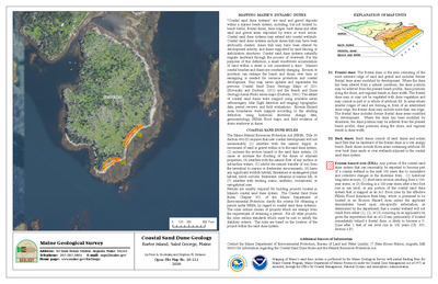
Coastal sand dune geology: Barter Island, Saint George, Maine
Peter A. Slovinsky and Stephen M. Dickson
Maine Geological Survey, Open-File Map 26-211
-

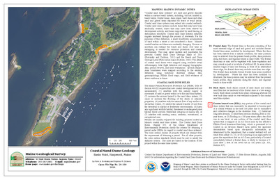
Coastal sand dune geology: Basin Point, Harpswell, Maine
Peter A. Slovinsky and Stephen M. Dickson
Maine Geological Survey, Open-File Map 26-190
-

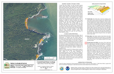
Coastal sand dune geology: Batch Head, Trescott Twp, Maine
Peter A. Slovinsky and Stephen M. Dickson
Maine Geological Survey, Open-File Map 26-157
-

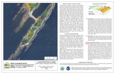
Coastal sand dune geology: Bates Island, Chebeague Island, Maine
Peter A. Slovinsky and Stephen M. Dickson
Maine Geological Survey, Open-File Map 26-182
-

Coastal sand dune geology: Beach Drive and Wildwood Park, Cumberland, Maine
Peter A. Slovinsky and Stephen M. Dickson
Maine Geological Survey, Open-File Map 26-78
-

Coastal sand dune geology: Bear Paw Rd, Harpswell, Maine
Peter A. Slovinsky and Stephen M. Dickson
Maine Geological Survey, Open-File Map 26-198
-

Coastal sand dune geology: Big Head, Milbridge, Maine
Peter A. Slovinsky and Stephen M. Dickson
Maine Geological Survey, Open-File Map 26-122
-

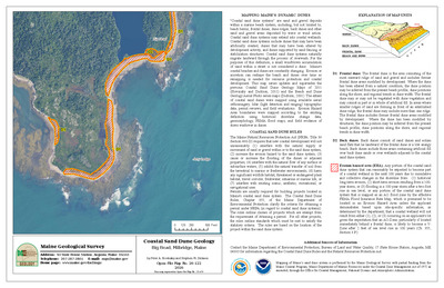
Coastal sand dune geology: Birch Harbor, Gouldsboro, Maine
Peter A. Slovinsky and Stephen M. Dickson
Maine Geological Survey, Open-File Map 26-115
-

Coastal sand dune geology: Birch Island, Muscle Ridge Twp, Maine
Peter A. Slovinsky and Stephen M. Dickson
Maine Geological Survey, Open-File Map 26-216
-

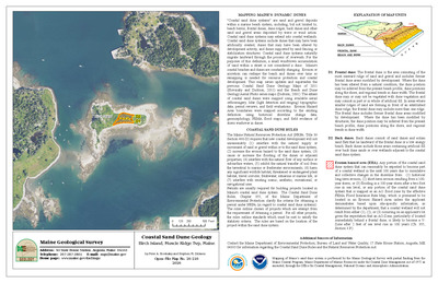
Coastal sand dune geology: Black Head, Roque Bluffs, Maine
Peter A. Slovinsky and Stephen M. Dickson
Maine Geological Survey, Open-File Map 26-137
-

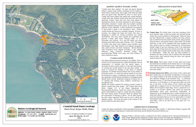
Coastal sand dune geology: Boat and Zeb Coves, Cape Elizabeth, Maine
Peter A. Slovinsky and Stephen M. Dickson
Maine Geological Survey, Open-File Map 26-59
-

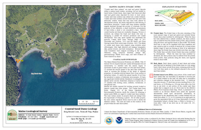
Coastal sand dune geology: Bog Brook Cove, Trescott Twp, Maine
Peter A. Slovinsky and Stephen M. Dickson
Maine Geological Survey, Open-File Map 26-153
-

Coastal sand dune geology: Bois Bubert Island Southeast, Milbridge, Maine
Peter A. Slovinsky and Stephen M. Dickson
Maine Geological Survey, Open-File Map 26-123
-

Coastal sand dune geology: Boot Cove, Lubec, Maine
Peter A. Slovinsky and Stephen M. Dickson
Maine Geological Survey, Open-File Map 26-254
-

Coastal sand dune geology: Boot Cove, Lubec, Maine
Peter A. Slovinsky and Stephen M. Dickson
Maine Geological Survey, Open-File Map 26-159
-

Coastal sand dune geology: Bull Point, Bristol, Maine
Peter A. Slovinsky and Stephen M. Dickson
Maine Geological Survey, Open-File Map 26-208
-

Coastal sand dune geology: Burnt Island, Addison, Maine
Peter A. Slovinsky and Stephen M. Dickson
Maine Geological Survey, Open-File Map 26-236
-

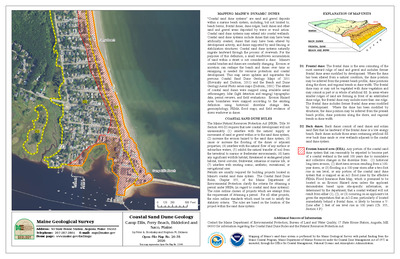
Coastal sand dune geology: Camp Ellis, Ferry Beach, Biddeford and Saco, Maine
Peter A. Slovinsky and Stephen M. Dickson
Maine Geological Survey, Open-File Map 26-35
-

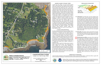
Coastal sand dune geology: Candys Cove, Saint George, Maine
Peter A. Slovinsky and Stephen M. Dickson
Maine Geological Survey, Open-File Map 26-91
-

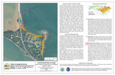
Coastal sand dune geology: Carlow Island, Pleasant Point and Eastport and Perry, Maine
Peter A. Slovinsky and Stephen M. Dickson
Maine Geological Survey, Open-File Map 26-166
-

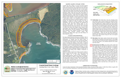
Coastal sand dune geology: Carrying Place Cove, Lubec, Maine
Peter A. Slovinsky and Stephen M. Dickson
Maine Geological Survey, Open-File Map 26-161
-

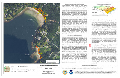
Coastal sand dune geology: Chandler and Bennett Coves, Chebeague Island, Maine
Peter A. Slovinsky and Stephen M. Dickson
Maine Geological Survey, Open-File Map 26-74
-

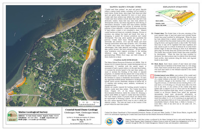
Coastal sand dune geology: Chebeague Point, Chebeague Island, Maine
Peter A. Slovinsky and Stephen M. Dickson
Maine Geological Survey, Open-File Map 26-77
-

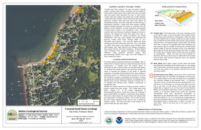
Coastal sand dune geology: City Point, Portland, Maine
Peter A. Slovinsky and Stephen M. Dickson
Maine Geological Survey, Open-File Map 26-64
-

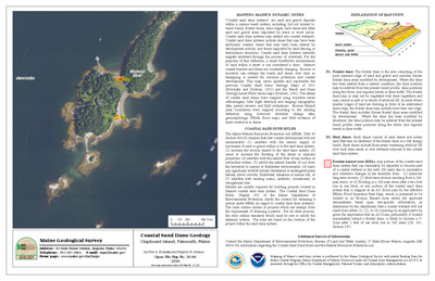
Coastal sand dune geology: Clapboard Island, Falmouth, Maine
Peter A. Slovinsky and Stephen M. Dickson
Maine Geological Survey, Open-File Map 26-66
-

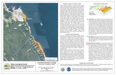
Coastal sand dune geology: Clark Point, Gouldsboro, Maine
Peter A. Slovinsky and Stephen M. Dickson
Maine Geological Survey, Open-File Map 26-117
-

Coastal sand dune geology: Cliff Island, Portland, Maine
Peter A. Slovinsky and Stephen M. Dickson
Maine Geological Survey, Open-File Map 26-72
-

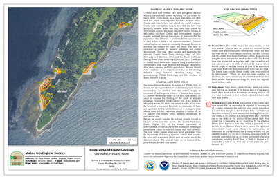
Coastal sand dune geology: Corea Harbor, Gouldsboro, Maine
Peter A. Slovinsky and Stephen M. Dickson
Maine Geological Survey, Open-File Map 26-225
-

Coastal sand dune geology: Crab Island, Freeport and Yarmouth, Maine
Peter A. Slovinsky and Stephen M. Dickson
Maine Geological Survey, Open-File Map 26-185
-

Coastal sand dune geology: Cranberry Point and Shark Cove, Gouldsboro, Maine
Peter A. Slovinsky and Stephen M. Dickson
Maine Geological Survey, Open-File Map 26-120
-

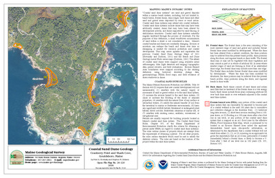
Coastal sand dune geology: Crescent Beach, Seapoint, Kittery, Maine
Peter A. Slovinsky and Stephen M. Dickson
Maine Geological Survey, Open-File Map 26-6
-

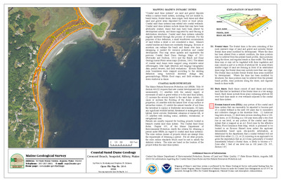
Coastal sand dune geology: Crescent Beach State Park, Cape Elizabeth, Maine
Peter A. Slovinsky and Stephen M. Dickson
Maine Geological Survey, Open-File Map 26-56
-

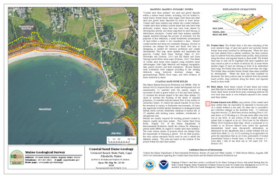
Coastal sand dune geology: Crockett and Ginn Points, Owls Head, Maine
Peter A. Slovinsky and Stephen M. Dickson
Maine Geological Survey, Open-File Map 26-96
-

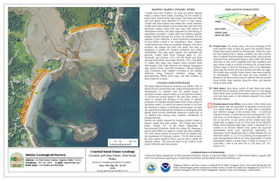
Coastal sand dune geology: Crockett Point, Vinalhaven, Maine
Peter A. Slovinsky and Stephen M. Dickson
Maine Geological Survey, Open-File Map 26-220
-

Coastal sand dune geology: Cross Island East, Cutler, Maine
Peter A. Slovinsky and Stephen M. Dickson
Maine Geological Survey, Open-File Map 26-149
-

Coastal sand dune geology: Curtis Cove, Harpswell, Maine
Peter A. Slovinsky and Stephen M. Dickson
Maine Geological Survey, Open-File Map 26-195
-

Coastal sand dune geology: Curtis Cove, New Barn Cove, Biddeford and Kennebunkport, Maine
Peter A. Slovinsky and Stephen M. Dickson
Maine Geological Survey, Open-File Map 26-31
-

Coastal sand dune geology: Cushing Point, Chebeague Island and Long Island, Maine
Peter A. Slovinsky and Stephen M. Dickson
Maine Geological Survey, Open-File Map 26-70
-

Coastal sand dune geology: Davis Beach, Cutler, Maine
Peter A. Slovinsky and Stephen M. Dickson
Maine Geological Survey, Open-File Map 26-147
-

Coastal sand dune geology: Davis Island, Saint George, Maine
Peter A. Slovinsky and Stephen M. Dickson
Maine Geological Survey, Open-File Map 26-209
-

Coastal sand dune geology: Deacon Brown Point, North Haven, Maine
Peter A. Slovinsky and Stephen M. Dickson
Maine Geological Survey, Open-File Map 26-98
-

Coastal sand dune geology: Dead Mans Cove, Yarmouth, Maine
Peter A. Slovinsky and Stephen M. Dickson
Maine Geological Survey, Open-File Map 26-79
-

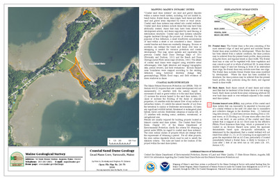
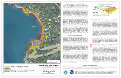
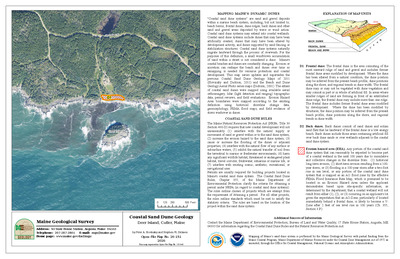
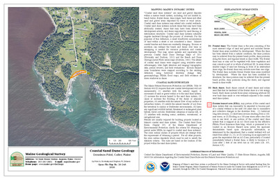
Coastal sand dune geology: Deep Cove, Winter Harbor, Maine
Peter A. Slovinsky and Stephen M. Dickson
Maine Geological Survey, Open-File Map 26-111
-

Coastal sand dune geology: Deer Island, Cutler, Maine
Peter A. Slovinsky and Stephen M. Dickson
Maine Geological Survey, Open-File Map 26-151
-

Coastal sand dune geology: Dennison Point, Cutler, Maine
Peter A. Slovinsky and Stephen M. Dickson
Maine Geological Survey, Open-File Map 26-248
-

Coastal sand dune geology: Division Point, Yarmouth and Chebeague Island, Maine
Peter A. Slovinsky and Stephen M. Dickson
Maine Geological Survey, Open-File Map 26-181
-

Coastal sand dune geology: Doyle Point, Yarmouth, Maine
Peter A. Slovinsky and Stephen M. Dickson
Maine Geological Survey, Open-File Map 26-184
-

Coastal sand dune geology: Drakes Island and Laudholm Beaches, Kennebunk and Wells, Maine
Peter A. Slovinsky and Stephen M. Dickson
Maine Geological Survey, Open-File Map 26-22
-

Coastal sand dune geology: Drakes Island Beach South, Wells, Maine
Peter A. Slovinsky and Stephen M. Dickson
Maine Geological Survey, Open-File Map 26-21
-

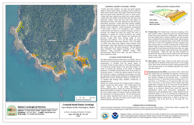
Coastal sand dune geology: Dyer Island South, Harrington, Maine
Peter A. Slovinsky and Stephen M. Dickson
Maine Geological Survey, Open-File Map 26-230
-

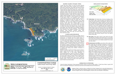
Coastal sand dune geology: Eastern Head, Trescott Twp, Maine
Peter A. Slovinsky and Stephen M. Dickson
Maine Geological Survey, Open-File Map 26-155
-

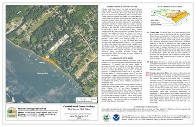
Coastal sand dune geology: Eastern Knubble, Cutler, Maine
Peter A. Slovinsky and Stephen M. Dickson
Maine Geological Survey, Open-File Map 26-249
-

Coastal sand dune geology: Eliot Shores, Eliot, Maine
Peter A. Slovinsky and Stephen M. Dickson
Maine Geological Survey, Open-File Map 26-3
-

Coastal sand dune geology: Fellows Island, Roque Bluffs, Maine
Peter A. Slovinsky and Stephen M. Dickson
Maine Geological Survey, Open-File Map 26-240
-

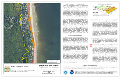
Coastal sand dune geology: Ferry Beach, Bay View, Saco, Maine
Peter A. Slovinsky and Stephen M. Dickson
Maine Geological Survey, Open-File Map 26-37
-

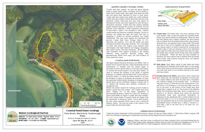
Coastal sand dune geology: Ferry Beach, Black Rock, Scarborough, Maine
Peter A. Slovinsky and Stephen M. Dickson
Maine Geological Survey, Open-File Map 26-47
-

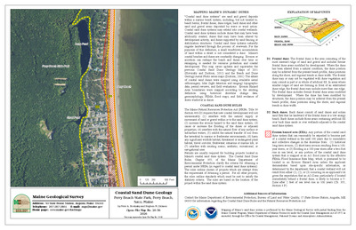
Coastal sand dune geology: Ferry Beach State Park, Ferry Beach, Saco, Maine
Peter A. Slovinsky and Stephen M. Dickson
Maine Geological Survey, Open-File Map 26-36
-

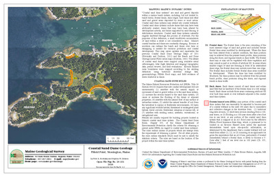
Coastal sand dune geology: Fifield Point, Stonington, Maine
Peter A. Slovinsky and Stephen M. Dickson
Maine Geological Survey, Open-File Map 26-101
-

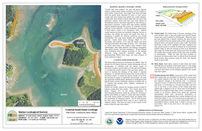
Coastal sand dune geology: Fish Point, Cranberry Isles, Maine
Peter A. Slovinsky and Stephen M. Dickson
Maine Geological Survey, Open-File Map 26-108
-

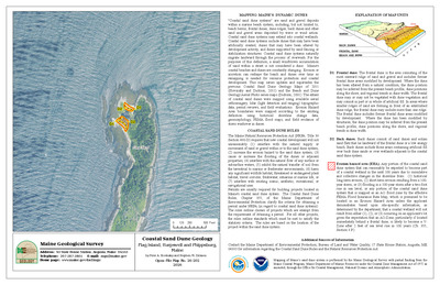
Coastal sand dune geology: Flag Island, Harpswell and Phippsburg, Maine
Peter A. Slovinsky and Stephen M. Dickson
Maine Geological Survey, Open-File Map 26-202
-

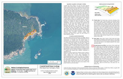
Coastal sand dune geology: Flint Island East, Harrington, Maine
Peter A. Slovinsky and Stephen M. Dickson
Maine Geological Survey, Open-File Map 26-232
-

Coastal sand dune geology: Flint Island West, Harrington, Maine
Peter A. Slovinsky and Stephen M. Dickson
Maine Geological Survey, Open-File Map 26-231
-

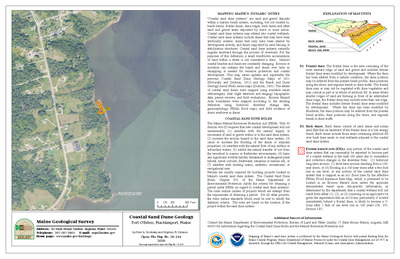
Coastal sand dune geology: Fort Foster, Gerrish Island, Kittery, Maine
Peter A. Slovinsky and Stephen M. Dickson
Maine Geological Survey, Open-File Map 26-4
-

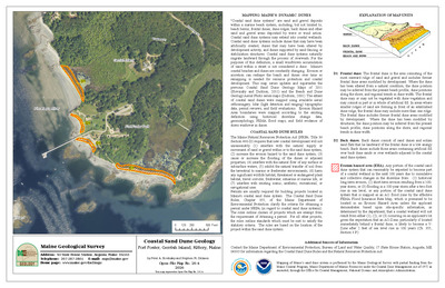
Coastal sand dune geology: Fort O'Brien, Machiasport, Maine
Peter A. Slovinsky and Stephen M. Dickson
Maine Geological Survey, Open-File Map 26-144
-

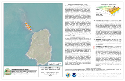
Coastal sand dune geology: Foster Island, Machiasport, Maine
Peter A. Slovinsky and Stephen M. Dickson
Maine Geological Survey, Open-File Map 26-243
-

Coastal sand dune geology: Gay Island South, Cushing, Maine
Peter A. Slovinsky and Stephen M. Dickson
Maine Geological Survey, Open-File Map 26-90
-

Coastal sand dune geology: Gleason Point, Perry, Maine
Peter A. Slovinsky and Stephen M. Dickson
Maine Geological Survey, Open-File Map 26-259
-

Coastal sand dune geology: Goose Rocks Beach, Batson River, Kennebunkport, Maine
Peter A. Slovinsky and Stephen M. Dickson
Maine Geological Survey, Open-File Map 26-26
-

Coastal sand dune geology: Goose Rocks Beach, Kennebunkport, Maine
Peter A. Slovinsky and Stephen M. Dickson
Maine Geological Survey, Open-File Map 26-28
-

Coastal sand dune geology: Goose Rocks Beach, Little River, Biddeford and Kennebunkport, Maine
Peter A. Slovinsky and Stephen M. Dickson
Maine Geological Survey, Open-File Map 26-29
-

Coastal sand dune geology: Goose Rocks Beach, Smith Brook, Kennebunkport, Maine
Peter A. Slovinsky and Stephen M. Dickson
Maine Geological Survey, Open-File Map 26-27
-

Coastal sand dune geology: Grand Beach, Surfside Beach, Scarborough and Old Orchard Beach, Maine
Peter A. Slovinsky and Stephen M. Dickson
Maine Geological Survey, Open-File Map 26-44
-

Coastal sand dune geology: Grassy Point, Cutler, Maine
Peter A. Slovinsky and Stephen M. Dickson
Maine Geological Survey, Open-File Map 26-148
-

Coastal sand dune geology: Grays Beach and Bare Cove, Machiasport and Roque Bluffs, Maine
Peter A. Slovinsky and Stephen M. Dickson
Maine Geological Survey, Open-File Map 26-138
-

Coastal sand dune geology: Great Bar, Jonesport, Maine
Peter A. Slovinsky and Stephen M. Dickson
Maine Geological Survey, Open-File Map 26-135
-

Coastal sand dune geology: Great Beach, Jonesport, Maine
Peter A. Slovinsky and Stephen M. Dickson
Maine Geological Survey, Open-File Map 26-134
-

Coastal sand dune geology: Hadley Point, Bar Harbor and Lamoine, Maine
Peter A. Slovinsky and Stephen M. Dickson
Maine Geological Survey, Open-File Map 26-110
-

Coastal sand dune geology: Hamilton Cove, Lubec, Maine
Peter A. Slovinsky and Stephen M. Dickson
Maine Geological Survey, Open-File Map 26-255
-

Coastal sand dune geology: Harbor Grace, Long Island, Maine
Peter A. Slovinsky and Stephen M. Dickson
Maine Geological Survey, Open-File Map 26-177
-

Coastal sand dune geology: Harbor Island, Phippsburg, Maine
Peter A. Slovinsky and Stephen M. Dickson
Maine Geological Survey, Open-File Map 26-205
-

Coastal sand dune geology: Haskell Drive, Chebeague Island, Maine
Peter A. Slovinsky and Stephen M. Dickson
Maine Geological Survey, Open-File Map 26-180
-

Coastal sand dune geology: Haskell Island, Harpswell, Maine
Peter A. Slovinsky and Stephen M. Dickson
Maine Geological Survey, Open-File Map 26-81
-

Coastal sand dune geology: Haycock Harbor, Trescott Twp, Maine
Peter A. Slovinsky and Stephen M. Dickson
Maine Geological Survey, Open-File Map 26-156
-

Coastal sand dune geology: Hayward Point, Harpswell, Maine
Peter A. Slovinsky and Stephen M. Dickson
Maine Geological Survey, Open-File Map 26-197
-

Coastal sand dune geology: Henry Point, Jonesport, Maine
Peter A. Slovinsky and Stephen M. Dickson
Maine Geological Survey, Open-File Map 26-237
-

Coastal sand dune geology: Heron Island, Winter Harbor, Maine
Peter A. Slovinsky and Stephen M. Dickson
Maine Geological Survey, Open-File Map 26-112
-

Coastal sand dune geology: Hewett Island, Muscle Ridge Twp, Maine
Peter A. Slovinsky and Stephen M. Dickson
Maine Geological Survey, Open-File Map 26-94
-

Coastal sand dune geology: High Street, South Portland, Maine
Peter A. Slovinsky and Stephen M. Dickson
Maine Geological Survey, Open-File Map 26-170
-

Coastal sand dune geology: Hills Beach, Biddeford, Maine
Peter A. Slovinsky and Stephen M. Dickson
Maine Geological Survey, Open-File Map 26-33
-

Coastal sand dune geology: Hills Beach, Fort Hill, Biddeford, Maine
Peter A. Slovinsky and Stephen M. Dickson
Maine Geological Survey, Open-File Map 26-32
-

Coastal sand dune geology: Hills Beach, Saco River, Biddeford and Saco, Maine
Peter A. Slovinsky and Stephen M. Dickson
Maine Geological Survey, Open-File Map 26-34
-

Coastal sand dune geology: Hog Island, Cutler and Machiasport, Maine
Peter A. Slovinsky and Stephen M. Dickson
Maine Geological Survey, Open-File Map 26-146
-

Coastal sand dune geology: Holmes Cove, Cutler, Maine
Peter A. Slovinsky and Stephen M. Dickson
Maine Geological Survey, Open-File Map 26-251
-

Coastal sand dune geology: Hotel and Sea Glass Beaches, Southport, Maine
Peter A. Slovinsky and Stephen M. Dickson
Maine Geological Survey, Open-File Map 26-87
-

Coastal sand dune geology: House Island, Portland, Maine
Peter A. Slovinsky and Stephen M. Dickson
Maine Geological Survey, Open-File Map 26-172
-

Coastal sand dune geology: Howard Point, Machiasport, Maine
Peter A. Slovinsky and Stephen M. Dickson
Maine Geological Survey, Open-File Map 26-142
-

Coastal sand dune geology: Indian Cove, Machiasport, Maine
Peter A. Slovinsky and Stephen M. Dickson
Maine Geological Survey, Open-File Map 26-245
-

Coastal sand dune geology: Indian Point, Chebeague Island, Maine
Peter A. Slovinsky and Stephen M. Dickson
Maine Geological Survey, Open-File Map 26-73
-

Coastal sand dune geology: Ingersoll Point, Addison, Maine
Peter A. Slovinsky and Stephen M. Dickson
Maine Geological Survey, Open-File Map 26-124
-

Coastal sand dune geology: Jaquish Gut, Harpswell, Maine
Peter A. Slovinsky and Stephen M. Dickson
Maine Geological Survey, Open-File Map 26-82
-

Coastal sand dune geology: Jasper Beach, Machiasport, Maine
Peter A. Slovinsky and Stephen M. Dickson
Maine Geological Survey, Open-File Map 26-143
-

Coastal sand dune geology: Johnson Bay, Lubec, Maine
Peter A. Slovinsky and Stephen M. Dickson
Maine Geological Survey, Open-File Map 26-256
-

Coastal sand dune geology: Johnson Cove, Chebeague Island, Maine
Peter A. Slovinsky and Stephen M. Dickson
Maine Geological Survey, Open-File Map 26-75
-

Coastal sand dune geology: Kelley Point, Jonesport, Maine
Peter A. Slovinsky and Stephen M. Dickson
Maine Geological Survey, Open-File Map 26-128
-

Coastal sand dune geology: Kelley School, Jonesport, Maine
Peter A. Slovinsky and Stephen M. Dickson
Maine Geological Survey, Open-File Map 26-127
-

Coastal sand dune geology: Kings Point, Southwest Harbor, Maine
Peter A. Slovinsky and Stephen M. Dickson
Maine Geological Survey, Open-File Map 26-104
-

Coastal sand dune geology: Kinney Shores and Ocean Park, Saco and Old Orchard Beach, Maine
Peter A. Slovinsky and Stephen M. Dickson
Maine Geological Survey, Open-File Map 26-39
-

Coastal sand dune geology: Kinney Shores, Bay View, Saco, Maine
Peter A. Slovinsky and Stephen M. Dickson
Maine Geological Survey, Open-File Map 26-38
-

Coastal sand dune geology: Lamson Cove, Great Diamond Island, Portland, Maine
Peter A. Slovinsky and Stephen M. Dickson
Maine Geological Survey, Open-File Map 26-65
-

Coastal sand dune geology: Lermond Cove, Rockland, Maine
Peter A. Slovinsky and Stephen M. Dickson
Maine Geological Survey, Open-File Map 26-217
-

Coastal sand dune geology: Lincolnville Beach, Lincolnville, Maine
Peter A. Slovinsky and Stephen M. Dickson
Maine Geological Survey, Open-File Map 26-99
-

Coastal sand dune geology: Little Bay, Machiasport, Maine
Peter A. Slovinsky and Stephen M. Dickson
Maine Geological Survey, Open-File Map 26-246
-

Coastal sand dune geology: Little Birch and Horse Islands, Harpswell, Maine
Peter A. Slovinsky and Stephen M. Dickson
Maine Geological Survey, Open-File Map 26-187
-

Coastal sand dune geology: Little Cape Point, Beals, Maine
Peter A. Slovinsky and Stephen M. Dickson
Maine Geological Survey, Open-File Map 26-126
-

Coastal sand dune geology: Little Chebeague Island, Chebeague Island and Long Island, Maine
Peter A. Slovinsky and Stephen M. Dickson
Maine Geological Survey, Open-File Map 26-71
-

Coastal sand dune geology: Little Pond Beach, Jonesport, Maine
Peter A. Slovinsky and Stephen M. Dickson
Maine Geological Survey, Open-File Map 26-130
-

Coastal sand dune geology: Little Two Bush Island, Muscle Ridge Twp, Maine
Peter A. Slovinsky and Stephen M. Dickson
Maine Geological Survey, Open-File Map 26-214
-

Coastal sand dune geology: Little Whaleboat Island, Harpswell, Maine
Peter A. Slovinsky and Stephen M. Dickson
Maine Geological Survey, Open-File Map 26-188
-

Coastal sand dune geology: Lobster Cove, York, Maine
Peter A. Slovinsky and Stephen M. Dickson
Maine Geological Survey, Open-File Map 26-8
-

Coastal sand dune geology: Long Beach, Central, York, Maine
Peter A. Slovinsky and Stephen M. Dickson
Maine Geological Survey, Open-File Map 26-10
-

Coastal sand dune geology: Long Beach, North, York, Maine
Peter A. Slovinsky and Stephen M. Dickson
Maine Geological Survey, Open-File Map 26-11
-

Coastal sand dune geology: Long Beach, South, York, Maine
Peter A. Slovinsky and Stephen M. Dickson
Maine Geological Survey, Open-File Map 26-9
-

Coastal sand dune geology: Long Mill Cove, Gouldsboro, Maine
Peter A. Slovinsky and Stephen M. Dickson
Maine Geological Survey, Open-File Map 26-226
-

Coastal sand dune geology: Long Point and Long Point Island, Harpswell, Maine
Peter A. Slovinsky and Stephen M. Dickson
Maine Geological Survey, Open-File Map 26-84
-

Coastal sand dune geology: Long Point Cove, Cutler, Maine
Peter A. Slovinsky and Stephen M. Dickson
Maine Geological Survey, Open-File Map 26-250
-

Coastal sand dune geology: Long Point, Cranberry Isles, Maine
Peter A. Slovinsky and Stephen M. Dickson
Maine Geological Survey, Open-File Map 26-106
-

Coastal sand dune geology: Long Point, Cranberry Isles, Maine
Peter A. Slovinsky and Stephen M. Dickson
Maine Geological Survey, Open-File Map 26-107
-

Coastal sand dune geology: Long Point Preserve, Machiasport, Maine
Peter A. Slovinsky and Stephen M. Dickson
Maine Geological Survey, Open-File Map 26-145
-

Coastal sand dune geology: Long Point Road, Harpswell, Maine
Peter A. Slovinsky and Stephen M. Dickson
Maine Geological Survey, Open-File Map 26-200
-

Coastal sand dune geology: Lookout Point, Harpswell, Maine
Peter A. Slovinsky and Stephen M. Dickson
Maine Geological Survey, Open-File Map 26-196
-

Coastal sand dune geology: Loon and Rhine Points, Jonesport, Maine
Peter A. Slovinsky and Stephen M. Dickson
Maine Geological Survey, Open-File Map 26-129
-

Coastal sand dune geology: Lords Point, Libbys Point, Kennebunk, Maine
Peter A. Slovinsky and Stephen M. Dickson
Maine Geological Survey, Open-File Map 26-24
-

Coastal sand dune geology: Louds Island North, Bristol and Bremen, Maine
Peter A. Slovinsky and Stephen M. Dickson
Maine Geological Survey, Open-File Map 26-89
-

Coastal sand dune geology: Lubec Neck, Lubec, Maine
Peter A. Slovinsky and Stephen M. Dickson
Maine Geological Survey, Open-File Map 26-257
-

Coastal sand dune geology: Mackerel Cove, Harpswell, Maine
Peter A. Slovinsky and Stephen M. Dickson
Maine Geological Survey, Open-File Map 26-83
-

Coastal sand dune geology: Mackworth Island, Falmouth and Portland, Maine
Peter A. Slovinsky and Stephen M. Dickson
Maine Geological Survey, Open-File Map 26-175
-

Coastal sand dune geology: Main Beach, Ram Island, Cape Elizabeth, Maine
Peter A. Slovinsky and Stephen M. Dickson
Maine Geological Survey, Open-File Map 26-53
-

Coastal sand dune geology: Malaga Island, Phippsburg, Maine
Peter A. Slovinsky and Stephen M. Dickson
Maine Geological Survey, Open-File Map 26-204
-

Coastal sand dune geology: Marsh Head and Bar Point, Cranberry Isles, Maine
Peter A. Slovinsky and Stephen M. Dickson
Maine Geological Survey, Open-File Map 26-109
-

Coastal sand dune geology: Mary Jims Point, Jonesport, Maine
Peter A. Slovinsky and Stephen M. Dickson
Maine Geological Survey, Open-File Map 26-239
-

Coastal sand dune geology: Maxwell Point, Staples Cove, and Dyer Cove, Cape Elizabeth, Maine
Peter A. Slovinsky and Stephen M. Dickson
Maine Geological Survey, Open-File Map 26-57
-

Coastal sand dune geology: Middle Beach, Mothers Beach, Kennebunk, Maine
Peter A. Slovinsky and Stephen M. Dickson
Maine Geological Survey, Open-File Map 26-25
-

Coastal sand dune geology: Ministerial Island, Chebeague Island, Maine
Peter A. Slovinsky and Stephen M. Dickson
Maine Geological Survey, Open-File Map 26-76
-

Coastal sand dune geology: Mitchell Cove, Tremont, Maine
Peter A. Slovinsky and Stephen M. Dickson
Maine Geological Survey, Open-File Map 26-223
-

Coastal sand dune geology: Mitchell Field, Harpswell, Maine
Peter A. Slovinsky and Stephen M. Dickson
Maine Geological Survey, Open-File Map 26-189
-

Coastal sand dune geology: Mitchell Marsh, Tremont, Maine
Peter A. Slovinsky and Stephen M. Dickson
Maine Geological Survey, Open-File Map 26-222
-

Coastal sand dune geology: Moody Beach, North, Wells, Maine
Peter A. Slovinsky and Stephen M. Dickson
Maine Geological Survey, Open-File Map 26-18
-

Coastal sand dune geology: Moody Beach, South, Ogunquit and Wells, Maine
Peter A. Slovinsky and Stephen M. Dickson
Maine Geological Survey, Open-File Map 26-17
-

Coastal sand dune geology: Moody Point, Fishermans Cove, Wells, Maine
Peter A. Slovinsky and Stephen M. Dickson
Maine Geological Survey, Open-File Map 26-19
-

Coastal sand dune geology: Moose Cove, Trescott Twp, Maine
Peter A. Slovinsky and Stephen M. Dickson
Maine Geological Survey, Open-File Map 26-154
-

Coastal sand dune geology: Moose Neck, Addison, Maine
Peter A. Slovinsky and Stephen M. Dickson
Maine Geological Survey, Open-File Map 26-125
-

Coastal sand dune geology: Moose Neck South, Addison, Maine
Peter A. Slovinsky and Stephen M. Dickson
Maine Geological Survey, Open-File Map 26-233
-

Coastal sand dune geology: Moose River Road, Trescott Twp, Maine
Peter A. Slovinsky and Stephen M. Dickson
Maine Geological Survey, Open-File Map 26-252
-

Coastal sand dune geology: Moose River, Trescott Twp, Maine
Peter A. Slovinsky and Stephen M. Dickson
Maine Geological Survey, Open-File Map 26-253
-

Coastal sand dune geology: Newman Cove, Gouldsboro, Maine
Peter A. Slovinsky and Stephen M. Dickson
Maine Geological Survey, Open-File Map 26-227
-

Coastal sand dune geology: Northeast Harbor, Cutler, Maine
Peter A. Slovinsky and Stephen M. Dickson
Maine Geological Survey, Open-File Map 26-247
-

Coastal sand dune geology: North Lubec Road, Lubec, Maine
Peter A. Slovinsky and Stephen M. Dickson
Maine Geological Survey, Open-File Map 26-165
-

Coastal sand dune geology: Oarweed Cove, Ogunquit, Maine
Peter A. Slovinsky and Stephen M. Dickson
Maine Geological Survey, Open-File Map 26-13
-

Coastal sand dune geology: Ogunquit Beach, Central, Ogunquit, Maine
Peter A. Slovinsky and Stephen M. Dickson
Maine Geological Survey, Open-File Map 26-15
-

Coastal sand dune geology: Ogunquit Beach, North, Ogunquit and Wells, Maine
Peter A. Slovinsky and Stephen M. Dickson
Maine Geological Survey, Open-File Map 26-16
-

Coastal sand dune geology: Ogunquit Beach, South, Ogunquit, Maine
Peter A. Slovinsky and Stephen M. Dickson
Maine Geological Survey, Open-File Map 26-14
-

Coastal sand dune geology: Old Orchard Beach, East Grand Avenue, Old Orchard Beach, Maine
Peter A. Slovinsky and Stephen M. Dickson
Maine Geological Survey, Open-File Map 26-42
-

Coastal sand dune geology: Old Orchard Beach, West Grand Avenue, Old Orchard Beach, Maine
Peter A. Slovinsky and Stephen M. Dickson
Maine Geological Survey, Open-File Map 26-40
-

Coastal sand dune geology: Owls Head Harbor, Owls Head, Maine
Peter A. Slovinsky and Stephen M. Dickson
Maine Geological Survey, Open-File Map 26-97
-

Coastal sand dune geology: Parsons Beach, Great Hill, Kennebunk, Maine
Peter A. Slovinsky and Stephen M. Dickson
Maine Geological Survey, Open-File Map 26-23
-

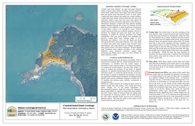
Coastal sand dune geology: Pemaquid Beach, Fish Point, Bristol, Maine
Peter A. Slovinsky and Stephen M. Dickson
Maine Geological Survey, Open-File Map 26-88
-

Coastal sand dune geology: Peter Cove, Harpswell, Maine
Peter A. Slovinsky and Stephen M. Dickson
Maine Geological Survey, Open-File Map 26-191
-

Coastal sand dune geology: Pier Road, Pleasant Point and Eastport and Perry, Maine
Peter A. Slovinsky and Stephen M. Dickson
Maine Geological Survey, Open-File Map 26-167
-

Coastal sand dune geology: Pine Point Beach, Scarborough, Maine
Peter A. Slovinsky and Stephen M. Dickson
Maine Geological Survey, Open-File Map 26-45
-

Coastal sand dune geology: Pine Point Beach, Scarborough River, Scarborough, Maine
Peter A. Slovinsky and Stephen M. Dickson
Maine Geological Survey, Open-File Map 26-46
-

Coastal sand dune geology: Pleasant Island, Muscle Ridge Twp, Maine
Peter A. Slovinsky and Stephen M. Dickson
Maine Geological Survey, Open-File Map 26-92
-

Coastal sand dune geology: Pobblestone Cove, Jonesport, Maine
Peter A. Slovinsky and Stephen M. Dickson
Maine Geological Survey, Open-File Map 26-131
-

Coastal sand dune geology: Point of Main, Machiasport, Maine
Peter A. Slovinsky and Stephen M. Dickson
Maine Geological Survey, Open-File Map 26-244
-

Coastal sand dune geology: Pond Cove Brook and Chimney Rock, Cape Elizabeth, Maine
Peter A. Slovinsky and Stephen M. Dickson
Maine Geological Survey, Open-File Map 26-60
-

Coastal sand dune geology: Potts Point, Harpswell, Maine
Peter A. Slovinsky and Stephen M. Dickson
Maine Geological Survey, Open-File Map 26-186
-

Coastal sand dune geology: Prospect Harbor Point, Gouldsboro, Maine
Peter A. Slovinsky and Stephen M. Dickson
Maine Geological Survey, Open-File Map 26-118
-

Coastal sand dune geology: Prospect Point, Gouldsboro, Maine
Peter A. Slovinsky and Stephen M. Dickson
Maine Geological Survey, Open-File Map 26-116
-

Coastal sand dune geology: Quahog Lane, Harpswell, Maine
Peter A. Slovinsky and Stephen M. Dickson
Maine Geological Survey, Open-File Map 26-201
-

Coastal sand dune geology: Quoddy, Eastport, Maine
Peter A. Slovinsky and Stephen M. Dickson
Maine Geological Survey, Open-File Map 26-258
-

Coastal sand dune geology: Raynes Neck, York, Maine
Peter A. Slovinsky and Stephen M. Dickson
Maine Geological Survey, Open-File Map 26-260.
-

Coastal sand dune geology: Reed Cove, Harpswell, Maine
Peter A. Slovinsky and Stephen M. Dickson
Maine Geological Survey, Open-File Map 26-199
-

Coastal sand dune geology: Richmond Island, Cape Elizabeth, Maine
Peter A. Slovinsky and Stephen M. Dickson
Maine Geological Survey, Open-File Map 26-55
-

Coastal sand dune geology: Roque Bluffs Beach, Roque Bluffs, Maine
Peter A. Slovinsky and Stephen M. Dickson
Maine Geological Survey, Open-File Map 26-136
-

Coastal sand dune geology: Roque Island Harbor, Jonesport, Maine
Peter A. Slovinsky and Stephen M. Dickson
Maine Geological Survey, Open-File Map 26-133
-

Coastal sand dune geology: Rumell Island, Tremont, Maine
Peter A. Slovinsky and Stephen M. Dickson
Maine Geological Survey, Open-File Map 26-221
-

Coastal sand dune geology: Russell Road, Cumberland, Maine
Peter A. Slovinsky and Stephen M. Dickson
Maine Geological Survey, Open-File Map 26-179
-

Coastal sand dune geology: Sand Cove, Beals, Maine
Peter A. Slovinsky and Stephen M. Dickson
Maine Geological Survey, Open-File Map 26-238
-

Coastal sand dune geology: Sand Cove, Gouldsboro, Maine
Peter A. Slovinsky and Stephen M. Dickson
Maine Geological Survey, Open-File Map 26-119
-

Coastal sand dune geology: Sandy Cove, Harpswell, Maine
Peter A. Slovinsky and Stephen M. Dickson
Maine Geological Survey, Open-File Map 26-85
-

Coastal sand dune geology: Sandy River Beach, Jonesport, Maine
Peter A. Slovinsky and Stephen M. Dickson
Maine Geological Survey, Open-File Map 26-132
-

Coastal sand dune geology: Scabby Islands, Machiasport, Maine
Peter A. Slovinsky and Stephen M. Dickson
Maine Geological Survey, Open-File Map 26-242
-

Coastal sand dune geology: Scarborough Beach, Prouts Neck, Scarborough, Maine
Peter A. Slovinsky and Stephen M. Dickson
Maine Geological Survey, Open-File Map 26-50
-

Coastal sand dune geology: Scarborough Beach, Scarborough, Maine
Peter A. Slovinsky and Stephen M. Dickson
Maine Geological Survey, Open-File Map 26-52
-

Coastal sand dune geology: Scarborough Beach State Park, Scarborough, Maine
Peter A. Slovinsky and Stephen M. Dickson
Maine Geological Survey, Open-File Map 26-51
-

Coastal sand dune geology: Seal Cove Ledge, Cutler, Maine
Peter A. Slovinsky and Stephen M. Dickson
Maine Geological Survey, Open-File Map 26-150
-

Coastal sand dune geology: Seal Cove, Portland, Maine
Peter A. Slovinsky and Stephen M. Dickson
Maine Geological Survey, Open-File Map 26-174
-

Coastal sand dune geology: Seal Harbor, Mount Desert, Maine
Peter A. Slovinsky and Stephen M. Dickson
Maine Geological Survey, Open-File Map 26-105
-

Coastal sand dune geology: Seapoint Beach, Cutts Island, Kittery, Maine
Peter A. Slovinsky and Stephen M. Dickson
Maine Geological Survey, Open-File Map 26-7
-

Coastal sand dune geology: Seashore Avenue and Wharf Cove, Portland, Maine
Peter A. Slovinsky and Stephen M. Dickson
Maine Geological Survey, Open-File Map 26-63
-

Coastal sand dune geology: Seashore Avenue, Portland, Maine
Peter A. Slovinsky and Stephen M. Dickson
Maine Geological Survey, Open-File Map 26-62
-

Coastal sand dune geology: Seavey and Stone Islands, Saint George, Maine
Peter A. Slovinsky and Stephen M. Dickson
Maine Geological Survey, Open-File Map 26-213
-

Coastal sand dune geology: Seawall Beach, Sprague River, Phippsburg, Maine
Peter A. Slovinsky and Stephen M. Dickson
Maine Geological Survey, Open-File Map 26-86
-

Coastal sand dune geology: Seawall Picnic Area, Southwest Harbor, Maine
Peter A. Slovinsky and Stephen M. Dickson
Maine Geological Survey, Open-File Map 26-102
-

Coastal sand dune geology: Seawall Pond, Southwest Harbor, Maine
Peter A. Slovinsky and Stephen M. Dickson
Maine Geological Survey, Open-File Map 26-224
-

Coastal sand dune geology: Seawall Pond, Southwest Harbor, Maine
Peter A. Slovinsky and Stephen M. Dickson
Maine Geological Survey, Open-File Map 26-103
-

Coastal sand dune geology: Shoppee Island, Roque Bluffs, Maine
Peter A. Slovinsky and Stephen M. Dickson
Maine Geological Survey, Open-File Map 26-241
-

Coastal sand dune geology: Short Sands Beach, York, Maine
Peter A. Slovinsky and Stephen M. Dickson
Maine Geological Survey, Open-File Map 26-12
-

Coastal sand dune geology: Sisters Point, Gerrish Island, Kittery, Maine
Peter A. Slovinsky and Stephen M. Dickson
Maine Geological Survey, Open-File Map 26-5
-

Coastal sand dune geology: Small Point Beach, Phippsburg, Maine
Peter A. Slovinsky and Stephen M. Dickson
Maine Geological Survey, Open-File Map 26-206
-

Coastal sand dune geology: Southern Louds Island, Bristol, Maine
Peter A. Slovinsky and Stephen M. Dickson
Maine Geological Survey, Open-File Map 26-207
-

Coastal sand dune geology: South Lubec Road, Lubec, Maine
Peter A. Slovinsky and Stephen M. Dickson
Maine Geological Survey, Open-File Map 26-164
-

Coastal sand dune geology: South Trescott, Lubec and Trescott Twp, Maine
Peter A. Slovinsky and Stephen M. Dickson
Maine Geological Survey, Open-File Map 26-158
-

Coastal sand dune geology: Spruce Point and Wonsqueak Harbor, Gouldsboro, Maine
Peter A. Slovinsky and Stephen M. Dickson
Maine Geological Survey, Open-File Map 26-114
-

Coastal sand dune geology: Stage Island, Biddeford, Maine
Peter A. Slovinsky and Stephen M. Dickson
Maine Geological Survey, Open-File Map 26-169
-

Coastal sand dune geology: Stanley Point, Steuben, Maine
Peter A. Slovinsky and Stephen M. Dickson
Maine Geological Survey, Open-File Map 26-121
-

Coastal sand dune geology: Starboard Creek, Machiasport, Maine
Peter A. Slovinsky and Stephen M. Dickson
Maine Geological Survey, Open-File Map 26-140
-

Coastal sand dune geology: Starboard Island, Machiasport, Maine
Peter A. Slovinsky and Stephen M. Dickson
Maine Geological Survey, Open-File Map 26-139
-

Coastal sand dune geology: Starboard, Machiasport, Maine
Peter A. Slovinsky and Stephen M. Dickson
Maine Geological Survey, Open-File Map 26-141
-

Coastal sand dune geology: Stepping Stone Brook, Vinalhaven, Maine
Peter A. Slovinsky and Stephen M. Dickson
Maine Geological Survey, Open-File Map 26-219
-

Coastal sand dune geology: Strawberry Hill Beach, Cape Elizabeth, Maine
Peter A. Slovinsky and Stephen M. Dickson
Maine Geological Survey, Open-File Map 26-54
-

Coastal sand dune geology: Sturdivant Island, Cumberland, Maine
Peter A. Slovinsky and Stephen M. Dickson
Maine Geological Survey, Open-File Map 26-178
-

Coastal sand dune geology: Surfside Beach, Old Orchard Beach, Maine
Peter A. Slovinsky and Stephen M. Dickson
Maine Geological Survey, Open-File Map 26-43
-

Coastal sand dune geology: Tank Farm, South Portland and Portland, Maine
Peter A. Slovinsky and Stephen M. Dickson
Maine Geological Survey, Open-File Map 26-171
-

Coastal sand dune geology: Tarrs Cove, Vinalhaven, Maine
Peter A. Slovinsky and Stephen M. Dickson
Maine Geological Survey, Open-File Map 26-218
-

Coastal sand dune geology: The Brothers, Falmouth, Maine
Peter A. Slovinsky and Stephen M. Dickson
Maine Geological Survey, Open-File Map 26-176