


The Maine Geological Survey provides the people and businesses of Maine with essential geologic information about the land where we live and work.
Note: Many state documents are offered in PDF format. To view PDF documents, you will need the free Adobe Reader. If you need assistance, view our Maine government PDF Help page or contact the contributing Maine State agency via the link on the left sidebar under “Links”.
-

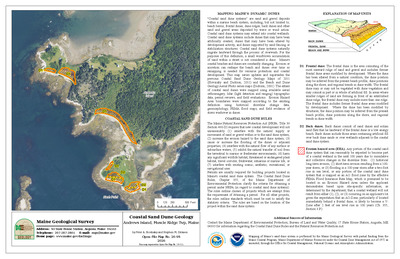
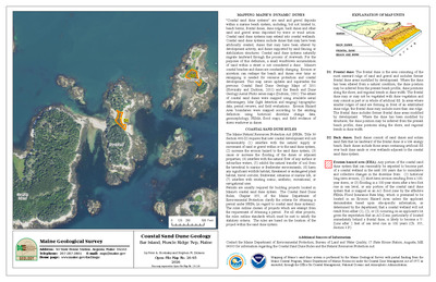
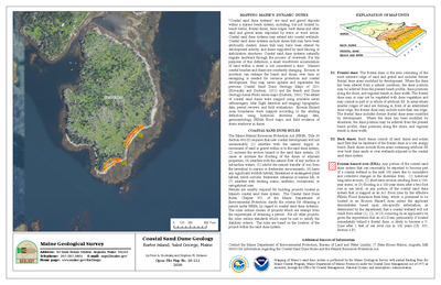
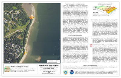
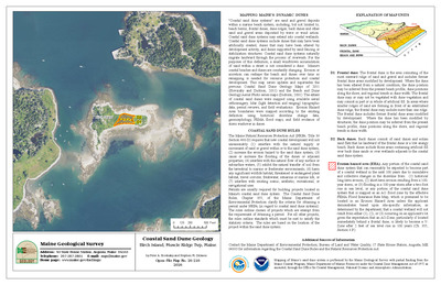
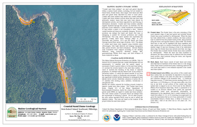
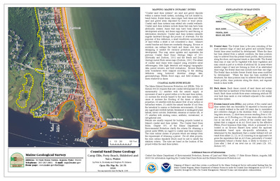
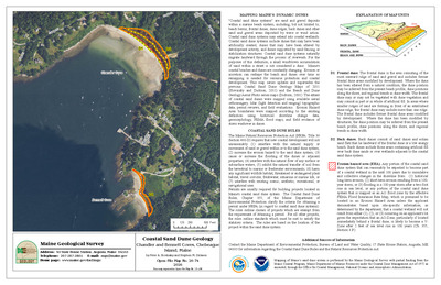
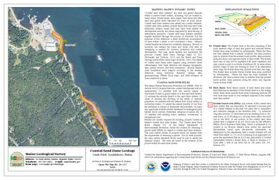
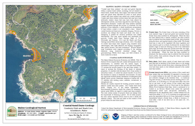
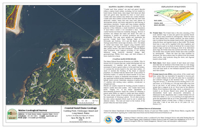
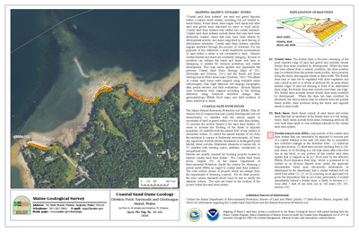
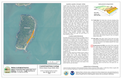
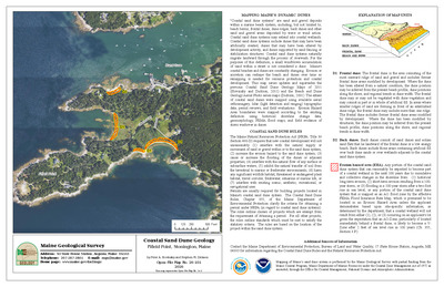
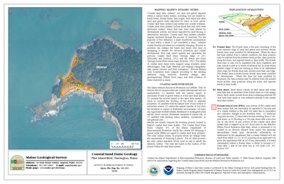
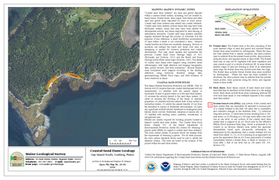
Coastal sand dune map of Higgins Beach, Scarborough, Maine
Stephen M. Dickson
Maine Geological Survey, Open-File Map 90-8 (Superseded by Dickson, 2001, Maine Geological Survey, Open-file Maps 01-422, 01-423)
-

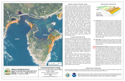
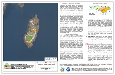
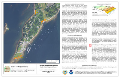
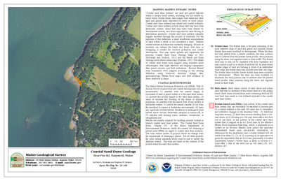
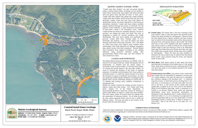
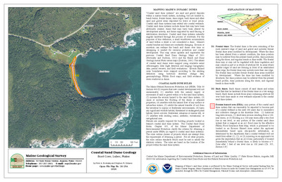
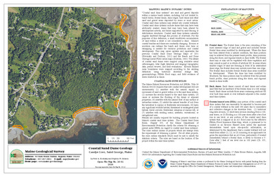
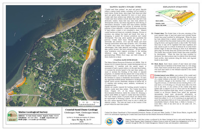
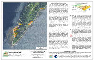
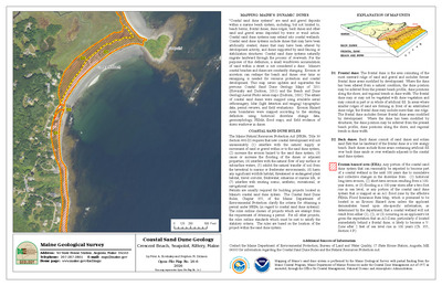
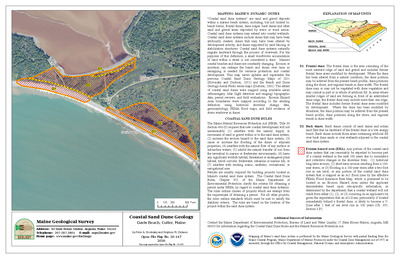
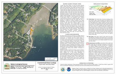
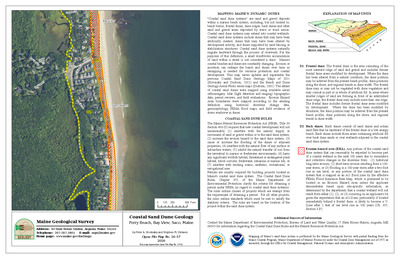
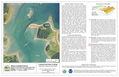
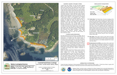
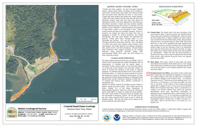
Coastal sand dune map of Hills Beach, Biddeford, Maine
Stephen M. Dickson
Maine Geological Survey, Open-File Map 90-9 (Superseded by Dickson, 2001, Maine Geological Survey, Open-file Maps 01-424, 01-425, 01-426)
-

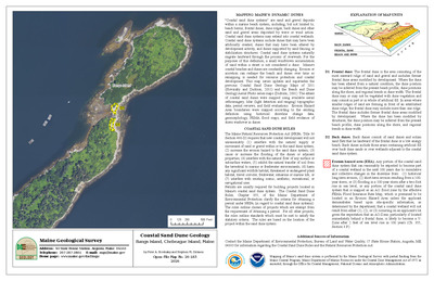
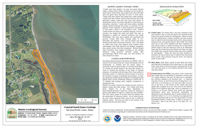
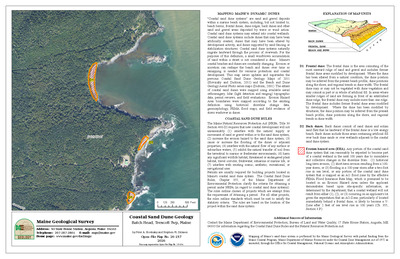
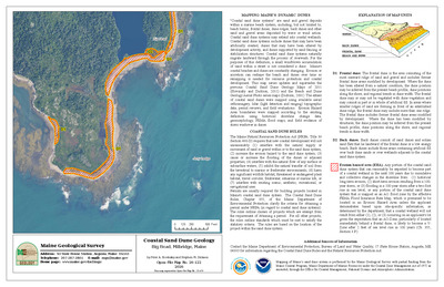
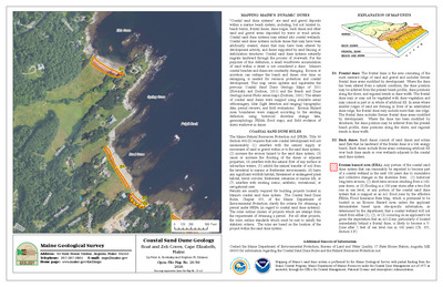
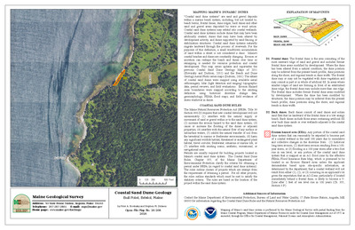
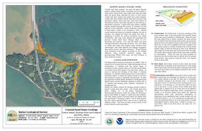
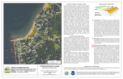
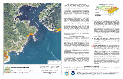
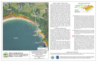
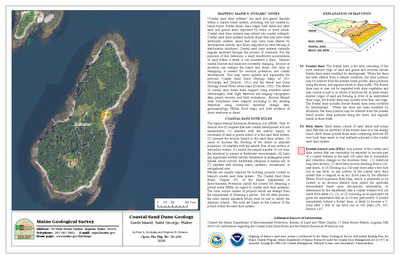
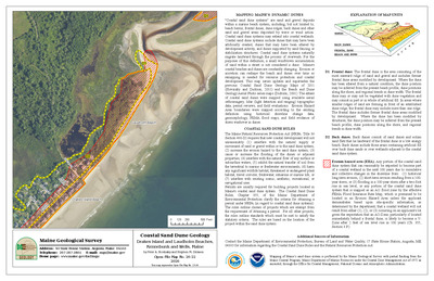
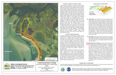
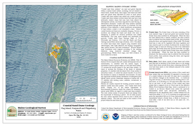
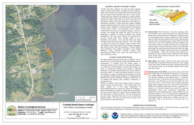
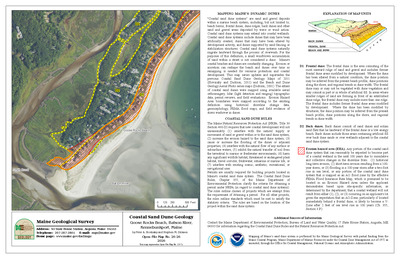
Coastal sand dune map of Horseshoe, New Barn, and Curtis Cove Beaches, Biddeford, Maine
Stephen M. Dickson
Maine Geological Survey, Open-File Map 90-10 (Superseded by Dickson, 2001, Maine Geological Survey, Open-file Maps 01-427, 01-428)
-

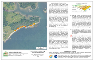
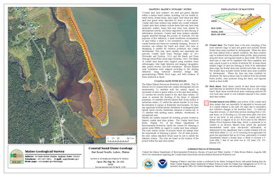
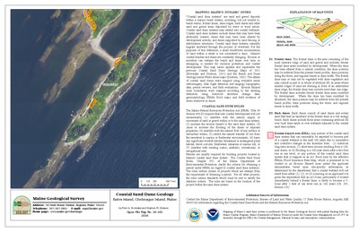
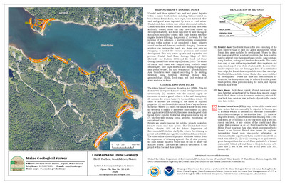
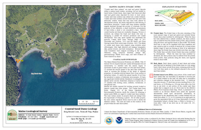
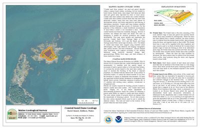
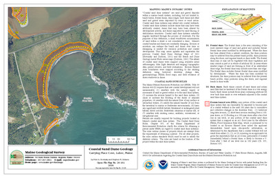
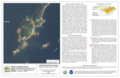
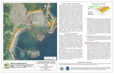
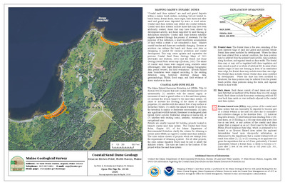
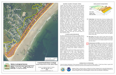
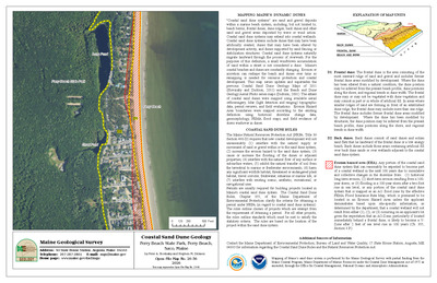
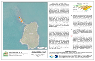
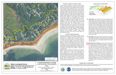
Coastal sand dune map of Kennebunk Beaches, Kennebunk, Maine
Stephen M. Dickson
Maine Geological Survey, Open-File Map 90-11 (Superseded by Dickson, 2001, Maine Geological Survey, Open-file Maps 01-429, 01-430, 01-431, 01-432)
-

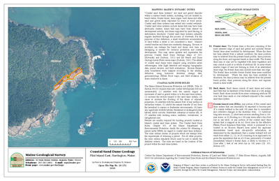
Coastal sand dune map of Long and Short Sand Beaches, York, Maine
Stephen M. Dickson
Maine Geological Survey, Open-File Map 90-12 (Superseded by Dickson, 2001, Maine Geological Survey, Open-file Maps 01-433, 01-434, 01-435, 01-436, 01-437)
-

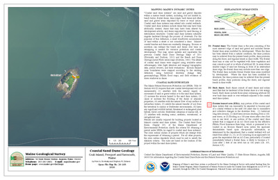
Coastal sand dune map of Moody Beach, Wells, Maine
Stephen M. Dickson
Maine Geological Survey, Open-File Map 90-13 (Superseded by Dickson, 2001, Maine Geological Survey, Open-file Maps 01-438, 01-439, 01-440, 01-441)
-

Coastal sand dune map of Ogunquit Beach, Wells, Maine
Stephen M. Dickson
Maine Geological Survey, Open-File Map 90-14 (Superseded by Dickson, 2001, Maine Geological Survey, Open-file Maps 01-442, 01-443, 01-444)
-

Coastal sand dune map of Old Orchard and Ocean Park Beaches, Old Orchard Beach, Maine
Stephen M. Dickson
Maine Geological Survey, Open-File Map 90-15 (Superseded by Dickson, 2001, Maine Geological Survey, Open-file Maps 01-446, 01-447, 01-448)
-

Coastal sand dune map of Old Orchard and Surfside Beaches, Old Orchard Beach, Maine
Stephen M. Dickson
Maine Geological Survey, Open-File Map 90-16 (Superseded by Dickson, 2001, Maine Geological Survey, Open-file Maps 01-449, 01-450, 01-451)
-

Coastal sand dune map of Pine Point and Grand Beaches, Scarborough, Maine
Stephen M. Dickson
Maine Geological Survey, Open-File Map 90-17 (Superseded by Dickson, 2001, Maine Geological Survey, Open-file Maps 01-452, 01-453, 01-454)
-

Coastal sand dune map of Popham and Hunnewell Beaches, Phippsburg, Maine
Stephen M. Dickson
Maine Geological Survey, Open-File Map 90-18 (Superseded by Dickson, 2001, Maine Geological Survey, Open-file Maps 01-455, 01-456, 01-457, 01-458)
-

Coastal sand dune map of Scarborough, Western, and Ferry Beaches, Scarborough, Maine
Stephen M. Dickson
Maine Geological Survey, Open-File Map 90-19 (Superseded by Dickson, 2001, Maine Geological Survey, Open-file Maps 01-463, 01-464, 01-465, 01-466, 01-467, 01-468, 01-469)
-

Coastal sand dune map of Seawall and Popham Beaches, Phippsburg, Maine
Stephen M. Dickson
Maine Geological Survey, Open-File Map 90-20 (Superseded by Dickson, 2001, Maine Geological Survey, Open-file Maps 01-470, 01-471, 01-472, 01-473)
-

Coastal sand dune map of Wells Beach, Wells, Maine
Stephen M. Dickson
Maine Geological Survey, Open-File Map 90-21 (Superseded by Dickson, 2001, Maine Geological Survey, Open-file Maps 01-474, 01-475, 01-476, 01-477)
-

Gravity study of the Bottle Lake complex
William E. Doll and Stephen S. Potts
Maine Geological Survey, Open-File Report 90-25c. Analysis of gravity data to generate contoured gravity anomaly maps and models of the complex's geometry at depth. Includes Bouguer gravity anomaly map.
-

Photo-lineament mapping at 1:40,000 scale in the Sebago batholith and Bottle Lake complex of Maine
Consultant Consultant
Maine Geological Survey, Open-File Report 90-25a. Interpretation of photo-lineaments from aerial photography and comparison to geologic and hydrologic features. Includes 3 maps of photolinears.
-

Revised bedrock geology of the Danforth, Scraggly Lake, Forest, Waite, Vanceboro, and Kellyland 15' quadrangles, Maine: report of mapping progress, June - August, 1989
Allan Ludman
Maine Geological Survey, Open-File Report 90-42
-

Tectonic fabrics of the Passadumkeag River pluton, Bottle Lake complex, Springfield and Scraggly Lake 15-minute quadrangles
John T. Hopeck
Maine Geological Survey, Open-File Report 90-25b. Discussion of brittle and ductile shear fabrics and relation to Late Acadian tectonics in eastern Maine. Includes bedrock geologic map.
-

Mount Desert Bedrock Geology Map
Richard A. Gilman, Carleton A. Chapman, Thomas V. Lowell, and Harold W. Borns Jr
Maine Geological Survey, Bulletin 38 (Superseded by Braun, 2018, Maine Geological Survey Geologic Map 18-16)
-

Mount Desert Surficial Geology Map
Richard A. Gilman, Carleton A. Chapman, Thomas V. Lowell, and Harold W. Borns Jr
Maine Geological Survey, Bulletin 38 (Superseded by Braun, Lowell, and Weddle, 2016, Maine Geological Survey Open-File 16-1)
-

Bedrock geology of portions of the North East Carry and Moosehead Lake quadrangles, Maine
Ruth Simmons
Maine Geological Survey, Open-File Report 87-22
-

Bedrock geology of the Camden Hills area, central coastal Maine
Henry N. Berry IV
Maine Geological Survey, Open-File Report 87-26. Describes stratigraphy, igneous rocks, structure, and metamorphism. Maps include bedrock geology, tectonic and metamorphic features, and cross section.
-

Bouguer gravity anomaly map of the Waterville, Maine, 15-minute quadrangle
Stephen S. Potts and William E. Doll
Maine Geological Survey, Open-File Report 87-21. Discusses models to explain 3-dimensional shape of bodies shown by gravity values.
-

Geologic map of the Caribou and northern Presque Isle quadrangles, Maine
David C. Roy
Maine Geological Survey, Open-File Report 87-2. Includes discussion of paleontology of area. Map includes 2 cross sections.
-

Inventory and bibliography of Maine landslides
Irwin D. Novak
Maine Geological Survey, Open-File Report 87-3. Lists location, date, type, and material of landslides.
-

Reconnaissance surficial geology of the Norridgewock quadrangle, Maine
Thomas K. Weddle
Maine Geological Survey, Open-File Map 87-23
-

Surficial geology of the Bangor 1 x 2 degree quadrangle, Maine
Woodrow B. Thompson
Maine Geological Survey, Open-File Map 87-9.
-

Surficial geology of the Bath 1 x 2 degree quadrangle, Maine
Woodrow B. Thompson
Maine Geological Survey, Open-File Map 87-8.
-

Surficial geology of the Campbellton 1 x 2 degree quadrangle, Maine
Thomas V. Lowell
Maine Geological Survey, Open-File Map 87-18.
-

Surficial geology of the Eastport 1 x 2 degree quadrangle, Maine
Woodrow B. Thompson and Thomas V. Lowell
Maine Geological Survey, Open-File Map 87-10.
-

Surficial geology of the Edmundston 1 x 2 degree quadrangle, Maine
Thomas V. Lowell
Maine Geological Survey, Open-File Map 87-17
-

Surficial geology of the Fredericton 1 x 2 degree quadrangle, Maine
Thomas V. Lowell
Maine Geological Survey, Open-File Map 87-13.
-

Surficial geology of the Lewiston 1 x 2 degree quadrangle, Maine
Woodrow B. Thompson
Maine Geological Survey, Open-File Map 87-7.
-

Surficial geology of the Millinocket 1 x 2 degree quadrangle, Maine
Lindley S. Hanson, Dabney W. Caldwell, and Thomas V. Lowell
Maine Geological Survey, Open-File Map 87-12.
-

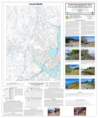
Surficial geology of the Portland 1 x 2 degree quadrangle, Maine
Woodrow B. Thompson
Maine Geological Survey, Open-File Map 87-6.
-

Surficial geology of the Presque Isle 1 x 2 degree quadrangle, Maine
Thomas V. Lowell
Maine Geological Survey, Open-File Map 87-15
-

Surficial geology of the Quebec 1 x 2 degree quadrangle, Maine
Thomas V. Lowell
Maine Geological Survey, Open-File Map 87-14.
-

Surficial geology of the Sherbrooke 1 x 2 degree quadrangle, Maine
Dabney W. Caldwell and Thomas V. Lowell
Maine Geological Survey, Open-File Map 87-11.
-

Surficial geology of the Woodstock 1 x 2 degree quadrangle, Maine
Thomas V. Lowell
Maine Geological Survey, Open-File Map 87-16
-

Lineaments, high-yield bedrock wells, and potential bedrock recharge areas in the Bangor 2 degree sheet
Consultant Consultant
Maine Geological Survey, Open-File Map 86-69. Bangor
-

Lineaments, high-yield bedrock wells, and potential bedrock recharge areas in the Maine portion of the Eastport 2 degree sheet
Consultant Consultant
Maine Geological Survey, Open-File Map 86-70. Eastport
-

Lineaments, high-yield bedrock wells, and potential bedrock recharge areas in the Maine portion of the Lewiston 2 degree sheet
Consultant Consultant
Maine Geological Survey, Open-File Map 86-68. Lewiston
-

Lineaments, high-yield bedrock wells, and potential bedrock recharge areas in the Maine portion of the Portland and Bath 2 degree sheets
Consultant Consultant
Maine Geological Survey, Open-File Map 86-67. Portland and Bath
-

Lineaments, high-yield bedrock wells, and potential bedrock recharge areas in the Maine portion of the Sherbrooke 2 degree sheet
Consultant Consultant
Maine Geological Survey, Open-File Map 86-71. Sherbrooke
-

Preliminary report on the bedrock geology of the Devils Head, Robbinston, and Red Beach 7.5-minute quadrangles, Maine
Richard N. Abbott Jr
Maine Geological Survey, Open-File Report 86-73
-

Reconnaissance surficial geology of the Allagash Falls quadrangle, Maine
Thomas V. Lowell
Maine Geological Survey, Open-File Map 86-41
-

Reconnaissance surficial geology of the Allagash quadrangle, Maine
Thomas V. Lowell
Maine Geological Survey, Open-File Map 86-40
-

Reconnaissance surficial geology of the Anson quadrangle, Maine
Dabney W. Caldwell
Maine Geological Survey, Open-File Map 86-28
-

Reconnaissance surficial geology of the Beau Lake quadrangle, Maine
Thomas V. Lowell
Maine Geological Survey, Open-File Map 86-42
-

Reconnaissance surficial geology of the Big Lake quadrangle, Maine
William R. Holland
Maine Geological Survey, Open-File Map 86-61
-

Reconnaissance surficial geology of the Brooks quadrangle, Maine
Geoffrey W. Smith and Woodrow B. Thompson
Maine Geological Survey, Open-File Map 86-2
-

Reconnaissance surficial geology of the Burnham quadrangle, Maine
Geoffrey W. Smith
Maine Geological Survey, Open-File Map 86-3
-

Reconnaissance surficial geology of the Caribou quadrangle, Maine
Andrew N. Genes
Maine Geological Survey, Open-File Map 86-59
-

Reconnaissance surficial geology of the Castine quadrangle, Maine
Woodrow B. Thompson and Geoffrey W. Smith
Maine Geological Survey, Open-File Map 86-9
-

Reconnaissance surficial geology of the Depot Lake quadrangle, Maine
Thomas V. Lowell
Maine Geological Survey, Open-File Map 86-43
-

Reconnaissance surficial geology of the Farmington quadrangle, Maine
Dabney W. Caldwell
Maine Geological Survey, Open-File Map 86-29
-

Reconnaissance surficial geology of the First Roach Pond quadrangle, Maine
Dabney W. Caldwell, Lindley S. Hanson, and Thomas Brewer
Maine Geological Survey, Open-File Map 86-30
-

Reconnaissance surficial geology of the Fish River Lake quadrangle, Maine
Eric F. Halter
Maine Geological Survey, Open-File Map 86-48
-

Reconnaissance surficial geology of the Forest quadrangle, Maine
Thomas Brewer
Maine Geological Survey, Open-File Map 86-55
-

Reconnaissance surficial geology of the Fort Fairfield quadrangle, Maine
Andrew N. Genes
Maine Geological Survey, Open-File Map 86-54
-

Reconnaissance surficial geology of the Great Pond quadrangle, Maine
William R. Holland
Maine Geological Survey, Open-File Map 86-62
-

Reconnaissance surficial geology of the Greenville quadrangle, Maine
Dabney W. Caldwell, Lindley S. Hanson, and Uldis Kaktins
Maine Geological Survey, Open-File Map 86-31
-

Reconnaissance surficial geology of the Howe Brook quadrangle, Maine
Thomas Brewer, Andrew N. Genes, and William A. Newman
Maine Geological Survey, Open-File Map 86-53
-

Reconnaissance surficial geology of the Jo-Mary Mountain quadrangle, Maine
Lindley S. Hanson and Dabney W. Caldwell
Maine Geological Survey, Open-File Map 86-32
-

Reconnaissance surficial geology of the Kellyland quadrangle, Maine
Thomas Brewer
Maine Geological Survey, Open-File Map 86-56
-

Reconnaissance surficial geology of the Kingsbury quadrangle, Maine
Lindley S. Hanson and Dabney W. Caldwell
Maine Geological Survey, Open-File Map 86-33
-

Reconnaissance surficial geology of the Lead Mountain quadrangle, Maine
William R. Holland
Maine Geological Survey, Open-File Map 86-63
-

Reconnaissance surficial geology of the Liberty quadrangle, Maine
Geoffrey W. Smith
Maine Geological Survey, Open-File Map 86-4
-

Reconnaissance surficial geology of the Little Bigelow Mountain quadrangle, Maine
Harold W. Borns Jr
Maine Geological Survey, Open-File Map 86-20
-

Reconnaissance surficial geology of the Little East Lake quadrangle, Maine
Thomas V. Lowell
Maine Geological Survey, Open-File Map 86-44
-

Reconnaissance surficial geology of the Millinocket quadrangle, Maine
William A. Newman
Maine Geological Survey, Open-File Map 86-60
-

Reconnaissance surficial geology of the Moosehead Lake quadrangle, Maine
Andrew N. Genes, Dabney W. Caldwell, and Lindley S. Hanson
Maine Geological Survey, Open-File Map 86-34
-

Reconnaissance surficial geology of the Nicatous Lake quadrangle, Maine
William R. Holland
Maine Geological Survey, Open-File Map 86-22
-

Reconnaissance surficial geology of the Norcross quadrangle, Maine
Andrew N. Genes and Willam A. Newman
Maine Geological Survey, Open-File Map 86-50
-

Reconnaissance surficial geology of the Palermo quadrangle, Maine
Geoffrey W. Smith
Maine Geological Survey, Open-File Map 86-5
-

Reconnaissance surficial geology of the Pittsfield quadrangle, Maine
Lindley S. Hanson and Dabney W. Caldwell
Maine Geological Survey, Open-File Map 86-35
-

Reconnaissance surficial geology of the Ragged Lake quadrangle, Maine
Lindley S. Hanson
Maine Geological Survey, Open-File Map 86-36
-

Reconnaissance surficial geology of the Razorville quadrangle, Maine
Geoffrey W. Smith and Woodrow B. Thompson
Maine Geological Survey, Open-File Map 86-66
-

Reconnaissance surficial geology of the Rocky Brook quadrangle, Maine
Thomas V. Lowell
Maine Geological Survey, Open-File Map 86-45
-

Reconnaissance surficial geology of the Rocky Mountain quadrangle, Maine
Thomas V. Lowell
Maine Geological Survey, Open-File Map 86-46
-

Reconnaissance surficial geology of the Round Pond quadrangle, Maine
Thomas V. Lowell
Maine Geological Survey, Open-File Map 86-47
-

Reconnaissance surficial geology of the Searsmont quadrangle, Maine
Geoffrey W. Smith and Woodrow B. Thompson
Maine Geological Survey, Open-File Map 86-65
-

Reconnaissance surficial geology of the Sebec Lake quadrangle, Maine
Lindley S. Hanson and Dabney W. Caldwell
Maine Geological Survey, Open-File Map 86-37
-

Reconnaissance surficial geology of the Skowhegan quadrangle, Maine
Lindley S. Hanson and Dabney W. Caldwell
Maine Geological Survey, Open-File Map 86-38
-

Reconnaissance surficial geology of the Smyrna Mills quadrangle, Maine
Thomas Brewer and William A. Newman
Maine Geological Survey, Open-File Map 86-57
-

Reconnaissance surficial geology of the Springfield quadrangle, Maine
William R. Holland
Maine Geological Survey, Open-File Map 86-23
-

Reconnaissance surficial geology of the Stacyville quadrangle, Maine
William A. Newman and Andrew N. Genes
Maine Geological Survey, Open-File Map 86-49
-

Reconnaissance surficial geology of the Stetson quadrangle, Maine
Lindley S. Hanson
Maine Geological Survey, Open-File Map 86-39
-

Reconnaissance surficial geology of the Stratton quadrangle, Maine
Harold W. Borns Jr
Maine Geological Survey, Open-File Map 86-21
-

Reconnaissance surficial geology of the Tug Mountain quadrangle, Maine
William R. Holland
Maine Geological Survey, Open-File Map 86-24
-

Reconnaissance surficial geology of the Vanceboro quadrangle, Maine
Thomas Brewer
Maine Geological Survey, Open-File Map 86-58
-

Reconnaissance surficial geology of the Vinalhaven quadrangle, Maine
Geoffrey W. Smith
Maine Geological Survey, Open-File Map 86-52
-

Reconnaissance surficial geology of the Wabassus Lake quadrangle, Maine
William R. Holland
Maine Geological Survey, Open-File Map 86-25
-

Reconnaissance surficial geology of the Washington quadrangle, Maine
Geoffrey W. Smith
Maine Geological Survey, Open-File Map 86-64
-

Reconnaissance surficial geology of the Waterville quadrangle, Maine
Geoffrey W. Smith
Maine Geological Survey, Open-File Map 86-51
-

Reconnaissance surficial geology of the Wesley quadrangle, Maine
William R. Holland and Harold W. Borns Jr
Maine Geological Survey, Open-File Map 86-26
-

Reconnaissance surficial geology of the Wytopitlock quadrangle, Maine
William A. Newman and William R. Holland
Maine Geological Survey, Open-File Map 86-27.
-

Bedrock geologic map of Maine
Philip H. Osberg, Arthur M. Hussey II, and Gary M. Boone
Maine Geological Survey. A 42" x 57", a color wall map showing the bedrock geology of Maine. Ages of rocks in color, lithologies differentiated by patterns, inset map of tectonic features, map of metamorphic zones, correlation chart, and extensive reference list.
-

Bedrock geology of the Caucomgomoc Lake area, Maine
Stephen G. Pollock
Maine Geological Survey, Open-File Map 85-85. Includes parts of Allagash Lake, St. John Pond, Caucomogomoc Lake, and North East Carry 15' quadrangles
-

Bedrock geology of the Palermo 7.5' quadrangle, Maine
Donald W. Newberg
Maine Geological Survey, Open-File Report 85-84
-

Bedrock geology of the Pierce Pond 15' quadrangle, Maine
Gary M. Boone
Maine Geological Survey, Open-File Map 85-86
-

Potential zones of high ground water transmissivity in the Bath quadrangle, Maine
Robert G. Gerber
Maine Geological Survey, Open-File Map 85-89d.
-

Potential zones of high ground water transmissivity in the Boothbay Harbor quadrangle, Maine
Robert G. Gerber
Maine Geological Survey, Open-File Map 85-89h.
-

Potential zones of high ground water transmissivity in the Bristol quadrangle, Maine
Robert G. Gerber
Maine Geological Survey, Open-File Map 85-89f.
-

Potential zones of high ground water transmissivity in the Damariscotta quadrangle, Maine
Robert G. Gerber
Maine Geological Survey, Open-File Map 85-89c.
-

Potential zones of high ground water transmissivity in the Pemaquid Point quadrangle, Maine
Robert G. Gerber
Maine Geological Survey, Open-File Map 85-89i.
-

Potential zones of high ground water transmissivity in the Phippsburg quadrangle, Maine
Robert G. Gerber
Maine Geological Survey, Open-File Map 85-89g.
-

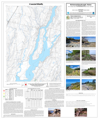
Potential zones of high ground water transmissivity in the Richmond quadrangle, Maine
Robert G. Gerber
Maine Geological Survey, Open-File Map 85-89a.
-

Potential zones of high ground water transmissivity in the Westport quadrangle, Maine
Robert G. Gerber
Maine Geological Survey, Open-File Map 85-89e.
-

Potential zones of high ground water transmissivity in the Wiscasset quadrangle, Maine
Robert G. Gerber
Maine Geological Survey, Open-File Map 85-89b.
-

Surficial geologic map of Maine
Woodrow B. Thompson and Harold W. Borns Jr
Maine Geological Survey. Wall map showing the surficial geology of Maine. Includes sites of special interest, radiocarbon-dated sites, reference list, correlation chart, inset map of inferred extent of ice cover during deglaciation.
-

The bedrock geology of the Bath and Portland 2 degree map sheets, Maine
Arthur M. Hussey II
Maine Geological Survey, Open-File Report 85-87. Detailed description of stratigraphy, intrusive rocks, and structure. Maps of bedrock geology and tectonic features.
-

Water quality in sand and gravel aquifers in York County, Maine
John S. Williams, Andrews L. Tolman, and Cheryl W. Fontaine
Maine Geological Survey, Open-File Report 85-77. Describes regional water quality and discusses water quality at 24 potential contamination sites. Map shows aquifers, recharge areas, contamination sources, and monitoring well sites.
-

Bedrock geology of the Gardiner 15' quadrangle, Maine
Donald W. Newberg
Maine Geological Survey, Open-File Report 84-8
-

Reconnaissance bedrock geology of the Bois Bubert 7.5' quadrangle, Maine
Olcott Gates and Sarah Cary
Maine Geological Survey, Open-File Map 84-11
-

Surficial geology of portions of the Grand Falls Lake area: An investigation of evidence for Holocene faulting
Geoffrey W. Smith
Maine Geological Survey, Open-File Report 84-9. Map shows surficial geology of area bordering inferred bedrock faults.
-

The geology of the Passamaquoddy Bay area, Maine and New Brunswick
Olcott Gates
Maine Geological Survey, Open-File Report 84-10. Discussion of stratigraphy, intrusive rocks, structure, and geophysics.
-

Bedrock geology of the Lewiston 15-minute quadrangle, Maine
Arthur M. Hussey II
Maine Geological Survey, Open-File No. 83-4. Also published in Thompson, Woodrow B., and Kelley, Joseph T. (editors), New England Seismotectonic Study activities in Maine during fiscal year 1982: Maine Geological Survey, contract report for U. S. Nuclear Regulatory Commission, p. 19-31.
-

Gravity survey of the northern Penobscot Valley area, Maine
Peter M. Messier
Maine Geological Survey, Open-File Report 83-5. Includes Bouguer gravity map and map of gravity stations. Appendix contains latitude and longitude of stations, gravity in mgal, and Bouguer anomaly.
-

Maine peat resource evaluation: Androscoggin, Cumberland, and York Counties
Carolyn A. Lepage
Maine Geological Survey, Open-File Map 83-13
-

Maine peat resource evaluation: Franklin and Oxford Counties
Carolyn A. Lepage
Maine Geological Survey, Open-File Map 83-14
-

Maine peat resource evaluation: Kennebec, Knox, Lincoln, Sagadahoc, and Waldo Counties
Carolyn A. Lepage
Maine Geological Survey, Open-File Map 83-15
-

Bedrock geology of the Fredericton 2-degree quadrangle, Maine
Allan Ludman
Maine Geological Survey, Open-File Report 82-30. Discusses stratigraphy, deformation history, and fault systems.
-

Brittle fractures in the Eastport 2-degree sheet, Maine
Olcott Gates
Maine Geological Survey, Open-File Report 82-29. Discusses faults and other brittle fractures.
-

Maine peat resource evaluation
Carolyn A. Lepage and Michael K. Mullen
Maine Geological Survey, Open-File Map 82-14.
-

Maine peat resource evaluation: Aroostook County
Carolyn A. Lepage and Michael K. Mullen
Maine Geological Survey, Open-File Map 82-15
-

Maine peat resource evaluation: Hancock County
Carolyn A. Lepage and Michael K. Mullen
Maine Geological Survey, Open-File Map 82-16
-

Maine peat resource evaluation: Penobscot County
Carolyn A. Lepage and Michael K. Mullen
Maine Geological Survey, Open-File Map 82-17
-

Maine peat resource evaluation: Piscataquis County
Carolyn A. Lepage and Michael K. Mullen
Maine Geological Survey, Open-File Map 82-18
-

Maine peat resource evaluation: Somerset County
Carolyn A. Lepage and Michael K. Mullen
Maine Geological Survey, Open-File Map 82-19
-

Maine peat resource evaluation: Washington County
Carolyn A. Lepage and Michael K. Mullen
Maine Geological Survey, Open-File Map 82-20
-

Reconnaissance surficial geology of the Calais quadrangle, Maine
Harold W. Borns Jr and Bjorn Andersen
Maine Geological Survey, Open-File Map 82-1
-

Reconnaissance surficial geology of the Cherryfield quadrangle, Maine
Harold W. Borns Jr and Bjorn Andersen
Maine Geological Survey, Open-File Map 82-2
-

Reconnaissance surficial geology of the Ellsworth quadrangle, Maine
Harold W. Borns Jr and Bjorn Andersen
Maine Geological Survey, Open-File Map 82-3
-

Reconnaissance surficial geology of the Gardner Lake quadrangle, Maine
Harold W. Borns Jr and Bjorn Andersen
Maine Geological Survey, Open-File Map 82-4
-

Reconnaissance surficial geology of the Grand Lake Seboeis quadrangle, Maine
Andrew N. Genes and William A. Newman
Maine Geological Survey, Open-File Map 82-10
-

Reconnaissance surficial geology of the Millinocket Lake quadrangle, Maine
Andrew N. Genes and William A. Newman
Maine Geological Survey, Open-File Map 82-11
-

Reconnaissance surficial geology of the Mooseleuk Lake quadrangle, Maine
Andrew N. Genes
Maine Geological Survey, Open-File Map 82-9
-

Reconnaissance surficial geology of the Oxbow quadrangle, Maine
Andrew N. Genes and William A. Newman
Maine Geological Survey, Open-File Map 82-12
-

Reconnaissance surficial geology of the Schoodic quadrangle, Maine
Dabney W. Caldwell, Lindley S. Hanson, and Thomas V. Lowell
Maine Geological Survey, Open-File Map 82-6
-

Reconnaissance surficial geology of the Tunk Lake quadrangle, Maine
Harold W. Borns Jr and Bjorn Andersen
Maine Geological Survey, Open-File Map 82-5
-

Bedrock geology of the lower Androscoggin Valley-Casco Bay area, Maine
Arthur M. Hussey II
Maine Geological Survey, Open-File No. 81-29. Description of stratigraphy, intrusive rocks, structure, and metamorphism.
-

Bedrock geology of the Machias, Columbia Falls, and Great Wass Island 15' quadrangles, Maine
Olcott Gates
Maine Geological Survey, Open-File Map 81-11
-
 and transverse faults in the east central part of the Sherbrooke quadrangle (1981) by Gary M. Boone")
Bedrock geology of the State of Maine portion of the Sherbrooke 2-degree quadrangle (1980) and transverse faults in the east central part of the Sherbrooke quadrangle (1981)
Gary M. Boone
Maine Geological Survey, Open-File 81-2. Contains 2 reports emphasizing structure of region.
-

Gravity survey of the Passamaquoddy Bay and southern Penobscot Valley areas
Willy Lehmann Weng
Maine Geological, Survey Open-File 81-88. Includes Bouguer gravity map and map of gravity stations. Appendix contains latitude and longitude of stations, gravity in mgal, and Bouguer anomaly.
-

Reconnaissance bedrock geology of the Bath and Small Point quadrangles, Maine
Arthur M. Hussey
Maine Geological Survey, Open-File No. 81-32
-

Reconnaissance bedrock geology of the Casco Bay quadrangle, Maine
Arthur M. Hussey
Maine Geological Survey, Open-File Map 81-31
-

Reconnaissance bedrock geology of the Freeport 15' quadrangle, Maine
Arthur M. Hussey
Maine Geological Survey, Open-File Map 81-30
-

Reconnaissance bedrock geology of the northern part of the Buckfield quadrangle and adjoining Dixfield quadrangle
Kost A. Pankiwskyj
Maine Geological Survey, Open-File Map 81-45
-

Reconnaissance bedrock geology of the Sherman, Mattawamkeag, and Millinocket 15' quadrangles, Maine
David C. Roy
Maine Geological Survey, Open-File Report 81-46
-

Reconnaissance bedrock geology of the The Forks quadrangle, Maine
William Burroughs and Robert G. Marvinney
Maine Geological Survey, Open-File Map 81-10
-

Reconnaissance bedrock geology of the Wesley quadrangle, Maine
David S. Westerman
Maine Geological Survey, Open-File Map 81-90
-

Reconnaissance surficial geology of the Boyd Lake quadrangle, Maine
Harold W. Borns Jr, Dabney W. Caldwell, and Lindley S. Hanson
Maine Geological Survey, Open-File Map 81-5
-

Reconnaissance surficial geology of the Bridgewater quadrangle, Maine
Thomas Brewer
Maine Geological Survey, Open-File Map 81-8
-

Reconnaissance surficial geology of the Dover-Foxcroft quadrangle, Maine
Lindley S. Hanson and Dabney W. Caldwell
Maine Geological Survey, Open-File Map 81-17
-

Reconnaissance surficial geology of the Eagle Lake quadrangle, Maine
Andrew N. Genes
Maine Geological Survey, Open-File Map 81-12
-

Reconnaissance surficial geology of the Fort Kent quadrangle, Maine
Andrew N. Genes
Maine Geological Survey, Open-File Map 81-14
-

Reconnaissance surficial geology of the Guilford quadrangle, Maine
Lindley S. Hanson and Dabney W. Caldwell
Maine Geological Survey, Open-File Map 81-18.
-

Reconnaissance surficial geology of the Houlton quadrangle, Maine
Thomas Brewer
Maine Geological Survey, Open-File Map 81-9
-

Reconnaissance surficial geology of the Island Falls quadrangle, Maine
William A. Newman
Maine Geological Survey, Open-File Map 81-38
-

Reconnaissance surficial geology of the Katahdin quadrangle, Maine
William A. Newman
Maine Geological Survey, Open-File Map 81-39
-

Reconnaissance surficial geology of the Mattawamkeag quadrangle, Maine
William A. Newman and William R. Holland
Maine Geological Survey, Open-File Map 81-43
-

Reconnaissance surficial geology of the Passadumkeag quadrangle, Maine
Harold W. Borns Jr
Maine Geological Survey, Open-File Map 81-4
-

Reconnaissance surficial geology of the Saponac quadrangle, Maine
William R. Holland
Maine Geological Survey, Open-File Map 81-26
-

Reconnaissance surficial geology of the Shin Pond quadrangle, Maine
William A. Newman
Maine Geological Survey, Open-File Map 81-40
-

Reconnaissance surficial geology of the St. Francis quadrangle, Maine
Andrew N. Genes
Maine Geological Survey, Open-File Map 81-15
-

Reconnaissance surficial geology of the Traveler Mountain quadrangle, Maine
William A. Newman
Maine Geological Survey, Open-File Map 81-42
-

Reconnaissance surficial geology of the Winn quadrangle, Maine
William R. Holland
Maine Geological Survey, Open-File Map 81-28
-

Reconnaissance surficial geology of the Winterville quadrangle, Maine
Andrew N. Genes
Maine Geological Survey, Open-File Map 81-16
-

End Moraines and Glaciofluvial Deposits, Cumberland and York Counties, Maine
Geoffrey W. Smith
Maine Geological Survey. Black and white wall map showing end moraines, eskers and crevasse fillings, and glaciofluvial deposits
-

Geologic structure of the Chain of Ponds pluton and vicinity, northwestern Maine
David S. Westerman
Maine Geological Survey, Open-File Report 80-36. Discussion of structure, contour diagrams of faults and fractures.
-

Preliminary geologic map of the Maine part of the Lewiston 2-degree quadrangle
Kost A. Pankiwskyj and Arthur M. Hussey II
Maine Geological Survey, Open-File Map 80-18 (out of print)
-

Reconnaissance surficial geology of the Amity quadrangle, Maine
Thomas Brewer
Maine Geological Survey, Open-File Map 80-2
-

Reconnaissance surficial geology of the Ashland quadrangle, Maine
Andrew N. Genes
Maine Geological Survey, Open-File Map 80-6
-

Reconnaissance surficial geology of the Danforth quadrangle, Maine
Thomas Brewer
Maine Geological Survey, Open-File Map 80-3
-

Reconnaissance surficial geology of the Greenlaw quadrangle, Maine
Andrew N. Genes
Maine Geological Survey, Open-File Map 80-7
-

Reconnaissance surficial geology of the Lincoln quadrangle, Maine
Thomas V. Lowell
Maine Geological Survey, Open-File Map 80-12
-

Reconnaissance surficial geology of the Mattawamkeag Lake quadrangle, Maine
William A. Newman
Maine Geological Survey, Open-File Map 80-16
-

Reconnaissance surficial geology of the Portage quadrangle, Maine
Andrew N. Genes
Maine Geological Survey, Open-File Map 80-8
-

Reconnaissance surficial geology of the Sebec quadrangle, Maine
Lindley S. Hanson and Dabney W. Caldwell
Maine Geological Survey, Open-File Map 80-10
-

Reconnaissance surficial geology of the Sherman quadrangle, Maine
William A. Newman
Maine Geological Survey, Open-File Map 80-17
-

Report on bedrock and brittle fracture mapping in the Dover-Foxcroft/Dexter area, central Maine
David S. Westerman
Maine Geological Survey, Open-File Report 80-35. Discussion of fractures.
-

Geologic maps of the Kingfield and Anson quadrangles, Maine
Kost A. Pankiwskyj
Maine Geological Survey, Geologic Map GM-7
-

Iron and nitrates in bedrock well water; Cumberland County, Maine
David E. Lewis and Schuyler Ludwig
Maine Geological Survey, Open-File Report 79-18. Maps showing levels of iron and nitrates in sampled wells.
-

Preliminary bedrock geology of the Poland 15' quadrangle, Maine
John W. Creasy
Maine Geological Survey, Open-File Report 79-15
-

Preliminary bedrock geology of the Spencer Lake 15' quadrangle, Maine
William A. Burroughs
Maine Geological Survey, Open-File Report 79-1
-

Preliminary bedrock geology of the Tenants Harbor and a portion of the Friendship 7.5' quadrangles, Maine
Charles V. Guidotti
Maine Geological Survey, Open-File Report 79-16
-

The possibility of Pleistocene-Holocene movement along the Oak Bay fault on the Maine-New Brunswick border
William A. Newman
Maine Geological Survey, Open-File 79-20. Discusses Late Wisconsinan-Holocene history of Oak Bay fault zone.
-

Bedrock geology of the Ashland 15' quadrangle and surrounding area, Maine
David C. Roy
Maine Geological Survey, Open-File Map 78-20. Includes parts of the Greenlaw and Presque Isle 15' quadrangles
-

Geologic map of a portion of northeastern Aroostook County, Maine
David C. Roy
Maine Geological Survey, Open-File Map 78-21. Covers parts of Ashland, Caribou, Portage, Presque Isle, Square Lake, and Stockholm 15' quadrangles
-

Geologic map of the Kingsbury quadrangle, Maine
Allan Ludman
Maine Geological Survey, Geologic Map GM-6
-

Preliminary bedrock and brittle fracture map of the Portland 2-degree quadrangle
Arthur M. Hussey II
Maine Geological Survey, Open-File Map 78-11 (superseded by Hussey, 1987, Maine Geological Survey Open-File 85-87)
-

Reconnaissance bedrock geology of the Buckfield quadrangle, Maine
Kost A. Pankiwskyj
Maine Geological Survey, Open-File Map 78-18
-

Reconnaissance bedrock geology of the Dixfield quadrangle, Maine
Kost A. Pankiwskyj
Maine Geological Survey, Open-File Map 78-15
-

Reconnaissance bedrock geology of the Farmington quadrangle, Maine
Kost A. Pankiwskyj
Maine Geological Survey, Open-File Map 78-16
-

Reconnaissance bedrock geology of the Gardner Lake quadrangle, Maine
Olcott Gates
Maine Geological Survey, Open-File Map 78-3
-

Reconnaissance bedrock geology of the Livermore quadrangle, Maine
Kost A. Pankiwskyj
Maine Geological Survey, Open-File Map 78-19
-

Reconnaissance bedrock geology of the Norridgewock quadrangle, Maine
Kost A. Pankiwskyj
Maine Geological Survey, Open-File Map 78-17
-

Reconnaissance surficial geology of the Mars Hill quadrangle, Maine
Andrew N. Genes
Maine Geological Survey, Open-File Map 78-5
-

Reconnaissance surficial geology of the Presque Isle quadrangle, Maine
Andrew N. Genes
Maine Geological Survey, Open-File Map 78-6
-

Reconnaissance surficial geology of the Square Lake quadrangle, Maine
Andrew N. Genes
Maine Geological Survey, Open-File Map 78-7
-

Reconnaissance surficial geology of the Stockholm quadrangle, Maine
Andrew N. Genes
Maine Geological Survey, Open-File Map 78-8
-

Reconnaissance surficial geology of the Van Buren quadrangle, Maine
Andrew N. Genes
Maine Geological Survey, Open-File Map 78-9
-

Geologic map and cross sections of the Eastport quadrangle, Maine
Olcott Gates
Maine Geological Survey, Geologic Map GM-3
-

Geologic map of the Kezar Falls quadrangle, Maine
Richard A. Gilman
Maine Geological Survey, Geologic Map GM-4
-

Geologic map of the Skowhegan quadrangle, Maine
Allan Ludman
Maine Geological Survey, Geologic Map GM-5
-

Geology of the Oquossoc 15' quadrangle, west-central Maine
Charles W. Guidotti
Maine Geological Survey, Open-File Report 77-2
-

Reconnaissance surficial geology of the Bath quadrangle, Maine
Geoffrey W. Smith
Maine Geological Survey, Open-File Map 77-8
-

Reconnaissance surficial geology of the Blue Hill quadrangle, Maine
Woodrow B. Thompson and Harold W. Borns Jr
Maine Geological Survey, Open-File Map 77-36
-

Reconnaissance surficial geology of the Bois Bubert quadrangle, Maine
Woodrow B. Thompson
Maine Geological Survey, Open-File Map 77-25
-

Reconnaissance surficial geology of the Cross Island quadrangle, Maine
Woodrow B. Thompson
Maine Geological Survey, Open-File Map 77-27
-

Reconnaissance surficial geology of the Farmington Falls quadrangle, Maine
Woodrow B. Thompson
Maine Geological Survey, Open-File Map 77-28 (Superseded by Theis and Millette, 2024, Maine Geological Survey Geologic Map 24-7)
-

Reconnaissance surficial geology of the Great Wass Island quadrangle, Maine
Woodrow B. Thompson
Maine Geological Survey, Open-File Map 77-29
-

Reconnaissance surficial geology of the Harrington quadrangle, Maine
Woodrow B. Thompson
Maine Geological Survey, Open-File Map 77-30
-

Reconnaissance surficial geology of the Jonesport quadrangle, Maine
Woodrow B. Thompson
Maine Geological Survey, Open-File Map 77-31
-

Reconnaissance surficial geology of the Matinicus quadrangle, Maine
Woodrow B. Thompson
Maine Geological Survey, Open-File Map 77-32
-

Reconnaissance surficial geology of the Monhegan quadrangle, Maine
Woodrow B. Thompson and Barry S. Timson
Maine Geological Survey, Open-File Map 77-47
-

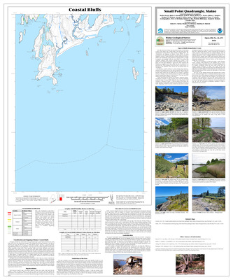
Reconnaissance surficial geology of the Small Point quadrangle, Maine
Geoffrey W. Smith
Maine Geological Survey, Open-File Map 77-17
-

Reconnaissance surficial geology of the Swans Island quadrangle, Maine
Woodrow B. Thompson and Harold W. Borns Jr
Maine Geological Survey, Open-File Map 77-37
-

Coastal marine geologic environments of the Addison quadrangle, Maine
Barry S. Timson
Maine Geological Survey, Open-File Map 76-49
-
![Coastal marine geologic environments of the Augusta SE [Augusta 7.5'] quadrangle, Maine by Barry S. Timson](https://digitalmaine.com/mgs_maps/1180/thumbnail.jpg "Coastal marine geologic environments of the Augusta SE [Augusta 7.5'] quadrangle, Maine by Barry S. Timson")
Coastal marine geologic environments of the Augusta SE [Augusta 7.5'] quadrangle, Maine
Barry S. Timson
Maine Geological Survey, Open-File Map 76-50
-

Coastal marine geologic environments of the Bailey Island quadrangle, Maine
Barry S. Timson
Maine Geological Survey, Open-File Map 76-51
-
![Coastal marine geologic environments of the Bangor SE [Bangor 7.5'] quadrangle, Maine by Barry S. Timson](https://digitalmaine.com/mgs_maps/1131/thumbnail.jpg "Coastal marine geologic environments of the Bangor SE [Bangor 7.5'] quadrangle, Maine by Barry S. Timson")
Coastal marine geologic environments of the Bangor SE [Bangor 7.5'] quadrangle, Maine
Barry S. Timson
Maine Geological Survey, Open-File Map 76-52
-
![Coastal marine geologic environments of the Bar Harbor NE [Winter Harbor 7.5'] quadrangle, Maine by Barry S. Timson](https://digitalmaine.com/mgs_maps/1153/thumbnail.jpg "Coastal marine geologic environments of the Bar Harbor NE [Winter Harbor 7.5'] quadrangle, Maine by Barry S. Timson")
Coastal marine geologic environments of the Bar Harbor NE [Winter Harbor 7.5'] quadrangle, Maine
Barry S. Timson
Maine Geological Survey, Open-File Map 76-53
-
![Coastal marine geologic environments of the Bar Harbor NW [Bar Harbor 7.5'] quadrangle, Maine by Barry S. Timson](https://digitalmaine.com/mgs_maps/1154/thumbnail.jpg "Coastal marine geologic environments of the Bar Harbor NW [Bar Harbor 7.5'] quadrangle, Maine by Barry S. Timson")
Coastal marine geologic environments of the Bar Harbor NW [Bar Harbor 7.5'] quadrangle, Maine
Barry S. Timson
Maine Geological Survey, Open-File Map 76-54
-
![Coastal marine geologic environments of the Bar Harbor SE [Schoodic Head 7.5'] quadrangle, Maine by Barry S. Timson](https://digitalmaine.com/mgs_maps/1155/thumbnail.jpg "Coastal marine geologic environments of the Bar Harbor SE [Schoodic Head 7.5'] quadrangle, Maine by Barry S. Timson")
Coastal marine geologic environments of the Bar Harbor SE [Schoodic Head 7.5'] quadrangle, Maine
Barry S. Timson
Maine Geological Survey, Open-File Map 76-55
-
![Coastal marine geologic environments of the Bar Harbor SW [Seal Harbor 7.5'] quadrangle, Maine by Barry S. Timson](https://digitalmaine.com/mgs_maps/1156/thumbnail.jpg "Coastal marine geologic environments of the Bar Harbor SW [Seal Harbor 7.5'] quadrangle, Maine by Barry S. Timson")
Coastal marine geologic environments of the Bar Harbor SW [Seal Harbor 7.5'] quadrangle, Maine
Barry S. Timson
Maine Geological Survey, Open-File Map 76-56
-
![Coastal marine geologic environments of the Bath NE [Bath 7.5'] quadrangle, Maine by Barry S. Timson](https://digitalmaine.com/mgs_maps/1192/thumbnail.jpg "Coastal marine geologic environments of the Bath NE [Bath 7.5'] quadrangle, Maine by Barry S. Timson")
Coastal marine geologic environments of the Bath NE [Bath 7.5'] quadrangle, Maine
Barry S. Timson
Maine Geological Survey, Open-File Map 76-57
-
![Coastal marine geologic environments of the Bath NW [Brunswick 7.5'] quadrangle, Maine by Barry S. Timson](https://digitalmaine.com/mgs_maps/1182/thumbnail.jpg "Coastal marine geologic environments of the Bath NW [Brunswick 7.5'] quadrangle, Maine by Barry S. Timson")
Coastal marine geologic environments of the Bath NW [Brunswick 7.5'] quadrangle, Maine
Barry S. Timson
Maine Geological Survey, Open-File Map 76-58
-

Coastal marine geologic environments of the Belfast quadrangle, Maine
Barry S. Timson
Maine Geological Survey, Open-File Map 76-59
-

Coastal marine geologic environments of the Biddeford Pool quadrangle, Maine
Barry S. Timson
Maine Geological Survey, Open-File Map 76-61
-

Coastal marine geologic environments of the Biddeford quadrangle, Maine
Barry S. Timson
Maine Geological Survey, Open-File Map 76-60
-
![Coastal marine geologic environments of the Blue Hill NE [Blue Hill 7.5'] quadrangle, Maine by Barry S. Timson](https://digitalmaine.com/mgs_maps/1181/thumbnail.jpg "Coastal marine geologic environments of the Blue Hill NE [Blue Hill 7.5'] quadrangle, Maine by Barry S. Timson")
Coastal marine geologic environments of the Blue Hill NE [Blue Hill 7.5'] quadrangle, Maine
Barry S. Timson
Maine Geological Survey, Open-File Map 76-62
-
![Coastal marine geologic environments of the Blue Hill NW [Penobscot 7.5'] quadrangle, Maine by Barry S. Timson](https://digitalmaine.com/mgs_maps/1176/thumbnail.jpg "Coastal marine geologic environments of the Blue Hill NW [Penobscot 7.5'] quadrangle, Maine by Barry S. Timson")
Coastal marine geologic environments of the Blue Hill NW [Penobscot 7.5'] quadrangle, Maine
Barry S. Timson
Maine Geological Survey, Open-File Map 76-63
-
![Coastal marine geologic environments of the Blue Hill SE [Brooklin 7.5'] quadrangle, Maine by Barry S. Timson](https://digitalmaine.com/mgs_maps/1177/thumbnail.jpg "Coastal marine geologic environments of the Blue Hill SE [Brooklin 7.5'] quadrangle, Maine by Barry S. Timson")
Coastal marine geologic environments of the Blue Hill SE [Brooklin 7.5'] quadrangle, Maine
Barry S. Timson
Maine Geological Survey, Open-File Map 76-64
-
![Coastal marine geologic environments of the Blue Hill SW [Sargentville 7.5'] quadrangle, Maine by Barry S. Timson](https://digitalmaine.com/mgs_maps/1165/thumbnail.jpg "Coastal marine geologic environments of the Blue Hill SW [Sargentville 7.5'] quadrangle, Maine by Barry S. Timson")
Coastal marine geologic environments of the Blue Hill SW [Sargentville 7.5'] quadrangle, Maine
Barry S. Timson
Maine Geological Survey, Open-File Map 76-65
-

Coastal marine geologic environments of the Bois Bubert quadrangle, Maine
Barry S. Timson
Maine Geological Survey, Open-File Map 76-66
-

Coastal marine geologic environments of the Boothbay Harbor quadrangle, Maine
Barry S. Timson
Maine Geological Survey, Open-File Map 76-67
-

Coastal marine geologic environments of the Bristol quadrangle, Maine
Barry S. Timson
Maine Geological Survey, Open-File Map 76-68
-
![Coastal marine geologic environments of the Bucksport NE [Hampden 7.5'] quadrangle, Maine by Barry S. Timson](https://digitalmaine.com/mgs_maps/1142/thumbnail.jpg "Coastal marine geologic environments of the Bucksport NE [Hampden 7.5'] quadrangle, Maine by Barry S. Timson")
Coastal marine geologic environments of the Bucksport NE [Hampden 7.5'] quadrangle, Maine
Barry S. Timson
Maine Geological Survey, Open-File Map 76-69
-
![Coastal marine geologic environments of the Bucksport SE [Bucksport 7.5'] quadrangle, Maine by Barry S. Timson](https://digitalmaine.com/mgs_maps/1198/thumbnail.jpg "Coastal marine geologic environments of the Bucksport SE [Bucksport 7.5'] quadrangle, Maine by Barry S. Timson")
Coastal marine geologic environments of the Bucksport SE [Bucksport 7.5'] quadrangle, Maine
Barry S. Timson
Maine Geological Survey, Open-File Map 76-70
-

Coastal marine geologic environments of the Calais quadrangle, Maine
Barry S. Timson
Maine Geological Survey, Open-File Map 76-71
-

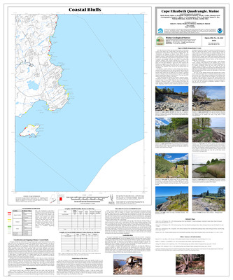
Coastal marine geologic environments of the Cape Elizabeth quadrangle, Maine
Barry S. Timson
Maine Geological Survey, Open-File Map 76-72
-
![Coastal marine geologic environments of the Castine NE [Castine 7.5'] quadrangle, Maine by Barry S. Timson](https://digitalmaine.com/mgs_maps/1158/thumbnail.jpg "Coastal marine geologic environments of the Castine NE [Castine 7.5'] quadrangle, Maine by Barry S. Timson")
Coastal marine geologic environments of the Castine NE [Castine 7.5'] quadrangle, Maine
Barry S. Timson
Maine Geological Survey, Open-File Map 76-73
-
![Coastal marine geologic environments of the Castine NW [Searsport 7.5'] quadrangle, Maine by Barry S. Timson](https://digitalmaine.com/mgs_maps/1159/thumbnail.jpg "Coastal marine geologic environments of the Castine NW [Searsport 7.5'] quadrangle, Maine by Barry S. Timson")
Coastal marine geologic environments of the Castine NW [Searsport 7.5'] quadrangle, Maine
Barry S. Timson
Maine Geological Survey, Open-File Map 76-74
-
![Coastal marine geologic environments of the Castine SE [Cape Rosier 7.5'] quadrangle, Maine by Barry S. Timson](https://digitalmaine.com/mgs_maps/1160/thumbnail.jpg "Coastal marine geologic environments of the Castine SE [Cape Rosier 7.5'] quadrangle, Maine by Barry S. Timson")
Coastal marine geologic environments of the Castine SE [Cape Rosier 7.5'] quadrangle, Maine
Barry S. Timson
Maine Geological Survey, Open-File Map 76-75
-
![Coastal marine geologic environments of the Castine SW [Islesboro 7.5'] quadrangle, Maine by Barry S. Timson](https://digitalmaine.com/mgs_maps/1161/thumbnail.jpg "Coastal marine geologic environments of the Castine SW [Islesboro 7.5'] quadrangle, Maine by Barry S. Timson")
Coastal marine geologic environments of the Castine SW [Islesboro 7.5'] quadrangle, Maine
Barry S. Timson
Maine Geological Survey, Open-File Map 76-76
-

Coastal marine geologic environments of the Cherryfield quadrangle, Maine
Barry S. Timson
Maine Geological Survey, Open-File Map 76-77
-

Coastal marine geologic environments of the Columbia Falls quadrangle, Maine
Barry S. Timson
Maine Geological Survey, Open-File Map 76-78
-

Coastal marine geologic environments of the Cross Island quadrangle, Maine
Barry S. Timson
Maine Geological Survey, Open-File Map 76-79