


The Maine Geological Survey provides the people and businesses of Maine with essential geologic information about the land where we live and work.
Note: Many state documents are offered in PDF format. To view PDF documents, you will need the free Adobe Reader. If you need assistance, view our Maine government PDF Help page or contact the contributing Maine State agency via the link on the left sidebar under “Links”.
-

Surficial geology of the Portland East quadrangle, Maine
Alexa Bernotavicz
Maine Geological Survey, Open-File Map 99-95
-

Surficial geology of the Portsmouth quadrangle, Maine
Geoffrey W. Smith and Cornelia C. Cameron
Maine Geological Survey, Open-File Map 99-96
-

Surficial geology of the Prouts Neck quadrangle, Maine
J Michael Clinch and Woodrow B. Thompson
Maine Geological Survey, Open-File Map 99-97
-

Surficial geology of the Rochester quadrangle, Maine
Geoffrey W. Smith
Maine Geological Survey, Open-File Map 99-98
-

Surficial geology of the Somersworth quadrangle, Maine
Geoffrey W. Smith
Maine Geological Survey, Open-File Map 99-99
-

Surficial geology of the South Harpswell quadrangle, Maine
Alexa Bernotavicz and Mark Dubois
Maine Geological Survey, Open-File Map 99-100
-

Surficial geology of the Standish quadrangle, Maine
John C. Gosse
Maine Geological Survey, Open-File Map 99-101
-

Surficial geology of the Steep Falls quadrangle, Maine
John C. Gosse and Woodrow B. Thompson
Maine Geological Survey, Open-File Map 99-102
-

Surficial geology of the Waterboro quadrangle, Maine
Andres Meglioli
Maine Geological Survey, Open-File Map 99-103
-

Surficial geology of the Wells quadrangle, Maine
Geoffrey W. Smith
Maine Geological Survey, Open-File Map 99-104
-

Surficial geology of the Yarmouth quadrangle, Maine
Michael J. Retelle
Maine Geological Survey, Open-File Map 99-105
-

Surficial geology of the York Beach quadrangle, Maine
Patrick O'Toole, J Michael Clinch, and Cornelia C. Cameron
Maine Geological Survey, Open-File Map 99-106
-

Surficial geology of the York Harbor quadrangle, Maine
J Michael Clinch, Patrick B. O'Toole, and Cornelia C. Cameron
Maine Geological Survey, Open-File Map 99-107
-

Surficial materials of the Biddeford Pool quadrangle, Maine
Carol T. Hildreth
Maine Geological Survey, Open-File Map 99-43
-

Surficial materials of the Bristol quadrangle, Maine
Daniel B. Locke
Maine Geological Survey, Open-File Map 99-47
-

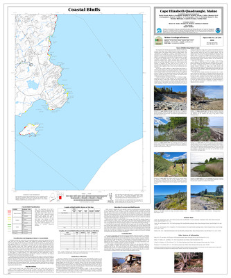
Surficial materials of the Cape Elizabeth quadrangle, Maine
J Michael Clinch and Woodrow B. Thompson
Maine Geological Survey, Open-File Map 99-42
-

Surficial materials of the Cumberland Center quadrangle, Maine
Michael J. Retelle
Maine Geological Survey, Open-File Map 99-64
-

Surficial materials of the Friendship quadrangle, Maine
Daniel B. Locke
Maine Geological Survey, Open-File Map 99-49
-

Surficial materials of the Gray quadrangle, Maine
Thomas K. Weddle
Maine Geological Survey, Open-File Map 99-61
-

Surficial materials of the Lisbon Falls North quadrangle, Maine
Thomas K. Weddle, Amanda E. Normand, Alexa A. Bernotavicz, and Craig D. Neil
Maine Geological Survey, Open-File Map 99-10
-

Surficial materials of the Lisbon Falls South quadrangle, Maine
Thomas K. Weddle
Maine Geological Survey, Open-File Map 99-63
-

Surficial materials of the Louds Island quadrangle, Maine
Daniel B. Locke
Maine Geological Survey, Open-File Map 99-48
-

Surficial materials of the North Pownal quadrangle, Maine
Cheryl L. Marvinney
Maine Geological Survey, Open-File Map 99-62
-

Surficial materials of the Orrs Island quadrangle, Maine
Daniel B. Locke
Maine Geological Survey, Open-File Map 99-57
-

Surficial materials of the Pemaquid Point quadrangle, Maine
Daniel B. Locke
Maine Geological Survey, Open-File Map 99-50
-

Surficial materials of the Phippsburg quadrangle, Maine
Daniel B. Locke
Maine Geological Survey, Open-File Map 99-58
-

Surficial materials of the Portland East quadrangle, Maine
Alexa Bernotavicz
Maine Geological Survey, Open-File Map 99-39
-

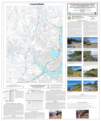
Surficial materials of the Portland West quadrangle, Maine
Woodrow B. Thompson
Maine Geological Survey, Open-File Map 99-38
-

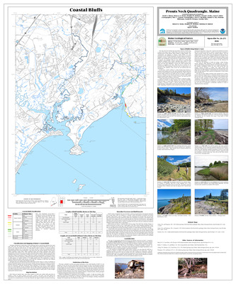
Surficial materials of the Prouts Neck quadrangle, Maine
J Michael Clinch and Woodrow B. Thompson
Maine Geological Survey, Open-File Map 99-41
-

Surficial materials of the South Harpswell quadrangle, Maine
Alexa Bernotavicz and Mark Dubois
Maine Geological Survey, Open-File Map 99-40
-

Surficial materials of the Westport quadrangle, Maine
Daniel B. Locke
Maine Geological Survey, Open-File Map 99-56
-

Surficial materials of the Yarmouth quadrangle, Maine
Michael J. Retelle
Maine Geological Survey, Open-File Map 99-65
-

Bedrock geology of the Portland 1:100,000 quadrangle, Maine and New Hampshire
Henry N. Berry IV and Arthur M. Hussey II
Maine Geological Survey, Open-File Map 98-1
-

Shoreline classification of Sebago Lake
Robert A. Johnston
Maine Geological Survey, Open-File Map 98-123. Shoreline classifications on the map provide information on the type and erodability of sediments along the shore. Bathymetry for lake bottom also shown.
-

Significant sand and gravel aquifers in the Alfred quadrangle, Maine
Craig D. Neil and Geoffrey W. Smith
Maine Geological Survey, Open-File Map 98-147
-

Significant sand and gravel aquifers in the Alligator Lake quadrangle, Maine
Craig D. Neil and Daniel B. Locke
Maine Geological Survey, Open-File Map 98-58
-

Significant sand and gravel aquifers in the Bald Mountain Pond quadrangle, Maine
Craig D. Neil and Daniel B. Locke
Maine Geological Survey, Open-File Map 98-3
-

Significant sand and gravel aquifers in the Bar Mills quadrangle, Maine
Craig D. Neil and Lewis E. Hunter
Maine Geological Survey, Open-File Map 98-145
-

Significant sand and gravel aquifers in the Barren Mountain East quadrangle, Maine
Craig D. Neil and Daniel B. Locke
Maine Geological Survey, Open-File Map 98-4
-

Significant sand and gravel aquifers in the Barren Mountain West quadrangle, Maine
Craig D. Neil and Daniel B. Locke
Maine Geological Survey, Open-File Map 98-5
-

Significant sand and gravel aquifers in the Biddeford quadrangle, Maine
Craig D. Neil and Carol T. Hildreth
Maine Geological Survey, Open-File Map 98-149
-

Significant sand and gravel aquifers in the Black Brook Pond quadrangle, Maine
Craig D. Neil and Daniel B. Locke
Maine Geological Survey, Open-File Map 98-6
-

Significant sand and gravel aquifers in the Brandy Pond quadrangle, Maine
Craig D. Neil and Daniel B. Locke
Maine Geological Survey, Open-File Map 98-60
-

Significant sand and gravel aquifers in the Brassua Lake West quadrangle, Maine
Craig D. Neil and Daniel B. Locke
Maine Geological Survey, Open-File Map 98-9
-

Significant sand and gravel aquifers in the Bridgton quadrangle, Maine
Craig D. Neil and Daniel B. Locke
Maine Geological Survey, Open-File Map 98-150
-

Significant sand and gravel aquifers in the Brownfield quadrangle, Maine
Craig D. Neil and Daniel B. Locke
Maine Geological Survey, Open-File Map 98-195
-

Significant sand and gravel aquifers in the Brownville Junction quadrangle, Maine
Craig D. Neil and Daniel B. Locke
Maine Geological Survey, Open-File Map 98-62
-

Significant sand and gravel aquifers in the Burlington quadrangle, Maine
Craig D. Neil and Daniel B. Locke
Maine Geological Survey, Open-File Map 98-61
-

Significant sand and gravel aquifers in the Casco quadrangle, Maine
Craig D. Neil and Daniel B. Locke
Maine Geological Survey, Open-File Map 98-151
-

Significant sand and gravel aquifers in the Center Lovell quadrangle, Maine
Craig D. Neil and Daniel B. Locke
Maine Geological Survey, Open-File Map 98-206
-

Significant sand and gravel aquifers in the Cornish quadrangle, Maine
Craig D. Neil and Daniel B. Locke
Maine Geological Survey, Open-File Map 98-198
-

Significant sand and gravel aquifers in the Dover East quadrangle, Maine
Craig D. Neil and Geoffrey W. Smith
Maine Geological Survey, Open-File Map 98-127
-

Significant sand and gravel aquifers in the Ebeemee Mountain quadrangle, Maine
Craig D. Neil and Daniel B. Locke
Maine Geological Survey, Open-File Map 98-63
-

Significant sand and gravel aquifers in the Fayette quadrangle, Maine
Craig D. Neil and Daniel B. Locke
Maine Geological Survey, Open-File Map 98-219
-

Significant sand and gravel aquifers in the Fryeburg quadrangle, Maine
Craig D. Neil and Daniel B. Locke
Maine Geological Survey, Open-File Map 98-193
-

Significant sand and gravel aquifers in the Gorham quadrangle, Maine
Craig D. Neil and Geoffrey W. Smith
Maine Geological Survey, Open-File Map 98-143
-

Significant sand and gravel aquifers in the Great East Lake quadrangle, Maine
Craig D. Neil and John C. Boothroyd
Maine Geological Survey, Open-File Map 98-137
-

Significant sand and gravel aquifers in the Great Pond quadrangle, Maine
Craig D. Neil and Daniel B. Locke
Maine Geological Survey, Open-File Map 98-65
-

Significant sand and gravel aquifers in the Greenfield quadrangle, Maine
Craig D. Neil and Daniel B. Locke
Maine Geological Survey, Open-File Map 98-64
-

Significant sand and gravel aquifers in the Greenville quadrangle, Maine
Craig D. Neil and Daniel B. Locke
Maine Geological Survey, Open-File Map 98-10
-

Significant sand and gravel aquifers in the Hiram quadrangle, Maine
Craig D. Neil and Daniel B. Locke
Maine Geological Survey, Open-File Map 98-196
-

Significant sand and gravel aquifers in the Indian Pond North quadrangle, Maine
Craig D. Neil and Daniel B. Locke
Maine Geological Survey, Open-File Map 98-12
-

Significant sand and gravel aquifers in the Kennebunk quadrangle, Maine
Craig D. Neil and Geoffrey W. Smith
Maine Geological Survey, Open-File Map 98-148
-

Significant sand and gravel aquifers in the Kezar Falls quadrangle, Maine
Craig D. Neil and Daniel B. Locke
Maine Geological Survey, Open-File Map 98-197
-

Significant sand and gravel aquifers in the Lake Auburn West quadrangle, Maine
Craig D. Neil and Daniel B. Locke
Maine Geological Survey, Open-File Map 98-223
-

Significant sand and gravel aquifers in the Lily Bay quadrangle, Maine
Craig D. Neil and Daniel B. Locke
Maine Geological Survey, Open-File Map 98-14
-

Significant sand and gravel aquifers in the Limerick quadrangle, Maine
Craig D. Neil and Thom Wilch
Maine Geological Survey, Open-File Map 98-136
-

Significant sand and gravel aquifers in the Limington quadrangle, Maine
Craig D. Neil, Andres Meglioli, and Woodrow B. Thompson
Maine Geological Survey, Open-File Map 98-141
-

Significant sand and gravel aquifers in the Mechanic Falls quadrangle, Maine
Craig D. Neil and Daniel B. Locke
Maine Geological Survey, Open-File Map 98-152
-

Significant sand and gravel aquifers in the Milo North quadrangle, Maine
Craig D. Neil and Daniel B. Locke
Maine Geological Survey, Open-File Map 98-67
-

Significant sand and gravel aquifers in the Milton quadrangle, Maine
Craig D. Neil and Andreas Meglioli
Maine Geological Survey, Open-File Map 98-139
-

Significant sand and gravel aquifers in the Misery Knob quadrangle, Maine
Craig D. Neil and Daniel B. Locke
Maine Geological Survey, Open-File Map 98-15
-

Significant sand and gravel aquifers in the Monmouth quadrangle, Maine
Craig D. Neil and Daniel B. Locke
Maine Geological Survey, Open-File Map 98-225
-

Significant sand and gravel aquifers in the Monson East quadrangle, Maine
Craig D. Neil and Daniel B. Locke
Maine Geological Survey, Open-File Map 98-16
-

Significant sand and gravel aquifers in the Monson West quadrangle, Maine
Craig D. Neil and Daniel B. Locke
Maine Geological Survey, Open-File Map 98-17
-

Significant sand and gravel aquifers in the Mount Kineo quadrangle, Maine
Craig D. Neil and Daniel B. Locke
Maine Geological Survey, Open-File Map 98-19
-

Significant sand and gravel aquifers in the Mount Zircon quadrangle, Maine
Craig D. Neil and Daniel B. Locke
Maine Geological Survey, Open-File Map 98-209
-

Significant sand and gravel aquifers in the Mousam Lake quadrangle, Maine
Craig D. Neil, Andreas Meglioli, and Woodrow B. Thompson
Maine Geological Survey, Open-File Map 98-138
-

Significant sand and gravel aquifers in the Moxie Pond quadrangle, Maine
Craig D. Neil and Daniel B. Locke
Maine Geological Survey, Open-File Map 98-20
-

Significant sand and gravel aquifers in the Naples quadrangle, Maine
Craig D. Neil and Carol T. Hildreth
Maine Geological Survey, Open-File Map 98-154
-

Significant sand and gravel aquifers in the North Berwick quadrangle, Maine
Craig D. Neil and Geoffrey W. Smith
Maine Geological Survey, Open-File Map 98-129
-

Significant sand and gravel aquifers in the North East Carry quadrangle, Maine
Craig D. Neil and Daniel B. Locke
Maine Geological Survey, Open-File Map 98-21
-

Significant sand and gravel aquifers in the North Sebago quadrangle, Maine
Craig D. Neil and Carolyn A. Lepage
Maine Geological Survey, Open-File Map 98-153
-

Significant sand and gravel aquifers in the North Waterford quadrangle, Maine
Craig D. Neil and Daniel B. Locke
Maine Geological Survey, Open-File Map 98-207
-

Significant sand and gravel aquifers in the North Windham quadrangle, Maine
Craig D. Neil, Andree M. Bolduc, Woodrow B. Thompson, and Andres Meglioli
Maine Geological Survey, Open-File Map 98-158
-

Significant sand and gravel aquifers in the Norway quadrangle, Maine
Craig D. Neil and Daniel B. Locke
Maine Geological Survey, Open-File Map 98-215
-

Significant sand and gravel aquifers in the Number Four Mountain quadrangle, Maine
Craig D. Neil and Daniel B. Locke
Maine Geological Survey, Open-File Map 98-22
-

Significant sand and gravel aquifers in the Old Orchard Beach quadrangle, Maine
Craig D. Neil and Michael J. Retelle
Maine Geological Survey, Open-File Map 98-146
-

Significant sand and gravel aquifers in the Oxford quadrangle, Maine
Craig D. Neil and Daniel B. Locke
Maine Geological Survey, Open-File Map 98-216
-

Significant sand and gravel aquifers in the Pleasant Mountain quadrangle, Maine
Craig D. Neil and Daniel B. Locke
Maine Geological Survey, Open-File Map 98-194
-

Significant sand and gravel aquifers in the Ragged Mountain quadrangle, Maine
Craig D. Neil and Daniel B. Locke
Maine Geological Survey, Open-File Map 98-68
-

Significant sand and gravel aquifers in the Raymond quadrangle, Maine
Craig D. Neil and Michael J. Retelle
Maine Geological Survey, Open-File Map 98-155
-

Significant sand and gravel aquifers in the Rochester quadrangle, Maine
Craig D. Neil and Geoffrey W. Smith
Maine Geological Survey, Open-File Map 98-125
-

Significant sand and gravel aquifers in the Sanford quadrangle, Maine
Craig D. Neil and Craig D. Neil
Maine Geological Survey, Open-File Map 98-140
-

Significant sand and gravel aquifers in the Saponac quadrangle, Maine
Craig D. Neil and Daniel B. Locke
Maine Geological Survey, Open-File Map 98-69
-

Significant sand and gravel aquifers in the Sebago Lake quadrangle, Maine
Craig D. Neil and Carol T. Hildreth
Maine Geological Survey, Open-File Map 98-157
-

Significant sand and gravel aquifers in the Sebec Lake West quadrangle, Maine
Craig D. Neil and Daniel B. Locke
Maine Geological Survey, Open-File Map 98-23
-

Significant sand and gravel aquifers in the Seboeis Lake quadrangle, Maine
Craig D. Neil and Daniel B. Locke
Maine Geological Survey, Open-File Map 98-71
-

Significant sand and gravel aquifers in the Seboomook Lake East quadrangle, Maine
Craig D. Neil and Daniel B. Locke
Maine Geological Survey, Open-File Map 98-25
-

Significant sand and gravel aquifers in the Seboomook Lake West quadrangle, Maine
Craig D. Neil and Daniel B. Locke
Maine Geological Survey, Open-File Map 98-26
-

Significant sand and gravel aquifers in the Seboomook quadrangle, Maine
Craig D. Neil and Daniel B. Locke
Maine Geological Survey, Open-File Map 98-24
-

Significant sand and gravel aquifers in the Shelburne quadrangle, Maine
Craig D. Neil and Daniel B. Locke
Maine Geological Survey, Open-File Map 98-199
-

Significant sand and gravel aquifers in the Silver Lake quadrangle, Maine
Craig D. Neil and Daniel B. Locke
Maine Geological Survey, Open-File Map 98-72
-

Significant sand and gravel aquifers in the Socatean Bay quadrangle, Maine
Craig D. Neil and Daniel B. Locke
Maine Geological Survey, Open-File Map 98-27
-

Significant sand and gravel aquifers in the Somersworth quadrangle, Maine
Craig D. Neil and Geoffrey W. Smith
Maine Geological Survey, Open-File Map 98-126
-

Significant sand and gravel aquifers in the Spring Lake quadrangle, Maine
Craig D. Neil and Daniel B. Locke
Maine Geological Survey, Open-File Map 98-73
-

Significant sand and gravel aquifers in the Standish quadrangle, Maine
Craig D. Neil and John C. Gosse
Maine Geological Survey, Open-File Map 98-142
-

Significant sand and gravel aquifers in the Steep Falls quadrangle, Maine
Craig D. Neil, John C. Gosse, and Woodrow B. Thompson
Maine Geological Survey, Open-File Map 98-156
-

Significant sand and gravel aquifers in the The Horseback quadrangle, Maine
Craig D. Neil and Daniel B. Locke
Maine Geological Survey, Open-File Map 98-74
-

Significant sand and gravel aquifers in the Tomhegan Pond quadrangle, Maine
Craig D. Neil and Daniel B. Locke
Maine Geological Survey, Open-File Map 98-29
-

Significant sand and gravel aquifers in the Waterboro quadrangle, Maine
Craig D. Neil and Andreas Meglioli
Maine Geological Survey, Open-File Map 98-144
-

Significant sand and gravel aquifers in the Waterford Flat quadrangle, Maine
Craig D. Neil and Daniel B. Locke
Maine Geological Survey, Open-File Map 98-214
-

Significant sand and gravel aquifers in the Wells quadrangle, Maine
Craig D. Neil and Geoffrey W. Smith
Maine Geological Survey, Open-File Map 98-130
-

Significant sand and gravel aquifers in the West Lake quadrangle, Maine
Craig D. Neil and Daniel B. Locke
Maine Geological Survey, Open-File Map 98-75
-

Significant sand and gravel aquifers in the West Newfield quadrangle, Maine
Craig D. Neil and Robert M. Newton
Maine Geological Survey, Open-File Map 98-135
-

Significant sand and gravel aquifers in the Wild River quadrangle, Maine
Craig D. Neil and Daniel B. Locke
Maine Geological Survey, Open-File Map 98-202
-

Significant sand and gravel aquifers in the York Harbor quadrangle, Maine
Craig D. Neil, J Michael Clinch, and Patrick B. O'Toole
Maine Geological Survey, Open-File Map 98-132
-

Songo River: Slope-stability / shoreline classification map
Elizabeth B. Lewis and Robert A. Johnston
Maine Geological Survey, Open-File Map 98-124. Shoreline classifications on the map show geologic environments and stability of the river banks.
-

Surficial materials of the Alfred quadrangle, Maine
Geoffrey W. Smith
Maine Geological Survey, Open-File Map 98-181
-

Surficial materials of the Alligator Lake quadrangle, Maine
Daniel B. Locke
Maine Geological Survey, Open-File Map 98-76
-

Surficial materials of the Bald Mountain Pond quadrangle, Maine
Daniel B. Locke
Maine Geological Survey, Open-File Map 98-30
-

Surficial materials of the Bar Mills quadrangle, Maine
Lewis E. Hunter
Maine Geological Survey, Open-File Map 98-179
-

Surficial materials of the Barren Mountain East quadrangle, Maine
Daniel B. Locke
Maine Geological Survey, Open-File Map 98-31
-

Surficial materials of the Barren Mountain West quadrangle, Maine
Daniel B. Locke
Maine Geological Survey, Open-File Map 98-32
-

Surficial materials of the Biddeford quadrangle, Maine
Carol T. Hildreth
Maine Geological Survey, Open-File Map 98-183
-

Surficial materials of the Big Shanty Mountain quadrangle, Maine
Daniel B. Locke
Maine Geological Survey, Open-File Map 98-77
-

Surficial materials of the Black Brook Pond quadrangle, Maine
Daniel B. Locke
Maine Geological Survey, Open-File Map 98-33
-

Surficial materials of the Brandy Pond quadrangle, Maine
Daniel B. Locke
Maine Geological Survey, Open-File Map 98-78
-

Surficial materials of the Brassua Lake East quadrangle, Maine
Daniel B. Locke
Maine Geological Survey, Open-File Map 98-35
-

Surficial materials of the Brassua Lake West quadrangle, Maine
Daniel B. Locke
Maine Geological Survey, Open-File Map 98-36
-

Surficial materials of the Brownfield quadrangle, Maine
P Thompson Davis
Maine Geological Survey, Open-File Map 98-228
-

Surficial materials of the Brownville Junction quadrangle, Maine
Daniel B. Locke
Maine Geological Survey, Open-File Map 98-80
-

Surficial materials of the Burlington quadrangle, Maine
Daniel B. Locke
Maine Geological Survey, Open-File Map 98-79
-

Surficial materials of the Center Lovell quadrangle, Maine
Woodrow B. Thompson
Maine Geological Survey, Open-File Map 98-239
-

Surficial materials of the Cornish quadrangle, Maine
Robert M. Newton
Maine Geological Survey, Open-File Map 98-231
-

Surficial materials of the Dover East quadrangle, Maine
Geoffrey W. Smith
Maine Geological Survey, Open-File Map 98-161
-

Surficial materials of the Ebeemee Mountain quadrangle, Maine
Daniel B. Locke
Maine Geological Survey, Open-File Map 98-81
-

Surficial materials of the Fryeburg quadrangle, Maine
Woodrow B. Thompson
Maine Geological Survey, Open-File Map 98-226
-

Surficial materials of the Gorham quadrangle, Maine
Geoffrey W. Smith
Maine Geological Survey, Open-File Map 98-177
-

Surficial materials of the Great East Lake quadrangle, Maine
Jon C. Boothroyd
Maine Geological Survey, Open-File Map 98-171
-

Surficial materials of the Great Pond quadrangle, Maine
Daniel B. Locke
Maine Geological Survey, Open-File Map 98-83
-

Surficial materials of the Greenfield quadrangle, Maine
Daniel B. Locke
Maine Geological Survey, Open-File Map 98-82
-

Surficial materials of the Greenville quadrangle, Maine
Daniel B. Locke
Maine Geological Survey, Open-File Map 98-37
-

Surficial materials of the Hay Mountain quadrangle, Maine
Daniel B. Locke
Maine Geological Survey, Open-File Map 98-38
-

Surficial materials of the Hiram quadrangle, Maine
Woodrow B. Thompson
Maine Geological Survey, Open-File Map 98-229
-

Surficial materials of the Indian Pond North quadrangle, Maine
Daniel B. Locke
Maine Geological Survey, Open-File Map 98-39
-

Surficial materials of the Indian Pond South quadrangle, Maine
Daniel B. Locke
Maine Geological Survey, Open-File Map 98-40
-

Surficial materials of the Jo-Mary Mountain quadrangle, Maine
Daniel B. Locke
Maine Geological Survey, Open-File Map 98-84
-

Surficial materials of the Kennebunkport quadrangle, Maine
Geoffrey W. Smith
Maine Geological Survey, Open-File Map 98-165
-

Surficial materials of the Kennebunk quadrangle, Maine
Geoffrey W. Smith
Maine Geological Survey, Open-File Map 98-182
-

Surficial materials of the Kezar Falls quadrangle, Maine
P Thompson Davis
Maine Geological Survey, Open-File Map 98-230
-

Surficial materials of the Kittery quadrangle, Maine
Patrick B. O'Toole and J Michael Clinch
Maine Geological Survey, Open-File Map 98-168
-

Surficial materials of the Lily Bay quadrangle, Maine
Daniel B. Locke
Maine Geological Survey, Open-File Map 98-41
-

Surficial materials of the Limerick quadrangle, Maine
Thom Wilch
Maine Geological Survey, Open-File Map 98-170
-

Surficial materials of the Limington quadrangle, Maine
Andres Meglioli and Woodrow B. Thompson
Maine Geological Survey, Open-File Map 98-175
-

Surficial materials of the Milo North quadrangle, Maine
Daniel B. Locke
Maine Geological Survey, Open-File Map 98-85
-

Surficial materials of the Milton quadrangle, Maine
Andres Meglioli
Maine Geological Survey, Open-File Map 98-173
-

Surficial materials of the Misery Knob quadrangle, Maine
Daniel B. Locke
Maine Geological Survey, Open-File Map 98-42
-

Surficial materials of the Monson East quadrangle, Maine
Daniel B. Locke and Craig D. Neil
Maine Geological Survey, Open-File Map 98-43
-

Surficial materials of the Monson West quadrangle, Maine
Daniel B. Locke and Craig D. Neil
Maine Geological Survey, Open-File Map 98-44
-

Surficial materials of the Moosehead quadrangle, Maine
Daniel B. Locke
Maine Geological Survey, Open-File Map 98-45
-

Surficial materials of the Mount Kineo quadrangle, Maine
Daniel B. Locke
Maine Geological Survey, Open-File Map 98-46
-

Surficial materials of the Mousam Lake quadrangle, Maine
Andres Meglioli and Woodrow B. Thompson
Maine Geological Survey, Open-File Map 98-172
-

Surficial materials of the Moxie Pond quadrangle, Maine
Daniel B. Locke
Maine Geological Survey, Open-File Map 98-47
-

Surficial materials of the Naples quadrangle, Maine
Carol T. Hildreth
Maine Geological Survey, Open-File Map 98-188
-

Surficial materials of the North Berwick quadrangle, Maine
Geoffry W. Smith
Maine Geological Survey, Open-File Map 98-163
-

Surficial materials of the North East Carry quadrangle, Maine
Daniel B. Locke
Maine Geological Survey, Open-File Map 98-48
-

Surficial materials of the North Sebago quadrangle, Maine
Carolyn A. Lepage
Maine Geological Survey, Open-File Map 98-187
-

Surficial materials of the North Waterford quadrangle, Maine
Woodrow B. Thompson
Maine Geological Survey, Open-File Map 98-240
-

Surficial materials of the North Windham quadrangle, Maine
Andree M. Bolduc, Andres Meglioli, and Woodrow B. Thompson
Maine Geological Survey, Open-File Map 98-192
-

Surficial materials of the Number Four Mountain quadrangle, Maine
Daniel B. Locke
Maine Geological Survey, Open-File Map 98-49
-

Surficial materials of the Pleasant Mountain quadrangle, Maine
Woodrow B. Thompson
Maine Geological Survey, Open-File Map 98-227
-

Surficial materials of the Portsmouth quadrangle, Maine
Geoffrey W. Smith
Maine Geological Survey, Open-File Map 98-162
-

Surficial materials of the Ragged Mountain quadrangle, Maine
Daniel B. Locke
Maine Geological Survey, Open-File Map 98-86
-

Surficial materials of the Raymond quadrangle, Maine
Michael J. Retelle
Maine Geological Survey, Open-File Map 98-189
-

Surficial materials of the Rochester quadrangle, Maine
Geoffrey W. Smith
Maine Geological Survey, Open-File Map 98-159
-

Surficial materials of the Sanford quadrangle, Maine
Craig D. Neil
Maine Geological Survey, Open-File Map 98-174
-

Surficial materials of the Saponac quadrangle, Maine
Daniel B. Locke
Maine Geological Survey, Open-File Map 98-87
-

Surficial materials of the Sebago Lake quadrangle, Maine
Carol T. Hildreth
Maine Geological Survey, Open-File Map 98-191
-

Surficial materials of the Sebec Lake East quadrangle, Maine
Daniel B. Locke
Maine Geological Survey, Open-File Map 98-88
-

Surficial materials of the Sebec Lake West quadrangle, Maine
Daniel B. Locke and Craig D. Neil
Maine Geological Survey, Open-File Map 98-50
-

Surficial materials of the Seboeis Lake quadrangle, Maine
Daniel B. Locke
Maine Geological Survey, Open-File Map 98-89
-

Surficial materials of the Seboomook Lake East quadrangle, Maine
Daniel B. Locke
Maine Geological Survey, Open-File Map 98-52
-

Surficial materials of the Seboomook Lake West quadrangle, Maine
Daniel B. Locke
Maine Geological Survey, Open-File Map 98-53
-

Surficial materials of the Seboomook quadrangle, Maine
Daniel B. Locke
Maine Geological Survey, Open-File Map 98-51
-

Surficial materials of the Shelburne quadrangle, Maine
Daniel B. Locke
Maine Geological Survey, Open-File Map 98-232
-

Surficial materials of the Silver Lake quadrangle, Maine
Daniel B. Locke
Maine Geological Survey, Open-File Map 98-90
-

Surficial materials of the Socatean Bay quadrangle, Maine
Daniel B. Locke
Maine Geological Survey, Open-File Map 98-54
-

Surficial materials of the Somersworth quadrangle, Maine
Geoffrey W. Smith
Maine Geological Survey, Open-File Map 98-160
-

Surficial materials of the Spring Lake quadrangle, Maine
Daniel B. Locke
Maine Geological Survey, Open-File Map 98-91
-

Surficial materials of the Standish quadrangle, Maine
John C. Gosse
Maine Geological Survey, Open-File Map 98-176
-

Surficial materials of the Steep Falls quadrangle, Maine
John C. Gosse and Woodrow B. Thompson
Maine Geological Survey, Open-File Map 98-190
-

Surficial materials of the The Forks quadrangle, Maine
Daniel B. Locke
Maine Geological Survey, Open-File Map 98-55
-

Surficial materials of the Tomhegan Pond quadrangle, Maine
Daniel B. Locke
Maine Geological Survey, Open-File Map 98-56
-

Surficial materials of the Waterboro quadrangle, Maine
Andres Meglioli
Maine Geological Survey, Open-File Map 98-178
-

Surficial materials of the Wells quadrangle, Maine
Geoffrey W. Smith
Maine Geological Survey, Open-File Map 98-164
-

Surficial materials of the West Lake quadrangle, Maine
Daniel B. Locke
Maine Geological Survey, Open-File Map 98-93
-

Surficial materials of the West Newfield quadrangle, Maine
Robert M. Newton
Maine Geological Survey, Open-File Map 98-169
-

Surficial materials of the Wild River quadrangle, Maine
Daniel B. Locke
Maine Geological Survey, Open-File Map 98-235
-

Surficial materials of the York Beach quadrangle, Maine
Patrick G. O'Toole and J Michael Clinch
Maine Geological Survey, Open-File Map 98-167
-

Surficial materials of the York Harbor quadrangle, Maine
J Michael Clinch and Patrick B. O'Toole
Maine Geological Survey, Open-File Map 98-166
-

Bedrock geology of the Gray 7.5-minute quadrangle, Cumberland County, Maine
John W. Creasy and Alexander C. Robinson
Maine Geological Survey, Open-File Report 97-3
-

Bedrock geology of the Limington quadrangle, Maine
Henry N. Berry IV
Maine Geological Survey, Open-File Map 97-60
-

Bedrock geology of the North Windham 7.5' quadrangle, Maine
Arthur M. Hussey II
Maine Geological Survey, Open-File Map 97-43
-

Surficial geology of the Brownfield quadrangle, Maine
P Thompson Davis and William R. Holland
Maine Geological Survey, Open-File Map 97-48
-

Surficial geology of the Cornish quadrangle, Maine
Robert M. Newton and William R. Holland
Maine Geological Survey, Open-File Map 97-54
-

Surficial geology of the Gray quadrangle, Maine
Thomas K. Weddle
Maine Geological Survey, Open-File Map 97-58
-

Surficial geology of the Great East Lake quadrangle, Maine
Jon C. Boothroyd
Maine Geological Survey, Open-File Map 97-46
-

Surficial geology of the Kezar Falls quadrangle, Maine
F Thompson Davis and William R. Holland
Maine Geological Survey, Open-File Map 97-52
-

Surficial geology of the Lisbon Falls South quadrangle, Maine
Thomas K. Weddle
Maine Geological Survey, Open-File Map 97-49
-

Surficial geology of the Mousam Lake quadrangle, Maine
Andres Meglioli and Woodrow B. Thompson
Maine Geological Survey, Open-File Map 97-59
-

Surficial geology of the Naples quadrangle, Maine
Carol T. Hildreth
Maine Geological Survey, Open-File Map 97-50
-

Surficial geology of the North Sebago quadrangle, Maine
Carolyn A. Lepage
Maine Geological Survey, Open-File Map 97-56
-

Surficial geology of the North Windham quadrangle, Maine
Andree M. Bolduc, Woodrow B. Thompson, and Andres Meglioli
Maine Geological Survey, Open-File Map 97-41
-

Surficial geology of the Raymond quadrangle, Maine
Michael J. Retelle
Maine Geological Survey, Open-File Map 97-57
-

Surficial geology of the Sanford quadrangle, Maine
Craig D. Neil
Maine Geological Survey, Open-File Map 97-55
-

Surficial geology of the Sebago Lake quadrangle, Maine
Carol T. Hildreth
Maine Geological Survey, Open-File Map 97-53
-

Surficial geology of the West Newfield quadrangle, Maine
Robert M. Newton
Maine Geological Survey, Open-File Map 97-47
-

Bedrock geology of the North Windham 7.5' quadrangle, Maine
Arthur M. Hussey II
Maine Geological Survey, Open-File Report 96-16. accompanies Open-File Map 97-43
-

Geology of the Standish 7.5' quadrangle, southwestern Maine
Arthur M. Hussey II
Maine Geological Survey, Open-File No. 96-1
-

Preliminary report: Bedrock geology of the Naples and Raymond quadrangles
John W. Creasy
Maine Geological Survey, Open-File Report 96-4
-

Structure and stratigraphy across the Hackmatack Pond Fault, Kennebec and Waldo Counties, Maine
Kost A. Pankiwskyj
Maine Geological Survey, Open-File Report 96-2
-

Surficial geology of the Maine inner continental shelf; Boothbay Harbor to North Haven, Maine
Walter A. Barnhardt, Daniel F. Belknap, Alice R. Kelley, Joseph T. Kelley, and Stephen M. Dickson
Maine Geological Survey, Geologic Map 96-10
-

Surficial geology of the Maine inner continental shelf; Cape Elizabeth to Pemaquid Point, Maine
Walter A. Barnhardt, Daniel F. Belknap, Alice R. Kelley, Joseph T. Kelley, and Stephen M. Dickson
Maine Geological Survey, Geologic Map 96-9
-

Surficial geology of the Maine inner continental shelf; Mt. Desert Island to Jonesport, Maine
Walter A. Barnhardt, Daniel F. Belknap, Alice R. Kelley, Joseph T. Kelley, and Stephen M. Dickson
Maine Geological Survey, Geologic Map 96-12
-

Surficial geology of the Maine inner continental shelf; Ogunquit to the Kennebec River, Maine
Walter A. Barnhardt, Daniel F. Belknap, Alice R. Kelley, Joseph T. Kelley, and Stephen M. Dickson
Maine Geological Survey, Geologic Map 96-8
-

Surficial geology of the Maine inner continental shelf; Petit Manan Point to West Quoddy Head, Maine
Walter A. Barnhardt, Daniel F. Belknap, Alice R. Kelley, Joseph T. Kelley, and Stephen M. Dickson
Maine Geological Survey, Geologic Map 96-13
-

Surficial geology of the Maine inner continental shelf; Piscataqua River to Biddeford Pool, Maine
Walter A. Barnhardt, Daniel F. Belknap, Alice R. Kelley, Joseph T. Kelley, and Stephen M. Dickson
Maine Geological Survey, Geologic Map 96-7
-

Surficial geology of the Maine inner continental shelf; Rockland to Bar Harbor, Maine
Walter A. Barnhardt, Daniel F. Belknap, Alice R. Kelley, Joseph T. Kelley, and Stephen M. Dickson
Maine Geological Survey, Geologic Map 96-11
-

Bedrock geology of the Bar Mills quadrangle, Maine
Robert G. Marvinney
Maine Geological Survey, Open-File Report 95-75
-

Earthquakes in Maine, August 1747 to January 1992
Robert A. Johnston
Maine Geological Survey, Open-File Map 95-2.
-

Bedrock geology of the Sandy Bay, Penobscot Lake, and Seboomook Lake quadrangles, Maine
Robert G. Marvinney
Maine Geological Survey, Open-File Map 94-3
-

Geomorphology and sedimentary framework of the inner continental shelf of Downeast Maine
Stephen M. Dickson, Joseph T. Kelley, and Walter A. Barnhardt
Maine Geological Survey, Open-File Report 94-11. Seismic reflection profiles, side-scan sonar images, bottom sediment composition and texture. Offshore coverage from Schoodic Point to Oak Bay.
-

Complete Bouguer gravity anomaly map of Maine and vicinity
Kevin R. Bond
Maine Geological Survey. Map showing gravity contours and station locations.
-

Bedrock geology of the Westport 7.5' quadrangle, Maine
Arthur M. Hussey II
Maine Geological Survey, Open-File No. 92-59
-

Reconnaissance bedrock geology of the Brewer Lake quadrangle, Maine
John P. Kaszuba
Maine Geological Survey, Open-File Report 92-63 (Map superseded by Pollock, Stephen G. and West, David P., Jr., 2016, Maine Geological Survey Open-File 16-9). Map superseded by detailed bedrock map MGS Open-File 16-9.
-

Reconnaissance bedrock geology of the Damariscotta quadrangle, Maine
Donald W. Newberg
Maine Geological Survey, Open-File Map 92-55 (Superseded by Grover and Newburg, 2016, Maine Geological Survey Open-File 16-22)
-

Reconnaissance bedrock geology of the Wiscasset 7.5' quadrangle, Maine
Donald W. Newberg
Maine Geological Survey, Open-File Map 92-58 (Superseded by West, 2016, Maine Geological Survey Open-File 16-27)
-

Bedrock geology of the Newfield 15' quadrangle, Maine - New Hampshire
Richard A. Gilman
Maine Geological Survey, Open-File Report 91-2
-

Bedrock geology of the upper St. John River area, northwestern Maine
David C. Roy, Stephen G. Pollock, and Lindley S. Hanson
Maine Geological Survey, Open-File Map 91-8. Quadrangles covered: Allagash, Beaver Pond, Beau Lake, Depot Lake, Little East Lake, Rocky Brook, Rocky Mountain, Seven Islands
-

Reconnaissance bedrock geology of the Waldoboro Pluton Complex and other intrusive rocks in coastal Lincoln and Knox Counties, Maine
William C. Sidle
Maine Geological Survey, Open-File Report 91-3 (Plate 2 partially superseded by West, 2023, Maine Geological Survey Open-File Map 23-20 and Berry & Dykstra, 2024, Maine Geological Survey Geologic Map 24-9). Discusses geology of Waldoboro Pluton Complex and geology and chemical analyses of Meduncook-South Cushing area granitoids.
-

Air photo reconnaissance of slope failures in the Presumpscot Formation, Cumberland County, Maine
Irwin D. Novak
Maine Geological Survey, Open-File Report 90-22. Analysis of air photos to locate landslides in Cumberland County
-

Bedrock geology of the Big Lake 15' quadrangle, Maine
Allan Ludman
Maine Geological Survey, Open-File Report 90-26
-

Bedrock geology of the Calais 15' quadrangle, Eastern Maine
Allan Ludman and Malcolm Hill
Maine Geological Survey, Open-File Report 90-27
-

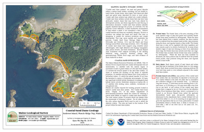
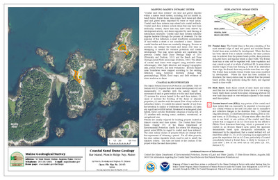
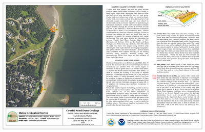
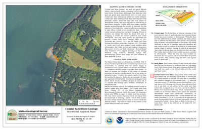
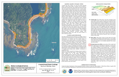
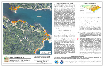
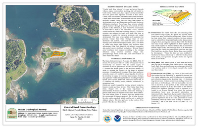
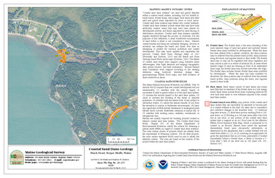
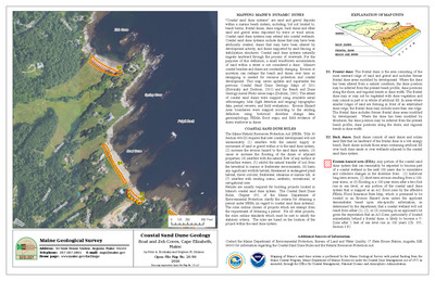
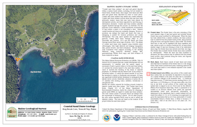
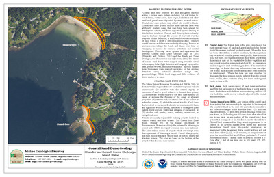
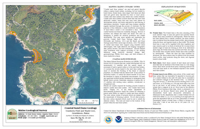
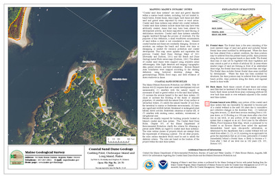
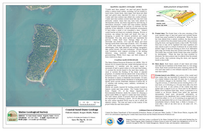
Coastal sand dune map of Camp Ellis and Ferry Beaches, Saco, Maine
Stephen M. Dickson
Maine Geological Survey, Open-File Map 90-2 (Superseded by Dickson, 2001, Maine Geological Survey, Open-file Maps 01-445, 01-402, 01-401, 01-400, 01-399, 01-398)
-

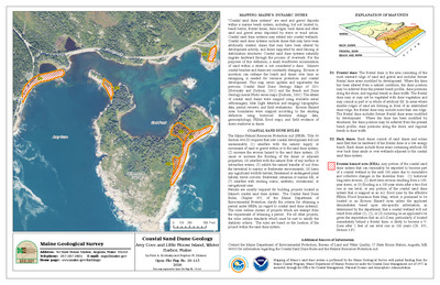
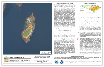
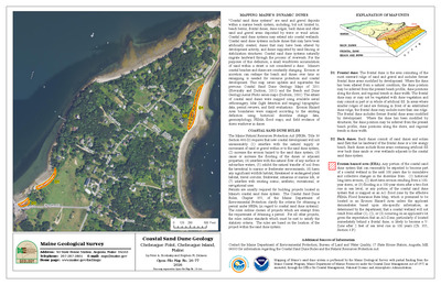
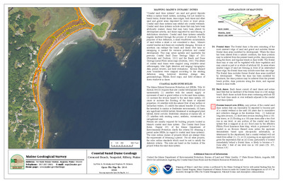
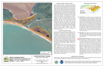
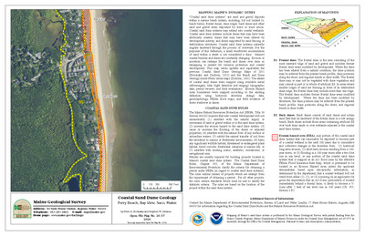
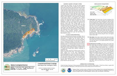
Coastal sand dune map of Crescent and Cape Elizabeth Beaches, Cape Elizabeth, Maine
Stephen M. Dickson
Maine Geological Survey, Open-File Map 90-3 (Superseded by Dickson, 2001, Maine Geological Survey, Open-file Maps 01-403, 01-404, 01-405, 01-406, 01-407)
-

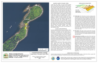
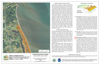
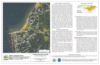
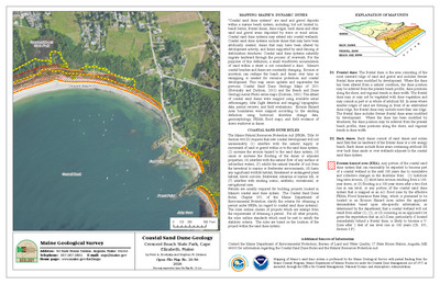
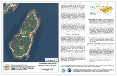
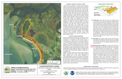
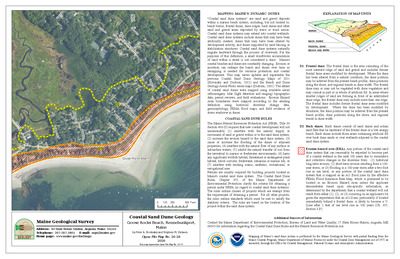
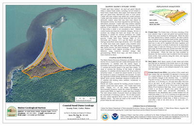
Coastal sand dune map of Crescent Surf and Parsons Beaches, Kennebunk, Maine
Stephen M. Dickson
Maine Geological Survey, Open-File Map 90-4 (Superseded by Dickson, 2001, Maine Geological Survey, Open-file Maps 01-408, 01-409, 01-410)
-

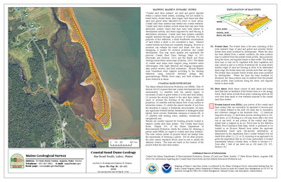
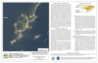
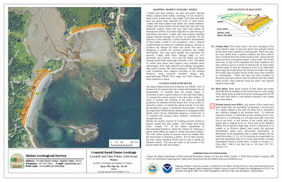
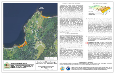
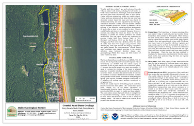
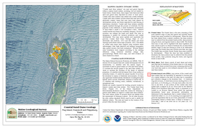
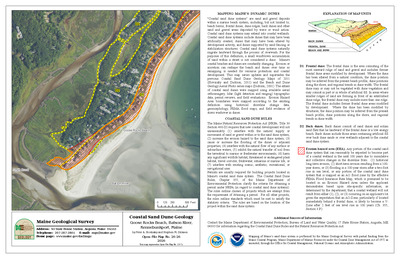
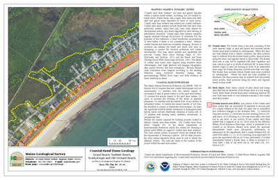
Coastal sand dune map of Drakes Island and Laudholm Beaches, Wells, Maine
Stephen M. Dickson
Maine Geological Survey, Open-File Map 90-5 (Superseded by Dickson, 2001, Maine Geological Survey, Open-file Maps 01-411, 01-412, 01-413)
-

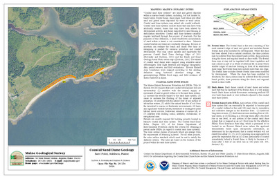
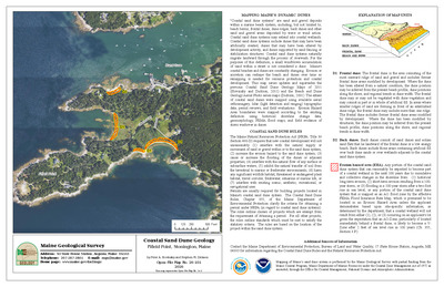
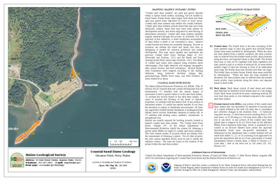
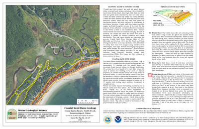
Coastal sand dune map of Fortunes Rocks and Mile Stretch Beaches, Biddeford, Maine
Stephen M. Dickson
Maine Geological Survey, Open-File Map 90-6 (Superseded by Dickson, 2001, Maine Geological Survey, Open-file Maps 01-414, 01-415, 01-416, 01-417)
-

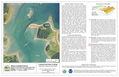
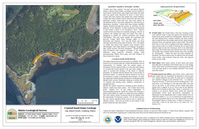
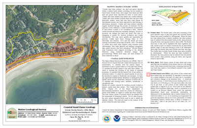
Coastal sand dune map of Goose Rocks Beach, Kennebunkport, Maine
Stephen M. Dickson
Maine Geological Survey, Open-File Map 90-7 (Superseded by Dickson, 2001, Maine Geological Survey, Open-file Maps 01-418, 01-419, 01-420, 01-421)