


Files
Download Map (2.2 MB)
Document Type
StillImage
Description
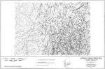
Maine Geological Survey, Open-File Map 86-68. Lewiston
Publication Code
86-68
Publication Date
1-1-1986
Publisher
Maine Geological Survey
Location
Androscoggin County; Cumberland County; Franklin County; Kennebec County; Oxford County; Sagadahoc County; Somerset County
Map Type
Lineaments, High-Yield Bedrock Wells and Potential Bedrock Recharge Area Maps (scale 1:250,000)
Map Scale
1:250000
Recommended Citation
Caswell, Eichler, and Hill, Inc., 1986, Lineaments, high-yield bedrock wells, and potential bedrock recharge areas in the Maine portion of the Lewiston 2 degree sheet: Maine Geological Survey, Open-File Map 86-68, map, scale 1:250,000. Maine Geological Survey Maps. 1211. http://digitalmaine.com/mgs_maps/1211
Rights Statement

No Copyright - United States. URI: http://rightsstatements.org/vocab/NoC-US/1.0/
The organization that has made the Item available believes that the Item is in the Public Domain under the laws of the United States, but a determination was not made as to its copyright status under the copyright laws of other countries. The Item may not be in the Public Domain under the laws of other countries. Please refer to the organization that has made the Item available for more information.