

-

Plan of Property on Woodside Drive, Cumberland, Maine, 1966
Carl E. Emery
Plan of Property on Woodside Drive, Cumberland, Maine was created by Carl E. Emery in 1966.
-

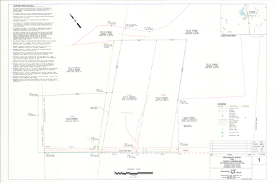
Plan of Greenwood at Cumberland, Cumberland, Maine, 1966
Gray Engineering Inc.
Plan of Greenwood at Cumberland, Cumberland, Maine was created by Gray Engineering Inc. in 1966. Includes plans from 1964.
-

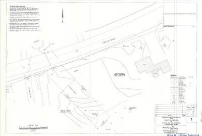
Plan of Woodland Development, Greely Road and Crystal Lane, Cumberland, Maine, 1966
Gray Engineering, Inc.
-

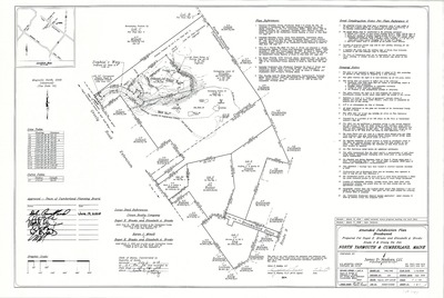
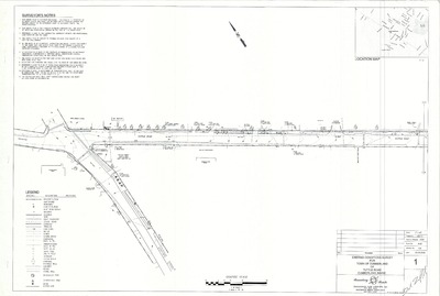
Plan of Fair Meadow, Main Street and Greely Road, Cumberland, Maine, 1966
Joseph E. Solari Co. and Whitman and Howard, Inc.
-

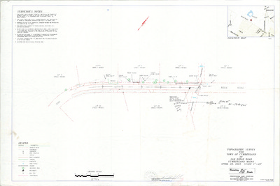
Plan of Gyger Gymnasium Renovations, Main Street, Cumberland, Maine, 1965
Allied Engineering Incorporated
Plan of Gyger Gymnasium Renovations, Main Street, Cumberland, Maine was created by Allied Engineering Incorporated in 1965. Scale 1"=4'.
-

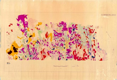
Property Maps, Cumberland, Maine, 1965
John E. O'Donnell & Associates
Property Maps, Cumberland, Maine was created by John E. O'Donnell & Associates in 1965. Scale 1"=500'/1"=100'.
-

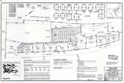
Plan of Foreside Meadows, Cumberland, Maine, 1965
Owen Haskell, Inc.
Plan of Foreside Meadows, Cumberland, Maine was created by Owen Haskell, Inc. in 1965.
-

Plan of Hallmark Road, Cumberland, Maine, 1965
Owen Haskell, Inc.
Plan of Hallmark Road, Cumberland, Maine was created by Owen Haskell, Inc. in 1965.
-

Profile of Surrey Lane, Foreside Meadows, Cumberland, Maine, 1965
Owen Haskell, Inc.
Profile of Surrey Lane, Foreside Meadows, Cumberland, Maine was created by Owen Haskell, Inc. in 1965.
-

Profiles of Roads, Schooner Rocks, Cumberland, Maine, 1965
Owen Haskell, Inc.
Profiles of Roads, Schooner Rocks, Cumberland, Maine was created by Owen Haskell, Inc. in 1965.
-

Cumberland High School Part B Additions, Main Street, Cumberland, Maine, 1964
Allied Engineering, Inc.
-

Profile of Kathy Lane, Cumberland, Maine, 1964
C. R. Storer, Inc.
Profile of Kathy Lane, Cumberland, Maine was created by C. R. Storer, Inc. in 1964.
-

Plan of Greenwood at Cumberland, Main Street and Cottage Farms Road, Cumberland, Maine, 1964
Gray Engineering, Inc.
-

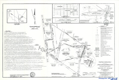
Plan of Property of Nicholas Fish, Foreside Road and Sturdivant Road, Cumberland, Maine, 1963
Edward C. Jordan Co., Inc.
-

Plan of Sturdivant Road, Cumberland, Maine, 1963
Edward C. Jordan Co., Inc.
Plan of Sturdivant Road, Cumberland, Maine was created by Edward C. Jordan Co., Inc. in 1963.
-

Plan of Pine Ridge and Pine Ridge II, Foreside Road and Pine Ridge Road, Cumberland, Maine, 1963
Edward C. Jordan Co., Inc. and Robert P. Titcomb Inc.
-

Plan of Cumberland Gardens, Cumberland, Maine, 1963
Carl E. Emery
Plan of Cumberland Gardens, Cumberland, Maine was created by Carl E. Emery in 1963.
-

Plan of Cumberland Garden, Main Street, Lawn Avenue and Maple Street, Cumberland, Maine, 1963
Carl E. Emory and Owen Haskell Inc.
The Town of Cumberland Plans gallery houses a collection of plans and maps of the Town of Cumberland, and exists to gather, preserve, and make available those materials. Materials in the Collection date from the late 19th century to recent times. Types of materials in the collection include subdivision plans, utility maps, planning maps, soil maps, building blueprint sets, and tax/zoning maps.
Printing is not supported at the primary Gallery Thumbnail page. Please first navigate to a specific Image before printing.


