

-

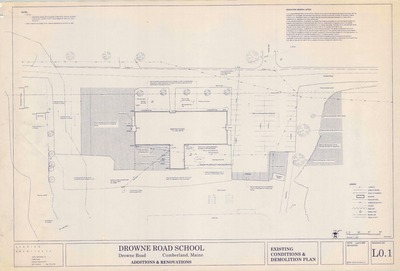
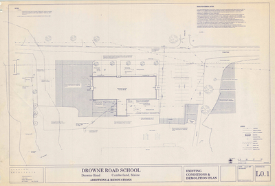
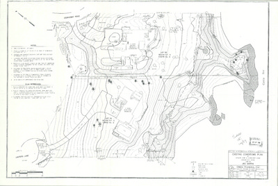
Additions and Renovations to Drowne Road School, Drowne Road, Cumberland, Maine, 1997
Terrien Architects
Additions and Renovations to Drowne Road School, Drowne Road, Cumberland, Maine was created by Terrien Architects in 1997. Scale 1"=20'.
-

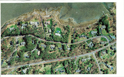
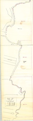
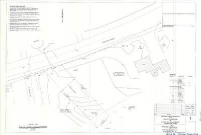
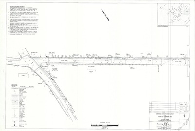
Aerial Photo of Foreside Road, Cumberland, Maine
- -
Aerial Photo of Foreside Road, Cumberland, Maine.
-

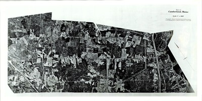
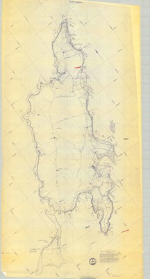
Aerial Photo of Mainland, Cumberland, Maine, 1986
Greater Portland Council of Governments and James W. Sewall Co.
Aerial Photo of Mainland, Cumberland, Maine was created by the Greater Portland Council of Governments in 1986. Scale 1"=1000'.
-

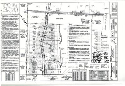
Amendment 1 of Plan of Windsor Subdivision, Blanchard Road and Windsor Lane, Cumberland, Maine, 2016
Davis Land Surveying, LLC
-

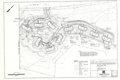
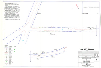
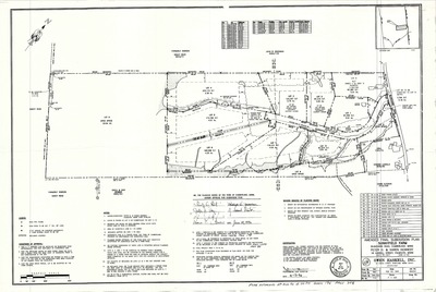
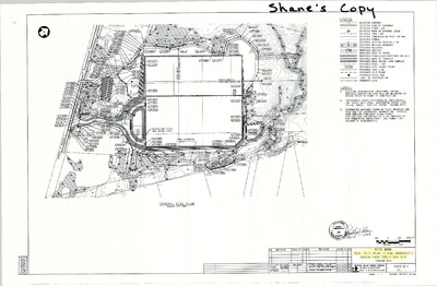
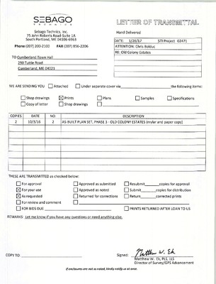
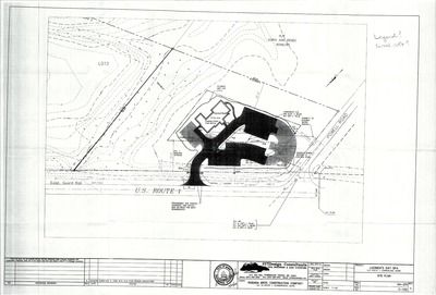
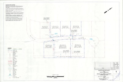
As-Built Grading and Utilities Plan, True Spring Farm, U.S. Route 1, Cumberland, Maine, 2005
Sebago Technics, Inc.
As-Built Grading and Utilities Plan, True Spring Farm, U.S. Route 1, Cumberland, Maine was created by Sebago Technics, Inc. in 2005.
-

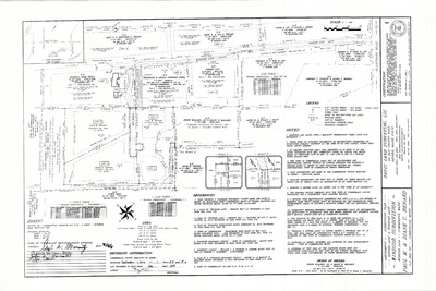
As Built Plan of Foxes Gore, Goose Pond Road, Cumberland, Maine, 2009
SGC Engineering
As Built Plan of Foxes Gore, Goose Pond Road, Cumberland, Maine was created by SGC Engineering in 2009. Scale 1"=100'.
-

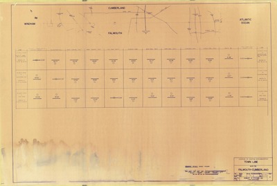
As-Built Survey, Route 100, Cumberland, Maine, 2007
Boundary Points Professional Land Surveying, LLC
-

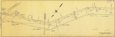
Boundary Survey Map of Cranberry Lane, Cumberland, Maine, 2005
Maine Boundary Consultants
Boundary Survey Map of Cranberry Lane, Cumberland, Maine was created by Maine Boundary Consultants in 2005.
-

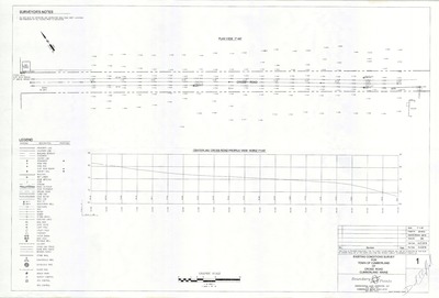
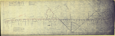
Central Maine Power Profiles and Right of Ways, Cumberland, Maine, 1958
Central Maine Power Co.
Central Maine Power Profiles and Right of Ways, Cumberland, Maine was created by Central Maine Power in 1958. Scale 1"=200'.
-

Clam Density Study, Mainland Shore, Cumberland, Maine, 1977
Wayne Wood & Co.
Clam Density Study, Mainland Shore, Cumberland, Maine was created by unknown in 1977. Scale N/A.
-

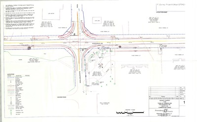
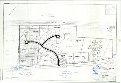
Conceptual Plan for Heritage Hills, Greater Portland Development Group, 2001
Mohr & Serodin and Owen Haskell
-

Construction Drawings of Rockwood Condominiums Phase IV, Route 1, Cumberland, Maine, 2005
Northeast Civil Solutions
-

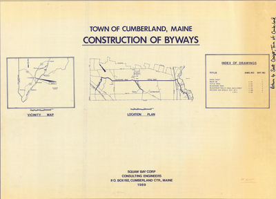
Construction Layout for Town of Cumberland of Proposed Athletic Fields, Greely Road, Cumberland, Maine, 2000
Boundary Points and Sevee & Maher Engineers, Inc.
Construction Layout for Town of Cumberland of Proposed Athletic Fields, Greely Road, Cumberland, Maine was created by Boundary Points and Sevee and Maher Engineers, Inc. in 2000.
-

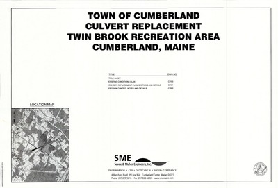
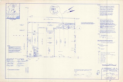
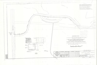
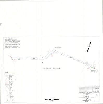
Culvert Replacement, Twin Brook Recreation Area, Cumberland, Maine, 2016
Sevee & Maher Engineers, Inc.
-

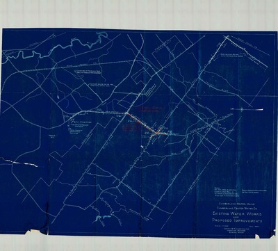
Cumberland Center Water Co. Existing Water Works and Proposed Improvements, 1946
Coffin & Richardson, Inc.
Cumberland Center Water Co. Existing Water Works and Proposed Improvements was created by Coffin & Richardson, Inc. in 1946. Scale 1":1000'.
-

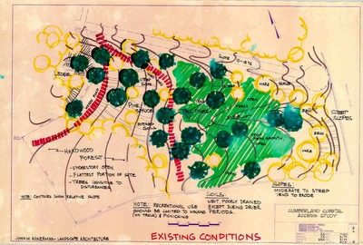
Cumberland Coastal Access Study, Cumberland, Maine, 1979
Wright-Pierce Engineers
Cumberland Coastal Access Study, Cumberland, Maine was created by Wright-Pierce Engineers in 1979. Scale 1"=20'.
-

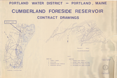
Cumberland Foreside Reservoir Contract Drawings and Reservoir Apurtenances, Cumberland, Maine, 1980
Portland Water District
Cumberland Foreside Reservoir was created by Portland Water District in 1980. Scale 1"=5'.
-

Cumberland High School Part B Additions, Main Street, Cumberland, Maine, 1964
Allied Engineering, Inc.
-

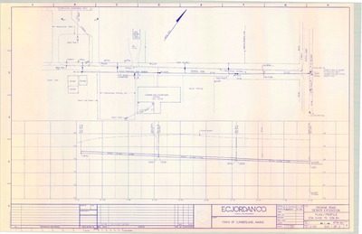
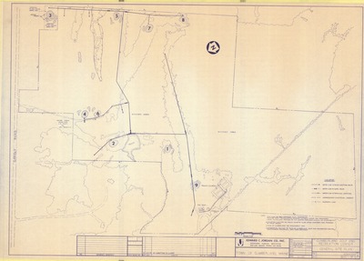
Cumberland Sewer System and Drowne Road Sewer Extension, Cumberland, Maine, 1989
Edward C. Jordan Co., Inc.
Cumberland Sewer System and Drowne Road Sewer Extension, Cumberland, Maine was created by Edward C. Jordan Co., Inc. in 1989. Scale varies.
-

Deed Sketch of Land on Drowne Road, Tuttle Road, and Oak Street, Cumberland, Maine, 1995
Walt Dunlap
Deed Sketch of Land on Drowne Road, Tuttle Road, and Oak Street, Cumberland, Maine was created by Walt Dunlap for the Town of Cumberland in 1995.
-

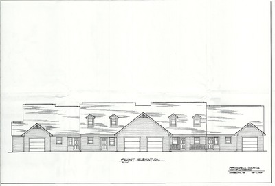
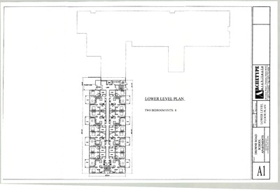
Drowne Road School Addition, 1997
Terrien Architects
Drowne Road School Addition was created by Terrien Architects in 1997. Scale 1"=20'.
-

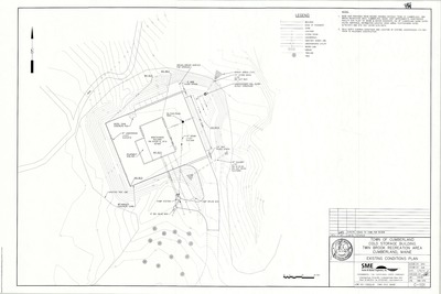
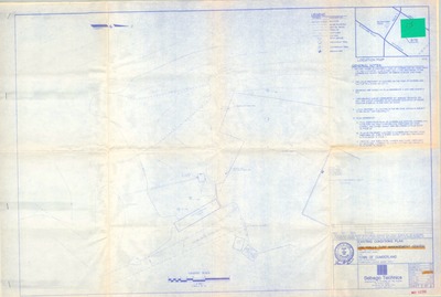
Existing Conditions Plan, Cold Storage Building, Twin Brook Recreation Area, Cumberland, Maine, 2014
Sevee & Maher Engineers, Inc.
-

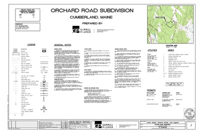
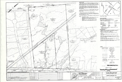
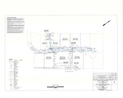
Existing Conditions Plan of Autumn Ridge Subdivision, Orchard Road, Cumberland, Maine, 2005
SYTDesign Consultants
Existing Conditions Plan of Autumn Ridge Subdivision, Orchard Road, Cumberland, Maine was created by SYTDesign Consultants in 2005.
-

Existing Conditions Plan of Lantern Lane and Stornoway Road, Cumberland, Maine, 2001
Owen Haskell, Inc.
Existing Conditions Plan of Lantern Lane and Stornoway Road, Cumberland, Maine was created by Owen Haskell, Inc. in 2001.
-

Existing Conditions Survey for the Town of Cumberland of Orchard Road and Blanchard Road Extension, Cumberland, Maine, 2006
Boundary Points
Existing Conditions Survey for the Town of Cumberland of Orchard Road and Blanchard Road Extension, Cumberland, Maine was created by Boundary Points in 2006.
-

Existing Conditions Survey for Town of Cumberland of 30' Wide Drainage Easement, Skillin Road, Cumberland, Maine, 2006
Boundary Points
Existing Conditions Survey for Town of Cumberland of 30' Wide Drainage Easement, Skillin Road, Cumberland, Maine was created by Boundary Points in 2006.
-

Existing Conditions Survey for Town of Cumberland of Farwell Avenue, Cumberland, Maine, 2006
Boundary Points
Existing Conditions Survey for Town of Cumberland of Farwell Avenue, Cumberland, Maine was created by Boundary Points in 2006.
-

Existing Conditions Survey for Town of Cumberland of Prince Street and Balsam Drive, Cumberland, Maine, 2000
Boundary Points
Existing Conditions Survey for Town of Cumberland of Prince Street and Balsam Drive, Cumberland, Maine was created by Boundary Points in 2000.
-

Existing Conditions Survey for Town of Cumberland of Town Landing Road, Cumberland, Maine, 2007
Boundary Points
Existing Conditions Survey for Town of Cumberland of Town Landing Road, Cumberland, Maine was created by Boundary Points in 2007.
-

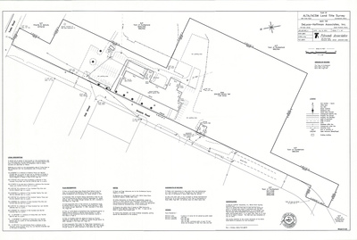
Existing Conditions Survey for Town of Cumberland of Tuttle Road, Cumberland, Maine, 2006
Boundary Points
Existing Conditions Survey for Town of Cumberland of Tuttle Road, Cumberland, Maine was created by Boundary Points in 2006.
-

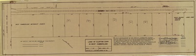
Final Plan of Sturbridge Estates, Cumberland, Maine, 1987
Gadbois & Associates
Final Plan of Sturbridge Estates, Cumberland, Maine was created by Gadbois & Associates in 1987.
-

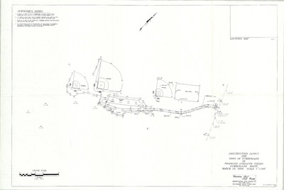
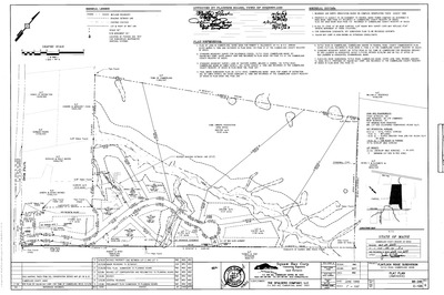
Flintlock Ridge Subdivision, Tuttle Road, Cumberland, Maine, 1999
Squaw Bay Corp Consulting Engineers & Land Surveyors
-

Flood Insurance Rate Maps, Cumberland, Maine, 1981
U.S. Department of Housing and Urban Development
Flood Insurance Rate Maps, Cumberland, Maine was created by the U.S. Department of Housing and Urban Development in 1981. Scale 1"=400'.
-

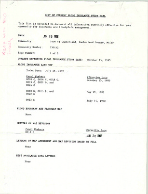
Flood Insurance Rate Maps, Cumberland, Maine, 1995
Federal Emergency Management Agency
Flood Insurance Rate Maps, Cumberland, Maine was created by the Federal Emergency Management Agency in 1995. Scale 1"=800'.
-

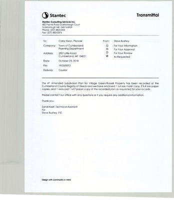
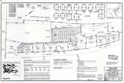
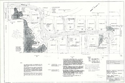
Fourth Amended Final Subdivision Plan, Wyman Way, Village Green, Cumberland, 2018
Stantec Consulting Services, Inc.
-

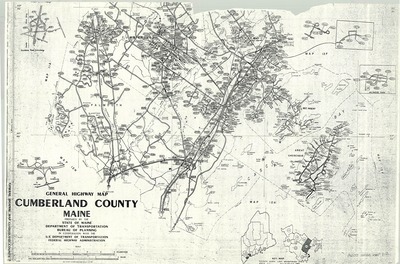
General Highway Map, Cumberland County, Maine
State of Maine Department of Transportation Bureau of Planning
-

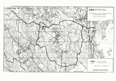
Groundwater Study, Cumberland, Maine, 1989
Greater Portland Council of Governments
Groundwater Study, Cumberland, Maine was created by Greater Portland Council of Governments in 1989. Scale 1"=1000'.
-

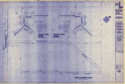
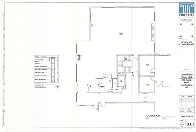
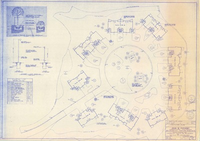
Landscape Plan of Cumberland Town Hall, Tuttle Road, Cumberland, Maine, 1998
Orcutt Associates
Landscape Plan of Cumberland Town Hall, Tuttle Road, Cumberland, Maine was created by Orcutt Associates in 1998.
-

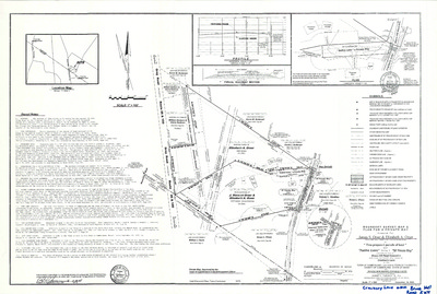
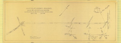
Location of Highway Monuments, Route 9/Main Street and Greely Road, Cumberland, Maine, 1986
- -
Location of Highway Monuments, Route 9/Main Street and Greely Road, Cumberland, Maine was created in 1986.
-

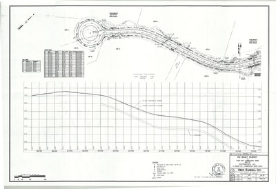
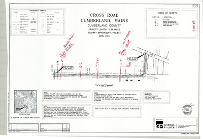
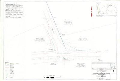
Maine Dept. of Transportation State Project No. 3590.00, Foreside Road, Cumberland, Maine, 1988
Maine Dept. of Transportation
-

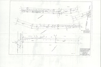
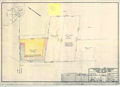
Maine State Highway Commission Right of Way Map, Goose Pond Road, Cumberland, Maine, 1958
Maine State Highway Commission
Maine State Highway Commission Right of Way Map, Goose Pond Road, Cumberland, Maine was created by the Maine State Highway Commission in 1958. Scale 1"=100'.
-

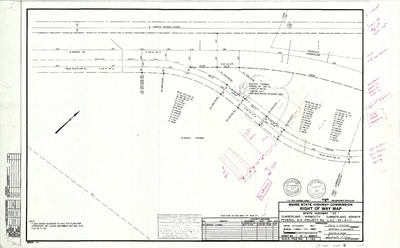
Maine State Highway Commission Right of Way Map, State Highway "95", Cumberland-Yarmouth, Maine, 1969
MaineDepartment of Transportation
Maine State Highway Commission Right of Way Map, State Highway "95", Cumberland-Yarmouth, Maine was created by Maine Dept. of Transportation in 1969.
The Town of Cumberland Plans gallery houses a collection of plans and maps of the Town of Cumberland, and exists to gather, preserve, and make available those materials. Materials in the Collection date from the late 19th century to recent times. Types of materials in the collection include subdivision plans, utility maps, planning maps, soil maps, building blueprint sets, and tax/zoning maps.
Printing is not supported at the primary Gallery Thumbnail page. Please first navigate to a specific Image before printing.


")


