

-

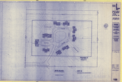
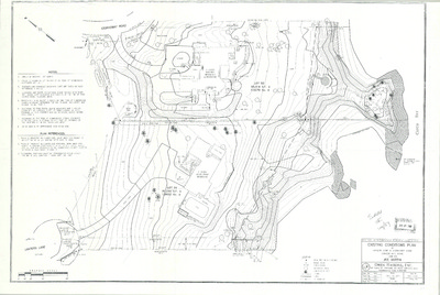
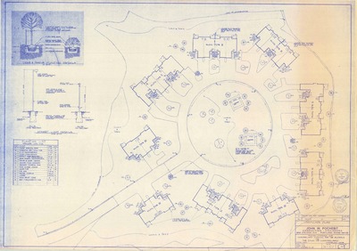
Mechanical Plan for Val Halla Country Club, Val Halla Road, Cumberland, Maine, 1995
Johnson and Jordan, Inc.
-

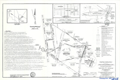
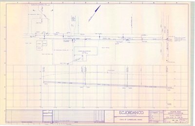
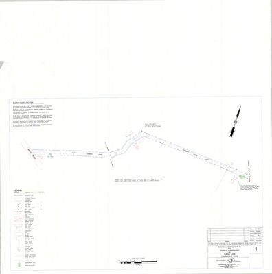
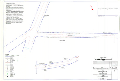
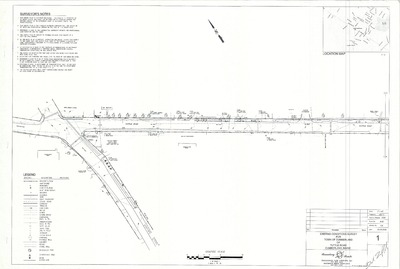
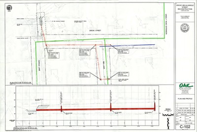
Middle Road Improvements, Roadway Improvements Project, Cumberland, Maine, 2017
Sevee & Maher Engineers, Inc.
-

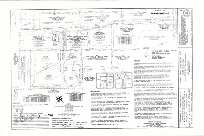
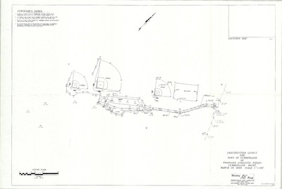
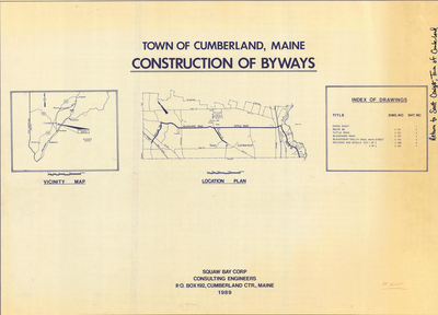
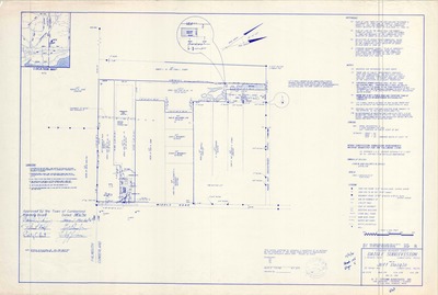
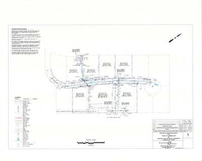
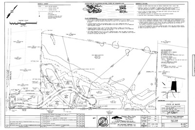
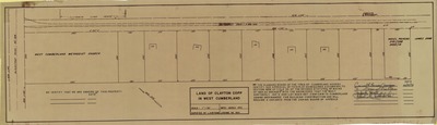
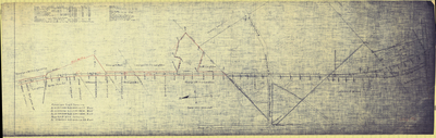
Moss Side Cemetery Standard Boundary Survey, Cumberland Cemetery Association, 1994
Squaw Bay Corp. Consulting Engineers
-

M.S.A.D. 51 Master Development Plan, Phase 1 and 2, Cumberland, Maine, 1993
Terrien Architects
M.S.A.D. 51 Master Development Plan, Phase 1 and 2, Cumberland, Maine, was created by Terrien Architechs in 1993.
-

New England Telephone & Telegraph Co. Buried Cable, Cumberland, Maine, 1969
New England Telephone & Telegraph Co.
-

Official Map of the Town of Cumberland, Maine, 1967
Wright & Pierce and John E. O'Donnell & Associates
Official Map of the Town of Cumberland, Maine was created by Wright & Pierce in 1962, revised by John E. O'Donnell & Associates in 1967. Scale 1"=1000'.
-

Official Zoning Maps, Cumberland, Maine, 1989
Greater Portland Council of Governments
Official Zoning Maps, Cumberland, Maine was created by Greater Portland Council of Governments in 1989. Scale 1"=1000'.
-

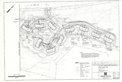
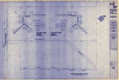
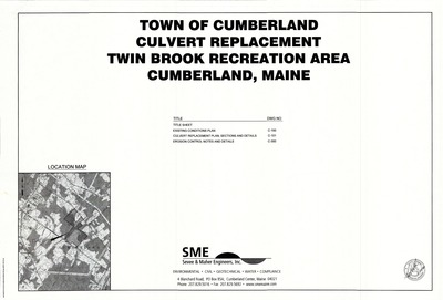
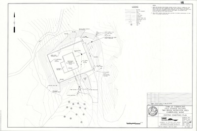
Overall Site Plan of Twin Brook Recreation Area, 2007 Improvements, Tuttle Road, Cumberland, Maine, 2007
Sevee & Maher Engineers, Inc.
Overall Site Plan of Twin Brook Recreation Area, 2007 Improvements, Tuttle Road, Cumberland, Maine was created by Sevee & Maher Engineers, Inc. in 2007. Includes overall site plan and surveying from 1994, 1996 and 2001.
-

Overall Site Plan, Stornoway Road, Cumberland, Maine, 2002
Winton Scott Architects and Carroll Associates
Overall Site Plan, Stornoway Road, Cumberland, Maine was created by Winton Scott Architects and Carroll Associates in 2002.
-

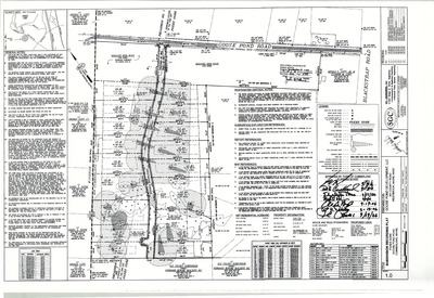
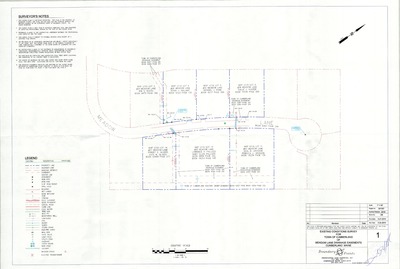
Partial Boundary Survey, John W. Paynter, Greely Road Extension, Cumberland, Maine, 2013
True North Surveying Services
-

Plan and Profile of Bea Lane, Cumberland, Maine, 1963
Gray Engineering Inc.
Plan and Profile of Bea Lane, Cumberland, Maine was created by Gray Engineering Inc. in 1963.
-

Plan and Profile of Mill Ridge Road, Cumberland, Maine, 1972
C. R. Storer, Inc.
Plan of Mill Ridge Road, Cumberland, Maine was created by C. R. Storer, Inc. in 1972. Revised 1973; redrawn by Bob Humphreys in 1989.
-

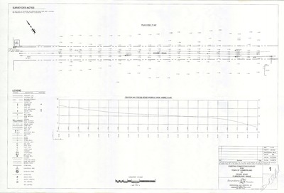
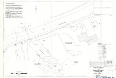
Plan and Profile of Offsite Drainage, MSAD #51 Middle School, Tuttle Road, Cumberland, Maine, 2002
Deluca-Hoffman Associates, Inc.
Plan and Profile of Offsite Drainage, MSAD #51 Middle School, Tuttle Road, Cumberland, Maine was created by Deluca-Hoffman Associates, Inc. in 2002.
-

Plan and Profile of Old Gray Road, Cumberland, Maine, 1906
Berry Huff McDonald Milligan, Inc.
Plan and Profile of Old Gray Road, Cumberland, Maine was created by Berry Huff McDonald Milligan, Inc. in 1978. Includes 1906 plan by H. W. Foster and 1922 plan by Wm. E. Winslow.
-

Plan and Profile of Skillin Road Reconstruction, Skillin Road, Cumberland, Maine, 2006
Aquarion Engineering Services
-

Plan and Profile of Storm Drain Improvements, Val Halla Road, Cumberland, Maine, 2008
Sevee & Maher Engineers, Inc.
Plan and Profile of Storm Drain Improvements, Val Halla Road, Cumberland, Maine was created by Sevee & Maher Engineers, Inc. in 2008.
-

Plan of 12' Beam Bridge, Pleasant Valley Road, Cumberland, Maine, 1999
Rodney L. Lemasters
Plan of 12' Beam Bridge, Pleasant Valley Road, Cumberland, Maine was created by Rodney Lemasters in 1999.
-

Plan of 179 Foreside Subdivision, Foreside Road, Cumberland, Maine, 2014
Fay, Spofford & Thorndike
Plan of 179 Foreside Subdivision, Foreside Road, Cumberland, Maine was created by Fay, Spofford & Thorndike in 2014. Scale 1"=120'.
-

Plan of 179 Foreside Subdivision, Foreside Road, Cumberland, Maine, 2015
Fay, Spofford & Thorndike
Plan of 179 Foreside Subdivision, Foreside Road, Cumberland, Maine was created by Fay, Spofford & Thorndike in 2015. Scale 1"=120'.
-

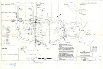
Plan of 199 Middle Road Subdivision, Cumberland, Maine, 2016
Pinkham & Greer Civil Engineers
199 Middle Road Subdivision Plan, Cumberland, Maine was created by Pinkham & Greer Civil Engineers in 2016. Scale 1"=50'.
-

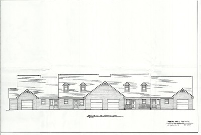
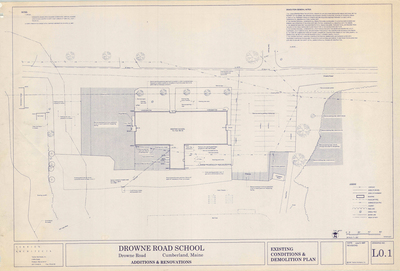
Plan of Addition and Alterations to the Mable I. Wilson School, Tuttle Road, Cumberland, Maine, 1993
Terrien Architects
Plan of Addition and Alterations to the Mable I. Wilson School, Tuttle Road, Cumberland, Maine was created by Terrien Architects in 1993.
-

Plan of Additions and Alterations to Mabel I. Wilson School, Design Development Submission, Tuttle Road, Cumberland, Maine, 1992
Terrien Architects
Plan of Additions and Alterations to Mabel I. Wilson School, Design Development Submission, Tuttle Road, Cumberland, Maine was created by Terrien Architects in 1992. Scale 1"=8'.
-

Plan of Additions and Alterations to Mabel I. Wilson School, Mechanical, Demolition and Electrical, Tuttle Road, Cumberland, Maine, 1992
Terrien Architects
Plan of Additions and Alterations to Mabel I. Wilson School, Mechanical, Demolition and Electrical, Tuttle Road, Cumberland, Maine was created by Terrien Architects in 1992. Scale 1"=8'.
-

Plan of Additions and Alterations to Mabel I. Wilson School, Revision 2 Vol. 1, Tuttle Road, Cumberland, Maine, 1993
Terrien Architects
Plan of Additions and Alterations to Mabel I. Wilson School, Revision 2 Vol. 1, Tuttle Road, Cumberland, Maine was created by Terrien Architects in 1993. Scale 1"=8'.
-

Plan of Additions and Alterations to Mabel I. Wilson School, Revision 2 Vol. 2, Tuttle Road, Cumberland, Maine, 1993
Terrien Architects
Plan of Additions and Alterations to Mabel I. Wilson School, Revision 2 Vol. 2, Tuttle Road, Cumberland, Maine was created by Terrien Architects in 1993. Scale 1"=8'.
-

Plan of Additions and Alterations to Mabel I. Wilson School, Revision 2 Vol. 3, Tuttle Road, Cumberland, Maine, 1993
Terrien Architects
Plan of Additions and Alterations to Mabel I. Wilson School, Revision 2 Vol. 3, Tuttle Road, Cumberland, Maine was created by Terrien Architects in 1993. Scale 1"=8'.
-

Plan of Additions and Alterations to Mabel I. Wilson School, Revision 2 Vol. 4, Tuttle Road, Cumberland, Maine, 1993
Terrien Architects
Plan of Additions and Alterations to Mabel I. Wilson School, Revision 2 Vol. 4, Tuttle Road, Cumberland, Maine was created by Terrien Architects in 1993. Scale 3/4 in=1'.
-

Plan of Additions and Alterations to Mabel I. Wilson School, Vol. 1, Tuttle Road, Cumberland, Maine, 1992
Terrien Architects
Plan of Additions and Alterations to Mabel I. Wilson School, Vol. 1, Tuttle Road, Cumberland, Maine was created by Terrien Architects in 1992. Scale 1"=8'.
-

Plan of Additions and Alterations to Mabel I. Wilson School, Vol. 2, Tuttle Road, Cumberland, Maine, 1993
Terrien Architects
Plan of Additions and Alterations to Mabel I. Wilson School, Vol. 2, Tuttle Road, Cumberland, Maine was created by Terrien Architects in 1993. Scale 1"=8'.
-

Plan of Additions and Alterations to Mabel I. Wilson School, Vol. 3, Tuttle Road, Cumberland, Maine, 1992
Terrien Architects
Plan of Additions and Alterations to Mabel I. Wilson School, Vol. 3, Tuttle Road, Cumberland, Maine was created by Terrien Architects in 1992. Scale 1"=8'.
-

Plan of Addition to Prince Memorial Library, Main Street, Cumberland, Maine, 1986
Owen Haskell Inc. and Terrien Architects
-

Plan of Addition to Prince Memorial Library, Main Street, Cumberland, Maine, 1995
Terrien Architects
Plan of Addition to Prince Memorial Library, Main Street, Cumberland, Maine was created by Terrien Architects in 1995. Scale 1"=4'.
-

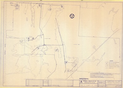
Plan of a Portion of Greely Road, Cumberland, Maine, 1957
H. I. & E. C. Jordan
Plan of a Portion of Greely Road, Cumberland, Maine was created by H. I. & E. C. Jordan in 1957. "As redefined by the Commissioners of the County of Cumberland..." Includes 1976 plan and profile for Kenneth Blanchard.
-

Plan of a Portion of Route 88, Cumberland, Maine, 1962
H. I. & E. C. Jordan
Plan of a Portion of Route 88, Cumberland, Maine was created by H. I. & E. C. Jordan in 1962. "As redefined by the Commissioners of the County of Cumberland."
-

Plan of a Portion of the Bruce Hill Road, Formerly the Abbott Road, Cumberland, Maine, 1962
H. I. & E. C. Jordan
Plan of a Portion of the Bruce Hill Road, Formerly the Abbott Road, Cumberland, Maine was created by H. I. & E. C. Jordan in 1962. “As redefined by the Commissioners of Cumberland County…”
-

Plan of a Portion of the Greely Road in the Town of Cumberland, Maine, as Redifined by the Commissioners of Cumberland County, 1957
Edward C. Jordan Co., Inc. and Harlan H. Sweetser
-

Plan of Astilbe Lane, Yarmouth, Maine, 2000
Land Use Consultants, Inc.
Plan of Astilbe Lane, Yarmouth, Maine was created by Land Use Consultants, Inc. in 2000. Scale 1"=50'.
-

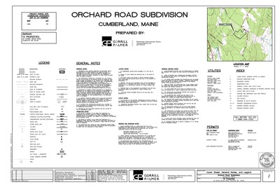
Plan of Autumn Ridge, Orchard Road, Cumberland, Maine, 2007
SYTDesign Consultants
Plan of Autumn Ridge Subdivision, Cumberland, Maine was created by SYTDesign Consultants in 2007. Scale 1"=100'.
-

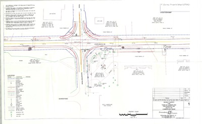
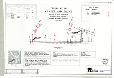
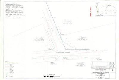
Plan of Blackstrap Road and Skillin Road Intersection Improvements, Cumberland, Maine, 2004
Gorrill-Palmer Consulting Engineers, Inc.
Plan of Blackstrap Road and Skillin Road Intersection Improvements, Cumberland, Maine was created by Gorrill-Palmer Consulting Engineers, Inc. in 2004.
-

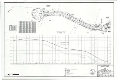
Plan of Blanchard Road Reconstruction Project, Cumberland, Maine, 2000
Gorrill-Palmer Consulting Engineers, Inc.
Plan of Blanchard Road Reconstruction Project, Cumberland, Maine was created by Gorrill-Palmer Consulting Engineers, Inc. in 2000.
-

Plan of Blanchard Road Reconstruction-Water Main, Cumberland, Maine, 2006
Edwards and Kelcey
Plan of Blanchard Road Reconstruction-Water Main, Cumberland, Maine was created by Edwards and Kelcey in 2006. Scale Horizontal: 1"=20ft Vertical: 1"=4'.
-

Plan of Blanchard Road Reconstruction-Watermain, Cumberland, Maine, 2006
Edwards and Kelcey
Plan of Blanchard Road Reconstruction-Watermain, Cumberland, Maine was created by Edwards and Kelcey in 2006. Scale Horizontal: 1"=20ft Vertical: 1"=4'.
-

Plan of Blanchard Road Reconstruction-Water Main, Cumberland, Maine, 2007
Edwards and Kelcey
Blanchard Road Reconstruction-Water Main was created by Edwards and Kelcey in 2007. Scale Horizontal: 1"=20ft Vertical: 1"=4'.
-

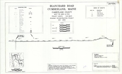
Plan of Blanchard Road Roadway Improvements Project, Cumberland, Maine, April 2013
Gorrill-Palmer Consulting Engineers, Inc.
Plan of Blanchard Road Roadway Improvements Project, Cumberland, Maine was created by Gorrill-Palmer Consulting Engineers, Inc. in 2013. Scale 1"=25'.
-

Plan of Blanchard Road Roadway Improvements Project, Cumberland, Maine, May 2013
Gorrill-Palmer Consulting Engineers, Inc.
Plan of Blanchard Road Roadway Improvements Project, Cumberland, Maine was created by Gorrill-Palmer Consulting Engineers, Inc. in 2013. Scale 1"= 25'.
-

Plan of Blanchard Road Water Main and Fairgrounds Water Service, Cumberland, Maine, 1991
Squaw Bay Corp.
Plan of Blanchard Road Water Main and Fairgrounds Water Service, Cumberland, Maine was created by Squaw Bay Corp. in 1991. Scale 1"=20'.
-

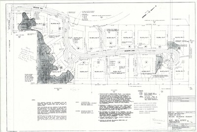
Plan of Break-A-Way Subdivision, Greely Road Extention, Cumberland, Maine, 2014
Maine Bounary Consultants
Plan of Break-A-Way Subdivision, Greely Road Extention, Cumberland, Maine was created by Maine Bounary Consultants in 2014. Scale 1"=100'.
-

Plan of Brentwood, Foreside Road and Ravine Road, Cumberland, Maine, 1979
Edward C. Jordan Co., Inc.
-

Plan of Brentwood, Ravine Drive, Cumberland, Maine, 1979
H. I. & E. C. Jordan and Land Use Consultants, Inc.
Plan of Brentwood, Ravine Drive, Cumberland, Maine was created by H. I. & E. C. Jordan in 1979.
-

Plan of Broad Cove Meadows, Cumberland, Maine, 1970
C. R. Storer, Inc.
Plan of Broad Cove Meadows, Cumberland, Maine was created by C. R. Storer, Inc. in 1970.
-

Plan of Broad Cove Meadows, Island View and Ebb Tide Drives, Cumberland, Maine, 1967
C. R. Storer Inc. and Titcomb Associates Inc.
-

Plan of Broad Cove Shores, Broad Cove Way and Foreside Road, Cumberland, Maine, 1960
Edward C. Jordan Co., Inc.
-

Plan of Broad Cove Wastewater Collection System, Contract No. 4, Cumberland, Maine, 1983
Edward C. Jordan Co., Inc.
-

Plan of Brookwood Subdivision Plan, Greely Road Extension, Cumberland, Maine, 2008
James D. Nadeau, LLC
Plan of Brookwood Subdivision Plan, Greely Road Extension, Cumberland, Maine was created by James D. Nadeau, LLC in 2008. Scale 1"=60'.
-

Plan of Bruce Hill Acres, Bruce Hill Road and Valley Road, Cumberland, Maine, 1980
Robert P. Titcomb Inc.
-

Plan of Bruce Hill Acres II, Cumberland, Maine, 1982
C. R. Storer, Inc.
Plan of Bruce Hill Acres II, Cumberland, Maine was created by C. R. Storer, Inc. in 1982.
-

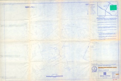
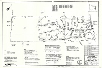
Plan of Bruce Hill Farms, Cumberland, Maine, 1988
Sebago Technics, Inc.
Plan of Bruce Hill Farms, Cumberland, Maine was created by Sebago Technics, Inc. in 1988. Includes amended plan dated 1996.
-

Plan of Bruce Hill Pines, Bruce Hill Road, Cumberland, Maine, 1970
C.R. Storer, Inc.
Plan of Bruce Hill Pines, Bruce Hill Road, Cumberland, Maine was created by C.R. Storer, Inc. in 1970. Scale 1"=100'.
-

Plan of Buried Cable, Blanchard Road and Skillings Road, Cumberland, Maine, 1967
New England Telephone
Plan of Buried Cable, Blanchard Road and Skillings Road, Cumberland, Maine was created by New England Telephone in 1967.
-

Plan of Buried Cable, Brookside Drive, Cumberland, Maine, 1970
New England Telephone
Plan of Buried Cable, Brookside Drive, Cumberland, Maine was created by New England Telephone in 1970.
-

Plan of Buried Cable, Main Street, Cumberland, Maine, 1960
New England Telephone
Plan of Buried Cable, Main Street, Cumberland, Maine was created by New England Telephone in 1960.
-

Plan of Buried Cable, Skillin Road, Cumberland, Maine, 1969
New England Telephone
Plan of Buried Cable, Skillin Road, Cumberland, Maine was created by New England Telephone in 1969.
-

Plan of Burried Cable, Maple View Terrace, Cumberland, Maine, 1971
New England Telephone
Plan of Burried Cable, Maple View Terrace, Cumberland, Maine was created by New England Telephone in 1971.
-

Plan of Castlerock Business Park, Gray Road, Cumberland, Maine, 2008
Terradyn Consultants L.L.C
Plan of Castlerock Business Park, Route 100, Cumberland, Maine was created by Terradyn Consultants L.L.C in 2008. Scale 1"=200'.
-

Plan of Castle Rock Homes, Gray Road, Cumberland, Maine, 2013
SYTDesign Consultants
Plan of Castle Rock Homes, Route 100, Cumberland, Maine was created by SYTDesign Consultants in 2013. Scale 1"=100'.
-

Plan of Cider Mill Subdivision, Whitney Road and Orchard Road, Cumberland, Maine, 2014
Wayne Wood & Co.
Plan of Cider Mill Subdivision, Whitney Road and Orchard Road, Cumberland, Maine was created by Wayne Wood & Co. in 2014. Scale 1"=100'.
-

Plan of Congregational Cemetery, Main Street, Cumberland, Maine, 1935
Sumner S. Lowe and Harlan H. Sweetser
-

Plan of Conifer Ridge Road, Cumberland, Maine, 1988.
SEA Consultants Inc.
Plan of Conifer Ridge Road, Cumberland, Maine was created by SEA Consultants Inc. in 1988.
-

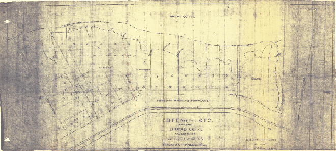
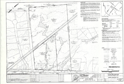
Plan of Cottage Farm Subdivision, Main Street, Cumberland, Maine, 2006
SYTDesign Consultants
Plan of Cottage Farm Subdivision, Main Street, Cumberland, Maine was created by SYTDesign Consultants in 2006. Scale 1"=20'.
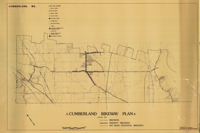
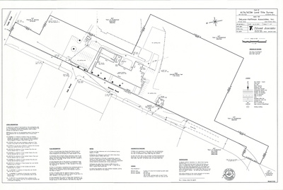
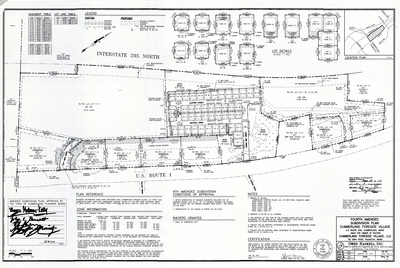
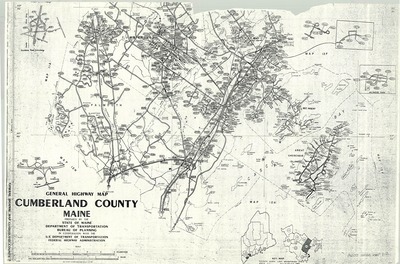
The Town of Cumberland Plans gallery houses a collection of plans and maps of the Town of Cumberland, and exists to gather, preserve, and make available those materials. Materials in the Collection date from the late 19th century to recent times. Types of materials in the collection include subdivision plans, utility maps, planning maps, soil maps, building blueprint sets, and tax/zoning maps.
Printing is not supported at the primary Gallery Thumbnail page. Please first navigate to a specific Image before printing.


