


The Maine Geological Survey provides the people and businesses of Maine with essential geologic information about the land where we live and work.
Note: Many state documents are offered in PDF format. To view PDF documents, you will need the free Adobe Reader. If you need assistance, view our Maine government PDF Help page or contact the contributing Maine State agency via the link on the left sidebar under “Links”.
-

Highest Astronomical Tide on the Maine Coast
Cameron Adams
Maine Geological Survey, Geologic Facts and Localities, Circular GFL-209
-

The Great Landslide of 1868, Westbrook, Maine
Stephen M. Dickson
Maine Geological Survey, Geologic Facts and Localities, Circular GFL-203
-

The Perham Family Quarries, Greenwood, Maine
Sydney D. Eckert
Maine Geological Survey, Geologic Facts and Localities, Circular GFL-205
-

Online Map Resources for Maine
Christian Halsted
Maine Geological Survey, Geologic Facts and Localities, Circular GFL-200
-

Shackford Head State Park, Eastport, Maine
Robert A. Johnston
Maine Geological Survey, Geologic Facts and Localities, Circular GFL-208
-

Geology Guides a Turtle Home, Blue Hill, Maine
Daniel B. Locke
Maine Geological Survey, Geologic Facts and Localities, Circular GFL-207
-

Grand Falls and Spencer Rips, Dead River
Robert G. Marvinney
Maine Geological Survey, Geologic Facts and Localities, Circular GFL-201
-

Status of Beach and Dune Restoration at Western Beach, Scarborough
Peter A. Slovinsky
Maine Geological Survey, Geologic Facts and Localities, Circular GFL-204
-

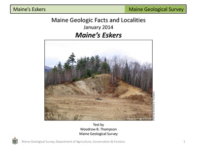
Maine's Eskers
Woodrow B. Thompson
Maine Geological Survey, Geologic Facts and Localities, Circular GFL-199
-

Coastal Bedrock Geology, Cape Newagen, Southport
Thomas K. Weddle
Maine Geological Survey, Geologic Facts and Localities, Circular GFL-202
-

Bedrock Geology at Wolfe's Neck Woods State Park
Thomas K. Weddle and Henry N. Berry IV
Maine Geological Survey, Geologic Facts and Localities, Circular GFL-206
-

The Big Eddy of the Kennebec, Skowhegan, ME
Henry N. Berry IV
Maine Geological Survey, Geologic Facts and Localities, Circular GFL-197
-

Coastal Change in Holmes Bay, Whiting, Maine
Stephen M. Dickson
Maine Geological Survey, Geologic Facts and Localities, Circular GFL-198
-

Fort Foster Park Beach, Kittery, Maine
Stephen M. Dickson
Maine Geological Survey, Geologic Facts and Localities, Circular GFL-190
-

Fluted Till Surfaces, Brookton, Maine
Robert A. Johnston
Maine Geological Survey, Geologic Facts and Localities, Circular GFL-196
-

Sandy River Bank Erosion, Avon, Maine - 2nd Update
Daniel B. Locke
Maine Geological Survey, Geologic Facts and Localities, Circular GFL-191
-

Hacker's Hill, Casco, Maine
Robert G. Marvinney
Maine Geological Survey, Geologic Facts and Localities, Circular GFL-189
-

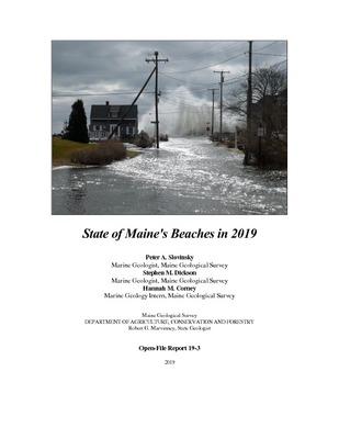
State of Maine's Beaches in 2013
Peter A. Slovinsky, Stephen M. Dickson, and Rachael E. Dye
Maine Geological Survey, Open-File Report 13-19. Provides a description of the changes observed at Maine beaches that are monitored as part of the State of Maine Beach Profiling Project
-

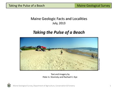
Taking the Pulse of a Beach
Peter A. Slovinsky and Rachael E. Dye
Maine Geological Survey, Geologic Facts and Localities, Circular GFL-194
-

Glacial Geology of Moose Point State Park
Woodrow B. Thompson
Maine Geological Survey, Geologic Facts and Localities, Circular GFL-192
-

Mineral Collecting in Newry, Maine
Woodrow B. Thompson
Maine Geological Survey, Geologic Facts and Localities, Circular GFL-195
-

Bauneg Beg Mountain Conservation Area North Berwick, Maine - Great Works Regional Land Trust Preserve
Thomas K. Weddle
Maine Geological Survey, Geologic Facts and Localities, Circular GFL-193
-

Marlboro Beach, Lamoine, Maine
Thomas K. Weddle
Maine Geological Survey, Geologic Facts and Localities, Circular GFL-188
-

Coastal Ledges of Kittery Formation, Granite, and Basalt - East Point Sanctuary, Biddeford Pool
Henry N. Berry IV
Maine Geological Survey, Geologic Facts and Localities, Circular GFL-184
-

The Rangeley Conglomerate
Henry N. Berry IV
Maine Geological Survey, Geologic Facts and Localities, Circular GFL-187