


The Maine Geological Survey provides the people and businesses of Maine with essential geologic information about the land where we live and work.
Note: Many state documents are offered in PDF format. To view PDF documents, you will need the free Adobe Reader. If you need assistance, view our Maine government PDF Help page or contact the contributing Maine State agency via the link on the left sidebar under “Links”.
-

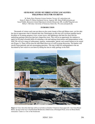
Dune Restoration at Willard Beach in Simonton Cove, South Portland, Maine
Stephen M. Dickson
Maine Geological Survey, Geologic Facts and Localities, Circular GFL-105
-

Geology of Mount Abraham
Robert G. Marvinney
Maine Geological Survey, Geologic Facts and Localities, Circular GFL-111
-

Giant Crystals from Maine
Woodrow B. Thompson
Maine Geological Survey, Geologic Facts and Localities, Circular GFL-108
-

Gordon Falls on the Mattawamkeag River: Red Rocks and White Water
Marc C. Loiselle
Maine Geological Survey, Geologic Facts and Localities, Circular GFL-112
-

Greenbush Landslide: June 30 - July 2, 2006
Michael E. Foley
Maine Geological Survey, Geologic Facts and Localities, Circular GFL-115
-

Impacts of future sea level rise on the coastal floodplain
Peter A. Slovinsky and Stephen M. Dickson
Maine Geological Survey, Open-File Report 06-14. Discusses impacts of 1-3 ft. of sea-level rise in area of Rachel Carson National Wildlife Refuge and surroundings.
-

Mosquito Mountain Granite Quarry, Frankfort, Maine
Henry N. Berry IV
Maine Geological Survey, Geologic Facts and Localities, Circular GFL-110
-

Natural Processes Affecting Stream Bank Erosion: An Update to "Engineered Solution to Stream Bank Erosion"
Daniel B. Locke
Maine Geological Survey, Geologic Facts and Localities, Circular GFL-107
-

Primary Sedimentary Structures in Some Metamorphic Rocks
Thomas K. Weddle
Maine Geological Survey, Geologic Facts and Localities, Circular GFL-114
-

Some Geological Features at Moxie Falls
Robert G. Marvinney
Maine Geological Survey, Geologic Facts and Localities, Circular GFL-104
-

Stretched Metamorphic Rocks, Friendship Boat Launch
Henry N. Berry IV
Maine Geological Survey, Geologic Facts and Localities, Circular GFL-106
-

Alder Pond Massive Sulfide Deposit
Michael E. Foley
Maine Geological Survey, Geologic Facts and Localities, Circular GFL-102
-

Allagash Falls Geology
Robert G. Marvinney
Maine Geological Survey, Geologic Facts and Localities, Circular GFL-100
-

Androscoggin Lake's Outlet Delta System
Daniel B. Locke
Maine Geological Survey, Geologic Facts and Localities, Circular GFL-95
-

Digital Elevation Models: Maine Geology in a New Light
Woodrow B. Thompson
Maine Geological Survey, Geologic Facts and Localities, Circular GFL-94
-

Geology of Augusta's Third Bridge Access Ways
Robert G. Marvinney
Maine Geological Survey, Geologic Facts and Localities, Circular GFL-93
-

Haskell Rock, East Branch Penobscot River
Henry N. Berry IV
Maine Geological Survey, Geologic Facts and Localities, Circular GFL-101
-

Litchfieldite and the Litchfield Sodalite Locality
Marc C. Loiselle
Maine Geological Survey, Geologic Facts and Localities, Circular GFL-103
-

Marshall Shore Town Park
Henry N. Berry IV
Maine Geological Survey, Geologic Facts and Localities, Circular GFL-99
-

Moosehead Lake and the Tale of Two Rivers
Alice R. Kelley, Joseph T. Kelley, Daniel F. Belknap, and A M. Gontz
Maine Geological Survey, Geologic Facts and Localities, Circular GFL-97
-

Ogunquit Beach and Dunes Over Time
Stephen M. Dickson
Maine Geological Survey, Geologic Facts and Localities, Circular GFL-96
-

Some Geological Features at Smalls Falls
Robert G. Marvinney
Maine Geological Survey, Geologic Facts and Localities, Circular GFL-98
-

Surficial geology of the China Lake 7.5' quadrangle, Kennebec County, Maine
Kent M. Syverson and David P. Mans
Maine Geological Survey, Open-File Report 05-18.
-

Virtual Tour of Maine's Bedrock Geology
Maine Geological Survey
Virtual Tours, Circular VT-1. An introductory, photographic tour of Maine's bedrock geology.
-

Virtual Tour of Maine's Coastal Marine Geology
Maine Geological Survey
Virtual Tours, Circular VT-2. An introductory, photographic tour of Maine's coastal marine geology.
-

Virtual Tour of Maine's Geologic Hazards
Maine Geological Survey
Virtual Tours, Circular VT-4. An introductory, photographic tour of Maine's geologic hazards.
-

Virtual Tour of Maine's Ground Water and Wells
Maine Geological Survey
Virtual Tours, Circular VT-5. An introductory, photographic tour of Maine's ground water and wells.
-

Virtual Tour of Maine's Minerals
Maine Geological Survey
Virtual Tours, Circular VT-6. An introductory, photographic tour of Maine's mineral resources.
-

Virtual Tour of Maine's Mines and Quarries
Maine Geological Survey
Virtual Tours, Circular VT-7. An introductory, photographic tour of Maine's mines and quarries.
-

Virtual Tour of Maine's Surficial Geology
Maine Geological Survey
Virtual Tours, Circular VT-8. An introductory, photographic tour of Maine's surficial geology.
-

An Underwater View of the Gulf of Maine Sea Floor
Stephen M. Dickson
Maine Geological Survey, Geologic Facts and Localities, Circular GFL-84
-

Basalt Dikes at Schoodic Point, Acadia National Park
Henry N. Berry IV
Maine Geological Survey, Geologic Facts and Localities, Circular GFL-90
-

Coastal Landslide with Outrunner Blocks, Bunganuc Bluff
Thomas K. Weddle and Henry N. Berry IV
Maine Geological Survey, Geologic Facts and Localities, Circular GFL-91
-

Daggett Rock - Maine's Largest Glacial Erratic
Thomas K. Weddle
Maine Geological Survey, Geologic Facts and Localities, Circular GFL-87
-

Geologically Speaking, What's in a Place Name?
Thomas K. Weddle
Maine Geological Survey, Geologic Facts and Localities, Circular GFL-81
-
 Map by Henry N. Berry IV")
Historical Bedrock Maps of Maine, Part II: The Keith (1933) Map
Henry N. Berry IV
Maine Geological Survey, Geologic Facts and Localities, Circular GFL-86
-
 Map by Henry N. Berry IV")
Historical Bedrock Maps of Maine, Part I: The Hitchcock (1885) Map
Henry N. Berry IV
Maine Geological Survey, Geologic Facts and Localities, Circular GFL-85
-

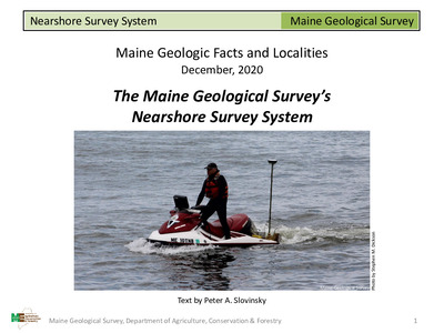
Imaging Nearshore Bathymetry using a Personal Watercraft
Peter A. Slovinsky
Maine Geological Survey, Geologic Facts and Localities, Circular GFL-83
-

Seismic Refraction Profiling: An important tool used in mapping sand and gravel aquifers
Daniel B. Locke
Maine Geological Survey, Geologic Facts and Localities, Circular GFL-82
-

Striped Ledge on Keewaydin Lake
Woodrow B. Thompson
Maine Geological Survey, Geologic Facts and Localities, Circular GFL-89
-

Surficial geology of the Belgrade 7.5' quadrangle, Kennebec County, Maine
Carol T. Hildreth
Maine Geological Survey, Open-File Report 04-38.
-

Surficial geology of the Purgatory quadrangle, Androscoggin, Kennebec, and Sagadahoc Counties, Maine
Carol T. Hildreth
Maine Geological Survey, Open-File Report 03-61.
-

Surficial geology of the Readfield 7.5' quadrangle, Kennebec County, Maine
Carol T. Hildreth
Maine Geological Survey, Open-File Report 04-41.
-

The Agassiz Outcrop: A National Historic Site
Robert G. Marvinney
Maine Geological Survey, Geologic Facts and Localities, Circular GFL-80
-

USGS National Geochemical Survey
Robert A. Johnston
Maine Geological Survey, Geologic Facts and Localities, Circular GFL-88
-

Beach Exposures of Tree Stumps in Wells Embayment
Stephen M. Dickson
Maine Geological Survey, Geologic Facts and Localities, Circular GFL-72.
-

Bedrock geology of the mainland portion of the Newbury Neck and Salsbury Cove 7.5-minute quadrangles
Douglas N. Reusch
Maine Geological Survey, Open-File Report 03-92. Accompanies Open-File Maps 02-162 and 03-91
-

Geology near the Augusta Civic Center
Robert G. Marvinney
Maine Geological Survey, Geologic Facts and Localities, Circular GFL-70.
-

Granite Quarrying in Maine
Robert A. Johnston
Maine Geological Survey, Geologic Facts and Localities, Circular GFL-75.
-

Hydrogeology of the Governor Hill Fish Hatchery Augusta, Maine
Marc C. Loiselle
Maine Geological Survey, Geologic Facts and Localities, Circular GFL-73.
-

Layered Rocks of the Waterville Formation, Central Maine
Henry N. Berry IV
Maine Geological Survey, Geologic Facts and Localities, Circular GFL-71.
-

Maine's Glacial Deltas
Woodrow B. Thompson
Maine Geological Survey, Geologic Facts and Localities, Circular GFL-79
-

Pillow Lavas I Have Known
Robert G. Marvinney
Maine Geological Survey, Geologic Facts and Localities, Circular GFL-69.
-

Red Beach Granite
Henry N. Berry IV
Maine Geological Survey, Geologic Facts and Localities, Circular GFL-77.
-

Surficial geology of the Bethel 7.5-minute quadrangle, Oxford County, Maine
Woodrow B. Thompson
Maine Geological Survey, Open-File Report 03-45
-

Surficial geology of the Bowdoinham 7.5-minute quadrangle, Kennebec and Sagadahoc Counties, Maine
Carol T. Hildreth
Maine Geological Survey, Open-File Report 03-54.
-

Surficial geology of the East Stoneham 7.5-minute quadrangle, Oxford County, Maine
Woodrow B. Thompson
Maine Geological Survey, Open-File Report 03-4
-

Surficial geology of the Gilead 7.5-minute quadrangle, Oxford County, Maine
Woodrow B. Thompson
Maine Geological Survey, Open-File Report 03-58
-

Surficial geology of the Phillips 7.5-minute quadrangle, Franklin County, Maine
Kent M. Syverson and Rachel M. Greve
Maine Geological Survey, Open-File Report 03-48
-

Surficial geology of the Speckled Mountain 7.5-minute quadrangle, Oxford County, Maine
Woodrow B. Thompson
Maine Geological Survey, Open-File Report 03-5
-

The Iron Age of Maine - 1800's - Katahdin Iron Works
Michael E. Foley
Maine Geological Survey, Geologic Facts and Localities, Circular GFL-76.
-
Archaeology by Thomas K. Weddle")
The Iron Age of Maine, Part II The Shapleigh Iron Company: A Foray into Industrial (geo)Archaeology
Thomas K. Weddle
Maine Geological Survey, Geologic Facts and Localities, Circular GFL-78.
-

The Ovens, Bar Harbor, Maine
Henry N. Berry IV
Maine Geological Survey, Geologic Facts and Localities, Circular GFL-74.
-

Variation of beach morphology along the Saco Bay littoral cell: An analysis of recent trends and management alternatives
Peter A. Slovinsky and Stephen M. Dickson
Maine Geological Survey, Open-File Report 03-78. Examination of shoreline types, beach profile shapes, erosion, and accretion along the Saco Bay shoreline. Makes recommendations for sediment management.
-

Bedrock geology of the Bath 1:100,000 map sheet, coastal Maine
Arthur M. Hussey II and Henry N. Berry IV
Maine Geological Survey, Bulletin 42. Describes stratified rock sequences, intrusive rocks, structural geology, and metamorphism of the Bath 1:100,000 map sheet. Accompanies Open-File Map 02-152.
-

Evidence of Ice Retreat, East Shore of Sabattus Pond
Michael E. Foley
Maine Geological Survey, Geologic Facts and Localities, Circular GFL-67.
-

Glacial and Postglacial Geology Highlights in the White Mountain National Forest, Western Maine
Woodrow B. Thompson
Maine Geological Survey, Geologic Facts and Localities, Circular GFL-68.
-

Glacial Lake Varves, Dennistown Plantation, Maine
Thomas K. Weddle
Maine Geological Survey, Geologic Facts and Localities, Circular GFL-66.
-

Mile and Half Mile Beaches at Reid State Park, Maine
Stephen M. Dickson
Maine Geological Survey, Geologic Facts and Localities, Circular GFL-60.
-

Scenic Ledges at Pemaquid Point Lighthouse
Henry N. Berry IV
Maine Geological Survey, Geologic Facts and Localities, Circular GFL-63.
-

Sea-Level Change on Mt. Desert Island, Maine
Joseph T. Kelley
Maine Geological Survey, Geologic Facts and Localities, Circular GFL-59.
-

Striations: the Stone Groove Truth!!
Thomas K. Weddle
Maine Geological Survey, Geologic Facts and Localities, Circular GFL-64.
-

Surficial geology of the Brunswick 7.5' quadrangle, Cumberland and Sagadahoc Counties, Maine
Thomas K. Weddle
Maine Geological Survey, Open-File Report 02-52
-

Surficial geology of the Lake Auburn East 7.5-Minute quadrangle, Androscoggin County, Maine
Carol T. Hildreth
Maine Geological Survey, Open-File Report 02-165
-

Surficial geology of the Lewiston 7.5-minute quadrangle, Androscoggin County, Maine
Carol T. Hildreth
Maine Geological Survey, Open-File Report 02-164
-

The Geology of Sebago Lake State Park
Robert A. Johnston
Maine Geological Survey, Geologic Facts and Localities, Circular GFL-65.
-

The Geology of the Marginal Way, Ogunquit, Maine
Arthur M. Hussey II and Robert G. Marvinney
Maine Geological Survey, Geologic Facts and Localities, Circular GFL-58.
-

The Geology of Two Lights State Park, Cape Elizabeth, Maine
Henry N. Berry IV and Robert G. Marvinney
Maine Geological Survey, Geologic Facts and Localities, Circular GFL-62.
-

The Riggsville Pothole, Georgetown Island, Maine
Thomas K. Weddle
Maine Geological Survey, Geologic Facts and Localities, Circular GFL-57.
-

Thomaston Prison Quarry, Thomaston, Maine
Robert G. Marvinney and Henry N. Berry IV
Maine Geological Survey, Geologic Facts and Localities, Circular GFL-61.
-

Bald Mountain, Washington Plantation, Maine
Robert G. Marvinney
Maine Geological Survey, Geologic Facts and Localities, Circular GFL-48.
-

Bedrock geology of North Haven and Vinalhaven Islands
Olcott Gates
Maine Geological Survey, Open-File Report 01-373. Accompanies Open-File Map 01-352
-

Bottom Sediments of Sebago Lake
Robert A. Johnston
Maine Geological Survey, Geologic Facts and Localities, Circular GFL-53.
-

Engineered Solutions to Stream Bank Erosion: A Case Study
Daniel B. Locke
Maine Geological Survey, Geologic Facts and Localities, Circular GFL-47.
-

Glacial and Postglacial Geology of Grafton Notch State Park
Woodrow B. Thompson
Maine Geological Survey, Geologic Facts and Localities, Circular GFL-55.
-

Laudholm and Drakes Island Beaches: Before and After Beach Nourishment
Stephen M. Dickson
Maine Geological Survey, Geologic Facts and Localities, Circular GFL-54.
-

Mount Apatite Park, Auburn, Maine
Woodrow B. Thompson
Maine Geological Survey, Geologic Facts and Localities, Circular GFL-46.
-

Presumpscot Formation: The Rise and Fall of the Glacial Sea in Maine
Thomas K. Weddle
Maine Geological Survey, Geologic Facts and Localities, Circular GFL-52.
-

Sand and Gravel Aquifer Maps - A Work in Progress
Daniel B. Locke
Maine Geological Survey, Geologic Facts and Localities, Circular GFL-50.
-

Surficial geology of the Lake Auburn West 7.5-minute quadrangle, Androscoggin and Oxford Counties, Maine
Woodrow B. Thompson
Maine Geological Survey, Open-File Report 01-392
-

Surficial geology of the Lisbon Falls North 7.5' quadrangle, Androscoggin, Kennebec, and Sagadahoc Counties, Maine
Thomas K. Weddle
Maine Geological Survey, Open-File Report 01-557
-

Surficial geology of the Mechanic Falls quadrangle, Androscoggin, Cumberland, and Oxford Counties, Maine
Carol T. Hildreth
Maine Geological Survey, Open-File Report 01-479
-

Surficial geology of the Minot 7.5-Minute quadrangle, Androscoggin and Cumberland Counties, Maine
Carol T. Hildreth
Maine Geological Survey, Open-File Report 01-481
-

Surficial geology of the Oxford 7.5-minute quadrangle, Oxford and Androscoggin Counties, Maine
Woodrow B. Thompson
Maine Geological Survey, Open-File Report 01-394
-

Thar's Silver in Them Thar Hills Maine's Silver Rush - 1878 to 1882
Woodrow B. Thompson
Maine Geological Survey, Geologic Facts and Localities, Circular GFL-56.
-

The Bedrock Geology of Mount Battie, Camden, Maine
Henry N. Berry IV
Maine Geological Survey, Geologic Facts and Localities, Circular GFL-51.
-

The Eroding Sandy Point Esker, Stockton Springs, Maine
Joseph T. Kelley
Maine Geological Survey, Geologic Facts and Localities, Circular GFL-49.
-

A General Introduction to the Presumpscot Formation Maine's "Blue Clay"
Thomas K. Weddle
Maine Geological Survey, Geologic Facts and Localities, Circular GFL-43.
-

A Geological Traverse along South Branch Ponds Brook Baxter State Park
Robert G. Marvinney
Maine Geological Survey, Geologic Facts and Localities, Circular GFL-38.
-

A Natural Beach Bonfire in Kittery, Maine
Stephen M. Dickson
Maine Geological Survey, Geologic Facts and Localities, Circular GFL-35.
-

Beach Pebbles Tell a Story
Henry N. Berry IV
Maine Geological Survey, Geologic Facts and Localities, Circular GFL-42.
-

Burnt Island's Glacial Erratics of the Lincoln Sill
Stephen M. Dickson
Maine Geological Survey, Geologic Facts and Localities, Circular GFL-44.
-

Jasper Beach, Machiasport, Maine
Joseph T. Kelley
Maine Geological Survey, Geologic Facts and Localities, Circular GFL-39.
-

Lake Levels and Climate Change in Maine and Eastern North America during the last 12,000 years
Robert A. Johnston
Maine Geological Survey, Geologic Facts and Localities, Circular GFL-45.
-

Maine Geology at the Smithsonian Institution
Robert G. Marvinney
Maine Geological Survey, Geologic Facts and Localities, Circular GFL-37.
-

Maine's Glacial Moraines: Living on the Edge
Woodrow B. Thompson
Maine Geological Survey, Geologic Facts and Localities, Circular GFL-34.
-

Marshall Point Lighthouse and Geology Port Clyde, Maine
Robert G. Marvinney
Maine Geological Survey, Geologic Facts and Localities, Circular GFL-36.
-

Mineralogy of Maine, Volume 2: Mining History, Gems, and Geology
Vandall T. King
Maine Geological Survey. This book is a collection of 16 articles with emphasis on the state's rich mining history, gem production, and geology. Topics include gem mining operations, the 1880's silver boom, meteorites, types of Maine gems, maps of known mineral localities in Maine.
-

Old Topographic Maps: Geological Tools and Records of History
Thomas K. Weddle
Maine Geological Survey, Geologic Facts and Localities, Circular GFL-40.
-

Surficial geology of the Bridgton 7.5-minute quadrangle, Cumberland and Oxford Counties, Maine
Carol T. Hildreth
Maine Geological Survey, Open-File Report 00-139
-

Surficial geology of the Casco quadrangle, Cumberland and Oxford Counties, Maine
Carol T. Hildreth
Maine Geological Survey, Open-File Report 00-142
-

Surficial geology of the Norway 7.5-minute quadrangle, Oxford and Cumberland Counties, Maine
Woodrow B. Thompson
Maine Geological Survey, Open-File Report 00-137
-

Surficial geology of the Southwest Harbor 7.5-minute quadrangle, Hancock County, Maine
Thomas V. Lowell
Maine Geological Survey, Open-File Report 00-146 (superseded by Braun, Lowell, and Foley, 2015, Maine Geological Survey Open-File 15-17 and Braun, Lowell, and Foley, 2015, Maine Geological Survey Open-File 15-38).
-

Surficial geology of the Waterford Flat 7.5-minute quadrangle, Oxford and Cumberland Counties, Maine
Woodrow B. Thompson
Maine Geological Survey, Open-File Report 00-136
-

The Geology of Cobscook Bay State Park
Robert A. Johnston
Maine Geological Survey, Geologic Facts and Localities, Circular GFL-41.
-

Aerial photographs of Maine - Views from the sky
Robert A. Johnston
Maine Geological Survey, Geologic Facts and Localities, Circular GFL-32.
-

Ground Water, Wells and the Summer of 1999
Marc C. Loiselle
Maine Geological Survey, Geologic Facts and Localities, Circular GFL-31.
-

Maine Springs
Andrews L. Tolman
Maine Geological Survey, Geologic Facts and Localities, Circular GFL-27.
-

Meteorites in Maine: Is the sky falling???
Michael E. Foley
Maine Geological Survey, Geologic Facts and Localities, Circular GFL-25.
-

Penobscot Bay 10,000 Years Ago: A submarine canyon was the ancestral Penobscot River valley
Stephen M. Dickson
Maine Geological Survey, Geologic Facts and Localities, Circular GFL-26.
-

Pipeline to the Ice Age
Woodrow B. Thompson
Maine Geological Survey, Geologic Facts and Localities, Circular GFL-23.
-

Seboomook Lake, Maine
Robert G. Marvinney
Maine Geological Survey, Geologic Facts and Localities, Circular GFL-29.
-

Surficial geology of the Bar Mills 7.5-minute quadrangle, York County, Maine
Lewis E. Hunter
Maine Geological Survey, Open-File Report 99-108
-

Surficial geology of the Biddeford 7.5-minute quadrangle, York County, Maine
Carol T. Hildreth
Maine Geological Survey, Open-File Report 99-109
-

Surficial geology of the Biddeford Pool 7.5-minute quadrangle, York County, Maine
Carol T. Hildreth
Maine Geological Survey, Open-File Report 99-110
-

Surficial geology of the Cape Elizabeth 7.5-minute quadrangle, Cumberland County, Maine
J Michael Clinch and Woodrow B. Thompson
Maine Geological Survey, Open-File Report 99-111
-

Surficial geology of the Center Lovell 7.5-minute quadrangle, Oxford County, Maine
Woodrow B. Thompson
Maine Geological Survey, Open-File Report 99-2
-

Surficial geology of the Cumberland Center 7.5-minute quadrangle, Cumberland County, Maine
Michael J. Retelle
Maine Geological Survey, Open-File Report 99-112
-

Surficial geology of the Dover East 7.5-minute quadrangle, York County, Maine
Geoffrey W. Smith
Maine Geological Survey, Open-File Report 99-113
-

Surficial geology of the Freeport 7.5-minute quadrangle, Cumberland County, Maine
Thomas K. Weddle
Maine Geological Survey, Open-File Report 99-114
-

Surficial geology of the Fryeburg 7.5-minute quadrangle, Oxford County, Maine
Woodrow B. Thompson
Maine Geological Survey, Open-File Report 99-8
-

Surficial geology of the Gorham 7.5-minute quadrangle, Cumberland and York Counties, Maine
Geoffrey W. Smith
Maine Geological Survey, Open-File Report 99-115
-

Surficial geology of the Hiram 7.5-minute quadrangle, Oxford and Cumberland Counties, Maine
Woodrow B. Thompson and William R. Holland
Maine Geological Survey, Open-File Report 99-116
-

Surficial geology of the Kennebunk 7.5-minute quadrangle, York County, Maine
Geoffrey W. Smith
Maine Geological Survey, Open-File Report 99-117
-

Surficial geology of the Kennebunkport 7.5-minute quadrangle, York County, Maine
Geoffrey W. Smith
Maine Geological Survey, Open-File Report 99-118
-

Surficial geology of the Kittery 7.5-minute quadrangle, York County, Maine
Patrick B. O'Toole and J Michael Clinch
Maine Geological Survey, Open-File Report 99-119
-

Surficial geology of the Limerick 7.5-minute quadrangle, York County, Maine
Thom Wilch
Maine Geological Survey, Open-File Report 99-120
-

Surficial geology of the Limington 7.5-minute quadrangle, York and Cumberland Counties, Maine
Andres Meglioli and Woodrow B. Thompson
Maine Geological Survey, Open-File Report 99-121
-

Surficial geology of the Milton 7.5-minute quadrangle, York County, Maine
Andres Meglioli
Maine Geological Survey, Open-File Report 99-122
-

Surficial geology of the North Berwick 7.5-minute quadrangle, York County, Maine
Geoffrey W. Smith
Maine Geological Survey, Open-File Report 99-123
-

Surficial geology of the North Pownal 7.5-minute quadrangle, Androscoggin and Cumberland Counties, Maine
Cheryl L. Marvinney
Maine Geological Survey, Open-File Report 99-124
-

Surficial geology of the North Waterford 7.5-minute quadrangle, Oxford County, Maine
Woodrow B. Thompson
Maine Geological Survey, Open-File Report 99-4
-

Surficial geology of the Old Orchard Beach 7.5-minute quadrangle, Cumberland and York Counties, Maine
Michael J. Retelle
Maine Geological Survey, Open-File Report 99-125
-

Surficial geology of the Pleasant Mountain 7.5-minute quadrangle, Oxford and Cumberland Counties, Maine
Woodrow B. Thompson
Maine Geological Survey, Open-File Report 99-6
-

Surficial geology of the Portland East 7.5-minute quadrangle, Cumberland County, Maine
Alexa Bernotavicz
Maine Geological Survey, Open-File Report 99-126
-

Surficial geology of the Portsmouth 7.5-minute quadrangle, York County, Maine
Geoffrey W. Smith
Maine Geological Survey, Open-File Report 99-127
-

Surficial geology of the Prouts Neck 7.5-minute quadrangle, Cumberland and York Counties, Maine
J Michael Clinch and Woodrow B. Thompson
Maine Geological Survey, Open-File Report 99-128
-

Surficial geology of the Rochester 7.5-minute quadrangle, York County, Maine
Geoffrey W. Smith
Maine Geological Survey, Open-File Report 99-129
-

Surficial geology of the Somersworth 7.5-minute quadrangle, York County, Maine
Geoffrey W. Smith
Maine Geological Survey, Open-File Report 99-130
-

Surficial geology of the South Harpswell 7.5-minute quadrangle, Cumberland County, Maine
Alexa A. Bernotavicz and Mark Dubois
Maine Geological Survey, Open-File Report 99-131
-

Surficial geology of the Standish 7.5-minute quadrangle, York and Cumberland Counties, Maine
John C. Gosse
Maine Geological Survey, Open-File Report 99-132
-

Surficial geology of the Steep Falls 7.5-minute quadrangle, York and Cumberland Counties, Maine
John C. Gosse and Woodrow B. Thompson
Maine Geological Survey, Open-File Report 99-133
-

Surficial geology of the Waterboro 7.5-minute quadrangle, York County, Maine
Andres Meglioli
Maine Geological Survey, Open-File Report 99-134
-

Surficial geology of the Wells 7.5-minute quadrangle, York County, Maine
Geoffrey W. Smith
Maine Geological Survey, Open-File Report 99-135
-

Surficial geology of the Yarmouth 7.5-minute quadrangle, Cumberland County, Maine
Michael J. Retelle
Maine Geological Survey, Open-File Report 99-136
-

Surficial geology of the York Beach 7.5-minute quadrangle, York County, Maine
Patrick B. O'Toole and J Michael Clinch
Maine Geological Survey, Open-File Report 99-137
-

Surficial geology of the York Harbor 7.5-minute quadrangle, York County, Maine
J Michael Clinch and Patrick B. O'Toole
Maine Geological Survey, Open-File Report 99-138
-

The Jailhouse Delta, Alfred, Maine
Thomas K. Weddle and Craig Neil
Maine Geological Survey, Geologic Facts and Localities, Circular GFL-30.
-

The Sunkhaze Peatland Complex
Daniel B. Locke
Maine Geological Survey, Geologic Facts and Localities, Circular GFL-33.
-

The Variety of Maine's Changing Shoreline
Joseph T. Kelley
Maine Geological Survey, Geologic Facts and Localities, Circular GFL-28.
-

Why is Sebago Lake so deep?
Robert A. Johnston
Maine Geological Survey, Geologic Facts and Localities, Circular GFL-24.
-

Active Coastal Processes in the Lubec Embayment
Joseph T. Kelley
Maine Geological Survey, Geologic Facts and Localities, Circular GFL-19.
-

A Geological Tour of Tumbledown Mountain, Maine
Robert G. Marvinney
Maine Geological Survey, Geologic Facts and Localities, Circular GFL-16.
-

Ancient Volcanic Rocks on Vinalhaven Island, Maine
Henry N. Berry IV
Maine Geological Survey, Geologic Facts and Localities, Circular GFL-15.
-

Beach dynamics of Sebago Lake: A report on the results of beach profiling
Robert A. Johnston and Martha N. Mixon
Maine Geological Survey, Open-File Report 98-122. Results of beach profiling around perimeter of Sebago Lake to determine shoreline erosion and accretion.
-

Folded Metamorphic Rocks Near Willard Beach South Portland, Maine
Henry N. Berry IV
Maine Geological Survey, Geologic Facts and Localities, Circular GFL-17.
-

Hydrogeology and water quality of significant sand and gravel aquifers in parts of Hancock, Penobscot, and Piscataquis Counties, Maine
Craig D. Neil, Daniel B. Locke, and William J. Nichols Jr
Maine Geological Survey, Open-File Report 98-57. Accompanies 1:24,000 Significant Aquifer Maps
-

Hydrogeology and water quality of significant sand and gravel aquifers in parts of Piscataquis and Somerset Counties, Maine
William J. Nichols, Craig D. Neil, Daniel B. Locke, and Michael E. Foley
Maine Geological Survey, Open-File Report 98-2. Accompanies 1:24000 Significant Aquifer Maps
-

Hydrogeology of the Bingham Water District Well
Andrews L. Tolman
Maine Geological Survey, Geologic Facts and Localities, Circular GFL-22.
-

Lobster Lake, Maine
Robert G. Marvinney
Maine Geological Survey, Geologic Facts and Localities, Circular GFL-20.
-

Somes Sound, Mount Desert Island, Maine
Joseph T. Kelley
Maine Geological Survey, Geologic Facts and Localities, Circular GFL-21.
-

Subsurface Geology of the Kennebec River
Daniel B. Locke
Maine Geological Survey, Geologic Facts and Localities, Circular GFL-18.
-

The seafloor revealed: The geology of the northwestern Gulf of Maine inner continental shelf
Joseph T. Kelley, Walter A. Barnhardt, Daniel F. Belknap, Stephen M. Dickson, and Alice R. Kelley
Maine Geological Survey, Open-File Report 96-6. Explains the surficial geology, physiography, and geologic history of the Maine coast. Methods and analysis detail how the seafloor was studied. Data were interpreted from side-scan sonar records, seismic reflection profiles, bottom samples, and submersible dives.
-

Tracy Corners Gravel Pit, Addison, Maine
Thomas K. Weddle
Maine Geological Survey, Geologic Facts and Localities, Circular GFL-14.
-

WWII Rockets Removed from Beach at Reid State Park
Stephen M. Dickson
Maine Geological Survey, Geologic Facts and Localities, Circular GFL-13.
-

Aftermath of the 1996 Rockland Landslide
Henry N. Berry IV, Stephen M. Dickson, Joseph T. Kelley, and Daniel B. Locke
Maine Geological Survey, Geologic Facts and Localities, Circular GFL-9.
-

Belfast Bay Pockmark Field, Maine
Joseph T. Kelley
Maine Geological Survey, Geologic Facts and Localities, Circular GFL-11.
-

How much snow is out there anyway?
Henry N. Berry IV and Marc C. Loiselle
Maine Geological Survey, Geologic Facts and Localities, Circular GFL-2.
-

Hydrogeology and water quality of significant sand and gravel aquifers in parts of Aroostook, Penobscot, and Washington Counties, Maine
Daniel B. Locke, Craig B. Neil, William J. Nichols Jr, and Thomas K. Weddle
Maine Geological Survey, Open-File Report 97-44. Accompanies 1:24000 Significant Aquifer Maps
-

Infilled Kettle Hole, Easton, Aroostook County, Main
Thomas K. Weddle
Maine Geological Survey, Geologic Facts and Localities, Circular GFL-5.
-

Mount Katahdin, Baxter State Park, Maine
Woodrow B. Thompson
Maine Geological Survey, Geologic Facts and Localities, Circular GFL-1.
-

Portland Head Light, Cape Elizabeth, Maine
Henry N. Berry IV
Maine Geological Survey, Geologic Facts and Localities, Circular GFL-6.
-

Sedimentary framework of the inner continental shelf of Maine with special emphasis on commercial quality sand and gravel deposits and potentially economic heavy mineral placers
J T. Kelley, S M. Dickson, C Lehmann, and W A. Barnhardt
Maine Geological Survey, Open-File Report 97-4
-

Shells on the Beach
Stephen M. Dickson
Maine Geological Survey, Geologic Facts and Localities, Circular GFL-4.
-

Songo Beach, Sebago Lake State Park
Robert A. Johnston
Maine Geological Survey, Geologic Facts and Localities, Circular GFL-8.
-

Summary of Sebago Lake Shoreline Change Studies, 1990-1997
Robert A. Johnston and Martha M. Mixon
Maine Geological Survey, Geologic Facts and Localities, Circular GFL-7.
-

Surficial geology of the Brownfield 7.5-minute quadrangle, Oxford County, Maine
P Thompson Davis and William R. Holland
Maine Geological Survey, Open-File Report 97-63
-

Surficial geology of the Cornish 7.5-minute quadrangle, Cumberland, Oxford, and York Counties, Maine
Robert M. Newton and William R. Holland
Maine Geological Survey, Open-File Report 97-69
-

Surficial geology of the Gray 7.5-minute quadrangle, Androscoggin and Cumberland Counties, Maine
Thomas K. Weddle
Maine Geological Survey, Open-File Report 97-73
-

Surficial geology of the Great East Lake 7.5-minute quadrangle, York County, Maine
Jon C. Boothroyd
Maine Geological Survey, Open-File Report 97-61
-

Surficial geology of the Kezar Falls 7.5-minute quadrangle, Oxford and York Counties, Maine
P Thompson Davis and William R. Holland
Maine Geological Survey, Open-File Report 97-67
-

Surficial geology of the Lisbon Falls South 7.5-minute quadrangle, Androscoggin, Cumberland, and Sagadahoc Counties, Maine
Thomas K. Weddle
Maine Geological Survey, Open-File Report 97-64
-

Surficial geology of the Mousam Lake 7.5-minute quadrangle, York County, Maine
Andres Meglioli and Woodrow B. Thompson
Maine Geological Survey, Open-File Report 97-74
-

Surficial geology of the Naples 7.5-minute quadrangle, Cumberland County, Maine
Carol T. Hildreth
Maine Geological Survey, Open-File Report 97-65
-

Surficial geology of the North Sebago 7.5-minute quadrangle, Oxford and Cumberland Counties, Maine
Carolyn A. Lepage
Maine Geological Survey, Open-File Report 97-71
-

Surficial geology of the North Windham 7.5-minute quadrangle, Cumberland County, Maine
Andreé M. Bolduc, Woodrow B. Thompson, and Andres Meglioli
Maine Geological Survey, Open-File Report 97-75
-

Surficial geology of the Portland West 7.5-minute quadrangle, Cumberland County, Maine
Woodrow B. Thompson
Maine Geological Survey, Open-File Report 97-66
-

Surficial geology of the Raymond 7.5-minute quadrangle, Cumberland County, Maine
Michael J. Retelle
Maine Geological Survey, Open-File Report 97-72
-

Surficial geology of the Sanford 7.5-minute quadrangle, York County, Maine
Craig D. Neil
Maine Geological Survey, Open-File Report 97-70
-

Surficial geology of the Sebago Lake 7.5-minute quadrangle, Cumberland County, Maine
Carol T. Hildreth
Maine Geological Survey, Open-File Report 97-68
-

Surficial geology of the West Newfield 7.5-minute quadrangle, York County, Maine
Robert M. Newton
Maine Geological Survey, Open-File Report 97-62
-

The Cap-Rouge, Quebec, Earthquake
Henry N. Berry IV
Maine Geological Survey, Geologic Facts and Localities, Circular GFL-12.
-

Thrust Faults in Northern Maine
Robert G. Marvinney
Maine Geological Survey, Geologic Facts and Localities, Circular GFL-10.
-

Volume and quality of sand and gravel aggregate in the submerged paleodeltas of the Kennebec and Penobscot River mouth areas, Maine
Joseph T. Kelley, Stephen M. Dickson, Walter A. Barnhardt, and Daniel F. Belknap
Maine Geological Survey, Open-File Report 97-5. Reports on results of a geophysical and coring investigation of sand volumes at mouths of Kennebec and Penobscot Rivers
-

Water, water everywhere....
Marc C. Loiselle
Maine Geological Survey, Geologic Facts and Localities, Circular GFL-3.
-

The April 1996 Rockland landslide
Henry N. Berry IV, Stephen M. Dickson, Joseph T. Kelley, Daniel B. Locke, Robert G. Marvinney, Woodrow B. Thompson, Thomas K. Weddle, Richard T. Reynolds, and Daniel F. Belknap
Maine Geological Survey, Open-File Report. Discussion of 1996 Rockland landslide. Includes black-and-white plate showing panoramic photos of the 1973 and 1996 Rockland landslides.
-

A sand budget for Saco Bay, Maine
J T. Kelley, D F. Belknap, D M. FitzGerald, D C. Barber, S M. Dickson, S van Heteren, L K. Fink, and P A. Manthorp
Maine Geological Survey, Open-File Report 95-01. Sand budget constructed using data from side-scan sonar, seismic reflection, vibracores, and ground-penetrating radar.
-

Hydrogeology and water quality of significant sand and gravel aquifers in parts of Franklin, Oxford and Somerset Counties, Maine
William J. Nichols Jr, Craig D. Neil, and Thomas K. Weddle
Maine Geological Survey, Open-File Report 95-3. Accompanies 1:24000 Significant Aquifer Maps
-

Hydrogeology and water quality of significant sand and gravel aquifers in parts of Franklin, Penobscot, Piscataquis, and Somerset Counties, Maine
Lauren E. Foster, Elizabeth B. Lewis, William J. Nichols Jr, Craig D. Neil, and Thomas K. Weddle
Maine Geological Survey, Open-File Report 95-37. Accompanies 1:24000 Significant Aquifer Maps
-

Late Wisconsinan glacial deposits in the Portland - Sebago Lake - Ossipee Valley region, southwestern Maine
Woodrow B. Thompson, P Thompson Davis, John C. Gosse, Robert A. Johnston, and Robert Newton
Maine Geological Survey, Open-File Report 95-74. Guidebook for the 58th Field Conference of the Northeastern Friends of the Pleistocene.
-

Volume and quality of sand and gravel aggregate in the submerged paleodelta, shorelines, and modern shoreface of Saco Bay, Maine
Joseph T. Kelley, Stephen M. Dickson, Walter A. Barnhardt, Donald Barber, and Daniel F. Belknap
Maine Geological Survey, Open-File Report 95-71. Sand volume and thickness in three offshore depositional environments of Saco Bay, with interpreted seismic reflection profiles and underwater vibracores.
-

Mineralogy of Maine, Volume 1: Descriptive mineralogy
Vandall T. King and Eugene E. Foord
Maine Geological Survey. A comprehensive listing of all known minerals found in Maine. Text includes locality names and extensive references to the discovery and abundance of Maine minerals.
-

Sebago Lake State Park beach dynamics; a report on results of beach profiling
Stephen M. Dickson and Robert A. Johnston
Maine Geological Survey, Open-File Report 94-4. Results of beach profiling at Sebago Lake State Park to determine shoreline erosion and accretion.
-

Field relationships, petrology, structure, and intrusion history of the Waldoboro pluton granitoid complex, Maine, U.S.A.
William C. Sidle and Michael Barton
Maine Geological Survey, Open-File Report 92-64. Discusses petrography, field relations, and structure of Waldoboro pluton complex.
-

Geology of the Saddle Pond-Grand Lake Seboeis region, north-central Maine
James P. Hibbard and Stephen A. Hall
Maine Geological Survey, Open-File Report 92-60. Describes stratigraphy, intrusive rocks, and structure. Includes small map of area (1:62500)
-

Hydrogeology and water quality of significant sand and gravel aquifers in parts of Aroostook, Hancock, Penobscot, Piscataquis, and Waldo Counties, Maine
Craig D. Neil, Judy I. Steiger, and Thomas K. Weddle
Maine Geological Survey, Open-File Report 92-2. Accompanies 1:24000 Significant Aquifer Maps
-

Geomorphology and sedimentary framework of Blue Hill and Frenchman Bays and adjacent inner continental shelf
Walter Barnhardt and Joseph T. Kelley
Maine Geological Survey, Open-File Report 91-6. Seismic reflection profiles, side-scan sonar images, bottom sediment composition and texture. Offshore coverage from Swans Island to Schoodic Point.
-

Microearthquake measurements near South Sebec, Maine, 1989-1990
Carol D. Rea, William E. Doll, John E. Ebel, Sandra J. Craven, and John J. Cipar
Maine Geological Survey, Open-File Report 91-5. Report on portable seismograph measurements of microearthquakes.
-

Mining in Maine: past, present, and future
Carolyn A. Lepage, Michael E. Foley, and Woodrow B. Thompson
Maine Geological Survey, Open-File Report 91-7. History of mining in Maine from early 1800's to the present
-

Response of balsam fir and red spruce trees to copper and molybdenum-rich soils at Catheart Mountain, Somerset County, Maine
Frank C. Canney and Gary A. Nowland
Maine Geological Survey, Open-File Report 91-1. Describes biogeochemical techniques and their utility for identifying molybdenum-bearing deposits.
-

Geochemistry of selected Maine peat deposits
Stephen A. Norton
Maine Geological Survey, Bulletin 34. Geochemistry of selected Maine peat deposits
-

Mineralogy and pore water chemistry of Presumpscot clays
Lawrence M. Mayer
Maine Geological Survey, Open-File Report 90-23. Analysis of samples from borings in landslides described in Open-File Report 90-24. Includes water content, salinity, and percent silt/clay.
-

Processing and preliminary interpretation of Bottle Lake seismic reflection data
John K. Costain, William J. Domoracki, and Cahit Coruh
Maine Geological Survey, Open-File Report 90-25d
-

Sedimentary framework of the southern Maine inner continental shelf: Preliminary results from vibracores
Joseph T. Kelley, Stephen M. Dickson, Daniel F. Belknap, and Julie K. Friez
Maine Geological Survey, Open-File Report 90-1. Descriptions of thirteen underwater vibracores and their relation to seismic reflection profiles and marine geologic environments. Cores from Saco Bay, Casco Bay, Cape Small/Seguin Island areas.
-

Stability of natural slopes in the Presumpscot Formation
Steven C. Devin and Thomas C. Sandford
Maine Geological Survey, Open-File Report 90-24. Discussion of Presumpscot Formation and analysis of Bunganuc and Westbrook landslides.
-
Ar/(39)Ar isotopic dating of the Horserace quartz diorite and its bearing on age relationships in the Katahdin batholith-Traveler rhyolite system by A Scott Denning and Daniel R. Lux")
(40)Ar/(39)Ar isotopic dating of the Horserace quartz diorite and its bearing on age relationships in the Katahdin batholith-Traveler rhyolite system
A Scott Denning and Daniel R. Lux
in Tucker, Robert D., and Marvinney, Robert G. (editors), Studies in Maine geology: Volume 4 - igneous and metamorphic geology: Maine Geological Survey, p. 115-123.
-

A contribution to the earthquake history of Maine
David C. Smith, Catherine Fox, Beatrice Craig, and Anne E. Bridges
in Anderson, Walter A., and Borns, Harold W., Jr. (editors), Neotectonics of Maine: studies in seismicity, crustal warping, and sea level change: Maine Geological Survey, Bulletin 40, p. 139-148.
-

An inventory of distribution and variation in salt marshes from different settings along the Maine coast
George L. Jacobson Jr and Heather A. Jacobson
in Anderson, Walter A., and Borns, Harold W., Jr. (editors), Neotectonics of Maine: studies in seismicity, crustal warping, and sea level change: Maine Geological Survey, Bulletin 40, p. 69-83.
-

An investigation of neotectonic activity in coastal Maine by seismic reflection methods
Joseph T. Kelley, Daniel F. Belknap, R Craig Shipp, and Sarah B. Miller
in Anderson, Walter A., and Borns, Harold W., Jr. (editors), Neotectonics of Maine: studies in seismicity, crustal warping, and sea level change: Maine Geological Survey, Bulletin 40, p. 157-204.
-

A stratigraphic synthesis of eastern Maine and western New Brunswick
Henry Newhall Berry IV and Philip H. Osberg
in Tucker, Robert D., and Marvinney, Robert G. (editors), Studies in Maine Geology: Volume 2 - structure and stratigraphy: Maine Geological Survey, p. 1-32.
-

A submerged shoreline on the inner continental shelf of the western Gulf of Maine
R Craig Shipp, Daniel F. Belknap, and Joseph T. Kelley
in Tucker, Robert D., and Marvinney, Robert G. (editors), Studies in Maine geology: Volume 5 - Quaternary geology: Maine Geological Survey, p. 11-28.
-

A thermal model for Carboniferous metamorphism near the Sebago batholith in western Maine
James J. De Yoreo, Daniel R. Lux, and Charles V. Guidotti
in Tucker, Robert D., and Marvinney, Robert G. (editors), Studies in Maine geology: Volume 3 - igneous and metamorphic geology: Maine Geological Survey, p. 19-34.
-

Carboniferous Barrovian metamorphism in southern Maine
Jennifer A. Thomson and Charles V. Guidotti
in Tucker, Robert D., and Marvinney, Robert G. (editors), Studies in Maine geology: Volume 3 - igneous and metamorphic geology: Maine Geological Survey, p. 35-51.
-

Changing perspectives of the Quaternary surficial geology of Maine
Harold W. Borns Jr
in Tucker, Robert D., and Marvinney, Robert G. (editors), Studies in Maine geology: Volume 6 - Quaternary geology: Maine Geological Survey, p. 1-11.
-

Commingled gabbroic and granitic magmas in the northern Bays-of-Maine igneous complex, Calais area
Malcolm D. Hill and Richard N. Abbott Jr
in Tucker, Robert D., and Marvinney, Robert G. (editors), Studies in Maine geology: Volume 4 - igneous and metamorphic geology: Maine Geological Survey, p. 35-43.
-

Compositional variation of plutonism in the coastal Maine magmatic province; mode of origin and tectonic setting
John P. Hogan and A Krishna Sinha
in Tucker, Robert D., and Marvinney, Robert G. (editors), Studies in Maine geology: Volume 4 - igneous and metamorphic geology: Maine Geological Survey, p. 1-33.
-

Deglaciation of the upper Androscoggin River valley and northeastern White Mountains, Maine and New Hampshire
Woodrow B. Thompson and Brian K. Fowler
in Tucker, Robert D., and Marvinney, Robert G. (editors), Studies in Maine geology: Volume 6 - Quaternary geology: Maine Geological Survey, p. 71-88.
-

Depositional sequence modeling of late Quaternary geologic history, west-central Maine coast
Daniel F. Belknap, R Craig Shipp, Joseph T. Kelley, and Detmar Schnitker
in Tucker, Robert D., and Marvinney, Robert G. (editors), Studies in Maine geology: Volume 5 - Quaternary geology: Maine Geological Survey, p. 29-46.
-

Final report - Pesticides in ground water study
Craig D. Neil, John S. Williams, and Thomas K. Weddle
Maine Geological Survey, Open-File Report 89-2. Final report on pesticide study in agricultural areas.
-

Geochemical aspects of volcanic rocks on islands in East Penobscot Bay
Steven R. Pinette and Philip H. Osberg
in Tucker, Robert D., and Marvinney, Robert G. (editors), Studies in Maine geology: Volume 3 - igneous and metamorphic geology: Maine Geological Survey, p. 91-110.
-

Geochemistry of the Catheart Mountain porphyry copper deposit, Maine
Robert A. Ayuso
in Tucker, Robert D., and Marvinney, Robert G. (editors), Studies in Maine geology: Volume 4 - igneous and metamorphic geology: Maine Geological Survey, p. 139-162.
-

Geochemistry of the granite-gabbro complex on Vinalhaven Island, Maine
Christopher B. Mitchell and J Michael Rhodes
in Tucker, Robert D., and Marvinney, Robert G. (editors), Studies in Maine geology: Volume 4 - igneous and metamorphic geology: Maine Geological Survey, p. 45-62.
-

Geochronology of the Songo pluton, western Maine
Daniel R. Lux, David Gibson, and P J. Hamilton
in Tucker, Robert D., and Marvinney, Robert G. (editors), Studies in Maine geology: Volume 4 - igneous and metamorphic geology: Maine Geological Survey, p. 101-114.
-

Geodetic evidence of current crustal motion in Maine
David Tyler
in Anderson, Walter A., and Borns, Harold W., Jr. (editors), Neotectonics of Maine: studies in seismicity, crustal warping, and sea level change: Maine Geological Survey, Bulletin 40, p. 205-208.
-

Geologic and geomechanical properties of the Mount Waldo granite, Maine
Fitzhugh T. Lee and Sharon F. Diehl
in Tucker, Robert D., and Marvinney, Robert G. (editors), Studies in Maine Geology: Volume 2 - structure and stratigraphy: Maine Geological Survey, p. 187-200.
-

Geology and geochemistry of the Rattlesnake Mountain igneous complex, Raymond and Casco, Maine
John W. Creasy
in Tucker, Robert D., and Marvinney, Robert G. (editors), Studies in Maine geology: Volume 4 - igneous and metamorphic geology: Maine Geological Survey, p. 63-78.
-

Geology of southwestern coastal Maine
Arthur M. Hussey II
in Anderson, Walter A., and Borns, Harold W., Jr. (editors), Neotectonics of Maine: studies in seismicity, crustal warping, and sea level change: Maine Geological Survey, Bulletin 40, p. 25-42.
-

Geomechanical aspects of subsidence in eastern Maine
Fitzhugh T. Lee and Sharon F. Diehl
in Anderson, Walter A., and Borns, Harold W., Jr. (editors), Neotectonics of Maine: studies in seismicity, crustal warping, and sea level change: Maine Geological Survey, Bulletin 40, p. 209-218.
-

Geomorphology and late Quaternary evolution of the Saco Bay region
Joseph T. Kelley, R Craig Shipp, and Daniel F. Belknap
in Tucker, Robert D., and Marvinney, Robert G. (editors), Studies in Maine geology: Volume 5 - Quaternary geology: Maine Geological Survey, p. 47-65.
-

Geomorphology and sedimentary framework of Penobscot Bay and adjacent inner continental shelf
Joseph T. Kelley and Daniel F. Belknap
Maine Geological Survey, Open-File Report 89-3. Seismic reflection profiles, side-scan sonar images, bottom sediment composition and texture. Offshore coverage from Rockland to Deer Isle.