


The Maine Geological Survey provides the people and businesses of Maine with essential geologic information about the land where we live and work.
Note: Many state documents are offered in PDF format. To view PDF documents, you will need the free Adobe Reader. If you need assistance, view our Maine government PDF Help page or contact the contributing Maine State agency via the link on the left sidebar under “Links”.
-

Beach Scraping and Dune Restoration at Goose Rocks Beach, Kennebunkport, Maine
Caroline Fales and Peter A. Slovinsky
Maine Geological Survey, Geologic Facts and Localities, Circular GFL-275.
-

Improvements to Industrial Water Use Data Collection for Maine, 2019-2022
Ryan P. Gordon, Stephen M. Dickson, and Mary E. Szatkowski
Maine Geological Survey, Circular 26-1.
-

Improving Agricultural Water Use Data in Maine, 2016-2018
Ryan P. Gordon, Amber T.H. Whittaker, Robert G. Marvinney, and Mary E. Szatkowski
Maine Geological Survey, Circular 26-2.
-

Rattlesnake Mountain, Raymond, Maine
Amber T.H. Whittaker
Maine Geological Survey, Geologic Facts and Localities, Circular GFL-276.
-

A Tale of Two Shorelines: Historical Shoreline Changes at Higgins Beach, Scarborough, ME
Jeannette Berman
Maine Geological Survey, Geologic Facts and Localities, Circular GFL-269.
-
 Enterprise Geodatabase Implementation Project Report by Christian H. Halsted")
GeMS (Geologic Map Schema) Enterprise Geodatabase Implementation Project Report
Christian H. Halsted
Maine Geological Survey, Circular 25-17.
-

Granitic Pegmatites and a Rock Castle at Round Mountain, Albany Twp, Maine
Myles Felch
Maine Geological Survey, Geologic Facts and Localities, Circular GFL-271.
-

Mount Zircon, Rumford, Maine
Lindsay J. Theis
Maine Geological Survey, Geologic Facts and Localities, Circular GFL-274.
-

Schist and Lichens at Glassface Ledges, Rumford, ME
Myles Felch and Julie Reiff
Maine Geological Survey, Geologic Facts and Localities, Circular GFL-270.
-

The Geology of Buck’s and Lapham Ledges, Woodstock, Maine
Myles Felch
Maine Geological Survey, Geologic Facts and Localities, Circular GFL-272.
-

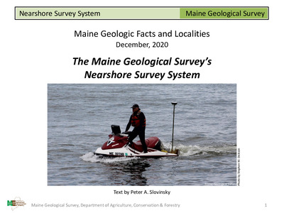
The Maine Geological Survey’s Updated Nearshore Survey System, “Nessie”
Peter A. Slovinsky and Jeannette Berman
Maine Geological Survey, Geologic Facts and Localities, Circular GFL-273.
-

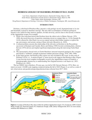
Bedrock Geology of Islesboro, Penobscot Bay, Maine
Luis Torres, Justin Strauss, Taury Smith, and Douglas Reusch
in Theis, L.J. and Whittaker, A.T.H., editors, Hills to Sea: Field trips in the Penobscot Bay Region, Maine: New England Intercollegiate Geological Conference, p. 268–295
-

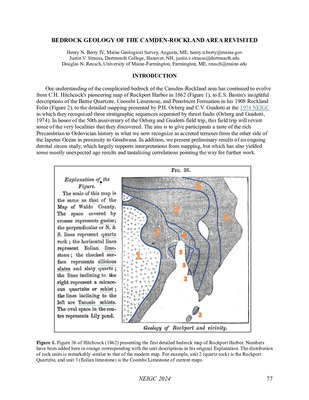
Bedrock Geology of the Camden-Rockland Area Revisited
Henry N. Berry IV, Justin V. Strauss, and Douglas N. Reusch
in Theis, L.J. and Whittaker, A.T.H., editors, Hills to Sea: Field trips in the Penobscot Bay Region, Maine: New England Intercollegiate Geological Conference, p. 77–98
-

Bedrock geology of the Louds Island and New Harbor 7.5' quadrangles, Maine
David P. West Jr
Maine Geological Survey, Bulletin 46.
-

Carlson Woods, Unity, ME
Lindsay J. Theis
Maine Geological Survey, Geologic Facts and Localities, Circular GFL-265.
-

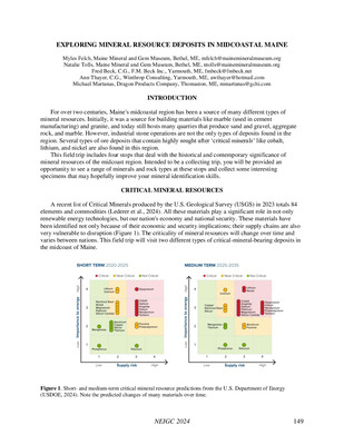
Exploring Mineral Resource Deposits in Midcoastal Maine
Myles Felch, Natalie Tolls, Fred M. Beck, Ann Thayer, and Michael Martunas
in Theis, L.J. and Whittaker, A.T.H., editors, Hills to Sea: Field trips in the Penobscot Bay Region, Maine: New England Intercollegiate Geological Conference, p. 149–162
-

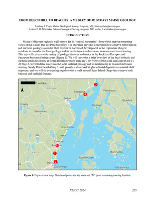
From Beech Hill to Beaches: A Medley of Midcoast Maine Geology
Lindsay J. Theis and Amber T H Whittaker
in Theis, L.J. and Whittaker, A.T.H., editors, Hills to Sea: Field trips in the Penobscot Bay Region, Maine: New England Intercollegiate Geological Conference, p. 255–267
-

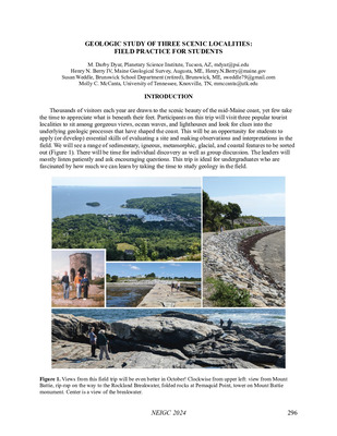
Geologic Study of Three Scenic Localities: Field Practice for Students
M Darby Dyar, Henry N. Berry IV, Susan Weddle, and Molly C. McCanta
in Theis, L.J. and Whittaker, A.T.H., editors, Hills to Sea: Field trips in the Penobscot Bay Region, Maine: New England Intercollegiate Geological Conference, p. 296–304
-

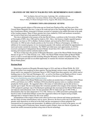
Granites of the Mount Waldo Pluton: Remembering Dave Gibson
M R. Van Baalen, Martin Yates, and Henry N. Berry IV
in Theis, L.J. and Whittaker, A.T.H., editors, Hills to Sea: Field trips in the Penobscot Bay Region, Maine: New England Intercollegiate Geological Conference, p. 20–45.
-

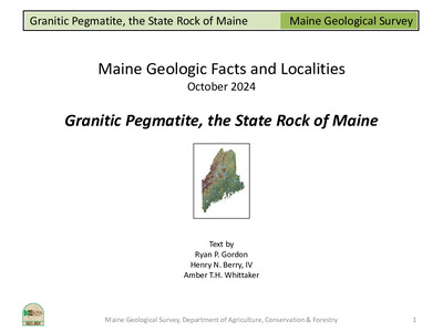
Granitic Pegmatite, the State Rock of Maine
Ryan P. Gordon, Henry N. Berry IV, and Amber T H Whittaker
Maine Geological Survey, Geologic Facts and Localities, Circular GFL-267.
-

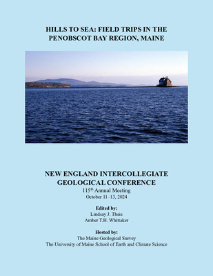
Hills to Sea: Field trips in the Penobscot Bay Region, Maine
Lindsay J. Theis and Amber T.H. Whittaker
New England Intercollegiate Geological Conference, 115th Annual Meeting, October 11-13, 2024, 304 p, color.
-

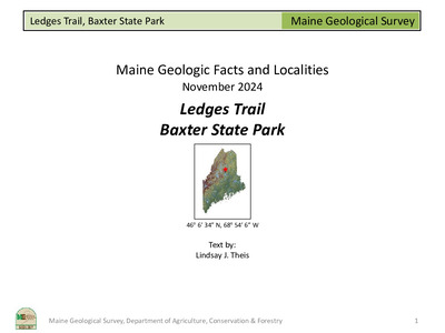
Ledges Trail, Baxter State Park
Lindsay Theis
Maine Geological Survey, Geologic Facts and Localities, Circular GFL-268.
-

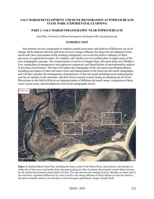
Salt Marsh Development and Dune Restoration at Popham Beach State Park: Experiential Learning
Julia Daly, Peter A. Slovinsky, and Nicholas R. Whiteman
in Theis, L.J. and Whittaker, A.T.H., editors, Hills to Sea: Field trips in the Penobscot Bay Region, Maine: New England Intercollegiate Geological Conference, p. 212–222
-

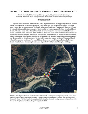
Shoreline Dynamics at Popham Beach State Park, Phippsburg, Maine
Peter A. Slovinsky and Nicholas R. Whiteman
in Theis, L.J. and Whittaker, A.T.H., editors, Hills to Sea: Field trips in the Penobscot Bay Region, Maine: New England Intercollegiate Geological Conference, p. 1–4.
-

Squeezing Too Much Rock into a Small Space with Barely Enough Time: A Mainland Traverse Through the Friendship Quadrangle
Henry N. Berry IV and J Dykstra Eusden Jr
in Theis, L.J. and Whittaker, A.T.H., editors, Hills to Sea: Field trips in the Penobscot Bay Region, Maine: New England Intercollegiate Geological Conference, p. 196–211
-

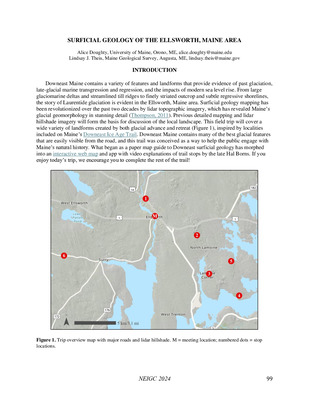
Surficial Geology of the Ellsworth, Maine Area
Alice Doughty and Lindsay J. Theis
in Theis, L.J. and Whittaker, A.T.H., editors, Hills to Sea: Field trips in the Penobscot Bay Region, Maine: New England Intercollegiate Geological Conference, p. 99–113
-

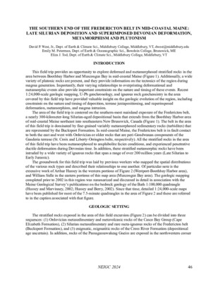
The southern end of the Fredericton Belt in Mid-Coastal Maine: Late Silurian Deposition and Superimposed Devonian Deformation, Metamorphism, and Plutonism
David P. West Jr, Emily M. Peterman, and Eliza J. Tod
in Theis, L.J. and Whittaker, A.T.H., editors, Hills to Sea: Field trips in the Penobscot Bay Region, Maine: New England Intercollegiate Geological Conference, p. 46–76
-

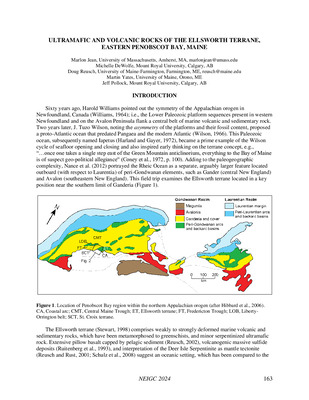
Ultramafic and Volcanic Rocks of the Ellsworth Terrane, Eastern Penobscot Bay, Maine
Marlon Jean, Michelle DeWolfe, Douglas Reusch, Martin Yates, and Jeff Pollock
in Theis, L.J. and Whittaker, A.T.H., editors, Hills to Sea: Field trips in the Penobscot Bay Region, Maine: New England Intercollegiate Geological Conference, p. 163–195
-
 by George Kendrick")
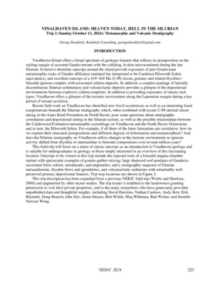
Vinalhaven Island: Heaven Today, Hell in the Silurian (Trip 1: Magma Chamber and Caldera Deposits)
George Kendrick
in Theis, L.J. and Whittaker, A.T.H., editors, Hills to Sea: Field trips in the Penobscot Bay Region, Maine: New England Intercollegiate Geological Conference, p. 114–148
-
 by George Kendrick")
Vinalhaven Island: Heaven Today, Hell in the Silurian (Trip 2: Metamorphic and Volcanic Stratigraphy)
George Kendrick
in Theis, L.J. and Whittaker, A.T.H., editors, Hills to Sea: Field trips in the Penobscot Bay Region, Maine: New England Intercollegiate Geological Conference, p.223–254
-

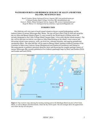
Water Resources and Bedrock Geology of Allen and Benner Islands, Muscongus Bay
Ryan P. Gordon, J Dykstra Eusden, Jessica L. Meeks, and Roger H. Morin
in Theis, L.J. and Whittaker, A.T.H., editors, Hills to Sea: Field trips in the Penobscot Bay Region, Maine: New England Intercollegiate Geological Conference, p. 5–19.
-

Beach and Dune Best Management Practices
Peter A. Slovinsky
Maine Geological Survey, Circular 23-585
-

Bedrock geology of the Greenfield quadrangle, Maine
Allan Ludman
Maine Geological Survey, Open-File Report 23-1.
-

Clark Island Preserve, St. George, ME
Myles Felch
Maine Geological Survey, Geologic Facts and Localities, Circular GFL-266.
-

Coastal sand dune geology maps: Kittery to Robbinston, Maine
Peter A. Slovinsky and Stephen M. Dickson
Maine Geological Survey, Report to Maine Board of Environmental Protection, Open-File Report 23-583.
-

Mount Agamenticus, York, ME
Zane Rahabi and Tristan Depew
Maine Geological Survey, Geologic Facts and Localities, Circular GFL-263.
-

Step Falls Preserve, Newry, ME
Lindsay J. Theis
Maine Geological Survey, Geologic Facts and Localities, Circular GFL-264.
-

2022 Beaches Conference: Maine Beach Profiling Program Posters
Natalie R. Meenan, Peter A. Slovinsky, and Stephen M. Dickson
Maine Geological Survey, Open-File Report 22-12. Provides a description of the changes observed at Maine beaches that are monitored as part of the State of Maine Beach Profiling Project
-

Bedrock, Glaciers, and People at Harriman Point, Brooklin, Maine
Christopher Gerbi, Allie Andersen, Briana Batista, Christopher Bibula, Sean Burke, Matt Henriques, Iris May-Fleming, Daphne McCollom, Brenna Murphy, Ian Ramsden, Katie Ritchie, Hana Stone, and Tommy Young
Maine Geological Survey, Geologic Facts and Localities, Circular GFL-258.
-

Geology of Grafton Notch State Park
G Christopher Koteas and Lindsay J. Spigel
New England Intercollegiate Geological Conference, Trip A1, October 15-17, 2021, Maine Geological Survey, Circular 22-13.
-

Geology of Mount Blue State Park
Lindsay J. Spigel
New England Intercollegiate Geological Conference, Trip B2, October 15-17, 2021, Maine Geological Survey, Circular 22-14.
-

Great Pond Mountain, Orland, Maine; A Geologic Tour of the Stuart Gross Trail
Thomas E. Whittaker and Amber TH Whittaker
Maine Geological Survey, Geologic Facts and Localities, Circular GFL-261.
-

Haystack Mountain, Liberty, Maine
Amber T.H. Whittaker
Maine Geological Survey, Geologic Facts and Localities, Circular GFL-260.
-

Jockey Cap Rock, Fryeburg, Maine
Myles Felch, Alison Graves, Aubrey Farnum, Brenna Fraser-Diaz, Caylee Bedard, Hauna Fitzmorris, Jack Bartash, Josie Stevenson, Lilah Sharkey, Lillian Smith, Maeve Grocki, Molly Cole, Silvia Saito, Sophia Percival, and Tobé Smith
Maine Geological Survey, Geologic Facts and Localities, Circular GFL-259.
-

State of Maine's Beaches in 2022
Peter A. Slovinsky, Stephen M. Dickson, and Natalie R. Meenan
Maine Geological Survey, Open-File Report 22-11. Provides a description of the changes observed at Maine beaches that are monitored as part of the State of Maine Beach Mapping and Profiling Projects
-

Weston Woods and Waters, Madison, ME
Will Robert
Maine Geological Survey, Geologic Facts and Localities, Circular GFL-262.
-

A New Silurian Graptolite Locality in the Central Maine/Aroostook-Matapedia Basin, Northeastern Maine
Allan Ludman and Michael J. Melchin
Maine Geological Survey, Open-File Report 21-14
-

Bass Rock: An Excellent Erratic, Weld, Maine
Lindsay J. Spigel
Maine Geological Survey, Geologic Facts and Localities, Circular GFL-256.
-

Beach and Dune Best Management Practices
Peter A. Slovinsky
Maine Geological Survey, Circular 21-4 (Superseded by Slovinsky, 2023, Maine Geological Survey Circular 23-585).
-

Borestone Mountain Audubon Sanctuary, Elliottsville Twp, Maine
Robert G. Marvinney
Maine Geological Survey, Geologic Facts and Localities, Circular GFL-254.
-

Horton Woods Preserve, Saco, Maine
Lindsay J. Spigel
Maine Geological Survey, Geologic Facts and Localities, Circular GFL-255.
-

Improvements to Domestic Water Use Data Collection Methods and Population Estimates for Maine
Ryan P. Gordon, Amber T.H. Whittaker, and Robert G. Marvinney
Final Technical Report for Water Use Data Research Program Award Number G18AC00186 Work period: September 30, 2018 – March 31, 2021, Maine Geological Survey, Circular 21-16.
-

Locating Your Well and Septic System - A Homeowner's Guide
Daniel B. Locke
Maine Geological Survey, Circular 21-13.
-

Maine Coastal Property Owner’s Guide to Erosion, Flooding, and Other Hazards, 2nd edition
Peter A. Slovinsky
Maine Geological Survey, Open-File Report 21-3
-

Mount David, Lewiston, Maine
Zane Rahabi
Maine Geological Survey, Geologic Facts and Localities, Circular GFL-257.
-

The Esker Loop Trail, Gilead, Maine
Lindsay J. Spigel
Maine Geological Survey, Geologic Facts and Localities, Circular GFL-253.
-

Bedrock geology of the Chemo Pond quadrangle, Maine
Chunzeng Wang
Maine Geological Survey, Open-File Report 20-21.
-

Bedrock geology of the Greenfield quadrangle, Maine
Allan Ludman
Maine Geological Survey, Open-File Report 20-10 (Superseded by Ludman, 2023, Maine Geological Survey Open-File 23-1)
-

Bedrock Geology of the Springfield 15′ quadrangle, Maine
Allan Ludman and John T. Hopeck
Maine Geological Survey, Open-File Report 20-22.
-

Bedrock geology of the The Horseback quadrangle, Maine
Chunzeng Wang
Maine Geological Survey, Open-File Report 20-13.
-

Carter Nature Preserve, Surry, Maine
Robert G. Marvinney
Maine Geological Survey, Geologic Facts and Localities, Circular GFL-249.
-

Geology of Little Jackson Mountain, Township 6 North of Weld, Maine
Lindsay J. Spigel and Amber T.H. Whittaker
Maine Geological Survey, Geologic Facts and Localities, Circular GFL-250.
-

Glimpses of Geologic History along the Bald Mountain Trail, Camden, Maine
Henry N. Berry IV
Maine Geological Survey, Geologic Facts and Localities, Circular GFL-247.
-

Kennebec River Sand Waves at Fort Popham, Phippsburg, Maine
Stephen M. Dickson
Maine Geological Survey, Geologic Facts and Localities, Circular GFL-248.
-

The Maine Geological Survey's Nearshore Survey System
Peter A. Slovinsky
Maine Geological Survey, Geologic Facts and Localities, Circular GFL-252.
-

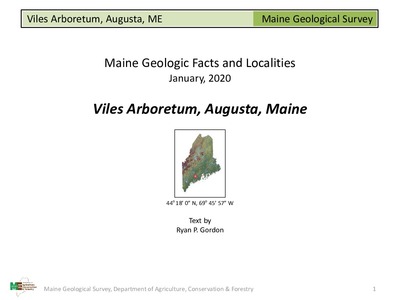
Viles Arboretum, Augusta, Maine
Ryan P. Gordon
Maine Geological Survey, Geologic Facts and Localities, Circular GFL-246.
-

Volcanic Activity in the Tatnic Hills, South Berwick, Maine
Bryce Neal
Maine Geological Survey, Geologic Facts and Localities, Circular GFL-251.
-

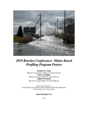
2019 Beaches Conference: Maine Beach Profiling Program Posters
Hannah M. Corney, Peter A. Slovinsky, and Stephen M. Dickson
Maine Geological Survey, Open-File Report 19-4. Provides a description of the changes observed at Maine beaches that are monitored as part of the State of Maine Beach Profiling Project
-

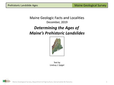
Determining the Ages of Maine's Prehistoric Landslides
Lindsay J. Spigel
Maine Geological Survey, Geologic Facts and Localities, Circular GFL-245.
-

Geology of Quarry Woods, Freeport, Maine
Lindsay J. Spigel and Amber T.H. Whittaker
Maine Geological Survey, Geologic Facts and Localities, Circular GFL-239.
-

Geology of the Frye Mountain Loop, Montville and Morrill, Maine
Lindsay J. Spigel and Amber T.H. Whittaker
Maine Geological Survey, Geologic Facts and Localities, Circular GFL-241.
-

Giant's Stairs, Harpswell, Maine
Ian Hillenbrand
Maine Geological Survey, Geologic Facts and Localities, Circular GFL-240.
-

Lost Pond Spring, T4 Indian Purchase, Maine
Daniel B. Locke
Maine Geological Survey, Geologic Facts and Localities, Circular GFL-243.
-

Mackworth Island, Falmouth, Maine
Ian Hillenbrand
Maine Geological Survey, Geologic Facts and Localities, Circular GFL-238.
-

Mars Hill Conglomerate, Mars Hill, Maine
Chunzeng Wang
Maine Geological Survey, Geologic Facts and Localities, Circular GFL-244.
-

Monitoring an unstable coastal bluff using remote sensing and photogrammetry, York, Maine
Sam Rickerich
Maine Geological Survey, Geologic Facts and Localities, Circular GFL-237.
-

Overview of Current Maine Geological Survey Activities and Programs
Robert G. Marvinney
Maine Geological Survey, Circular 19-1.
-

Overview of the Maine Beach Mapping Program
Hannah M. Corney
Maine Geological Survey, Geologic Facts and Localities, Circular GFL-242.
-

State of Maine's Beaches in 2019
Peter A. Slovinsky, Stephen M. Dickson, and Hannah M. Corney
Maine Geological Survey, Open-File Report 19-3. Provides a description of the changes observed at Maine beaches that are monitored as part of the State of Maine Beach Mapping and Profiling Projects
-

Coastal Storm Impacts - Winter 2018 at Pine Point, Saco and Western Beaches in Southern Maine
Peter A. Slovinsky
Maine Geological Survey, Geologic Facts and Localities, Circular GFL-232.
-

Falmouth Town Landing, Falmouth, Maine
Ian Hillenbrand
Maine Geological Survey, Geologic Facts and Localities, Circular GFL-231.
-

Geology of Mount Kineo State Park, Kineo Township, Maine
Lindsay J. Spigel
Maine Geological Survey, Geologic Facts and Localities, Circular GFL-236.
-

Going Green - Furthering Living Shorelines in Maine Workshop Proceedings
Peter A. Slovinsky
Going Green - Furthering Living Shorelines in Maine Workshop, April 6, 2018, Portland, Maine, Maine Geological Survey, Circular 18-6.
-

Interpretation of field magnetic survey and bedrock mapping to constrain contact of the Bottle Lake Complex near Passadumkeag Mountain, East-central Maine
Timothy T. Eaton and Allan Ludman
Maine Geological Survey, Open-File Report 18-5.
-

Ocean crust, fossils, and an unconformity: Bedrock Geology of Ripogenus Dam
Ian Hillenbrand
Maine Geological Survey, Geologic Facts and Localities, Circular GFL-233.
-

Oil and Gas Potential in Maine - Onshore and Offshore
Robert G. Marvinney
Maine Geological Survey, Circular 18-1. Originally published as Appendix 6: Assessment of Oil and Gas Development Potential in the Gulf of Maine: in the Final Report of the Ocean Energy Task Force to Governor John E. Baldacci, 2009.
-

Quaggy Jo Mountain, Aroostook State Park, Presque Isle, Maine
Robert G. Marvinney
Maine Geological Survey, Geologic Facts and Localities, Circular GFL-235.
-

Sears Island, Searsport, Maine
Ryan P. Gordon
Maine Geological Survey, Geologic Facts and Localities, Circular GFL-230.
-

Shoreline Changes from 2017 to 2018 at Higgins Beach, Scarborough, Maine
Peter A. Slovinsky
Maine Geological Survey, Geologic Facts and Localities, Circular GFL-234.
-

Surveying Beach and Bathymetry Changes near the Scarborough River, Scarborough, Maine
Peter A. Slovinsky
Maine Geological Survey, Geologic Facts and Localities, Circular GFL-229.
-

Survey of Agricultural Water Users in Maine: Results for Calendar Year 2016
Ryan P. Gordon, Amber T.H. Whittaker, and Robert G. Marvinney
Maine Geological Survey, Circular 18-9.
-

A Summary of the 2017 State of Maine's Beaches Report
Peter A. Slovinsky
Maine Geological Survey, Geologic Facts and Localities, Circular GFL-225.
-

Corrosive Water - Facts, Common Questions, and Resources
Ryan P. Gordon
Maine Geological Survey, Circular 17-13
-

Maine Flood Resilience Checklist; A self-assessment tool for Maine's coastal communities to evaluate vulnerability to flood hazards and increase resilience
Abbie Sherwin
Maine Geological Survey, Open-File Report 17-15.
-

State of Maine's Beaches in 2017
Peter A. Slovinsky, Stephen M. Dickson, and David B. Cavagnaro
Maine Geological Survey, Open-File Report 17-14. Provides a description of the changes observed at Maine beaches that are monitored as part of the State of Maine Beach Profiling Project
-

Surficial Geology of the Sebago Lake Land Reserve, Standish, Maine
Lindsay J. Spigel
Maine Geological Survey, Geologic Facts and Localities, Circular GFL-228.
-

The Bubbles, Acadia National Park
Amber T.H. Whittaker and Thomas E. Whittaker
Maine Geological Survey, Geologic Facts and Localities, Circular GFL-222
-

The Falmouth-Brunswick Sequence exposed at the Androscoggin Brunswick-Topsham Riverwalk
Ian Hillenbrand
Maine Geological Survey, Geologic Facts and Localities, Circular GFL-226.
-

The influence of the Presumpscot Formation on seismic hazard in southern coastal Maine
Robert G. Marvinney and Hannah Glover
Maine Geological Survey, Circular 17-3.
-

The Passagassawakeag Rail Trail, Belfast, Maine
Amber T.H. Whittaker and Thomas E. Whittaker
Maine Geological Survey, Geologic Facts and Localities, Circular GFL-224
-

The Rock Garden at the Maine Mineral and Gem Museum, Bethel, Maine
Myles Felch
Maine Geological Survey, Geologic Facts and Localities, Circular GFL-227.
-

Bedrock geology of Small Point, Maine: A fresh look at the stratigraphy, structure, and metamorphism
Dykstra J. Eusden, Heather Doolittle, Tim Grover, and Jen Lindelof
in Berry, Henry N., IV, and West, David P., Jr., editors, Guidebook for field trips along the Maine coast from Maquoit Bay to Muscongus Bay: New England Intercollegiate Geological Conference, p. 129-146
-

Bedrock geology of the Kittery 1:100,000 quadrangle, southwestern Maine and southeastern New Hampshire
Arthur M. Hussey II, Wallace A. Bothner, and Peter J. Thompson
Maine Geological Survey, Bulletin 45. Describes stratified rock sequences, intrusive rocks, structural geology, metamorphism, and geologic history of the Kittery 1:100,000 map sheet. Accompanies Open-File Map 16-6.
-

Bedrock relationships along the Sennebec Pond fault: A structural puzzle, a stratigraphic enigma, and a tectonic riddle
Henry N. Berry IV, David P. West Jr., and William B. Burke
in Berry, Henry N., IV, and West, David P., Jr., editors, Guidebook for field trips along the Maine coast from Maquoit Bay to Muscongus Bay: New England Intercollegiate Geological Conference, p. 43-70
-

Coastal bluff erosion, landslides and associated salt marsh environments in northern Casco Bay, Maine
Nicolas Whiteman, Joseph T. Kelley, Daniel F. Belknap, and Stephen M. Dickson
in Berry, Henry N., IV, and West, David P., Jr., editors, Guidebook for field trips along the Maine coast from Maquoit Bay to Muscongus Bay: New England Intercollegiate Geological Conference, p. 95-106
-

Creating resilient infrastructure in the face of sea level rise
Peter A. Slovinsky, Stephanie M. Wyman, Robert Faunce, and Jonathan Edgerton
in Berry, Henry N., IV, and West, David P., Jr., editors, Guidebook for field trips along the Maine coast from Maquoit Bay to Muscongus Bay: New England Intercollegiate Geological Conference, p. 307-314
-

Geomorphology of the Sheepscot River: Postglacial evolution, salmon habitat and historic dams
Noah P. Snyder
in Berry, Henry N., IV, and West, David P., Jr., editors, Guidebook for field trips along the Maine coast from Maquoit Bay to Muscongus Bay: New England Intercollegiate Geological Conference, p. 155-164
-

Glacial deposits, subglacial meltwater processes, and deglaciation of the Belfast area, midcoast Maine: New insights using LiDAR imagery
Woodrow B. Thompson and Roger LeB. Hooke
in Berry, Henry N., IV, and West, David P., Jr., editors, Guidebook for field trips along the Maine coast from Maquoit Bay to Muscongus Bay: New England Intercollegiate Geological Conference, p. 231-248
-

Guidebook for field trips along the Maine coast from Maquoit Bay to Muscongus Bay
Henry N. Berry IV and David P. West Jr.
New England Intercollegiate Geological Conference, 108th Annual Meeting, October 14-16, 2016, Bath, Maine, 326 p, color.
-

Heart of Poland Conservation Area, Poland, Maine
Ryan P. Gordon
Maine Geological Survey, Geologic Facts and Localities, Circular GFL-219
-

Hydrogeology and coastal processes at Popham Beach State Park
Ryan P. Gordon and Stephen M. Dickson
in Berry, Henry N., IV, and West, David P., Jr., editors, Guidebook for field trips along the Maine coast from Maquoit Bay to Muscongus Bay: New England Intercollegiate Geological Conference, p. 201-230
-

Ice Jam on the Kennebec River on Wednesday, February 17, 2016
Ryan P. Gordon and Amber T.H. Whittaker
Maine Geological Survey, Geologic Facts and Localities, Circular GFL-220
-

Impacts of rising sea level on prehistoric human occupation of the central Maine coast
Bruce J. Bourque and Thomas K. Weddle
in Berry, Henry N., IV, and West, David P., Jr., editors, Guidebook for field trips along the Maine coast from Maquoit Bay to Muscongus Bay: New England Intercollegiate Geological Conference, p. 315-326
-

Increasing Maine's Resiliency to Flood Hazards through the Community Rating System
Abbie Sherwin
Maine Geological Survey, Geologic Facts and Localities, Circular GFL-223
-

Influence of geology on contaminant migration and remediation at three sites at the former Brunswick Naval Air Station
Chris Evans
in Berry, Henry N., IV, and West, David P., Jr., editors, Guidebook for field trips along the Maine coast from Maquoit Bay to Muscongus Bay: New England Intercollegiate Geological Conference, p. 71-84
-

Kinematic indicators and ductile strain domains associated with regional shearing: A transect across the Norumbega fault and shear zone system, Pemaquid Point to northern Casco Bay
Mark T. Swanson
in Berry, Henry N., IV, and West, David P., Jr., editors, Guidebook for field trips along the Maine coast from Maquoit Bay to Muscongus Bay: New England Intercollegiate Geological Conference, p. 1-18
-

Late Wisconsinan glacial and marine geology and early postglacial geomorphic evolution of the lower Androscoggin Valley and Casco Bay Lowland
Michael J. Retelle, Thomas K. Weddle, and Sydney K. Eckert
in Berry, Henry N., IV, and West, David P., Jr., editors, Guidebook for field trips along the Maine coast from Maquoit Bay to Muscongus Bay: New England Intercollegiate Geological Conference, p. 183-200
-

Middle Ordovician to Early Silurian terranes of the northern Casco Bay region, Maine
David P. West Jr. and Arthur M. Hussey II
in Berry, Henry N., IV, and West, David P., Jr., editors, Guidebook for field trips along the Maine coast from Maquoit Bay to Muscongus Bay: New England Intercollegiate Geological Conference, p. 249-266
-

Pine Hill Serpentinized Peridotite, Little Deer Isle, Maine
Robert G. Marvinney
Maine Geological Survey, Geologic Facts and Localities, Circular GFL-221
-

Plutonic rocks from Waldoboro to Richmond, Maine
Amber T.H. Whittaker, Henry N. Berry IV, and David P. West Jr.
in Berry, Henry N., IV, and West, David P., Jr., editors, Guidebook for field trips along the Maine coast from Maquoit Bay to Muscongus Bay: New England Intercollegiate Geological Conference, p. 267-294
-

Pulpit Rock, Perry, Maine
Robert A. Johnston
Maine Geological Survey, Geologic Facts and Localities, Circular GFL-218
-

Stratigraphy, structure, and plutonism in the Wiscasset-Dresden region of mid-coastal Maine
David P. West Jr. and Cailey B. Condit
in Berry, Henry N., IV, and West, David P., Jr., editors, Guidebook for field trips along the Maine coast from Maquoit Bay to Muscongus Bay: New England Intercollegiate Geological Conference, p. 165-182
-

Stream morphology and water quality in a densely developed watershed, Topsham Fair Mall, Maine
John Hopeck
in Berry, Henry N., IV, and West, David P., Jr., editors, Guidebook for field trips along the Maine coast from Maquoit Bay to Muscongus Bay: New England Intercollegiate Geological Conference, p. 85-94
-

Teaching rocks: Field-inspired practice and discussion of teaching geologic content
Julia Daly
in Berry, Henry N., IV, and West, David P., Jr., editors, Guidebook for field trips along the Maine coast from Maquoit Bay to Muscongus Bay: New England Intercollegiate Geological Conference, p. 147-154
-

The ecogeomorphology of two salt marshes in midcoast Maine: Natural history and human impacts
Beverly J. Johnson, Curtis Bohlen, Cailene Gunn, and Erin Beirne
in Berry, Henry N., IV, and West, David P., Jr., editors, Guidebook for field trips along the Maine coast from Maquoit Bay to Muscongus Bay: New England Intercollegiate Geological Conference, p. 111-128
-

The historic cribstone bridge, Bailey Island
Ryan P. Gordon and Daniel B. Locke
in Berry, Henry N., IV, and West, David P., Jr., editors, Guidebook for field trips along the Maine coast from Maquoit Bay to Muscongus Bay: New England Intercollegiate Geological Conference, p. 107-110
-

The Migmatite-Granite Complex of southern Maine: Its structure, petrology, geochemistry, geochronology, and relation to the Sebago Pluton
Gary S. Solar and Paul B. Tomascak
in Berry, Henry N., IV, and West, David P., Jr., editors, Guidebook for field trips along the Maine coast from Maquoit Bay to Muscongus Bay: New England Intercollegiate Geological Conference, p. 19-42
-

What to do about 2,000 gallons of oil in a school leachfield: An environmental geologist's perspective
Keith R. Taylor
in Berry, Henry N., IV, and West, David P., Jr., editors, Guidebook for field trips along the Maine coast from Maquoit Bay to Muscongus Bay: New England Intercollegiate Geological Conference, p. 295-306
-

A Summary of the 2015 State of Maine's Beaches Report
Peter A. Slovinsky
Maine Geological Survey, Geologic Facts and Localities, Circular GFL-213
-

Beautifully Preserved Volcanic Debris in Bedrock, Western Head, Isle au Haut
Henry N. Berry IV
Maine Geological Survey, Geologic Facts and Localities, Circular GFL-215
-

Encroachment of Rising Sea Level upon Raised Freshwater Wetlands, Lubec and Jonesport
Joseph T. Kelley, Daniel F. Belknap, and Margot E. Mansfield
Maine Geological Survey, Geologic Facts and Localities, Circular GFL-210
-

Gwenyth's Rock, Beddington, Maine
Thomas K. Weddle
Maine Geological Survey, Geologic Facts and Localities, Circular GFL-216
-

Legacy Mines in Maine
Robert G. Marvinney and Henry N. Berry IV
Maine Geological Survey, Circular 15-10.
-

Maine Coastal Mapping Initiative: An examination of gravelly and sandy benthic environments off the southern Maine coast
Ivy Ozmon and Emily Norton
Maine Geological Survey, Geologic Facts and Localities, Circular GFL-212
-

Overview of Maine Metallic Mineral Deposits and Mining
Robert G. Marvinney
Maine Geological Survey, Circular 15-9
-

State of Maine's Beaches in 2015
Peter A. Slovinsky, Stephen M. Dickson, and Cameron D. Adams
Maine Geological Survey, Open-File Report 15-25. Provides a description of the changes observed at Maine beaches that are monitored as part of the State of Maine Beach Profiling Project
-

Surficial geology handbook for southern Maine
Woodrow B. Thompson
Maine Geological Survey, Bulletin 44
-

The Cribstone Bridge, Harpswell, Maine and its Granite Source Quarries
Daniel B. Locke
Maine Geological Survey, Geologic Facts and Localities, Circular GFL-217
-

The Geology of Howard Hill, Backdrop to the Maine State House
Robert G. Marvinney
Maine Geological Survey, Geologic Facts and Localities, Circular GFL-211
-

The Geology of Sarampus Falls
John Haley
Maine Geological Survey, Geologic Facts and Localities, Circular GFL-214
-

Bedrock Geology at Wolfe's Neck Woods State Park
Thomas K. Weddle and Henry N. Berry IV
Maine Geological Survey, Geologic Facts and Localities, Circular GFL-206
-

Coastal Bedrock Geology, Cape Newagen, Southport
Thomas K. Weddle
Maine Geological Survey, Geologic Facts and Localities, Circular GFL-202
-

Geology Guides a Turtle Home, Blue Hill, Maine
Daniel B. Locke
Maine Geological Survey, Geologic Facts and Localities, Circular GFL-207
-

Grand Falls and Spencer Rips, Dead River
Robert G. Marvinney
Maine Geological Survey, Geologic Facts and Localities, Circular GFL-201
-

Highest Astronomical Tide on the Maine Coast
Cameron Adams
Maine Geological Survey, Geologic Facts and Localities, Circular GFL-209
-

Maine's Eskers
Woodrow B. Thompson
Maine Geological Survey, Geologic Facts and Localities, Circular GFL-199
-

Online Map Resources for Maine
Christian Halsted
Maine Geological Survey, Geologic Facts and Localities, Circular GFL-200
-

Shackford Head State Park, Eastport, Maine
Robert A. Johnston
Maine Geological Survey, Geologic Facts and Localities, Circular GFL-208
-

Status of Beach and Dune Restoration at Western Beach, Scarborough
Peter A. Slovinsky
Maine Geological Survey, Geologic Facts and Localities, Circular GFL-204
-

The Great Landslide of 1868, Westbrook, Maine
Stephen M. Dickson
Maine Geological Survey, Geologic Facts and Localities, Circular GFL-203
-

The Perham Family Quarries, Greenwood, Maine
Sydney D. Eckert
Maine Geological Survey, Geologic Facts and Localities, Circular GFL-205
-

Bauneg Beg Mountain Conservation Area North Berwick, Maine - Great Works Regional Land Trust Preserve
Thomas K. Weddle
Maine Geological Survey, Geologic Facts and Localities, Circular GFL-193
-

Coastal Change in Holmes Bay, Whiting, Maine
Stephen M. Dickson
Maine Geological Survey, Geologic Facts and Localities, Circular GFL-198
-

Fluted Till Surfaces, Brookton, Maine
Robert A. Johnston
Maine Geological Survey, Geologic Facts and Localities, Circular GFL-196
-

Fort Foster Park Beach, Kittery, Maine
Stephen M. Dickson
Maine Geological Survey, Geologic Facts and Localities, Circular GFL-190
-

Glacial Geology of Moose Point State Park
Woodrow B. Thompson
Maine Geological Survey, Geologic Facts and Localities, Circular GFL-192
-

Hacker's Hill, Casco, Maine
Robert G. Marvinney
Maine Geological Survey, Geologic Facts and Localities, Circular GFL-189
-

Marlboro Beach, Lamoine, Maine
Thomas K. Weddle
Maine Geological Survey, Geologic Facts and Localities, Circular GFL-188
-

Mineral Collecting in Newry, Maine
Woodrow B. Thompson
Maine Geological Survey, Geologic Facts and Localities, Circular GFL-195
-

Sandy River Bank Erosion, Avon, Maine - 2nd Update
Daniel B. Locke
Maine Geological Survey, Geologic Facts and Localities, Circular GFL-191
-

State of Maine's Beaches in 2013
Peter A. Slovinsky, Stephen M. Dickson, and Rachael E. Dye
Maine Geological Survey, Open-File Report 13-19. Provides a description of the changes observed at Maine beaches that are monitored as part of the State of Maine Beach Profiling Project
-

Taking the Pulse of a Beach
Peter A. Slovinsky and Rachael E. Dye
Maine Geological Survey, Geologic Facts and Localities, Circular GFL-194
-

The Big Eddy of the Kennebec, Skowhegan, ME
Henry N. Berry IV
Maine Geological Survey, Geologic Facts and Localities, Circular GFL-197
-
 Geologic Features Under Different Lighting Conditions by Woodrow B. Thompson")
A Trick of the Light: Seeing (or Not Seeing) Geologic Features Under Different Lighting Conditions
Woodrow B. Thompson
Maine Geological Survey, Geologic Facts and Localities, Circular GFL-181
-

Beach Scraping at Popham Beach State Park
Stephen M. Dickson
Maine Geological Survey, Geologic Facts and Localities, Circular GFL-177
-

Big Rock - An Erratic in Waltham, Maine
Thomas K. Weddle
Maine Geological Survey, Geologic Facts and Localities, Circular GFL-186
-

Coastal Ledges of Kittery Formation, Granite, and Basalt - East Point Sanctuary, Biddeford Pool
Henry N. Berry IV
Maine Geological Survey, Geologic Facts and Localities, Circular GFL-184
-

Geology of Sentinel Mountain, Baxter State Park
Robert A. Johnston
Maine Geological Survey, Geologic Facts and Localities, Circular GFL-183
-

Measurement of Stream Discharge Using Weirs and Flumes
Daniel B. Locke
Maine Geological Survey, Geologic Facts and Localities, Circular GFL-178
-

Orris Falls Conservation Area and the Great Balancing Rock of Tatnic
Thomas K. Weddle
Maine Geological Survey, Geologic Facts and Localities, Circular GFL-179
-

Sampling the Gulf of Maine Seabed from the Ocean Survey Vessel Bold
Stephen M. Dickson and Kara Jacobacci
Maine Geological Survey, Geologic Facts and Localities, Circular GFL-185
-

Some Geological Features at Whitecap Mountain, Rumford, Maine
Robert G. Marvinney
Maine Geological Survey, Geologic Facts and Localities, Circular GFL-176
-

Sugarloaf Mountain near Shin Pond, Maine - A Classic Geological Locality
Robert G. Marvinney
Maine Geological Survey, Geologic Facts and Localities, Circular GFL-182
-

The Rangeley Conglomerate
Henry N. Berry IV
Maine Geological Survey, Geologic Facts and Localities, Circular GFL-187
-

Watching the Tides: The 100th Anniversary of the Portland Tidal Station
Peter A. Slovinsky
Maine Geological Survey, Geologic Facts and Localities, Circular GFL-180
-

A Geological Tour of Bartlett Narrows and Vicinity
Robert G. Marvinney
Maine Geological Survey, Geologic Facts and Localities, Circular GFL-164
-

Geology of Horse Mountain, Baxter State Park
Robert A. Johnston
Maine Geological Survey, Geologic Facts and Localities, Circular GFL-173
-

La Verna Preserve, Bristol, Maine
Henry N. Berry IV
Maine Geological Survey, Geologic Facts and Localities, Circular GFL-172
-

Lidar Imagery Reveals Maine's Land Surface in Unprecedented Detail
Woodrow B. Thompson
Maine Geological Survey, Geologic Facts and Localities, Circular GFL-175
-

Maine's Dug Wells
Daniel B. Locke
Maine Geological Survey, Geologic Facts and Localities, Circular GFL-166
-

North Ridge, Traveler Mountain, Baxter State Park
Robert A. Johnston
Maine Geological Survey, Geologic Facts and Localities, Circular GFL-170
-

Sea-Level Rise and the Damariscotta River Oyster Shell Middens
Thomas K. Weddle
Maine Geological Survey, Geologic Facts and Localities, Circular GFL-167
-

Setting the Stage for a Course Change at Popham Beach
Stephen M. Dickson
Maine Geological Survey, Geologic Facts and Localities, Circular GFL-165
-

Settlement Quarry, Stonington, Maine
Henry N. Berry IV
Maine Geological Survey, Geologic Facts and Localities, Circular GFL-169
-

Shoreline Erosion at Western and Ferry Beaches, Scarborough, Maine
Peter A. Slovinsky
Maine Geological Survey, Geologic Facts and Localities, Circular GFL-171
-

Simulating Future Impacts of Sea Level Rise on Coastal Wetlands: An example from Scarborough, Maine
Peter A. Slovinsky
Maine Geological Survey, Geologic Facts and Localities, Circular GFL-168
-

State of Maine's Beaches in 2011
Peter A. Slovinsky and Stephen M. Dickson
Maine Geological Survey, Open-File Report 11-149 (online edition). Provides a description of the changes observed at Maine beaches that are monitored as part of the State of Maine Beach Profiling Project
-

Stratigraphy and structural geology of the Bangor and Veazie 7.5' quadrangles
Stephen G. Pollock
Maine Geological Survey, Open-File Report 11-147. Accompanies Open-File Maps 11-57 and 11-58
-

Surficial geology of the Hampden 7.5' quadrangle, Hancock, Penobscot, and Waldo Counties, Maine
Kent M. Syverson and Jeffrey D. Olson
Maine Geological Survey, Open-File Report 11-7.
-

The Landscape of Mount Desert Island Past and Present
Thomas K. Weddle and Dave Manski
Maine Geological Survey, Geologic Facts and Localities, Circular GFL-174
-

A Brief Review of the Geology of Monhegan Island
Robert G. Marvinney
Maine Geological Survey, Geologic Facts and Localities, Circular GFL-155
-

A guide to the geology of Baxter State Park and Katahdin
Douglas W. Rankin and Dabney W. Caldwell
Maine Geological Survey, Bulletin 43. Popular guide to the geology of Baxter State Park and Mount Katahdin. Describes the geological processes recorded in bedrock and glacial materials that produced the dramatic landscape of the Park. Includes color surficial geology and bedrock geology maps of Baxter State Park. Five recommended geological hikes help the reader explore and understand the geology of this spectacular area.
-

Earth shattering events at Mount Desert Island!
Robert G. Marvinney
Maine Geological Survey, Geologic Facts and Localities, Circular GFL-161
-

Geology of the Little Knife Edge, Baxter State Park
Robert A. Johnston
Maine Geological Survey, Geologic Facts and Localities, Circular GFL-160
-

Hiking the Bold Coast, Cutler, Maine
Robert A. Johnston
Maine Geological Survey, Geologic Facts and Localities, Circular GFL-157
-

Landslide Susceptibility Mapping in Maine
Michael E. Foley
Maine Geological Survey, Geologic Facts and Localities, Circular GFL-162
-

Lucerne Granite, Lucerne-in-Maine
Henry N. Berry IV
Maine Geological Survey, Geologic Facts and Localities, Circular GFL-159
-

Migmatite in New Gloucester, Maine
Henry N. Berry IV
Maine Geological Survey, Geologic Facts and Localities, Circular GFL-158
-

Migration of the Morse River into Back Dunes at Popham Beach State Park
Stephen M. Dickson
Maine Geological Survey, Geologic Facts and Localities, Circular GFL-152
-
 Near Grand Schoodic Lake by Thomas K. Weddle")
Mount Ktaadn from W. Butterfield's (Oct. 8th 1836) Near Grand Schoodic Lake
Thomas K. Weddle
Maine Geological Survey, Geologic Facts and Localities, Circular GFL-154
-

The Freeport Basin Study: A Cooperative Investigation of Water Use
Daniel B. Locke
Maine Geological Survey, Geologic Facts and Localities, Circular GFL-156
-

The Palmer Hill Glacial-Marine Delta, Whitefield, Maine
Woodrow B. Thompson
Maine Geological Survey, Geologic Facts and Localities, Circular GFL-163
-

Using LIDAR to Monitor Beach Changes: Goochs Beach, Kennebunk, Maine
Peter A. Slovinsky
Maine Geological Survey, Geologic Facts and Localities, Circular GFL-153
-

Alkalinity: An Important Parameter in Assessing Water Chemistry
Daniel B. Locke
Maine Geological Survey, Geologic Facts and Localities, Circular GFL-140
-

Alpine Glacial Features along the Chimney Pond Trail, Baxter State Park
Robert A. Johnston
Maine Geological Survey, Geologic Facts and Localities, Circular GFL-148
-

Birch Point Beach State Park
Henry N. Berry IV
Maine Geological Survey, Geologic Facts and Localities, Circular GFL-145
-

Civil War Soldiers' Monument, Bath, Maine
Thomas K. Weddle
Maine Geological Survey, Geologic Facts and Localities, Circular GFL-150
-

Coastal Erosion at Crescent Beach State Park
Peter A. Slovinsky
Maine Geological Survey, Geologic Facts and Localities, Circular GFL-142
-

Dune Recovery at Ferry Beach: A Helping Hand
Laura Wurst
Maine Geological Survey, Geologic Facts and Localities, Circular GFL-147
-

Geology at Mt. Pisgah, Winthrop and Wayne, Maine
Robert G. Marvinney
Maine Geological Survey, Geologic Facts and Localities, Circular GFL-143
-

Glacial and Marine Sediments in Augusta, Maine: The Cony Street Exposure
Woodrow B. Thompson
Maine Geological Survey, Geologic Facts and Localities, Circular GFL-141
-

Norridgewock Landslide: July 9, 2009
Michael E. Foley
Maine Geological Survey, Geologic Facts and Localities, Circular GFL-146
-

Rockin' around Rockport Harbor
Woodrow B. Thompson and Henry N. Berry IV
Maine Geological Survey, Geologic Facts and Localities, Circular GFL-151
-

State of Maine's beaches in 2009
Peter A. Slovinsky and Stephen M. Dickson
Maine Geological Survey, Open-File Report 09-57. Provides a description of the changes observed at Maine beaches that are monitored as part of the State of Maine Beach Profiling Project
-

Storm and Channel Dynamics at Popham Beach State Park
Stephen M. Dickson
Maine Geological Survey, Geologic Facts and Localities, Circular GFL-144
-

The Geology of Gulf Hagas, Bowdoin College Grant East, Maine
Robert A. Johnston
Maine Geological Survey, Geologic Facts and Localities, Circular GFL-149
-

Virtual Tour of Maine's Fossils
Maine Geological Survey
Virtual Tours, Circular VT-3. An introductory, photographic tour of Maine's fossils.
-

A Brief Geological Review of Coos Canyon, Byron, Maine
Robert G. Marvinney
Maine Geological Survey, Geologic Facts and Localities, Circular GFL-128
-

Bradbury Mountain, Pownal, Maine
Henry N. Berry IV
Maine Geological Survey, Geologic Facts and Localities, Circular GFL-135
-

Coastal Circulation in the Vicinity of the Kennebunk River and Goochs Beach
Peter A. Slovinsky
Maine Geological Survey, Geologic Facts and Localities, Circular GFL-132
-

Evidence for a calving embayment in the Penobscot River Valley
Kent Syverson and Andrew Thompson
Maine Geological Survey, Geologic Facts and Localities, Circular GFL-139
-

Historical Bedrock Maps of Maine, Part IV: The 1985 Bedrock Geologic Map of Maine
Marc C. Loiselle and Henry N. Berry IV
Maine Geological Survey, Geologic Facts and Localities, Circular GFL-129
-

Ichthyoglypts and Other Igneous Animals, Topsham
Marc C. Loiselle
Maine Geological Survey, Geologic Facts and Localities, Circular GFL-136
-

Maine's Highest Yielding Well
Daniel B. Locke
Maine Geological Survey, Geologic Facts and Localities, Circular GFL-134
-

Porter Point Preserve, Boothbay
Robert G. Marvinney
Maine Geological Survey, Geologic Facts and Localities, Circular GFL-133
-

Sandy Point Beach, Cousins Island, Yarmouth, Maine
Thomas K. Weddle
Maine Geological Survey, Geologic Facts and Localities, Circular GFL-131
-

Seawall and Popham Beach Dynamics
Stephen M. Dickson
Maine Geological Survey, Geologic Facts and Localities, Circular GFL-138
-

Surficial geology of the Bangor 7.5' quadrangle, Penobscot County, Maine
Kent M. Syverson and Andrew H. Thompson
Maine Geological Survey, Open-File Report 08-52.
-

Surficial geology of the Veazie 7.5' quadrangle, Penobscot County, Maine
Carol T. Hildreth
Maine Geological Survey, Open-File Report 08-56.
-

The Geology of Haystack Mountain, Castle Hill, Maine
Robert A. Johnston
Maine Geological Survey, Geologic Facts and Localities, Circular GFL-137
-

Tombolo Breach at Popham Beach State Park
Stephen M. Dickson
Maine Geological Survey, Geologic Facts and Localities, Circular GFL-130
-

Ancient Fault Rocks at Fort Foster Park
Henry N. Berry IV
Maine Geological Survey, Geologic Facts and Localities, Circular GFL-119
-

Brunswick, Maine Patriots' Day 2007 Landslide
Michael E. Foley
Maine Geological Survey, Geologic Facts and Localities, Circular GFL-126
-

Exterior Stone of Some Architecturally Prominent Buildings in Portland, Maine
Thomas K. Weddle
Maine Geological Survey, Geologic Facts and Localities, Circular GFL-116
-

Geology of Jamies Pond
Robert G. Marvinney
Maine Geological Survey, Geologic Facts and Localities, Circular GFL-121
-

Grindle Point, Islesboro, Maine
Henry N. Berry IV
Maine Geological Survey, Geologic Facts and Localities, Circular GFL-127
-

Historical Bedrock Maps of Maine Part III: The 1967 Preliminary Geologic Map of Maine
Henry N. Berry IV
Maine Geological Survey, Geologic Facts and Localities, Circular GFL-123
-

Maine's Enchanted Cave
Daniel B. Locke
Maine Geological Survey, Geologic Facts and Localities, Circular GFL-117
-

Maine's Ice Age Trail
Woodrow B. Thompson and Harold W. Borns Jr
Maine Geological Survey, Geologic Facts and Localities, Circular GFL-122
-

Portland Tide Gauge and Waterfront
Stephen M. Dickson
Maine Geological Survey, Geologic Facts and Localities, Circular GFL-118
-

State of Maine's beaches in 2007
Peter A. Slovinsky and Stephen M. Dickson
Maine Geological Survey, Open-File Report 07-99. Provides a description of the changes observed at Maine beaches that are monitored as part of the State of Maine Beach Profiling Project
-

The 2007 Patriots' Day Storm at Willard Beach
Peter A. Slovinsky
Maine Geological Survey, Geologic Facts and Localities, Circular GFL-120
-

The Geology of the Moose River Bow Trip
Robert A. Johnston
Maine Geological Survey, Geologic Facts and Localities, Circular GFL-125
-

The U.S. Route 1/State Route 3 Roadcut at the Approach to the Penobscot Narrows Bridge
Marc C. Loiselle
Maine Geological Survey, Geologic Facts and Localities, Circular GFL-124
-

A Geologic Transect along the Appalachian Trail to Saddleback Mountain
Robert A. Johnston
Maine Geological Survey, Geologic Facts and Localities, Circular GFL-113
-

Beach Nourishment at Western Beach, Scarborough, Maine: Benefits for the Beaches and the Birds
Peter A. Slovinsky
Maine Geological Survey, Geologic Facts and Localities, Circular GFL-109


