• Home
  • Search
  • Browse State Agencies
  • My Account
  • About
  • DC Network Digital Commons Network™
Skip to main content
Digital Maine Maine State Library
  • Home
  • About
  • FAQs
  • My Account

Home > StateDocs > sos > ARCHIVES > ARC_IMG > ARC_MAPS > PLANBOOK_MAPS > PLANBOOK5B

Plan Book 5

Printing is not supported at the primary Gallery Thumbnail page. Please first navigate to a specific Image before printing.

Follow

Switch View View Slideshow
 
  • Page 12. Plan of Township 6 Range 7; Plan of Public Lands in Township 3 Range 5 WKR; Plan of Public Lands in Township 4 Range 5 WKR by Lore Alford and Samuel Weston

    Page 12. Plan of Township 6 Range 7; Plan of Public Lands in Township 3 Range 5 WKR; Plan of Public Lands in Township 4 Range 5 WKR

  • Page 13. Plan of the north west quarter of Township 5 Range 7 WELS; Plan of Township 2 Range 6 WELS; Plan of Township 7 Range 4 NBPP; Plan of Township 1 Range 4 BKP WKP by David Haynes, Harris Garcelon, and Charles Eddy

    Page 13. Plan of the north west quarter of Township 5 Range 7 WELS; Plan of Township 2 Range 6 WELS; Plan of Township 7 Range 4 NBPP; Plan of Township 1 Range 4 BKP WKP

  • Page 14. Plan of Bancroft, Benedicta, Macwahoc Plantation, Reed Plantation, North Yarmouth Grant, Upper Molunkus, Glenwood Plantation, Haynesville Plantation, Orient, Weston, Molunkus, Silver Ridge Plantation, and Township 1 Range 5 WELS

    Page 14. Plan of Bancroft, Benedicta, Macwahoc Plantation, Reed Plantation, North Yarmouth Grant, Upper Molunkus, Glenwood Plantation, Haynesville Plantation, Orient, Weston, Molunkus, Silver Ridge Plantation, and Township 1 Range 5 WELS

  • Page 15.5. Plan of Township 4 Range 3 BKP WKR (Bigelow and Wyman)
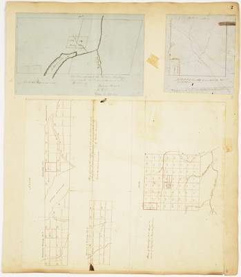
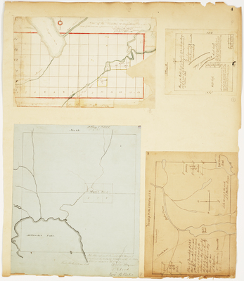
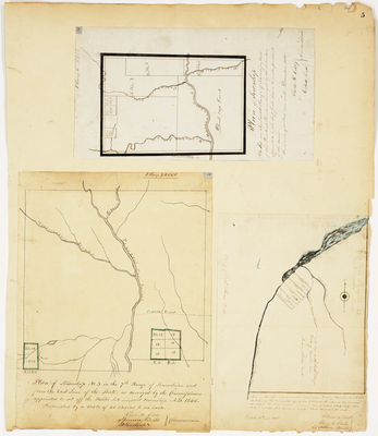
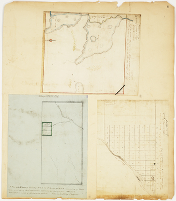
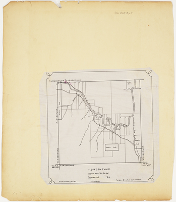
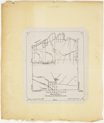
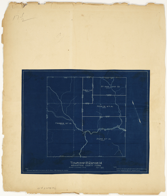
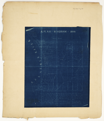
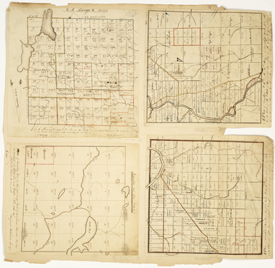
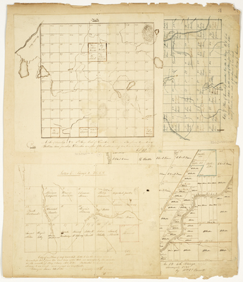
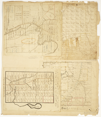
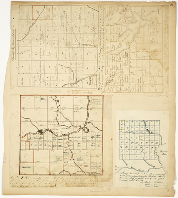
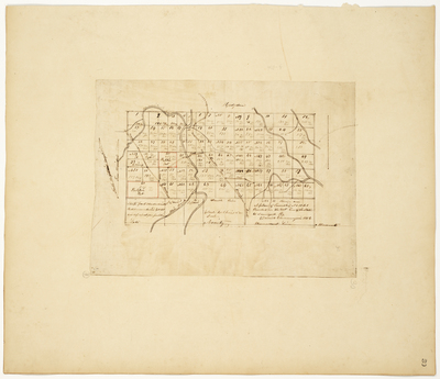
, Somerset and Franklin Counties, 1900 by William Viles

    Page 15.5. Plan of Township 4 Range 3 BKP WKR (Bigelow and Wyman), Somerset and Franklin Counties, 1900

  • Page 15. Plan of Township 5 Range 8 WELS; Plan of Township 2 Range 3 NBKP (Soldiertown)
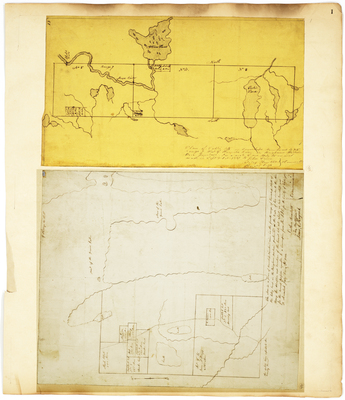
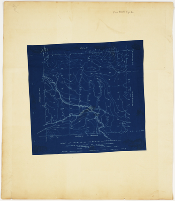
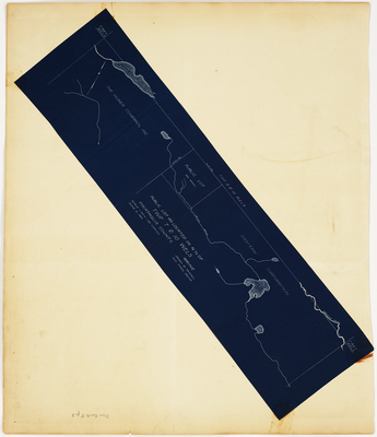
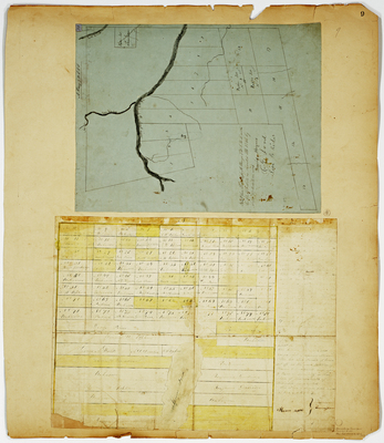
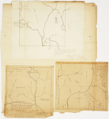
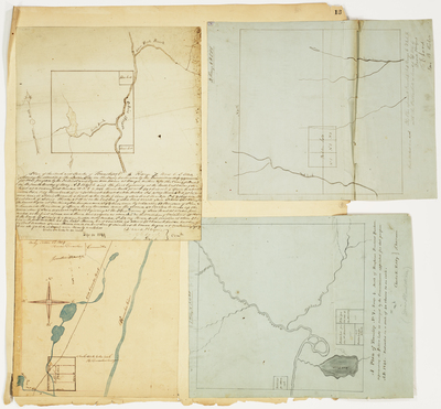
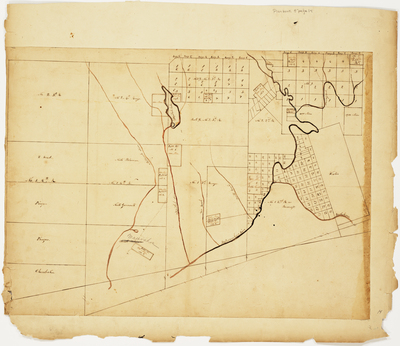
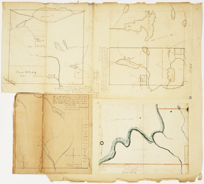
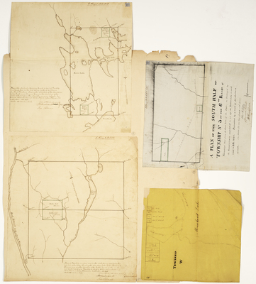
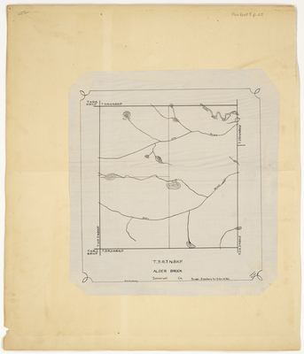
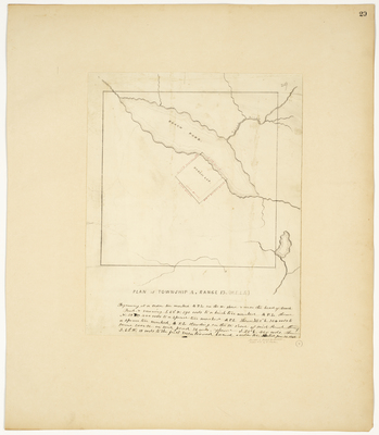
; Plan of Township 1 Range 5 BKP WKR (West Forks Plantation) by George W. Coffin, Caleb Leavitt, John Webber, Lore Alford, and Ira Pitman

    Page 15. Plan of Township 5 Range 8 WELS; Plan of Township 2 Range 3 NBKP (Soldiertown); Plan of Township 1 Range 5 BKP WKR (West Forks Plantation)

  • Page 16.5. Plan of Township 15 Range 13, Aroostook County, Maine by P. L. Sawyer

    Page 16.5. Plan of Township 15 Range 13, Aroostook County, Maine

  • Page 16. Plan of Reserved Land in Township 7 Range 9; Plan of Public Lands in Township 3 Range 6 WKR; Plan of Township 6 Range 8; Plan of Township 1 Range 2 NBKP by David Haynes, Samuel Weston, Lore Alford, and William Flint

    Page 16. Plan of Reserved Land in Township 7 Range 9; Plan of Public Lands in Township 3 Range 6 WKR; Plan of Township 6 Range 8; Plan of Township 1 Range 2 NBKP

  • Page 17.5. Plan of Township 15 Range 14, Aroostook County, Maine by P. L. Sawyer

    Page 17.5. Plan of Township 15 Range 14, Aroostook County, Maine

 
  • 1
  • 2
  • 3
  • 4
  • 5
  • 6


Search

Advanced Search

  • Notify me via email or RSS

Browse

  • State Agencies
  • Subjects
  • Contributors

For Agency Contributors

  • FAQs

Featured Links

  • Maine Government
  • Maine State Library
  • Maine State Agencies
  • Digital Maine Partners

Gallery Locations

  • View gallery on map
  • View gallery in Google Earth
 
Digital Commons

Home | About | FAQ | My Account | Accessibility Statement

Privacy Copyright