


Preview
Contributing Institution
Maine Geological Survey
Document Type
Image
Identifier
10851
Description
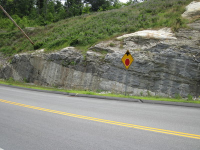
Photo 5: View towards the southeast of a road cut exposing multiple thick, light-colored granite sills within gently dipping darker colored biotite gneiss in the Vassalboro Group (SOvbg). A close-up view of the biotite gneiss is provided in Photo 6. The intimate relationship between the igneous and metamorphic rocks illustrated at this location is inferred to be representative of the north-central portion of the quadrangle, although bedrock is poorly exposed in this area. Large roadcut south of Route 9, Durham, approximately 300 feet west of the intersection with Route 125.
Project Name: Bedrock Geology 24k Lisbon Falls South
Exact Creation Date
7-12-2018
Location
Durham
Supplemental Rights
Credit must be given to the photographer and the Maine Geological Survey when this photo is displayed, reproduced, distributed and/or used in derivative works.
Keywords
bedrock geology; STATEMAP; Lisbon Falls South