


Preview
Contributing Institution
Maine Geological Survey
Document Type
Image
Identifier
72159
Description
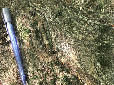
Photo 8: Weathered exposure of the garnet gneiss member of the Sangerville Formation (Ssgg). The subtle layering in this rock is defined by variable concentrations of very fine grained garnet. East of Old Green Road, Lewiston.
Project Name: STATEMAP Lake Auburn East Bedrock24k
Exact Creation Date
9-16-2022
Location
Lewiston
Supplemental Rights
Credit must be given to the photographer and the Maine Geological Survey when this photo is displayed, reproduced, distributed and/or used in derivative works.
Keywords
bedrock mapping; outcrop; STATEMAP; Lake Auburn East