

Title
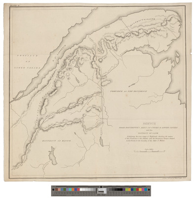
1829 Sketch from Bouchette's Maps of Upper and Lower Canada and of the District of Gaspe, Plate II
Preview
Contributing Institution
Maine State Archives
Document Type
Image
Description
Sketch from Bouchette's Maps of Upper & Lower Canada and of the District of Gaspe exhibiting the true range of highlands dividing the waters of the St. Lawrence and the Atlantic, and the Imaginary Ranges claimed by the British for the boundary of the State of Maine. Plate II (4 copies). Published by Shirley & Hyde, 1829.
See also http://www.davidrumsey.com/maps880036-24204.html
Exact Creation Date
1829
Language
English
Keywords
Cartography; Maps; Surveys