Home
Search
Browse State Agencies
My Account
About
Digital Commons Network™
Skip to main content
Home
About
FAQs
My Account
Home
>
StateDocs
>
sos
>
ARCHIVES
>
ARC_IMG
>
ARC_LAND_OFFICE
>
ME_HIGHLANDS
Maine Highlands
Printing is not supported at the primary Gallery Thumbnail page. Please first navigate to a specific Image before printing.
Follow
Switch View to List
View Slideshow
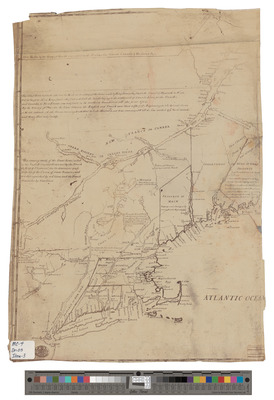
[Undated] Copy of a Map of New England, the Province of Maine, and Canada
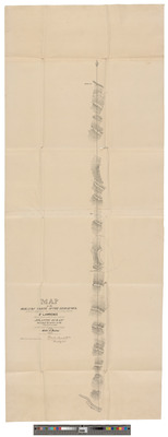
1838 Map of the Highlands North of the Kedgewick Which Separate the Rivers Running Into the St. Lawrence From those which Run Into the Atlantic Ocean
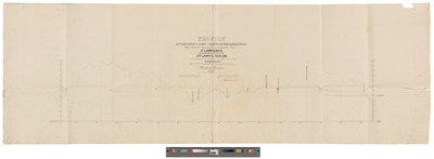
1838 Profile of the Highlands North of the Kedgewick Which Separate the Waters Running Into the River St. Lawrence From Those Which Fall Into the Atlantic Ocean
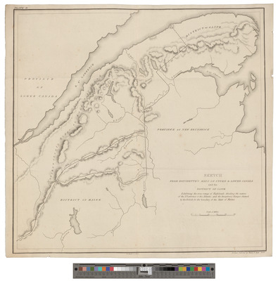
1829 Sketch from Bouchette's Maps of Upper and Lower Canada and of the District of Gaspe, Plate II
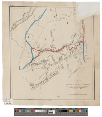
1829 Sketch of the Imaginary Ranges of Highlands Reported by the British Surveyors Under the Treaty of Ghent, As Extending Across the State of Maine, Plate 3
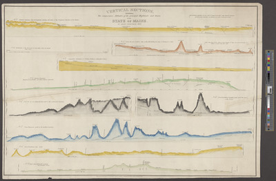
Vertical Sections, Exhibiting the Comparative Altitudes of the Principal Highlands and Rivers of the State of Maine
Search
Enter search terms:
Select context to search:
in this collection
Digital Maine
Advanced Search
Notify me via email or
RSS
Browse
State Agencies
Subjects
Contributors
For Agency Contributors
FAQs
Links
MA Archives: Eastern Lands papers Land Office correspondence, 1783-1859
Featured Links
Maine Government
Maine State Library
Maine State Agencies
Digital Maine Partners
Gallery Locations
View gallery on map
View gallery in Google Earth


![[Undated] Copy of a Map of New England, the Province of Maine, and Canada](https://digitalmaine.com/me_highlands/1002/thumbnail.jpg "[Undated] Copy of a Map of New England, the Province of Maine, and Canada")


