

Preview
Contributing Institution
Maine State Archives
Document Type
StillImage
Identifier
302962
Description
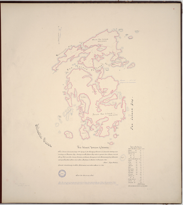
Page 7 of Knox County planbook. Survey of the Fox Islands (now North Haven and Vinalhaven and smaller islands of Sheep, Watermans, Islands B-D, Long, Arey, Jewell, Otter, Brimstone, Dog Fish, Crockets, Browns, Greens, Burges, and Hamelton).
"These islands delineated page 104 leying in the County of Lincoln are bounded westerly and northerly on Penobscot Bay, Easterly on Fox Island Bay which seperate these Islands from the Isle of Holt [Isle Au Haut], and Deer Island Divisions of Islands. Surveyed for the Commonwealth of Massachusetts by Jonathan Stone and John Mathews in October & November 1785, attest. Rufus Putnam. Granted conditionally to John Calderwood and others March 13, 1786."
Scale of 200 rods to an inch. Copied from the Massachusetts Archives Maps and Plans #1343.
Broad Creation Date
1785
Language
English
Location
Knox County; Isle Au Haut; North Haven; Vinalhaven
Keywords
Cartography; Maps; Maine Land Office; Planbooks; Surveys