• Home
  • Search
  • Browse State Agencies
  • My Account
  • About
  • DC Network Digital Commons Network™
Skip to main content
Digital Maine Maine State Library
  • Home
  • About
  • FAQs
  • My Account

Home > StateDocs > Maine State Library (MSL) > MSL Special Collections > Northeast Boundary Dispute > Webster–Ashburton Treaty Maps

Webster–Ashburton Treaty Maps

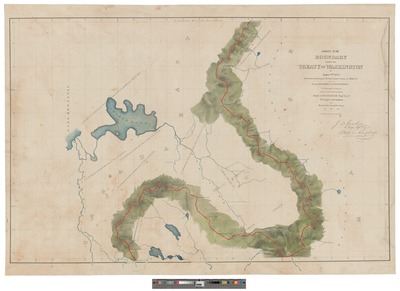
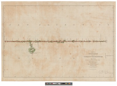
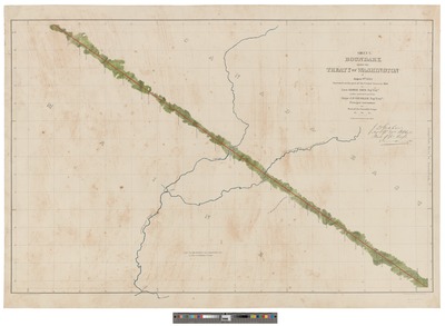
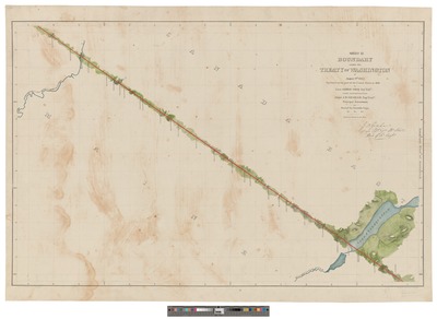
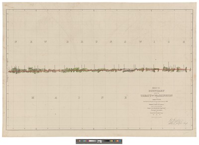
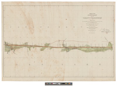
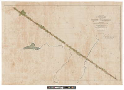
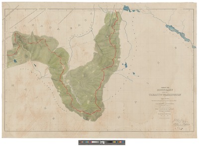
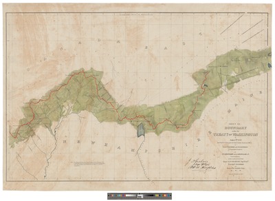
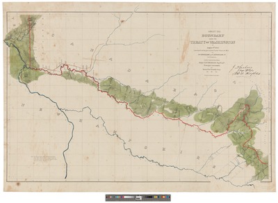
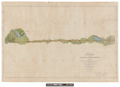
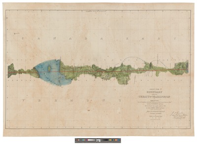
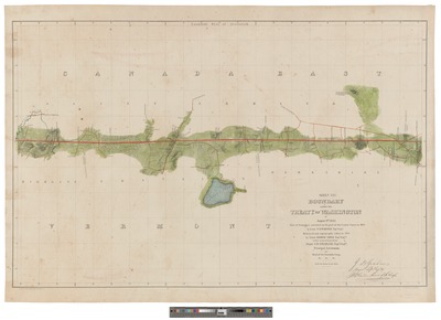
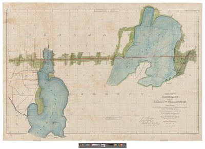
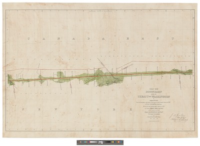
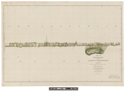
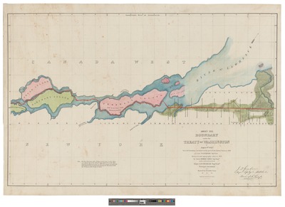
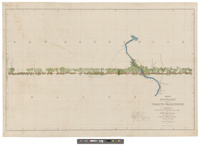
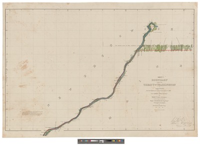
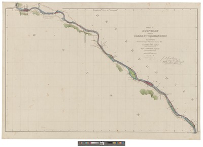
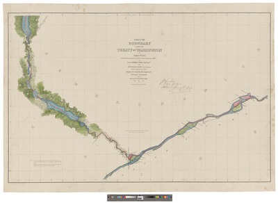
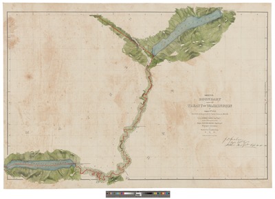
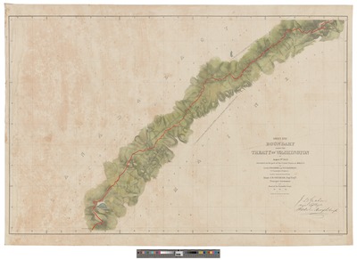
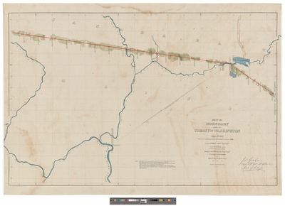
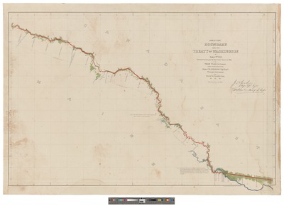
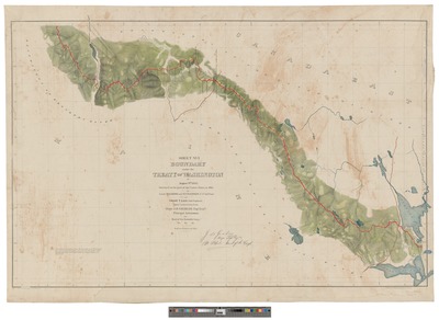
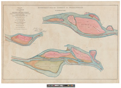
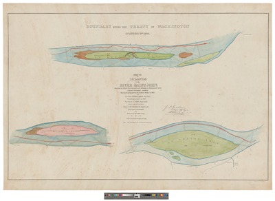
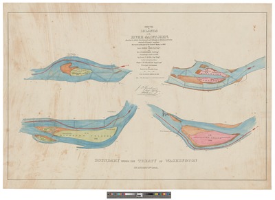
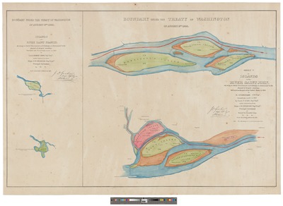
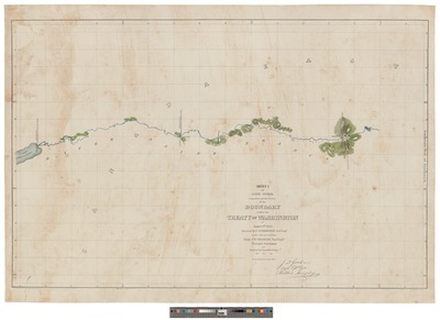
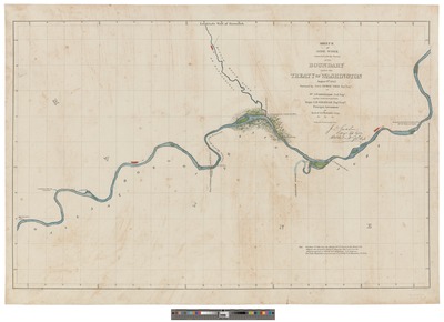
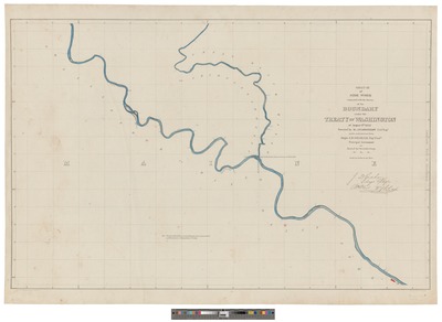
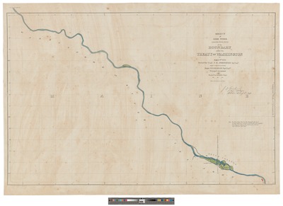
The Treaty of Washington, better known as the Webster–Ashburton Treaty, signed August 9, 1842, was a treaty resolving several border issues between the United States and the British North American colonies. Signed under John Tyler's presidency, it resolved the Aroostook War, a nonviolent dispute over the location of the Maine–New Brunswick border. The maps in this series are among the original supporting documents for the Treaty. Each is hand drawn, hand colored and signed by Major J. D. Graham, Principal Astronomer and head of the Scientific Corps.
Printing is not supported at the primary Gallery Thumbnail page. Please first navigate to a specific Image before printing.

Follow

Switch View View Slideshow
 
  • Boundary Under the Treaty of Washington of August 9th 1842. Islands in the River Saint John by F. Schroeder, Alexander Wadsworth Longfellow, Georg Thom, J. E. Johnston, and James Graham Duncan

    Boundary Under the Treaty of Washington of August 9th 1842. Islands in the River Saint John

  • Boundary under the Treaty of Washington of August 9th 1842. Islands in the River Saint John by F. Schroeder, Alexander Wadsworth Longfellow, Georg Thom, J. E. Johnston, and James Duncan Graham

    Boundary under the Treaty of Washington of August 9th 1842. Islands in the River Saint John

  • Boundary under the Treaty of Washington of August 9th 1842. Islands in the River Saint John by F. Schroeder, Alexander Wadsworth Longfellow, Georg Thom, John E. Johnston, and James Duncan Graham

    Boundary under the Treaty of Washington of August 9th 1842. Islands in the River Saint John

  • Boundary Under the Treaty of Washington of August 9th 1842. Islands in the River Saint John by F. Schroeder, Alexander Wadsworth Longfellow, Goerg Thom, J. E. Johnston, and James Graham Duncan

    Boundary Under the Treaty of Washington of August 9th 1842. Islands in the River Saint John

  • Boundary under the Treaty of Washington of August 9th 1842. Islands in the River Saint John by F. Schroeder, Alexander Wordsworth Longfellow, Georg Thom, J. E. Johnston, and James Duncan Graham

    Boundary under the Treaty of Washington of August 9th 1842. Islands in the River Saint John

  • Sidework connected with the survey of the boundary Under the Treaty of Washington, August 9th, 1842 by F. Schroeder, Alexander Wadsworth Longfellow, Georg Thom, J. E. Johnston, and James Duncan Graham

    Sidework connected with the survey of the boundary Under the Treaty of Washington, August 9th, 1842

 
  • 1
  • 2
  • 3
  • 4
  • 5
  • 6


Search

Advanced Search

  • Notify me via email or RSS

Browse

  • State Agencies
  • Subjects
  • Contributors

For Agency Contributors

  • FAQs

Featured Links

  • Maine Government
  • Maine State Library
  • Maine State Agencies
  • Digital Maine Partners

Gallery Locations

  • View gallery on map
  • View gallery in Google Earth
 
Digital Commons

Home | About | FAQ | My Account | Accessibility Statement

Privacy Copyright