

Preview
Document Type
StillImage
Contributing Institution
Maine State Library
Identifier
BOWASH8422 p4
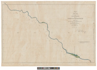
Description
Map was Surveyed under instructions from Major J.D. Graham, Topographical. Engineers., Principal Astronomer and Head of the Scientific Corps; drawn by C. Delisle. 4 map sections on 4 sheets : hand colored, mounted on cardboard. Section 4 Latitude 46.34-46.5 Longitude 69.49-69.34
Exact Creation Date
8-9-1842
Language
English
Keywords
Maine; Canada; New Brunswick; Quebec; Northeast Boundary Dispute; Treaty of Washington 1842; Webster Ashburton Treaty; Bloodless Aroostook War