


Preview
Contributing Institution
Maine Geological Survey
Document Type
Image
Identifier
67559
Description
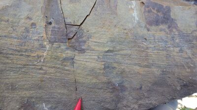
Photo 3: Ripple cross-laminated sandstone deposited in a nearshore setting in the St. Froid Lake Formation (Dsf).
Project Name: STATEMAP Carr Pond Bedrock24k
Exact Creation Date
8-8-2021
Supplemental Rights
Credit must be given to the photographer and the Maine Geological Survey when this photo is displayed, reproduced, distributed and/or used in derivative works.
Keywords
bedrock mapping; outcrop; STATEMAP; Carr Pond