Home
Search
Browse State Agencies
My Account
About
Digital Commons Network™
Skip to main content
Home
About
FAQs
My Account
Home
>
StateDocs
>
sos
>
ARCHIVES
>
ARC_IMG
>
ARC_LAND_OFFICE
>
CANAL_RIVER_MAPS
Canal and River Maps
Printing is not supported at the primary Gallery Thumbnail page. Please first navigate to a specific Image before printing.
Follow
Switch View to List
View Slideshow
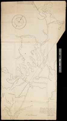
1822 Plan of the St. John Waters
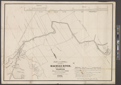
1835 A Plan And Level Of A Section Of Machias River, With The Projection Of A Profile Shewing The Rise & Fall Of Water Also Of The Adjoining Land
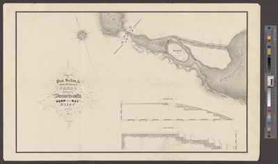
1835 Plan, Section, Etc. Of the Proposed Canal Between Damariscotta Pond and Bay Maine
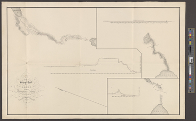
1835 Survey Of A Route For A Canal Between Thompson and Sebago Ponds, By Order of the Board of Improvement
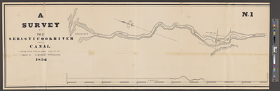
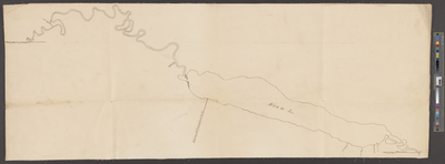
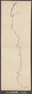
1836 A Survey of the Sebasticook River For A Canal, No. 1
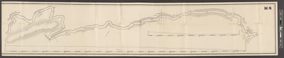
1836 A Survey of the Sebasticook River For A Canal, No. 2
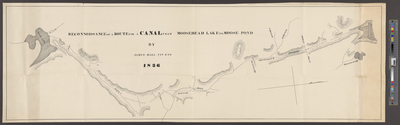
1836 A Survey of the Sebasticook River For A Canal, No. 3
1836 A Survey of the Sebasticook River For A Canal, No. 4
1
2
Search
Enter search terms:
Select context to search:
in this collection
Digital Maine
Advanced Search
Notify me via email or
RSS
Browse
State Agencies
Subjects
Contributors
For Agency Contributors
FAQs
Links
MA Archives: Eastern Lands papers Land Office correspondence, 1783-1859
Featured Links
Maine Government
Maine State Library
Maine State Agencies
Digital Maine Partners
Gallery Locations
View gallery on map
View gallery in Google Earth


