• Home
  • Search
  • Browse State Agencies
  • My Account
  • About
  • DC Network Digital Commons Network™
Skip to main content
Digital Maine Maine State Library
  • Home
  • About
  • FAQs
  • My Account

Home > StateDocs > Maine State Library (MSL) > MSL Special Collections > Northeast Boundary Dispute > Treaty of Ghent Border Atlas

Treaty of Ghent Border Atlas

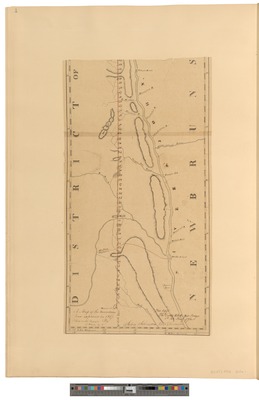
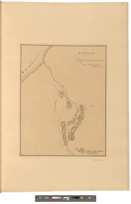
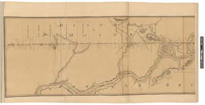
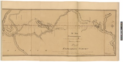
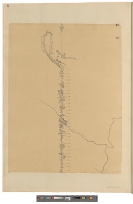
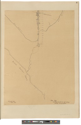
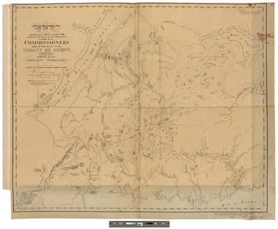
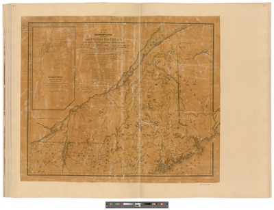
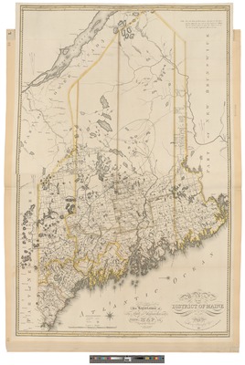
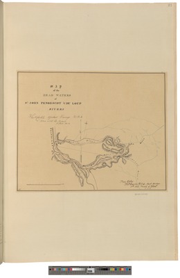
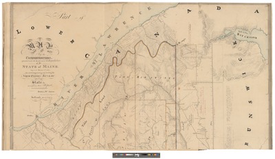
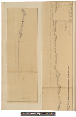
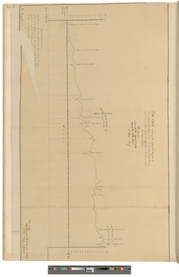
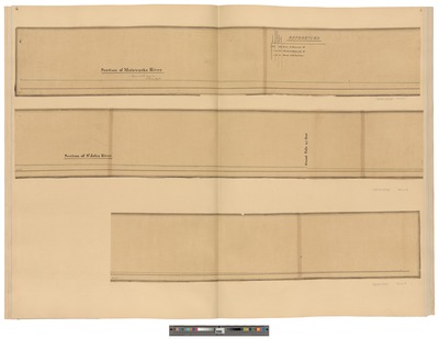
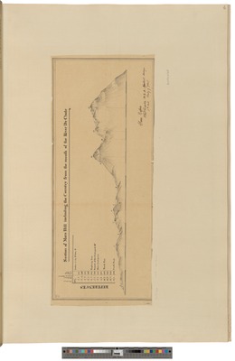
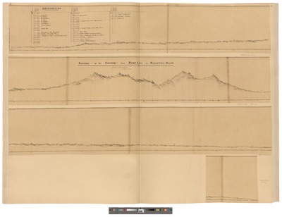
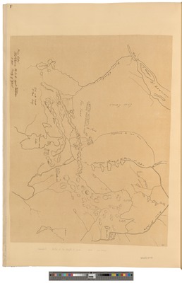
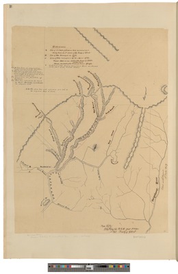
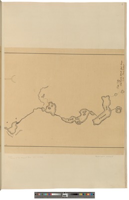
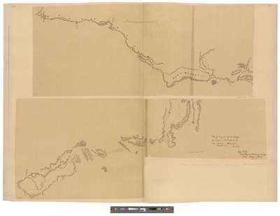
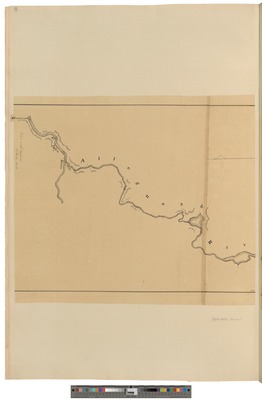
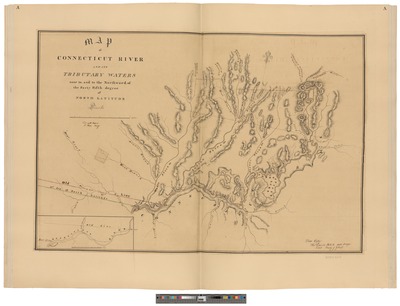
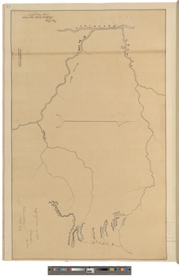
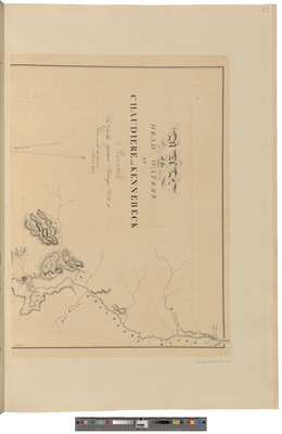
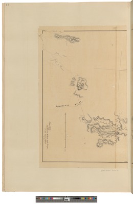
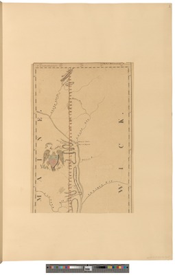
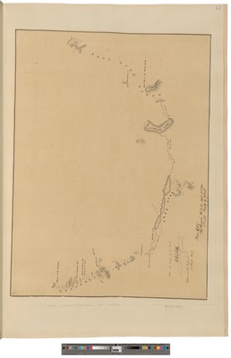
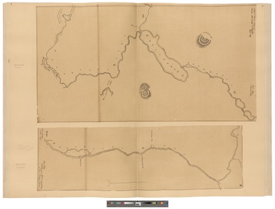
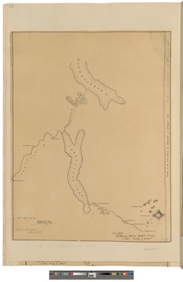
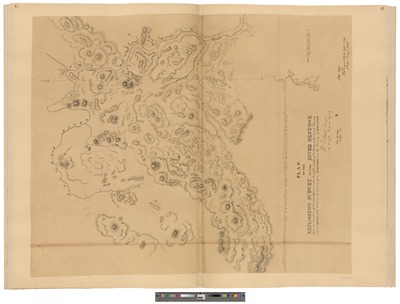
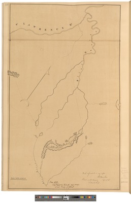
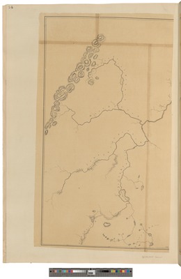
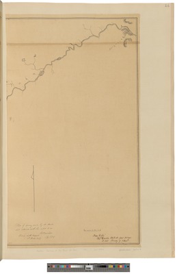
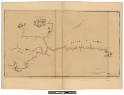
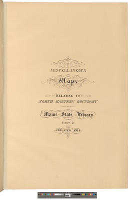
In 1914, staff at the Maine State Library compiled an atlas of maps relating to the Treaty of Ghent. The Treaty signed December 24, 1814 ended the War of 1812 and resolved disputes between the United States and the British North American Colonies over border issues.
Printing is not supported at the primary Gallery Thumbnail page. Please first navigate to a specific Image before printing.

Follow

Switch View View Slideshow
 
  • A Map of the Boundary Line Explored in 1817 Part 1 by John Johnson and Maine State Library

    A Map of the Boundary Line Explored in 1817 Part 1

  • A Map of the Boundary Line Explored in 1817 Part 2 by John Johnson and Maine State Library

    A Map of the Boundary Line Explored in 1817 Part 2

  • Back Cover Maps of the North Eastern Bounday Part 2 Maine State Library by Maine State Library

    Back Cover Maps of the North Eastern Bounday Part 2 Maine State Library

  • Fronstpiece Maps of the North Eastern Bounday Part 1 Maine State Library by Maine State Library

    Fronstpiece Maps of the North Eastern Bounday Part 1 Maine State Library

  • Front Cover Maps of the North Eastern Bounday Part 1 Maine State Library by Maine State Library and Maine State Library

    Front Cover Maps of the North Eastern Bounday Part 1 Maine State Library

  • Front Cover Maps of the North Eastern Bounday Part 2 Maine State Library by Maine State Library

    Front Cover Maps of the North Eastern Bounday Part 2 Maine State Library

  • Further Survey of River Ouelle by Thomas Carlile and Maine State Library

    Further Survey of River Ouelle

  • Further Survey of the North Line and Adjacent Country in 1818 Sections 1, 2 & 3 by John Johnson and Maine State Library

    Further Survey of the North Line and Adjacent Country in 1818 Sections 1, 2 & 3

  • Further Survey of the North Line and Adjacent Country in 1818 Sections 4, 5, & 6 by Joseph Bouchette and Maine State Library

    Further Survey of the North Line and Adjacent Country in 1818 Sections 4, 5, & 6

  • Further Survey of the North Line Section 1 by William F. Odell and Maine State Library

    Further Survey of the North Line Section 1

  • Further Survey of the North Line Section 2 by William Odell and Maine State Library

    Further Survey of the North Line Section 2

  • Map Exhibiting the Tract of Country Explored in the Years 1817, 1818, and 1820 by William Odell and Maine State Library

    Map Exhibiting the Tract of Country Explored in the Years 1817, 1818, and 1820

  • Map of the Boundary lines Between United States and British Provinces by T. J. Lee and Maine State Library

    Map of the Boundary lines Between United States and British Provinces

  • Map of the District of Maine by Moses Greenleaf and Maine State Library

    Map of the District of Maine

  • Map of the headwaters of the Saint John, Penobscot, and Du Loop Rivers. by Thomas Carlile and Maine State Library

    Map of the headwaters of the Saint John, Penobscot, and Du Loop Rivers.

  • Map of the State of Maine Part 1 by William Anson and Maine State Library

    Map of the State of Maine Part 1

  • Section of Different Heights through Grand Portage by A. Partridge and Maine State Library

    Section of Different Heights through Grand Portage

  • Section of Line North from Saint Croix. by Bouchette and Maine State Library

    Section of Line North from Saint Croix.

  • Section of Madawaska and Saint John Rivers by A. Partridge and Maine State Library

    Section of Madawaska and Saint John Rivers

  • Section of Mars Hill by A. Partridge and Maine State Library

    Section of Mars Hill

  • Section of the County from Point Levi to Hallowell Maine by A. Partridge and Maine State Library

    Section of the County from Point Levi to Hallowell Maine

  • Sketch of Height of Land Annexed to Maine by Campbell and Maine State Library

    Sketch of Height of Land Annexed to Maine

  • Streams Tributary to the Connecticut River by Hiram Burnham and Maine State Library

    Streams Tributary to the Connecticut River

  • Survey of the Allagash River by Hunter and Maine State Library

    Survey of the Allagash River

  • Survey of the Chaudiere River by A. Partridge and Maine State Library

    Survey of the Chaudiere River

  • Survey of the Chaudiere the Source of the Dead River and the East Branch of the Connecticut by A. Partridge and Maine State Library

    Survey of the Chaudiere the Source of the Dead River and the East Branch of the Connecticut

  • Survey of the Connecticut River and its Tributary Streams by Tiark and Maine State Library

    Survey of the Connecticut River and its Tributary Streams

  • Survey of the DuLoup River by Hiram Burnham and Maine State Library

    Survey of the DuLoup River

  • Survey of the HeadWaters of the Chaudiere and Kennebek Rivers Section 1 by Thomas Carlile and Maine State Library

    Survey of the HeadWaters of the Chaudiere and Kennebek Rivers Section 1

  • Survey of the HeadWaters of the Chaudiere and Kennebek Rivers Section 2 by Thomas Carlile and Maine State Library

    Survey of the HeadWaters of the Chaudiere and Kennebek Rivers Section 2

  • Survey of the Line North from the Saint Croix in 1817 Section 2 by John Johnson and Maine State Library

    Survey of the Line North from the Saint Croix in 1817 Section 2

  • Survey of the Moose River by Nathaniel Hall Loring and Maine State Library

    Survey of the Moose River

  • Survey of the Penobscot : First and Second Parts by Hunter and Maine State Library

    Survey of the Penobscot : First and Second Parts

  • Survey of the Penobscot River by Nathaniel Loring and Maine State Library

    Survey of the Penobscot River

  • Survey of the Restook Section of the Same and of Mars Hill by A. Partridge and Maine State Library

    Survey of the Restook Section of the Same and of Mars Hill

  • Survey of the Restook with a Sketch of the Country as Viewed from Mars Hill and the Vicinity of the Houlton Plantation by William F. Odell and Maine State Library

    Survey of the Restook with a Sketch of the Country as Viewed from Mars Hill and the Vicinity of the Houlton Plantation

  • Survey of the River Ouelle and the Source of the Black River by Hiram Burnham and Maine State Library

    Survey of the River Ouelle and the Source of the Black River

  • Survey of the River Saint John Section 1 by Hunter and Maine State Library

    Survey of the River Saint John Section 1

  • Survey of the River Saint John Section 2 by Hunter and Maine State Library

    Survey of the River Saint John Section 2

  • Survey of the Saint John River by Loss and Maine State Library

    Survey of the Saint John River

  • Three Maps: Extract of Carrigans Map of New Hampshire; Extract of Mitchell's Map of the Connecticut River; Plans Showing the different Lines Considered as the Parallel of 45 North by Joseph Bouchette and Maine State Library

    Three Maps: Extract of Carrigans Map of New Hampshire; Extract of Mitchell's Map of the Connecticut River; Plans Showing the different Lines Considered as the Parallel of 45 North

  • Title Page Maps of the North Eastern Bounday Part 2 Maine State Library by Maine State Library

    Title Page Maps of the North Eastern Bounday Part 2 Maine State Library


Search

Advanced Search

  • Notify me via email or RSS

Browse

  • State Agencies
  • Subjects
  • Contributors

For Agency Contributors

  • FAQs

Featured Links

  • Maine Government
  • Maine State Library
  • Maine State Agencies
  • Digital Maine Partners

Gallery Locations

  • View gallery on map
  • View gallery in Google Earth
 
Digital Commons

Home | About | FAQ | My Account | Accessibility Statement

Privacy Copyright