

Preview
Document Type
StillImage
Contributing Institution
Maine State Archives
Identifier
210859
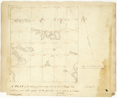
Description
Survey for the lotting of T2 R9 WELS into sections of one mile square on a scale of 40 chains to one inch.
Exact Creation Date
1832
Language
English
Location
Piscataquis County; T2 R9 WELS
Other Location
Loon Pond; Katahdin Pond; Compass Pond; River Pond; Penobscot River; Beaver Pond;
Keywords
Cartography; Maps; Maine Land Office; Planbooks; Surveys