Home
Search
Browse State Agencies
My Account
About
Digital Commons Network™
Skip to main content
Home
About
FAQs
My Account
Home
>
StateDocs
>
sos
>
ARCHIVES
>
ARC_IMG
>
ARC_LAND_OFFICE
>
PLANBOOK_MAPS
>
PLANBOOK_23
Plan Book 23
Printing is not supported at the primary Gallery Thumbnail page. Please first navigate to a specific Image before printing.
Follow
Switch View to List
View Slideshow
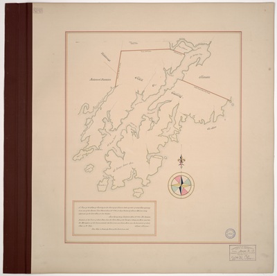
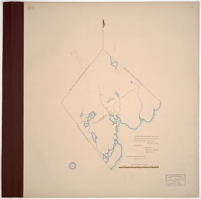
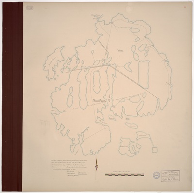
Page 16. A True Plan of Blue Hill Agreable to A Resolve of the Hon. General Court Held in Boston June 18, 1794. Surveyed by me, John Peters, Surveyor.
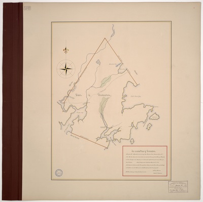
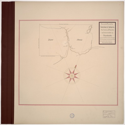
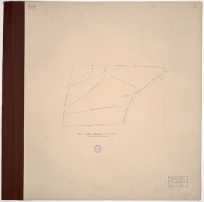
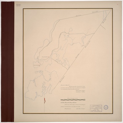
Page 17. A Plan of Buckstown in the County of Hancock and District of Maine. Surveyed A.D. 1787. Copied from the Original by Osgood Carleton.
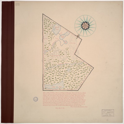
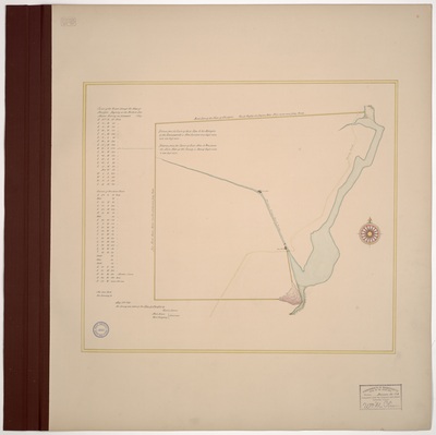
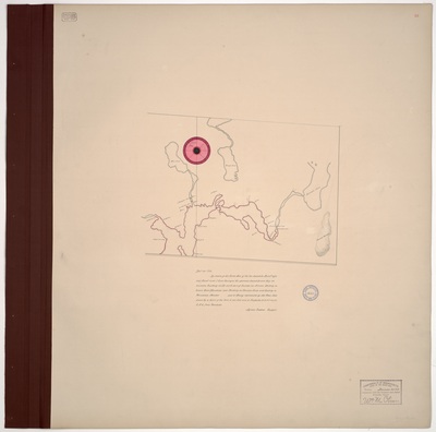
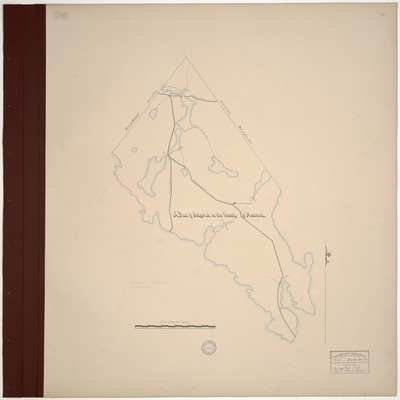
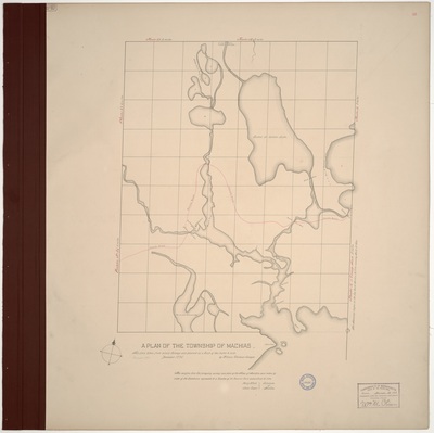
Page 18. Plan of T8 and T9 SD, Hancock County in 1795.
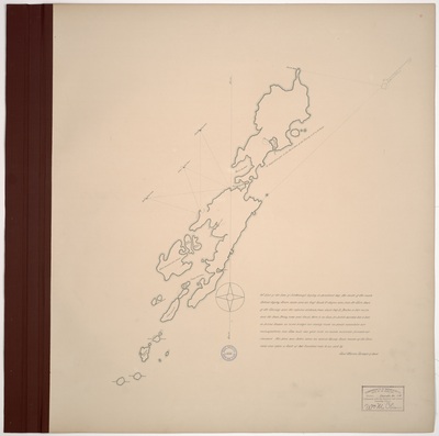
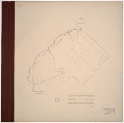
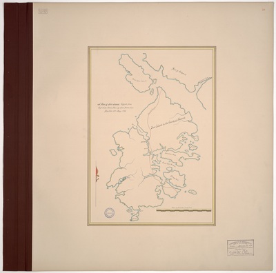
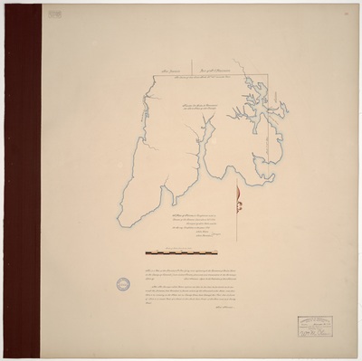
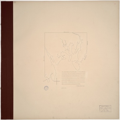
Page 19. A Plan of Deer Island, copyed from Capt. John Stones Plan by John Peters, Jr, Blue Hill 21st May 1795.
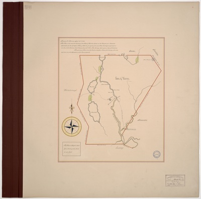
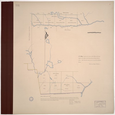
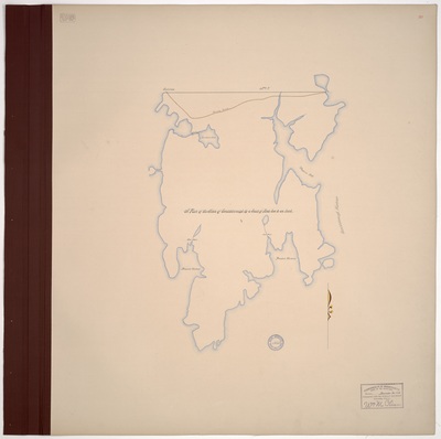
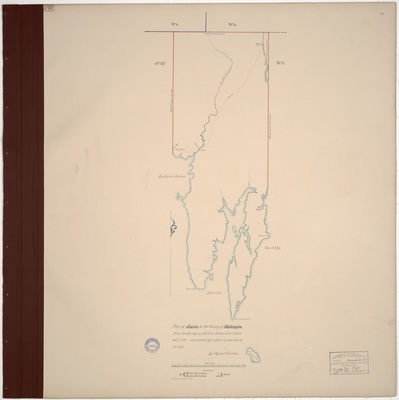
Page 20. A Plan of the Town of Gouldsborough by a Scale of Rods 200 to an Inch.
Page 21. A Plan of Mount Desert Agreable to a Resolve of the Hon. General Court held in Boston June 18, 1794. The Eastern Part of this Island Surveyed in the year 1789 and the West Part in the year 1795. Surveyed by Me, John Peters, Surveyor.
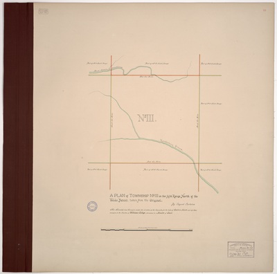
Page 22. A Plan of Township No. II East of Penobscot River copied A.D. 1795 from a Plan of the Survey made by Captain Sherburn A.D. 1793 by Osgood Carleton.
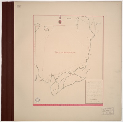
Page 23. A True Plan of the Town of Penobscot Drawn from a Survey taken in the year 1794 Agreable to a Resolve of the Honorable General Court Past June 18 1794. Surveyed by me John Peters, Surveyor.
1
2
3
4
Search
Enter search terms:
Select context to search:
in this collection
Digital Maine
Advanced Search
Notify me via email or
RSS
Browse
State Agencies
Subjects
Contributors
For Agency Contributors
FAQs
Featured Links
Maine Government
Maine State Library
Maine State Agencies
Digital Maine Partners
Gallery Locations
View gallery on map
View gallery in Google Earth


