Home
Search
Browse State Agencies
My Account
About
Digital Commons Network™
Skip to main content
Home
About
FAQs
My Account
Home
>
StateDocs
>
sos
>
ARCHIVES
>
ARC_IMG
>
ARC_LAND_OFFICE
>
PLANBOOK_MAPS
>
PLANBOOK_23
Plan Book 23
Printing is not supported at the primary Gallery Thumbnail page. Please first navigate to a specific Image before printing.
Follow
Switch View to List
View Slideshow
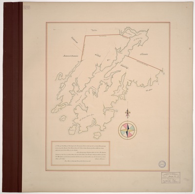
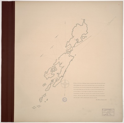
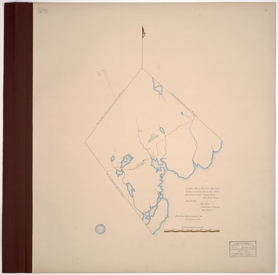
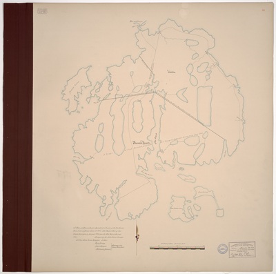
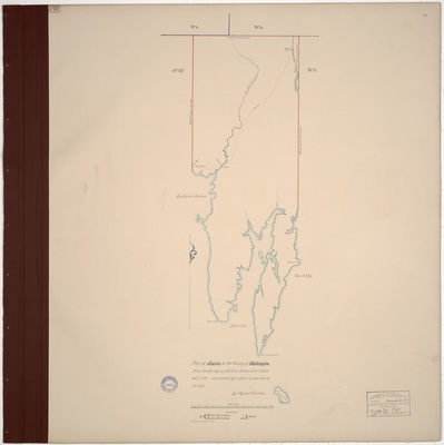
Page 09. A plan of the Town of Islesborough laying in Penobscot Bay.
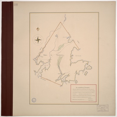
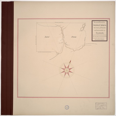
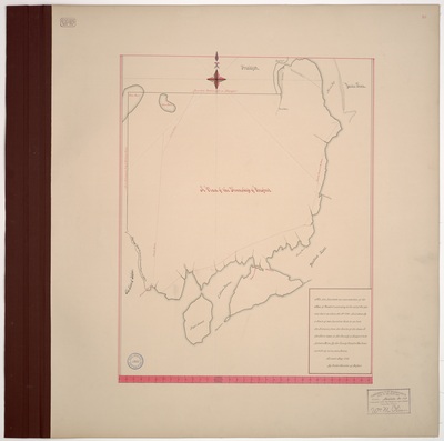
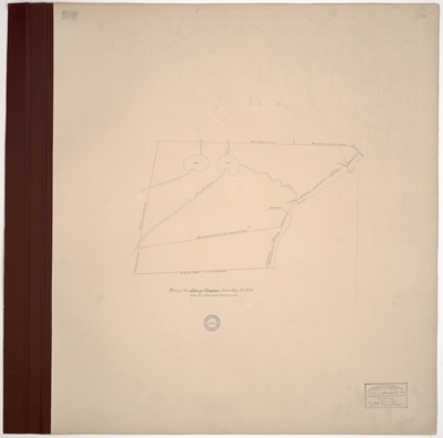
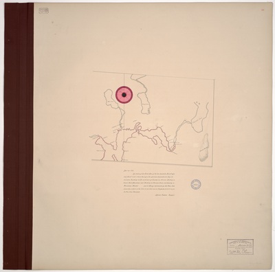
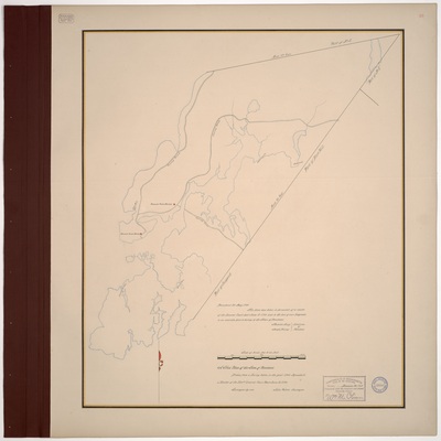
Page 10. Plan of the Township of Prospect surveyed May 1795
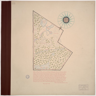
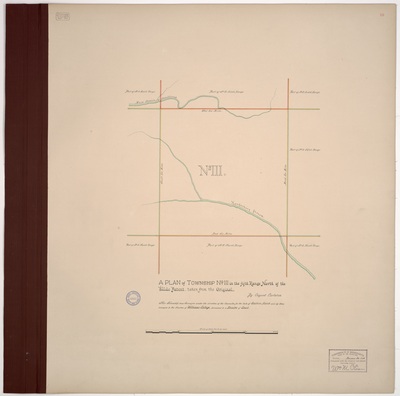
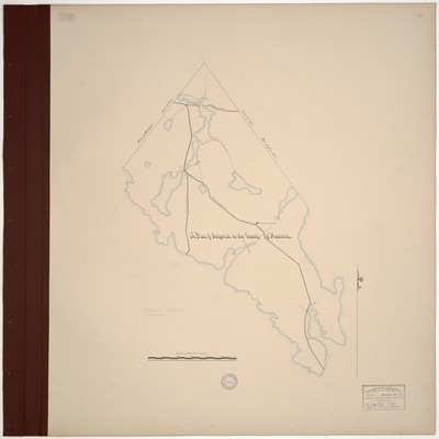
Page 12.5. A plan of Township No. III in the fifth Range North of the Waldo Patent, taken from the Original. This Township was Surveyed under the direction of the Commites for the Sale of Eastern Lands and by them conveyed to the Trustees of Williams College, pursuant to a Resolve of Court.
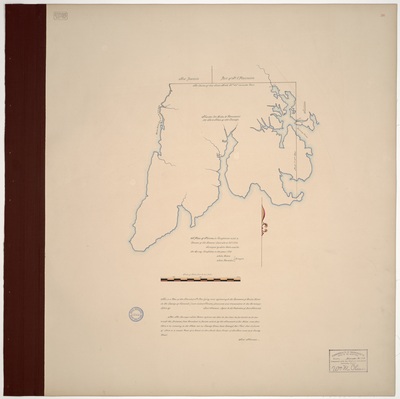
Page 12. A Plan of the town of Bangor in the County of Hancock and Commonwealth of Massachusetts, west side of Penobscot River, together with an accurate survey of the River and Canduskege Stream, October 20, 1795.
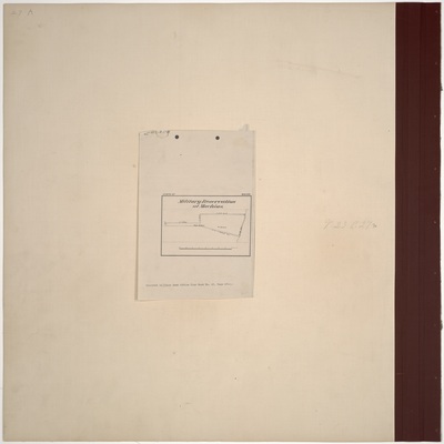
Page 13.5. Military Reservation Fort at Edgecombe, Lincoln County.
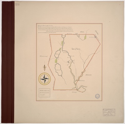
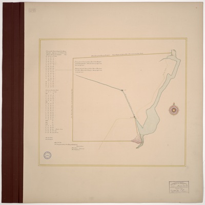
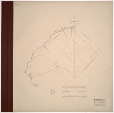
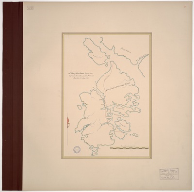
Page 13. Plan of the Town of Hampden taken May 16th, 1795.
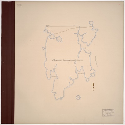
Page 14. Map of the Town of Orrington in the County of Hancock & Commonwealth of Massachusetts.
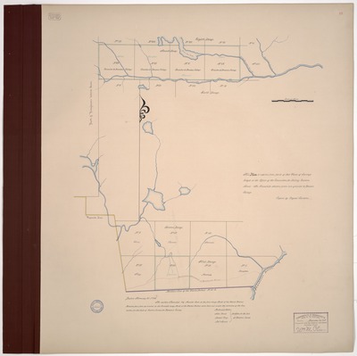
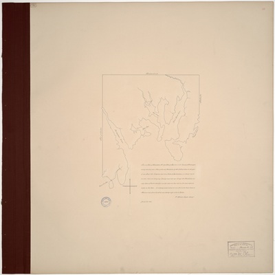
Page 15. This Plan is copied from parts of two Plans of Surveys lodged in the Office of the Committee for Selling Eastern Land. The Townships shaded green are granted to Bowdoin College. Copied by Osgood Carleton.
1
2
3
4
Search
Enter search terms:
Select context to search:
in this collection
Digital Maine
Advanced Search
Notify me via email or
RSS
Browse
State Agencies
Subjects
Contributors
For Agency Contributors
FAQs
Featured Links
Maine Government
Maine State Library
Maine State Agencies
Digital Maine Partners
Gallery Locations
View gallery on map
View gallery in Google Earth


