• Home
  • Search
  • Browse State Agencies
  • My Account
  • About
  • DC Network Digital Commons Network™
Skip to main content
Digital Maine Maine State Library
  • Home
  • About
  • FAQs
  • My Account

Home > StateDocs > sos > ARCHIVES > ARC_IMG > ARC_MAPS > PLANBOOK_MAPS > PLANBOOK_1

Plan Book 1

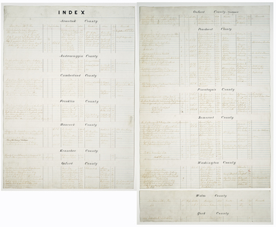
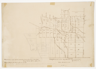
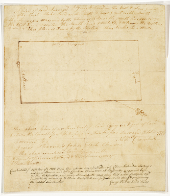
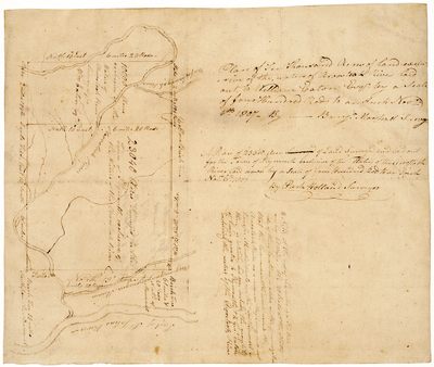
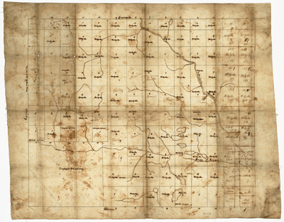
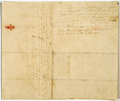
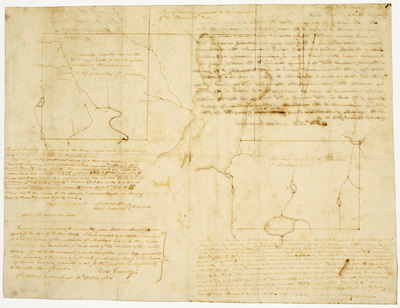
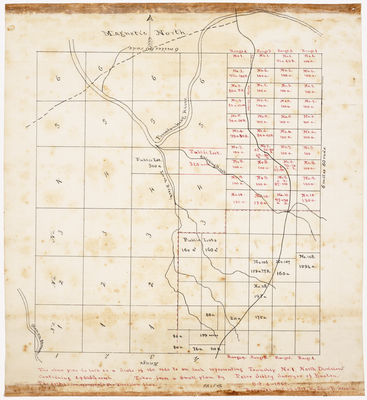
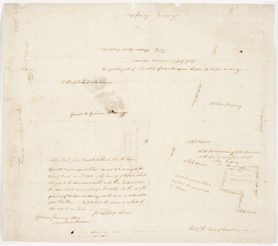
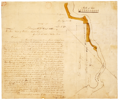
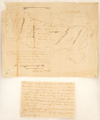
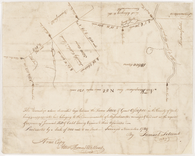
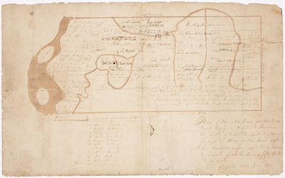
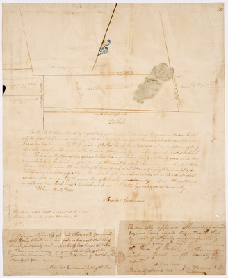
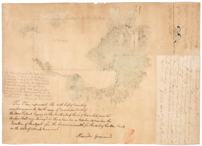
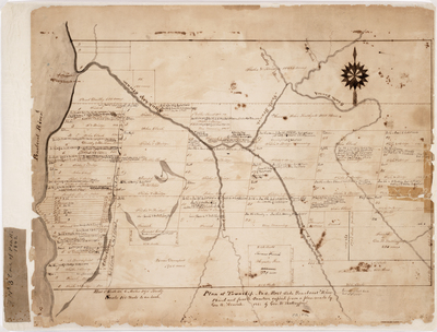
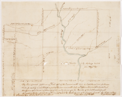
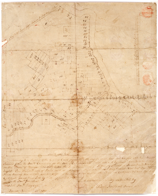
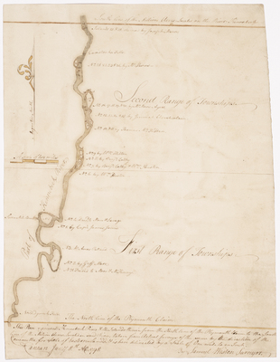
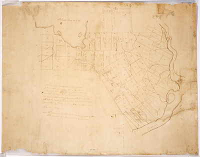
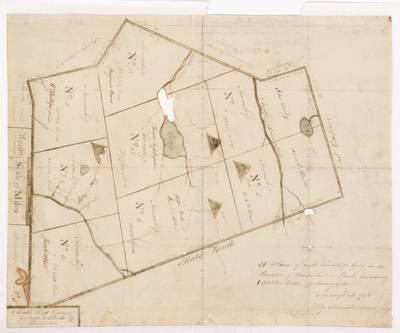
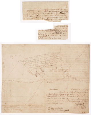
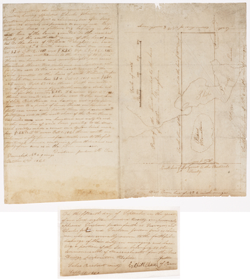
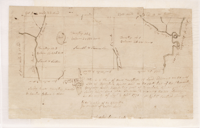
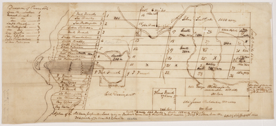
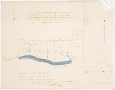
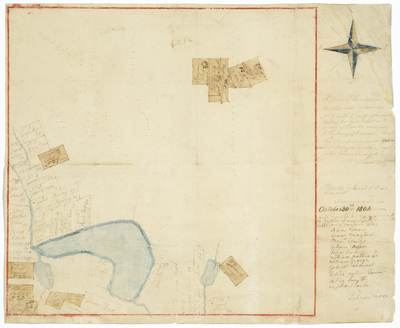
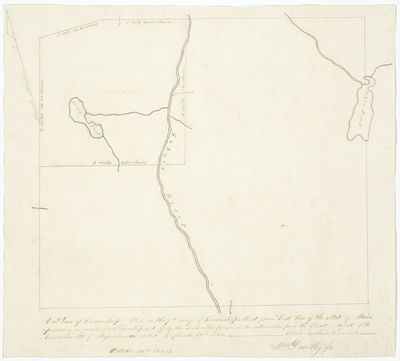
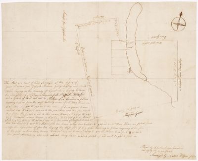
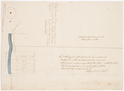
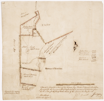
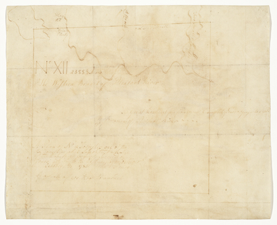
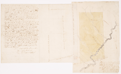
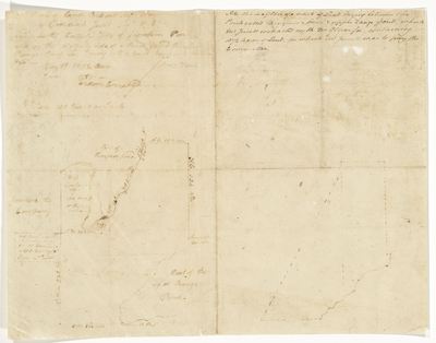
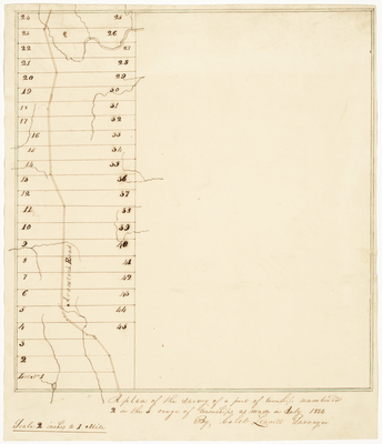
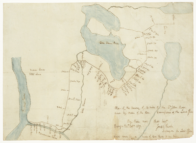
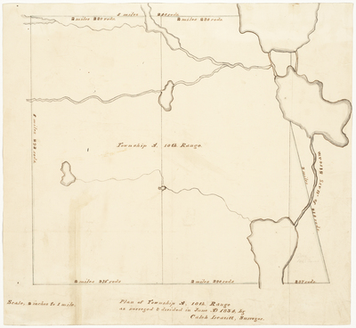
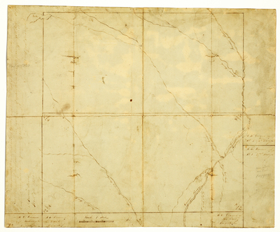
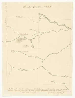
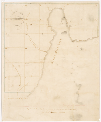
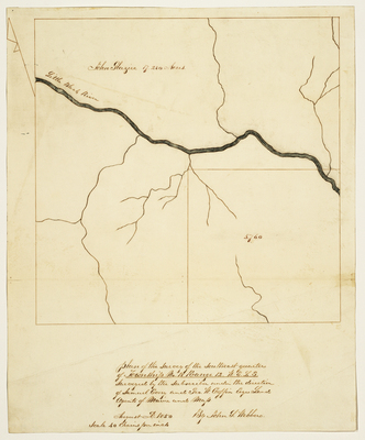
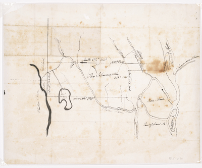
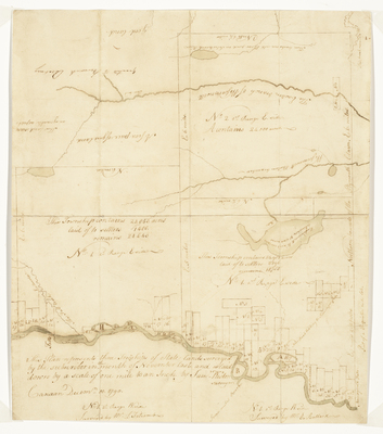
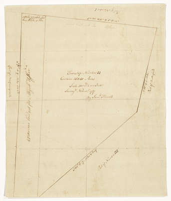
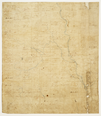
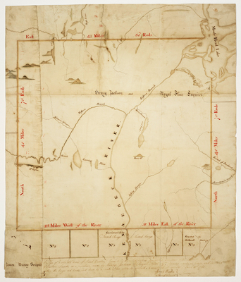
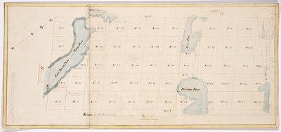
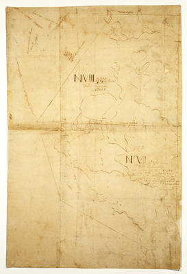
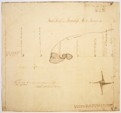
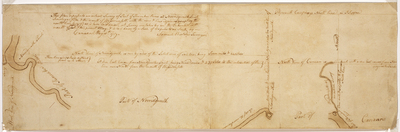
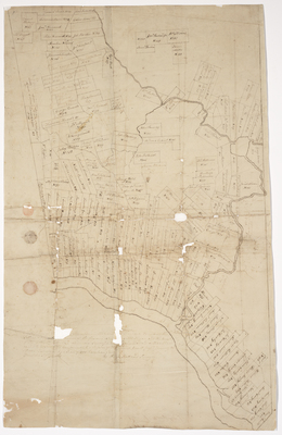
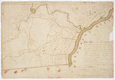
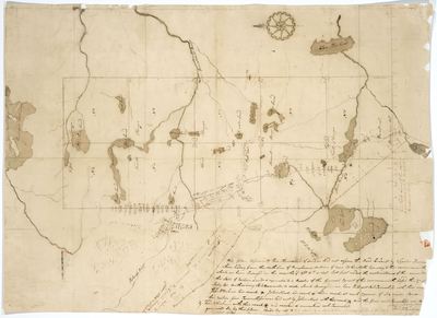
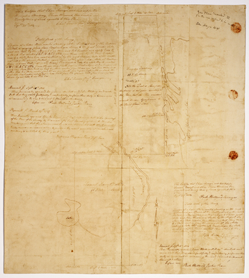
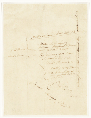
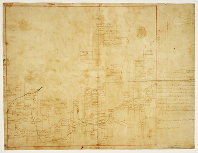
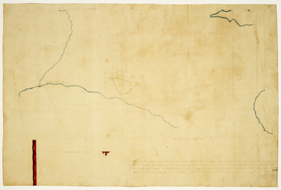
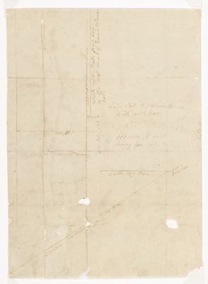
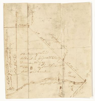
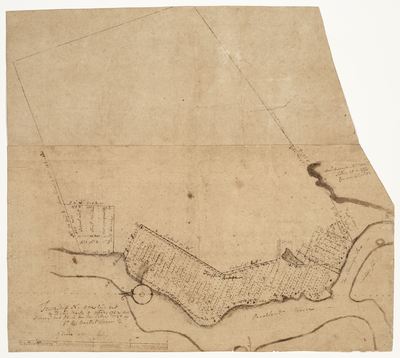
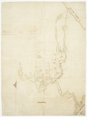
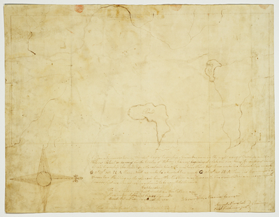
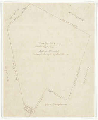
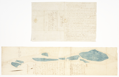
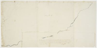
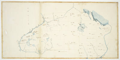
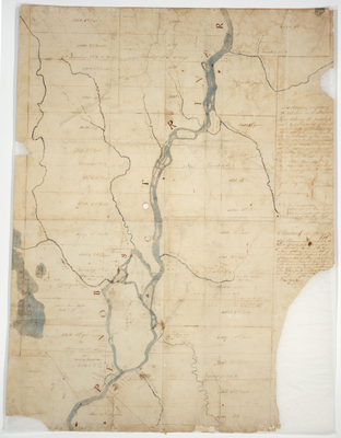
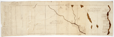
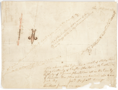
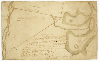
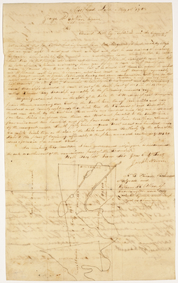
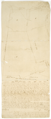
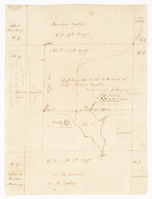
Plan Book 1 includes several maps and plans from different regions of the State of Maine. Many of these maps were created prior to Maine becoming a state in 1820. The maps were then transferred to the Maine Land Office and other maps were created for the Land Agent. The pages of Plan Book 1 often had several maps but this book was conserved and the maps separated. Original page numbers have been used.
Printing is not supported at the primary Gallery Thumbnail page. Please first navigate to a specific Image before printing.

Follow

Switch View View Slideshow
 
  • Page 06. Plan of grant of land between Bethel and the grant to Dummer Academy in the County of Oxford, 1814 by Alexander Greenwood

    Page 06. Plan of grant of land between Bethel and the grant to Dummer Academy in the County of Oxford, 1814

  • Page 06. Plan of the north half of Township 9 in the 10th Range of townships north of the Waldo Patent lying on the north side of the half township granted to Saco Academy surveyed by the subscribers in October 1813 under the direction of the Agent for the Commonwealth for the Sale of Eastern Lands. by Alexander Greenwood

    Page 06. Plan of the north half of Township 9 in the 10th Range of townships north of the Waldo Patent lying on the north side of the half township granted to Saco Academy surveyed by the subscribers in October 1813 under the direction of the Agent for the Commonwealth for the Sale of Eastern Lands.

  • Page 07.5. Plan of Township No. 3 East Side Penobscot River, Third and Fourth Quarters, copied from a plan made by George A. Herrick, 1842 by George A. Herrick and George W. Wallingford

    Page 07.5. Plan of Township No. 3 East Side Penobscot River, Third and Fourth Quarters, copied from a plan made by George A. Herrick, 1842

  • Page 07. Plan of 19,520 acres of land located out of the Commonwealth lands in eight thousand acres for Ebenezer Weston for making a road through a part of the Commonwealth land and eleven thousand five hundred twenty acres equal to one half townships of six miles square for the Proprietors of the half Township granted for making the County road through Dixmont and No. 2 located by order of the Surveyor General by Andrew Strong

    Page 07. Plan of 19,520 acres of land located out of the Commonwealth lands in eight thousand acres for Ebenezer Weston for making a road through a part of the Commonwealth land and eleven thousand five hundred twenty acres equal to one half townships of six miles square for the Proprietors of the half Township granted for making the County road through Dixmont and No. 2 located by order of the Surveyor General

  • Page 07. Plan of Bangor, 1801 by Park Holland

    Page 07. Plan of Bangor, 1801

  • Page 07. This plan represents Kennebeck River and the Islands therein from the North line of the Plymouth Claim to the South line of the Million Acres located on said River, taken from actual surveys of the same by the direction of the Committee for the Sale of Eastern Lands, 1798 by Samuel Weston

    Page 07. This plan represents Kennebeck River and the Islands therein from the North line of the Plymouth Claim to the South line of the Million Acres located on said River, taken from actual surveys of the same by the direction of the Committee for the Sale of Eastern Lands, 1798

  • Page 08.5. Plan of the southwest part of the Town of Orono which was formerly Number 5 on the west side of Penobscot River in the County of Penobscot. by Andrew Strong and Japheth Gilman

    Page 08.5. Plan of the southwest part of the Town of Orono which was formerly Number 5 on the west side of Penobscot River in the County of Penobscot.

  • Page 08. Plan of 8 Townships lying in the Counties of Cumberland and Lincoln containing 194361 acres including water, 1793. by Samuel Titcomb

    Page 08. Plan of 8 Townships lying in the Counties of Cumberland and Lincoln containing 194361 acres including water, 1793.


Page 4 of 15

  • 1
  • 2
  • 3
  • 4
  • 5
  • 6
  • 7


Search

Advanced Search

  • Notify me via email or RSS

Browse

  • State Agencies
  • Subjects
  • Contributors

For Agency Contributors

  • FAQs

Featured Links

  • Maine Government
  • Maine State Library
  • Maine State Agencies
  • Digital Maine Partners

Gallery Locations

  • View gallery on map
  • View gallery in Google Earth
 
Digital Commons

Home | About | FAQ | My Account | Accessibility Statement

Privacy Copyright