

Preview
Contributing Institution
Maine State Archives
Document Type
StillImage
Identifier
29457
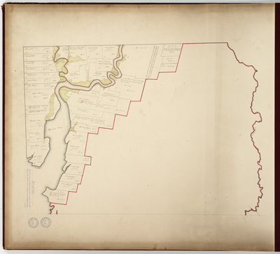
Description
This map is the second part of the 1794 survey of Addison in Washington County. First part of survey bound in plan book as page 5. Copied from Massachusetts Archives Maps and Plans #1431 Vol 48 Page 7 and #1014 Vol 48 Page 8.
Exact Creation Date
1794
Language
English
Location
Washington County; Addison
Other Location
Pleasant River; Clam Point; Smelt Mill Brook
Keywords
Cartography; Maps; Maine Land Office; Planbooks; Surveys
Image Location
Rights Statement
No Copyright - United States. URI: http://rightsstatements.org/vocab/NoC-US/1.0/
The organization that has made the Item available believes that the Item is in the Public Domain under the laws of the United States, but a determination was not made as to its copyright status under the copyright laws of other countries. The Item may not be in the Public Domain under the laws of other countries. Please refer to the organization that has made the Item available for more information.