


Files
Download Map (11.2 MB)
Document Type
StillImage
Description
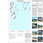
Maine Geological Survey, Open-File Map 99-100
Publication Code
99-100
Publication Date
1-1-1999
Publisher
Maine Geological Survey
Related Item
Alexa A. Bernotavicz and Mark Dubois, Surficial geology of the South Harpswell 7.5-minute quadrangle, Cumberland County, Maine
Supercedes
95-73
Location
Cumberland County
Map Type
Surficial Geology Maps (scale 1:24,000)
Map Scale
1:24000
Recommended Citation
Bernotavicz, Alexa and Dubois, Mark, 1999, Surficial geology of the South Harpswell quadrangle, Maine: Maine Geological Survey, Open-File Map 99-100, map, scale 1:24,000. Maine Geological Survey Maps. 997. http://digitalmaine.com/mgs_maps/997
Rights Statement

No Copyright - United States. URI: http://rightsstatements.org/vocab/NoC-US/1.0/
The organization that has made the Item available believes that the Item is in the Public Domain under the laws of the United States, but a determination was not made as to its copyright status under the copyright laws of other countries. The Item may not be in the Public Domain under the laws of other countries. Please refer to the organization that has made the Item available for more information.