


Files
Download Map (6.7 MB)
Document Type
StillImage
Description
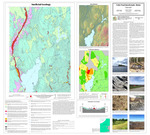
Maine Geological Survey, Open-File Map 22-4.
Publication Code
22-4
Publication Date
3-30-2022
Publisher
Maine Geological Survey
Location
Penobscot County; Somerset County; Waldo County
Map Type
Surficial Geology Maps (scale 1:24,000)
Map Scale
1:24000
Recommended Citation
Spigel, Lindsay J., 2022, Surficial geology of the Unity Pond quadrangle, Maine: Maine Geological Survey, Open-File Map 22-4, map, scale 1:24,000. Maine Geological Survey Maps. 2150. https://digitalmaine.com/mgs_maps/2150
Additional Resources
GIS data is available in GeMS format from the USGS National Geologic Map Database.
Rights Statement

No Copyright - United States. URI: http://rightsstatements.org/vocab/NoC-US/1.0/
The organization that has made the Item available believes that the Item is in the Public Domain under the laws of the United States, but a determination was not made as to its copyright status under the copyright laws of other countries. The Item may not be in the Public Domain under the laws of other countries. Please refer to the organization that has made the Item available for more information.