• Home
  • Search
  • Browse State Agencies
  • My Account
  • About
  • DC Network Digital Commons Network™
Skip to main content
Digital Maine Maine State Library
  • Home
  • About
  • FAQs
  • My Account

Home > StateDocs > ACF > Maine Geological Survey > MGS Field Photos

Maine Geological Survey Field Photos

Maine Geological Survey Field Photos

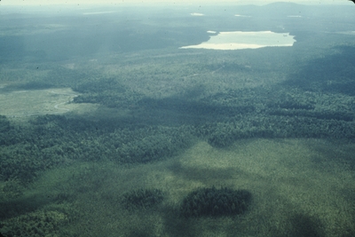
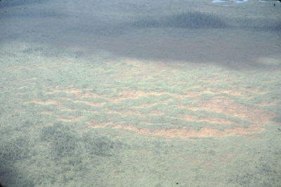
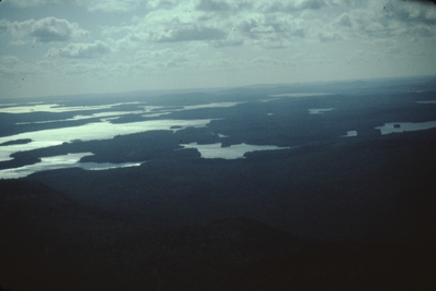
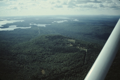
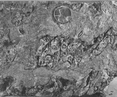
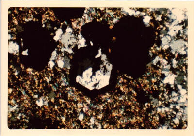
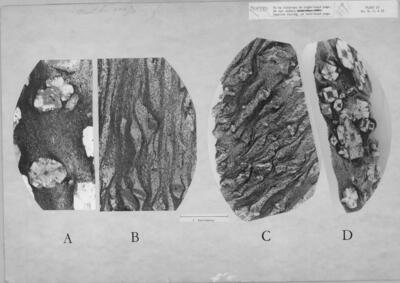
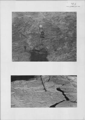
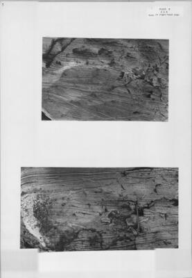
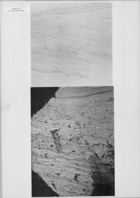
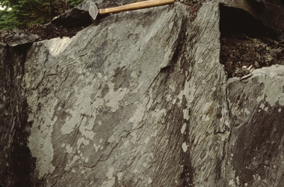
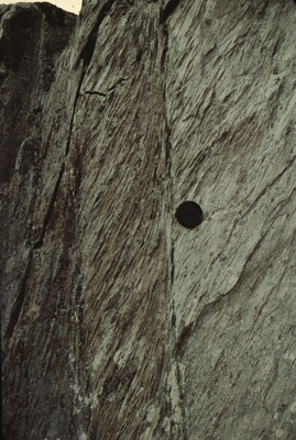
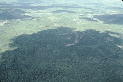
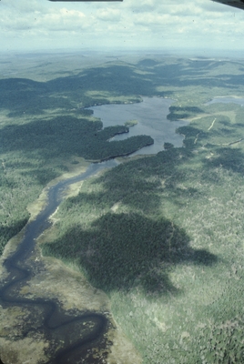
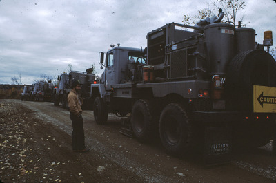
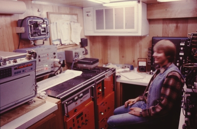
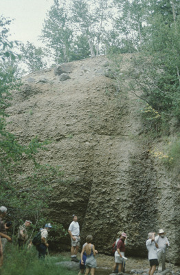
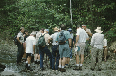
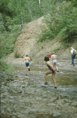
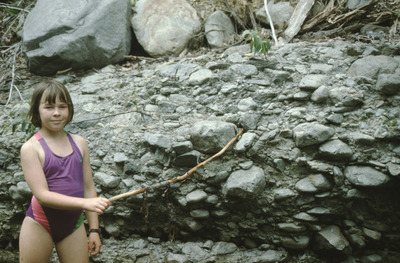
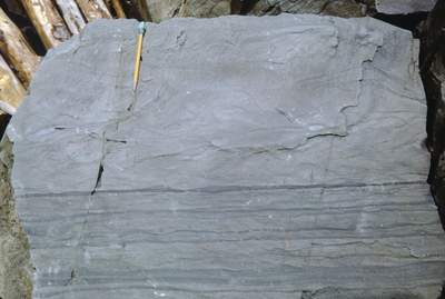
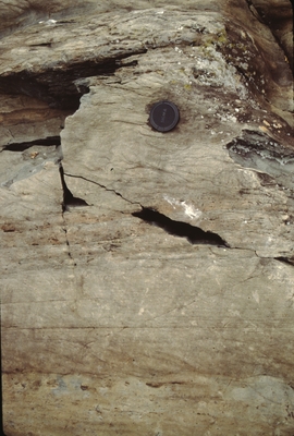
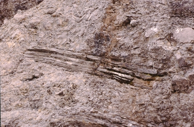
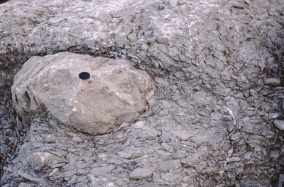
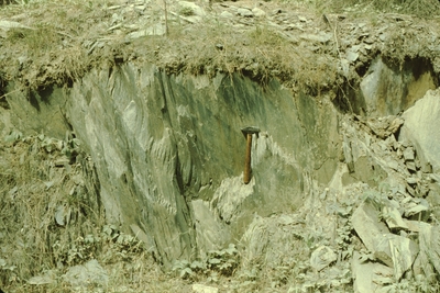
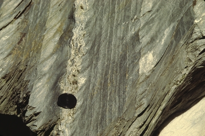
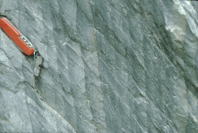
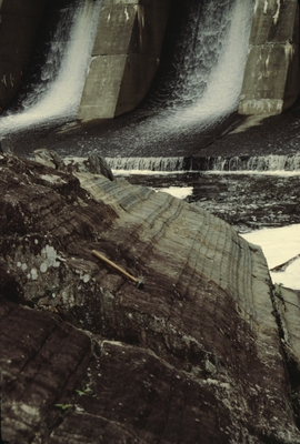
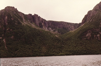
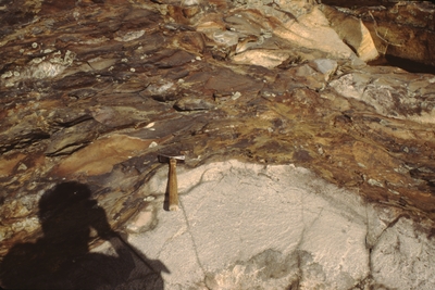
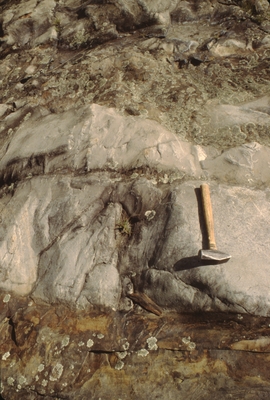
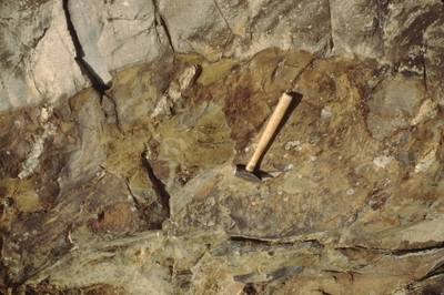
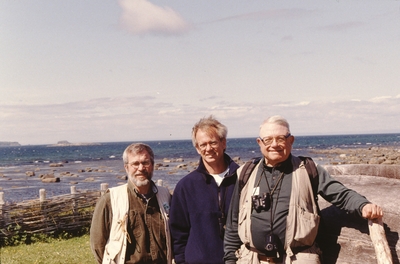
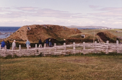
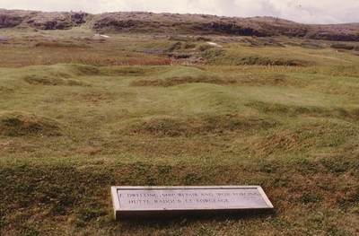
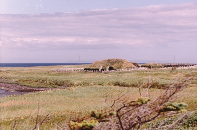
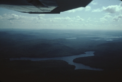
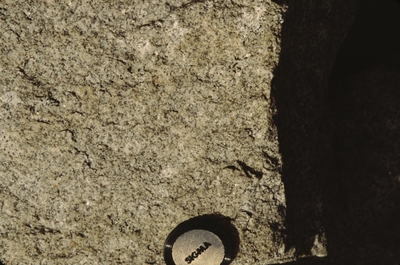
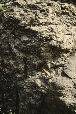
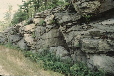
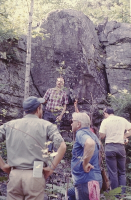
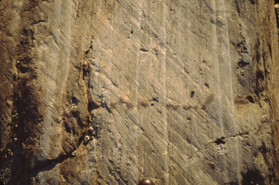
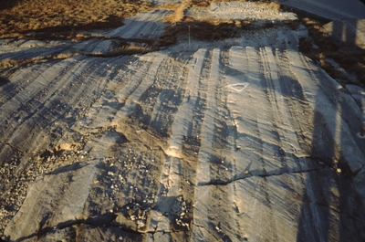
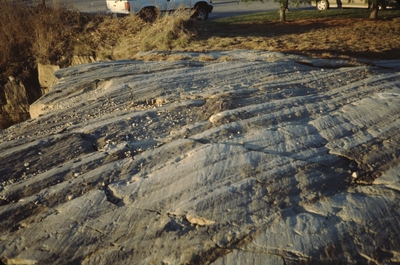
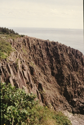
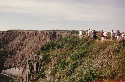
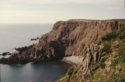
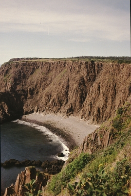
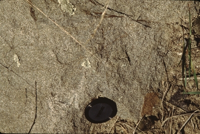
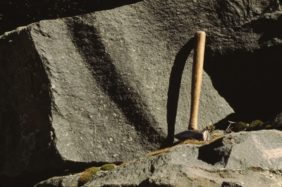
The Maine Geological Survey provides the people and businesses of Maine with essential geologic information about the land where we live and work. This collection contains field photographs of geologic features taken by Maine Geological Survey geologists. Use of the photos is free but please credit Maine Geological Survey and the photographer.

Printing is not supported at the primary Gallery Thumbnail page. Please first navigate to a specific Image before printing.

Follow

Switch View to List View Slideshow
 
  • Higgins Beach 05312013

    Higgins Beach 05312013

  • Higgins Beach 05312013

    Higgins Beach 05312013

  • Higgins Beach 05312013

    Higgins Beach 05312013

  • Higgins Beach 05312013

    Higgins Beach 05312013

  • Higgins Beach 05312013

    Higgins Beach 05312013

  • Higgins Shipwreck Drive 09042013

    Higgins Shipwreck Drive 09042013

  • Higgins Shipwreck Drive 09042013

    Higgins Shipwreck Drive 09042013

  • Higgins Shipwreck Drive 09042013

    Higgins Shipwreck Drive 09042013

  • Higgins Shipwreck Drive 09042013

    Higgins Shipwreck Drive 09042013

  • Higgins Shipwreck Drive 09042013

    Higgins Shipwreck Drive 09042013

  • Higgins Shipwreck Drive 09042013

    Higgins Shipwreck Drive 09042013

  • Higgins Shipwreck Drive 09042013

    Higgins Shipwreck Drive 09042013

  • Higgins Shipwreck Drive 09042013

    Higgins Shipwreck Drive 09042013

  • Higgins Shipwreck Drive 09042013

    Higgins Shipwreck Drive 09042013

  • Higgins Shipwreck Drive 09042013

    Higgins Shipwreck Drive 09042013

  • Higgins Shipwreck Drive 09042013

    Higgins Shipwreck Drive 09042013

  • Higgins Shipwreck Drive 09042013

    Higgins Shipwreck Drive 09042013

  • Higgins Shipwreck Drive 09042013

    Higgins Shipwreck Drive 09042013

  • Higgins Shipwreck Drive 09042013

    Higgins Shipwreck Drive 09042013

  • Hills Beach back dune by Joseph Kelley

    Hills Beach back dune

  • lighthouse on granite by Joseph Kelley

    lighthouse on granite

  • Monument Cove in Acadia National Park by Joseph Kelley

    Monument Cove in Acadia National Park

  • North Haven from boat by Joseph Kelley

    North Haven from boat

  • North Haven from Fox Island Thoro by Joseph Kelley

    North Haven from Fox Island Thoro

  • Pine Pt from parking lot by Joseph Kelley

    Pine Pt from parking lot

  • Piping Plover Popham Beach State Park by Joseph Kelley

    Piping Plover Popham Beach State Park

  • Rockland Fish Plant by Joseph Kelley

    Rockland Fish Plant

  • Sand Beach berm view east by Joseph Kelley

    Sand Beach berm view east

  • Sand Beach berm view west by Joseph Kelley

    Sand Beach berm view west

  • Sand Beach dune fence view by Joseph Kelley

    Sand Beach dune fence view

  • Sand Beach Inlet by Joseph Kelley

    Sand Beach Inlet

  • Sand Beach with big waves by Joseph Kelley

    Sand Beach with big waves

  • Seal Harbor gravel pile near road by Joseph Kelley

    Seal Harbor gravel pile near road

  • Seal Harbor gravel pile near road by Joseph Kelley

    Seal Harbor gravel pile near road

  • site of Callahan Mine near Castine by Joseph Kelley

    site of Callahan Mine near Castine

  • Stonington from boat by Joseph Kelley

    Stonington from boat

  • storm waves at Sand Beach by Joseph Kelley

    storm waves at Sand Beach

  • wave-eroded shoreline above present sea level by Joseph Kelley

    wave-eroded shoreline above present sea level

  • Wells Reserve buildings by Joseph Kelley

    Wells Reserve buildings

  • Willard Beach 06062013

    Willard Beach 06062013

  • Willard Beach 06062013

    Willard Beach 06062013

  • Willard Beach 06062013

    Willard Beach 06062013

  • Willard Beach 06062013

    Willard Beach 06062013

  • Willard Beach 06062013

    Willard Beach 06062013

  • 1978 storm erosional scarp in dunes by Joseph Kelley

    1978 storm erosional scarp in dunes

  • 3 units in eroding bluff by Joseph Kelley

    3 units in eroding bluff

  • Air Photo Cape Elizabeth by Joseph Kelley

    Air Photo Cape Elizabeth

  • Air Photo Cape Elizabeth by Joseph Kelley

    Air Photo Cape Elizabeth

  • Air Photo Cape Elizabeth by Joseph Kelley

    Air Photo Cape Elizabeth

  • Air Photo Cape Elizabeth Two Lights by Joseph Kelley

    Air Photo Cape Elizabeth Two Lights

  • Air Photo East Grant Ave by Joseph Kelley

    Air Photo East Grant Ave

  • air photo Fort Popham Popham Colony site by Joseph Kelley

    air photo Fort Popham Popham Colony site

  • Air Photo Fort Popham view down by Joseph Kelley

    Air Photo Fort Popham view down

  • air photo, Kinney Shores by Joseph Kelley

    air photo, Kinney Shores

  • Air photo of Camp Ellis looking seaward by Joseph Kelley

    Air photo of Camp Ellis looking seaward

  • Air photo of Camp Ellis looking SW by Joseph Kelley

    Air photo of Camp Ellis looking SW

  • Air photo of Camp Ellis looking W by Joseph Kelley

    Air photo of Camp Ellis looking W

  • Air photo of Camp Ellis looking W by Joseph Kelley

    Air photo of Camp Ellis looking W

  • Air photo of Camp Ellis looking W by Joseph Kelley

    Air photo of Camp Ellis looking W

  • Air photo of Camp Ellis looking W by Joseph Kelley

    Air photo of Camp Ellis looking W

  • Air photo of Hills Beach across jetties by Joseph Kelley

    Air photo of Hills Beach across jetties

  • Air Photo Scarborough Beach State Park by Joseph Kelley

    Air Photo Scarborough Beach State Park

  • Air Photo Scarborough River Ebb Delta by Joseph Kelley

    Air Photo Scarborough River Ebb Delta

  • Air Photo Two Lights State Park by Joseph Kelley

    Air Photo Two Lights State Park

  • air view Coast Guard Beach by Joseph Kelley

    air view Coast Guard Beach

  • Air view east Morse River Popham Beach by Joseph Kelley

    Air view east Morse River Popham Beach

  • air view Fort Baldwin by Joseph Kelley

    air view Fort Baldwin

  • Air view Ogunquit Beach and marsh by Joseph Kelley

    Air view Ogunquit Beach and marsh

  • All Crescent Beach State Park by Joseph Kelley

    All Crescent Beach State Park

  • All Ogunquit Beach from aIr by Joseph Kelley

    All Ogunquit Beach from aIr

  • All Willard Beach from air by Joseph Kelley

    All Willard Beach from air

  • Anemone Cave by Joseph Kelley

    Anemone Cave

  • Atkins Bay flat and marsh by Joseph Kelley

    Atkins Bay flat and marsh

  • back dune maritime tree Reid Beach State by Joseph Kelley

    back dune maritime tree Reid Beach State

  • back dune Mile Beach by Joseph Kelley

    back dune Mile Beach

  • back dune plants in winter by Joseph Kelley

    back dune plants in winter

  • back dune plants in winter by Joseph Kelley

    back dune plants in winter

  • back dunes Reid Beach State Park by Joseph Kelley

    back dunes Reid Beach State Park

  • backshore view Half Mile Beach by Joseph Kelley

    backshore view Half Mile Beach

  • Bailey Island area by Joseph Kelley

    Bailey Island area

  • bath house Reid Beach State Park by Joseph Kelley

    bath house Reid Beach State Park

  • Baxter Park from Matagamon Lake by Joseph Kelley

    Baxter Park from Matagamon Lake

  • Beach Heather and Cladonia by Joseph Kelley

    Beach Heather and Cladonia

  • Beach near Richmond Island by Joseph Kelley

    Beach near Richmond Island

  • Beach Profiling Program Line of Sight Photo: Ogunquit-OG07

    Beach Profiling Program Line of Sight Photo: Ogunquit-OG07

  • Beach Profiling Program Photo: Ogunquit-OG07

    Beach Profiling Program Photo: Ogunquit-OG07

  • Beach Profiling Program Photo: Ogunquit-OG07

    Beach Profiling Program Photo: Ogunquit-OG07

  • Beach Profiling Program Photo: Ogunquit-OG07

    Beach Profiling Program Photo: Ogunquit-OG07

  • Beach Profiling Program Photo: Ogunquit-OG07

    Beach Profiling Program Photo: Ogunquit-OG07

  • Beach Profiling Program Photo: Ogunquit-OG07

    Beach Profiling Program Photo: Ogunquit-OG07

  • Beach Profiling Program Photo: Ogunquit-OG07

    Beach Profiling Program Photo: Ogunquit-OG07

  • Beach Profiling Program Photo: Ogunquit-OG07

    Beach Profiling Program Photo: Ogunquit-OG07

  • Beach Profiling Program Photo: Ogunquit-OG07

    Beach Profiling Program Photo: Ogunquit-OG07

  • Beach Profiling Program Photo: Ogunquit-OG07

    Beach Profiling Program Photo: Ogunquit-OG07

  • Beach Profiling Program Photo: Ogunquit-OG07

    Beach Profiling Program Photo: Ogunquit-OG07

  • Beach Profiling Program Photo: Ogunquit-OG07

    Beach Profiling Program Photo: Ogunquit-OG07

  • Beach Profiling Program Photo: Ogunquit-OG07

    Beach Profiling Program Photo: Ogunquit-OG07

  • Beach Profiling Program Photo: Ogunquit-OG07

    Beach Profiling Program Photo: Ogunquit-OG07

  • Beach Profiling Program Photo: Ogunquit-OG07

    Beach Profiling Program Photo: Ogunquit-OG07

  • Beach Profiling Program Photo: Ogunquit-OG07

    Beach Profiling Program Photo: Ogunquit-OG07

  • Beach Profiling Program Photo: Ogunquit-OG07

    Beach Profiling Program Photo: Ogunquit-OG07

  • Beach Profiling Program Photo: Ogunquit-OG07

    Beach Profiling Program Photo: Ogunquit-OG07

  • Beach Profiling Program Photo: Ogunquit-OG07

    Beach Profiling Program Photo: Ogunquit-OG07

  • Beach Profiling Program Photo: Ogunquit-OG07

    Beach Profiling Program Photo: Ogunquit-OG07

  • Beach Profiling Program Photo: Ogunquit-OG07

    Beach Profiling Program Photo: Ogunquit-OG07

  • Beach Profiling Program Photo: Ogunquit-OG07

    Beach Profiling Program Photo: Ogunquit-OG07

  • Beach Profiling Program Photo: Ogunquit-OG07

    Beach Profiling Program Photo: Ogunquit-OG07

  • Beach Profiling Program Photo: Ogunquit-OG07

    Beach Profiling Program Photo: Ogunquit-OG07

  • Beach Profiling Program Photo: Ogunquit-OG07

    Beach Profiling Program Photo: Ogunquit-OG07

  • Beach Profiling Program Stake Photo: Ogunquit-OG07

    Beach Profiling Program Stake Photo: Ogunquit-OG07

  • Bedrock 24k Seal Harbor Photo 4 by Duane D. Braun

    Bedrock 24k Seal Harbor Photo 4

  • Bedrock Brooks West Photo 2 by David P. West Jr.

    Bedrock Brooks West Photo 2

  • Bedrock Brooks West Photo 4 by David P. West Jr.

    Bedrock Brooks West Photo 4

  • Bedrock Brooks West Photo 5 by David P. West Jr.

    Bedrock Brooks West Photo 5

  • Bedrock Brooks West Photo 8 by David P. West Jr.

    Bedrock Brooks West Photo 8

  • Biddeford Pool from air by Joseph Kelley

    Biddeford Pool from air

  • Biddeford Pool harbor and entrance by Joseph Kelley

    Biddeford Pool harbor and entrance

  • Biddeford Pool lagoon by Joseph Kelley

    Biddeford Pool lagoon

  • Biddeford Pool lagoon by Joseph Kelley

    Biddeford Pool lagoon

  • Biddeford Pool Mile Road next to park by Joseph Kelley

    Biddeford Pool Mile Road next to park

  • Biddeford Pool Town Park from air by Joseph Kelley

    Biddeford Pool Town Park from air

  • Big and Little Diamond Islands by Joseph Kelley

    Big and Little Diamond Islands

  • Bluff erosion at Bungunac by Joseph Kelley

    Bluff erosion at Bungunac

  • bluff erosion Bungunac by Joseph Kelley

    bluff erosion Bungunac

  • bluff erosion Bungunac by Joseph Kelley

    bluff erosion Bungunac

  • bluff erosion; Bungunac by Joseph Kelley

    bluff erosion; Bungunac

  • Bungunac Bluff landslides by Joseph Kelley

    Bungunac Bluff landslides

  • Camp Ellis Air Photo by Joseph Kelley

    Camp Ellis Air Photo

  • Camp Ellis jetties and Hills Beach by Joseph Kelley

    Camp Ellis jetties and Hills Beach

  • Cape Porpoise air photo by Joseph Kelley

    Cape Porpoise air photo

  • Cape Porpoise Harbor air photo by Joseph Kelley

    Cape Porpoise Harbor air photo

  • CBRA beaches Long Island by Joseph Kelley

    CBRA beaches Long Island

  • CBRA beaches Long Island Close up by Joseph Kelley

    CBRA beaches Long Island Close up

  • Central Crescent Beach State Park by Joseph Kelley

    Central Crescent Beach State Park

  • Central Scarborough Beach by Joseph Kelley

    Central Scarborough Beach

  • Chandler Cove in Casco Bay by Joseph Kelley

    Chandler Cove in Casco Bay

  • Cliff Island from air by Joseph Kelley

    Cliff Island from air

  • Cliff Island from air by Joseph Kelley

    Cliff Island from air

  • Cliff Island from air by Joseph Kelley

    Cliff Island from air

  • Coast Guard and Popham Beach from air by Joseph Kelley

    Coast Guard and Popham Beach from air

  • Coast Guard Beach south from air by Joseph Kelley

    Coast Guard Beach south from air

  • Cushing Island from air by Joseph Kelley

    Cushing Island from air

  • Cuspate Foreland Cape Elizabeth by Joseph Kelley

    Cuspate Foreland Cape Elizabeth

  • double tombolo Biddeford Pool by Joseph Kelley

    double tombolo Biddeford Pool

  • Drakes Island bridge and marshes by Joseph Kelley

    Drakes Island bridge and marshes

  • Drakes Island from air by Joseph Kelley

    Drakes Island from air

  • dropstone in glacial-marine sediment by Joseph Kelley

    dropstone in glacial-marine sediment

  • dune vu west by Joseph Kelley

    dune vu west

  • East Branch Penobscot River by Joseph Kelley

    East Branch Penobscot River

  • East Branch Penobscot River by Joseph Kelley

    East Branch Penobscot River

  • Eastern Crescent Beach State Park by Joseph Kelley

    Eastern Crescent Beach State Park

  • Eastern Scarborough Beach by Joseph Kelley

    Eastern Scarborough Beach

  • East Goose Rocks Beach from air by Joseph Kelley

    East Goose Rocks Beach from air

  • East Goose Rocks Beach from air by Joseph Kelley

    East Goose Rocks Beach from air

  • Echo Lake from Beech Mt by Joseph Kelley

    Echo Lake from Beech Mt

  • Ferry Beach State park area by Joseph Kelley

    Ferry Beach State park area

  • Ferry Beach State Park from air by Joseph Kelley

    Ferry Beach State Park from air

  • flood tidal delta by Joseph Kelley

    flood tidal delta

  • flood tidal delta in by Joseph Kelley

    flood tidal delta in

  • flood tide oriented ripples by Joseph Kelley

    flood tide oriented ripples

  • footprints in soft beach sand by Joseph Kelley

    footprints in soft beach sand

  • Fore River and Casco Bay by Joseph Kelley

    Fore River and Casco Bay

  • Fore River Estuary by Joseph Kelley

    Fore River Estuary

  • Former Little River Inlet in Scarboro by Joseph Kelley

    Former Little River Inlet in Scarboro

  • Former Little River Inlet Site by Joseph Kelley

    Former Little River Inlet Site

  • Fort Gorges by Joseph Kelley

    Fort Gorges

  • Fortunes Rocks by Joseph Kelley

    Fortunes Rocks

  • Fortunes Rocks Etherington Pond from air by Joseph Kelley

    Fortunes Rocks Etherington Pond from air

  • Fortunes Rocks lagoons from air by Joseph Kelley

    Fortunes Rocks lagoons from air

  • frontal dune Mile Beach by Joseph Kelley

    frontal dune Mile Beach

  • glacial polish and striae by Joseph Kelley

    glacial polish and striae

  • Gooches Beach east side from air by Joseph Kelley

    Gooches Beach east side from air

  • Gooches Beach from air by Joseph Kelley

    Gooches Beach from air

  • Goosefare Brook and marsh from air by Joseph Kelley

    Goosefare Brook and marsh from air

  • Goosefare Brook from air by Joseph Kelley

    Goosefare Brook from air

  • Goosefare Brook Inlet by Joseph Kelley

    Goosefare Brook Inlet

  • Goose Rocks Beach east side from air by Joseph Kelley

    Goose Rocks Beach east side from air

  • Goose Rocks Beach east to central by Joseph Kelley

    Goose Rocks Beach east to central

  • Goose Rocks Beach from air by Joseph Kelley

    Goose Rocks Beach from air

  • Goose Rocks Beach from air on west side by Joseph Kelley

    Goose Rocks Beach from air on west side

  • Goose Rocks Beach-west side by Joseph Kelley

    Goose Rocks Beach-west side

  • Goose Rocks western spit from air by Joseph Kelley

    Goose Rocks western spit from air

  • Gouldsboro marsh from south by Joseph Kelley

    Gouldsboro marsh from south

  • Grand Lake Matagamon raised lake mud by Joseph Kelley

    Grand Lake Matagamon raised lake mud

  • Grand lake Matagamon with canoes by Joseph Kelley

    Grand lake Matagamon with canoes

  • Greater Head Beach from air by Joseph Kelley

    Greater Head Beach from air

  • Great Hill and Mousam River from air by Joseph Kelley

    Great Hill and Mousam River from air

  • gullies in glacial-marine sediment by Joseph Kelley

    gullies in glacial-marine sediment

  • Half Mile Beach from Todd Point by Joseph Kelley

    Half Mile Beach from Todd Point

  • Half Mile Beach Reid Beach State Park by Joseph Kelley

    Half Mile Beach Reid Beach State Park

  • Half Mile Beach Reid Beach State Park by Joseph Kelley

    Half Mile Beach Reid Beach State Park

  • Half Mile Beach south of Todd Point by Joseph Kelley

    Half Mile Beach south of Todd Point

  • Half Mile dune top view north by Joseph Kelley

    Half Mile dune top view north

  • Head Beach from air view NW by Joseph Kelley

    Head Beach from air view NW

  • Higgins Beach by Joseph Kelley

    Higgins Beach

  • Higgins Beach by Joseph Kelley

    Higgins Beach

  • Higgins Beach 05252012

    Higgins Beach 05252012

  • Higgins Beach 05252012

    Higgins Beach 05252012

  • Higgins Beach 05252012

    Higgins Beach 05252012

  • Higgins Beach 05252012

    Higgins Beach 05252012

  • Higgins Beach 05252012

    Higgins Beach 05252012

  • Higgins Beach 05252012

    Higgins Beach 05252012

  • Higgins Beach 05252012

    Higgins Beach 05252012

  • Higgins Beach 05252012

    Higgins Beach 05252012

  • Higgins Beach 05252012

    Higgins Beach 05252012

  • Higgins Beach 05252012

    Higgins Beach 05252012

  • Higgins Beach 05252012

    Higgins Beach 05252012

  • Higgins Beach 05252012

    Higgins Beach 05252012

  • Higgins Beach 05252012

    Higgins Beach 05252012

  • Hills Beach by Joseph Kelley

    Hills Beach

  • Hills Beach air photo by Joseph Kelley

    Hills Beach air photo

  • Hills Beach and Camp Ellis from air by Joseph Kelley

    Hills Beach and Camp Ellis from air

  • Hills Beach close up by Joseph Kelley

    Hills Beach close up

  • Hills Beach close up by Joseph Kelley

    Hills Beach close up

  • Hills Beach sand bars by Joseph Kelley

    Hills Beach sand bars

  • Hills Beach sand bars by Joseph Kelley

    Hills Beach sand bars

  • Hills Beach sand bars by Joseph Kelley

    Hills Beach sand bars

  • Horseshoe Cove all from air by Joseph Kelley

    Horseshoe Cove all from air

  • Horseshoe Cove undeveloped beach by Joseph Kelley

    Horseshoe Cove undeveloped beach

  • Hunnewell Beach all from Air view N by Joseph Kelley

    Hunnewell Beach all from Air view N

  • Hunnewell Beach eastern end by Joseph Kelley

    Hunnewell Beach eastern end

  • inlet closed by Joseph Kelley

    inlet closed

  • Ironbound Island caves by Joseph Kelley

    Ironbound Island caves

  • Ironbound Island sea caves by Joseph Kelley

    Ironbound Island sea caves

  • Kennebec Point Beach from air by Joseph Kelley

    Kennebec Point Beach from air

  • Kennebunk Beach and former Strawberry Is by Joseph Kelley

    Kennebunk Beach and former Strawberry Is

  • Kennebunk River and harbor by Joseph Kelley

    Kennebunk River and harbor

  • Kennebunk River Estuary from air by Joseph Kelley

    Kennebunk River Estuary from air

  • Kennebunk River jetties close from air by Joseph Kelley

    Kennebunk River jetties close from air

  • lagoon at Reid Beach State Park by Joseph Kelley

    lagoon at Reid Beach State Park

  • lagoon Biddeford Pool by Joseph Kelley

    lagoon Biddeford Pool

  • Land between Curtis and New Barn Cove by Joseph Kelley

    Land between Curtis and New Barn Cove

  • LiDAR Marsh Photos of Seawall in Phippsburg by Peter A. Slovinsky

    LiDAR Marsh Photos of Seawall in Phippsburg

  • Little and Great Chebeague Islands by Joseph Kelley

    Little and Great Chebeague Islands

  • Little Chebeague by Joseph Kelley

    Little Chebeague

  • Little River Ebb Tidal delta Reid Beach by Joseph Kelley

    Little River Ebb Tidal delta Reid Beach

  • Little River marsh by Joseph Kelley

    Little River marsh

  • logs washed over Reid Beach by Joseph Kelley

    logs washed over Reid Beach

  • Long Island beaches from air by Joseph Kelley

    Long Island beaches from air

  • Lords Point and Kennebunk Beach from air by Joseph Kelley

    Lords Point and Kennebunk Beach from air

  • Lords Pt and eroded point from sea level by Joseph Kelley

    Lords Pt and eroded point from sea level

  • lower beach Mile Beach by Joseph Kelley

    lower beach Mile Beach

  • Merrymeeting Bay from air by Joseph Kelley

    Merrymeeting Bay from air

  • Middle Saco Estuary from Air by Joseph Kelley

    Middle Saco Estuary from Air

  • Mile Beach Reid Beach State Park by Joseph Kelley

    Mile Beach Reid Beach State Park

  • Mile Beach Reid Beach State Park by Joseph Kelley

    Mile Beach Reid Beach State Park

  • Mile Rd Beach from air by Joseph Kelley

    Mile Rd Beach from air

  • Mile Rd salt marsh Wells Beach by Joseph Kelley

    Mile Rd salt marsh Wells Beach

  • Ministerial and Bates Islands Casco Bay by Joseph Kelley

    Ministerial and Bates Islands Casco Bay

  • Monument Cove Acadia National Park by Joseph Kelley

    Monument Cove Acadia National Park


Page 97 of 135

  • 94
  • 95
  • 96
  • 97
  • 98
  • 99
  • 100


Search

Advanced Search

  • Notify me via email or RSS

Browse

  • State Agencies
  • Subjects
  • Contributors

For Agency Contributors

  • FAQs

Links

  • Maine Geological Survey

Featured Links

  • Maine Government
  • Maine State Library
  • Maine State Agencies
  • Digital Maine Partners

Gallery Locations

  • View gallery on map
  • View gallery in Google Earth
 
Elsevier - Digital Commons

Home | About | FAQ | My Account | Accessibility Statement

Privacy Copyright