


Preview
Contributing Institution
Maine Geological Survey
Document Type
Image
Identifier
50695
Description
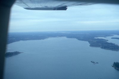
Aerial view of bay. Bunganuc Point (mid left, see inlet), Merepoint (mid right), Sister Island and ledge (lower left), and Little Flying Point (lower right).
Project Name: Kelley NGGDPP Grant 2019
Exact Creation Date
11-12-1985
Location
Brunswick
Supplemental Rights
Credit must be given to the photographer and the Maine Geological Survey when this photo is displayed, reproduced, distributed and/or used in derivative works.
Keywords
Natalie scan, Maquoit Bay, aerial