


Preview
Contributing Institution
Maine Geological Survey
Document Type
Image
Identifier
10716
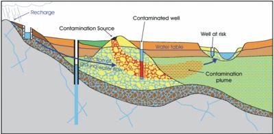
Description
Diagram of how contamination can enter a well. Used on all MGS 1:24,000-scale Sand and Gravel Aquifer Maps.
Project Name: Aquifer Map Default Photos
Keywords
well; groundwater