


Preview
Contributing Institution
Maine Geological Survey
Document Type
Image
Identifier
10717
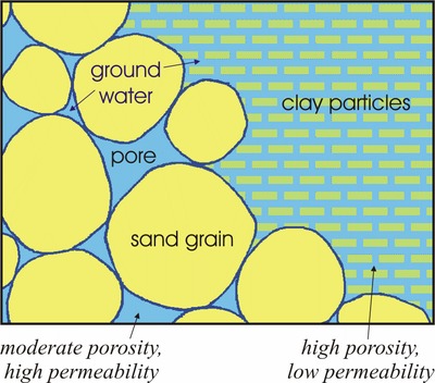
Description
Diagram showing the different properties of porosity and permability in an sand and gravel aquifer. Used on all MGS 1:24,000-scale Sand and Gravel Aquifer Maps.
Project Name: Aquifer Map Default Photos
Keywords
well; groundwater