


Preview
Contributing Institution
Maine Geological Survey
Document Type
Image
Identifier
10998
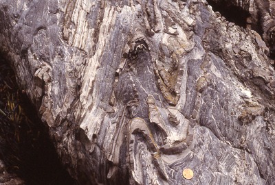
Description
Thinly bedded calc-silicate rock and limestone. Folds plunge steeply to the southwest. Eastern shoreline of Rockport Harbor. Station 50, Berry field notes.
Project Name: Camden Quadrangle Bedrock
Exact Creation Date
7-23-1998
Location
Rockport
Supplemental Rights
Credit must be given to the photographer and the Maine Geological Survey when this photo is displayed, reproduced, distributed and/or used in derivative works.
Keywords
Camden; bedrock mapping