


Preview
Contributing Institution
Maine Geological Survey
Document Type
Image
Identifier
10995
Description
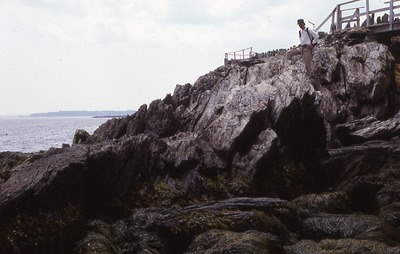
Weathered, steeply dipping schist. Just east of south end of Weatherend Estate, Deadman Point, Rockport. with Andrew Fagenholz. Station 18 of Berry field notes.
Project Name: Camden Quadrangle Bedrock
Exact Creation Date
7-21-1998
Location
Rockport
Supplemental Rights
Credit must be given to the photographer and the Maine Geological Survey when this photo is displayed, reproduced, distributed and/or used in derivative works.
Keywords
Camden; bedrock mapping