


Preview
Contributing Institution
Maine Geological Survey
Document Type
Image
Identifier
11357
Description
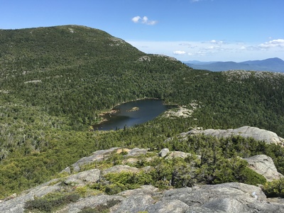
View of Little Jackson Mountain and Tumbledown Pond from the Rumbledown Ridge Trail; Mount Blue is visible in far right.
Project Name: STATEMAP Roxbury Surficial
Exact Creation Date
8-27-2019
Location
Township 6 North of Weld
Supplemental Rights
Credit must be given to the photographer and the Maine Geological Survey when this photo is displayed, reproduced, distributed and/or used in derivative works.
Keywords
Tumbledown Pond; surficial mapping