


Preview
Contributing Institution
Maine Geological Survey
Document Type
Image
Identifier
10130
Description
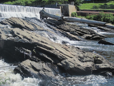
Photo 8: View towards the northeast of gently southeast-dipping layers within the Vassalboro Group (SOvu). Layering within nearly all stratified metamorphic rocks exposed west of the Flying Point fault in the Yarmouth quadrangle tilt towards the southeast. Royal River, approximately 500 feet south of Route 1, Yarmouth.
Project Name: Bedrock Geology 24k Yarmouth
Exact Creation Date
7-14-2016
Location
Yarmouth
Supplemental Rights
Credit must be given to the photographer and the Maine Geological Survey when this photo is displayed, reproduced, distributed and/or used in derivative works.
Keywords
bedrock mapping; outcrop; STATEMAP; Yarmouth