


Preview
Contributing Institution
Maine Geological Survey
Document Type
Image
Identifier
10103
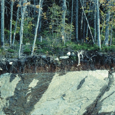
Description
Till over bedrock: d(t)/rk -- Road cut on Route 17 in Township D, showing thin layer of till overlying glacially eroded bedrock. Dark streaks on the rock face are wet areas.
Project Name: Surficial Materials Map Default Photos
Location
Township D
Supplemental Rights
Credit must be given to the photographer and the Maine Geological Survey when this photo is displayed, reproduced, distributed and/or used in derivative works.
Keywords
materials; till; bedrock