


Preview
Contributing Institution
Maine Geological Survey
Document Type
Image
Identifier
9709
Description
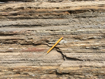
Photo 4: Light gray, fine-grained phyllite of the Eliot Formation (Se). These rocks represent relatively low-intensity metamorphism of what was originally fine-grained sediment. Rocks of the Eliot Formation in the Freeport quadrangle display characteristic weathering pits that represent areas containing greater percentages of the mineral calcite, which weathers more readily that the surrounding minerals (quartz, feldspar, and mica). Shoreline exposure on the southeastern tip of Cousins Island at the west edge of the map.
Project Name: Bedrock Geology 24k Freeport
Exact Creation Date
8-11-2017
Location
Yarmouth
Supplemental Rights
Credit must be given to the photographer and the Maine Geological Survey when this photo is displayed, reproduced, distributed and/or used in derivative works.
Keywords
bedrock mapping; outcrop; STATEMAP; Freeport