


Preview
Contributing Institution
Maine Geological Survey
Document Type
Image
Identifier
9542
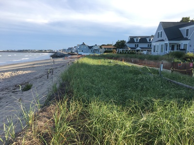
Description
Artificially enhanced frontal dune provided flood protection in 2018 storms. Surf Street sheetpile, geotubes and riprap revetment in distance. Saco jetty extends left on the horizon.
Project Name: MBMAP
Exact Creation Date
9-23-2018
Location
Saco
Supplemental Rights
Credit must be given to the photographer and the Maine Geological Survey when this photo is displayed, reproduced, distributed and/or used in derivative works.
Keywords
SMBPP; MBMAP