


Preview
Contributing Institution
Maine Geological Survey
Document Type
Image
Identifier
6725
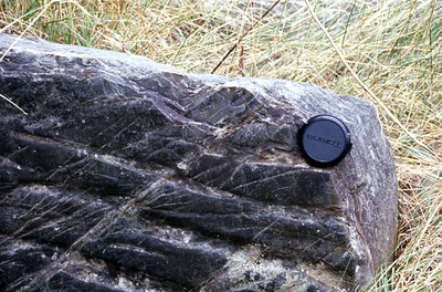
Description
Sangerville Fm. - Sebec Village Rd. (outcrop #4) just N of Rte. 16. Plane strikes E-W. (East left)
Supplemental Rights
Credit must be given to the photographer and the Maine Geological Survey when this photo is displayed, reproduced, distributed and/or used in derivative works.
Keywords
bedrock; lineations; Sangerville Fm; Sebec Village; cleavage surface; plane strikes; fault; outcrop