


Preview
Contributing Institution
Maine Geological Survey
Document Type
Image
Identifier
91192
Description
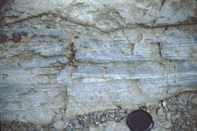
Location of pavement outcrop somewhere along this road or at reservoir. Sandstone layers with numerous slate chips. Graded beds indicate topping to S (top of image).
/="/"> Project Name: Marvinney Historical Photos
Exact Creation Date
9-6-1990
Supplemental Rights
Credit must be given to the photographer and the Maine Geological Survey when this photo is displayed, reproduced, distributed and/or used in derivative works.
Keywords
Sangerville Formation; Silurian; soft sediment deformation