


Preview
Contributing Institution
Maine Geological Survey
Document Type
Image
Identifier
91190
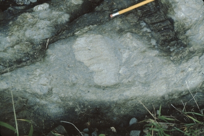
Description
Approximate location of road pavement outcrop. Soft sediment deformation in sandstone layers of Sangerville Formation. Bedding and cleavage are parallel to pencil (points NE). Cleavage crosscuts sandstone clasts.
/="/"> Project Name: Marvinney Historical Photos
Exact Creation Date
8-1-1990
Supplemental Rights
Credit must be given to the photographer and the Maine Geological Survey when this photo is displayed, reproduced, distributed and/or used in derivative works.
Keywords
Sangerville Formation; Silurian; soft sediment deformation