


Preview
Contributing Institution
Maine Geological Survey
Document Type
Image
Identifier
91171
Description
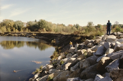
Erosion of the unconsolidated river bank of the Sandy River. Various mitigation efforts have been tried over the years, including riprap seen in some images. Several images show sand stockpiled on the inside of the river meander.
Project Name: Marvinney Historical Photos
Broad Creation Date
October 2001
Location
Farmington
Supplemental Rights
Credit must be given to the photographer and the Maine Geological Survey when this photo is displayed, reproduced, distributed and/or used in derivative works.
Keywords
Sandy River; erosion; riprap