


Preview
Contributing Institution
Maine Geological Survey
Document Type
Image
Identifier
91095
Description
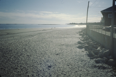
Level of sand on Wells Beach following harbor dredge in December 2000. Casino Square. Red line on seawall marks maximum elevation of sand immediately following the dredge
Project Name: Marvinney Historical Photos
Broad Creation Date
December 2000
Location
Wells
Supplemental Rights
Credit must be given to the photographer and the Maine Geological Survey when this photo is displayed, reproduced, distributed and/or used in derivative works.
Keywords
Dredge; Wells Harbor; beach nourishment